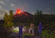
| RSS | EN | DE | EL | ES | FR | IT | RU

Belknap Volcano

Updated: May 1, 2025 06:34 GMT -
shield volcanoes
Oregon (Canada and USA (mainland)), 44.29°N / -121.84°W
Summit height: 2095 m / 6,873 ft
Current status: normal or dormant (1 out of 5)

Belknap Crater volcano is located near McKenzie Pass, north of the Three Sisters volcanoes in Central Oregon. It is the center and source of one of the largest number of geologically recent eruptions in the Cascade Range. It was very active between about 3000 and 1500 years ago.
The McKenzie highway 242 crosses the barren lava fields on the SE flank and offers with spectacular views toward Mt. Jefferson and the Three Sisters volcanoes.

[smaller] [larger]
Typical eruption style: effusive
Belknap volcano eruptions: 400 AD (?), 800 BC ± 300, 1030 BC ± 300 (all radiocarbon dated)

Latest nearby earthquakes

Date and TimeMag / DepthDistance / Location

Background

Belknap is a basaltic to basaltic-andesite shield volcano, topped by the Belknap Crater, a cinder cone, and the shield volcano of Little Belknap to the west. Lava flows from these vents have spread to all directions and created an impressive landscape of lava flows. The youngest of these flows traveled 15 km west into the McKenzie River valley.

Significant volcanic eruptions: Belknap volcano

No historic eruptions are known from Belknap volcano, but evidence from at least 4 eruptions during the past 10,000 years can be found in the geological record.
The table below lists all known eruptions (date in bold face) of Belknap volcano in historic times and during the past 10,000 years. Updates on the most recent volcanic activity of Belknap can be found on the news page of Belknap volcano.
DateNoteVEIDeathsDamage
475 ±215 y. ADBelknap Crater2?
685 ±50 y. BCSouth Belknap and Twin Craters2?
1071 ±241 y. BCLittle Belknap?
5050 ? BC?
Remark:
Our list of volcanic eruptions closely follows the database of eruptions of the Smithsonian's Global Volcanism Project (GVP), the internationally most recognized data source for volcanic eruptions, but also includes significant eruptive episodes or related volcano events. "Volcanic eruptions" are usually to be understood as sequences of individual eruptive episodes that can follow each other, or even overlap (if several vents are involved), and can last many years, decades or even longer. For example, the current activity of Stromboli volcano is understood as a single eruption that has been ongoing since 1934.
Sources: NOAA National Centers for Environmental Information (NCEI), Global Significant Volcanic Eruptions Database. doi:10.7289/V5TD9V7K | Global Volcanism Project / Smithsonian Institution

Belknap Volcano FAQ

+When was the last eruption of Belknap volcano?

+When was the largest eruption of Belknap volcano?

Latest satellite images

Belknap satellite image sat1Belknap satellite image sat2

Belknap Volcano Maps

Below is a selection of maps showing the location and surroundings of the volcano at various resolutions based on aerial-imagery / terrain maps. Feel free to use them for non-commercial purposes on your blog or website as long as you credit them with a link back to this page (click to copy it).
Satellite/aerial-type map of Belknap volcano (world scale)
Terrain-type map of Belknap volcano (world scale)
Satellite/aerial-type map of Belknap volcano (region scale large)
Terrain-type map of Belknap volcano (region scale large)
Satellite/aerial-type map of Belknap volcano (region scale medium)
Terrain-type map of Belknap volcano (region scale medium)
Satellite/aerial-type map of Belknap volcano (region scale small)
Terrain-type map of Belknap volcano (region scale small)
Satellite/aerial-type map of Belknap volcano (local scale large)
Terrain-type map of Belknap volcano (local scale large)
Satellite/aerial-type map of Belknap volcano (local scale medium)
Terrain-type map of Belknap volcano (local scale medium)
Satellite/aerial-type map of Belknap volcano (local scale small)
Terrain-type map of Belknap volcano (local scale small)
Satellite/aerial-type map of Belknap volcano (scale of 10s of km)
Terrain-type map of Belknap volcano (scale of 10s of km)
Satellite/aerial-type map of Belknap volcano (scale of 20-40 km)
Terrain-type map of Belknap volcano (scale of 20-40 km)
Satellite/aerial-type map of Belknap volcano (scale of approx. 10-20 km)
Terrain-type map of Belknap volcano (scale of approx. 10-20 km)
Satellite/aerial-type map of Belknap volcano (scale of 5-10 km)
Satellite/aerial-type map of Belknap volcano (scale of few kilometers)
Volcanoes & Earthquakes - new app for Android
Guaranteed tours
9-25 Jun 2025: Volcanoes and Spices - Sulawesi/Halmahera (Indonesia)
7-22 Jul 2025: From Krakatau to Bali - Java (Indonesia)
7-23 Jul 2025: Volcanoes and Spices - Sulawesi/Halmahera (Indonesia)
1-17 Aug 2025: Volcanoes and Spices - Sulawesi/Halmahera (Indonesia)
1-14 Oct 2025: Desert, salt and volcanoes - Danakil desert (Ethiopia)
4-12 Oct 2025: From Stromboli to Etna - Sicily and Eolian Islands (Italy)
6-21 Oct 2025: From Krakatau to Bali - Java (Indonesia)
3-19 Nov 2025: Volcanoes and Spices - Sulawesi/Halmahera (Indonesia)
= spaces available   = guaranteed   = few spaces left   = booked out

No news in this list.

On this page:

Try our free app!
Volcanoes & Earthquakes - new app for Android
Android | iOS version

More on VolcanoDiscovery

Why is there advertising on this site?

Support us - Help us upgrade our services!

We truly love working to bring you the latest volcano and earthquake data from around the world. Maintaining our website and our free apps does require, however, considerable time and resources.
We need financing to increase hard- and software capacity as well as support our editor team. We're aiming to achieve uninterrupted service wherever an earthquake or volcano eruption unfolds, and your donations can make it happen! Every donation will be highly appreciated. If you find the information useful and would like to support our team in integrating further features, write great content, and in upgrading our soft- and hardware, please make a donation (PayPal).

Planned features:Thanks to your past donations, these features have been added recently:
Download and Upgrade the Volcanoes & Earthquakes app to get one of the fastest seismic and volcano alerts online:
Android | IOS
Thank you!
Sources: VolcanoDiscovery / VolcanoAdventures and other sources as noted.
Use of material: Most text and images on our websites are owned by us. Re-use is generally not permitted without authorization. Contact us for licensing rights.
Volcanoes & Earthquakes
VolcanoDiscovery Home
Volcanoes | Earthquakes | Photos | Volcano News | | Shop | App
Adventure & Study Travel
Tours to Volcanoes and Volcanic Areas: walking tours, photo tours, study tours
Tours & Dates | FAQ | About us
Get our newsletter!
Company info
Contact | Legal info | Terms & conditions
Follow us
Follow us on facebook Follow us on Instagram Follow us on Bluesky Follow us on Twitter Visit our Youtube channel
EN | DE | EL | ES | FR | IT | RU
VolcanoDiscovery GmbH, Germany, Reg. nr.: HRB 103744, EU Tax Id: DE 297 465 123 owned and created by
Dr. Tom Pfeiffer, volcanologist, volcano photographer, tour organizer member of
IAVCEI
IAVCEI
Vulkanologische Gesellschaft
Volcanological Society
Ecotourism Greece
Ecotourism Greece
RUV insurance
Insured by R+V
VolcanoDiscovery © 2004- All Rights Reserved | Privacy - Cookie Settings