Acatenango Volcano
Updated: 27. Apr. 2024 05:59 GMT -
Stratovolcano 3976 m / 13,044 ft
Guatemala, 14.5°N / -90.88°W
Aktueller Status: normal / ruhend (1 von 5)
Guatemala, 14.5°N / -90.88°W
Aktueller Status: normal / ruhend (1 von 5)
[smaller] [larger]
Ausbrüche des Acatenango: 1972
Letzte Erdbeben in der Nähe
| Uhrzeit | Mag. / Tiefe | Entfernung / Ort | |||
| 26. Apr. 00:49 (Guatemala) | 2.7 146 km | 8.3 km südöstlich | Info | ||
| Mittwoch, 24. April 2024 GMT (1 Beben) | |||||
| 24. Apr. 02:18 (Guatemala) | 2.4 35 km | 21 km südwestlich | Info | ||
| Dienstag, 16. April 2024 GMT (1 Beben) | |||||
| 15. Apr. 19:30 (Guatemala) | 2.7 22 km | 19 km südlich | Info | ||
Beschreibung
Acatenango, along with its twin volcano to the south, Volcán Fuego, overlooks the historic former capital city of Antigua, Guatemala. Acatenango, which has two principal summits, was constructed during three eruptive periods post-dating the roughly 85,000-year-old Los Chocoyos tephra from Atitlán caldera. An ancestral Acatenango volcano collapsed to the south sometime prior to 43,000 years ago, forming La Democracia debris-avalanche deposit, which covers a wide area of the Pacific coastal plain. Construction of Yepocapa, the northern summit of Acatenango, was completed about 20,000 years ago, after which growth of the southern and highest cone, Pico Central (also known as Pico Mayor), began. The first well-documented eruptions of Acatenango took place from 1924 to 1927, although earlier historical eruptions may have occurred. Francisco Vasquez, writing in 1690, noted that in 1661 a volcano that lay aside of Fuego "opened a smoking mouth and still gives off smoke from another three, but without noise."---
Smithsonian / GVP volcano information
Acatenango Volcano Photos
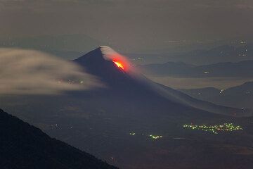
Der Pacaya Vulkan mit seinen aktiven Lavaströmen vom Acatenango aus gesehen. (Photo: Tom Pfeiffer)
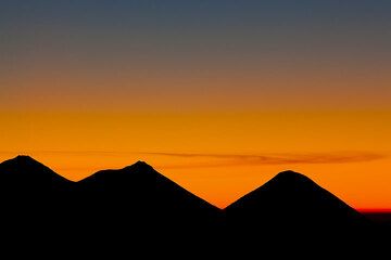
Die Silhouetten der Vulkane Acatenango, Fuego und Atitlán volcanoes in der Dämmerung (Photo: Tom Pfeiffer)
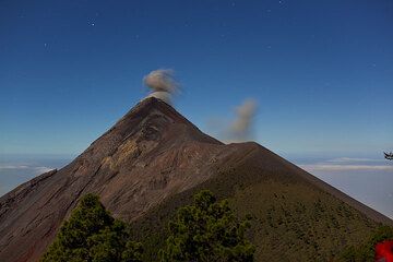
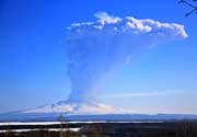
Kleiner Ausbruch des Fuego vom Vulkan Acatenango aus gesehen (Photo: Tom Pfeiffer)
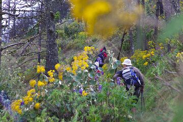
Auf dem Weg zum Acatenango (Photo: Tom Pfeiffer)
Latest satellite images