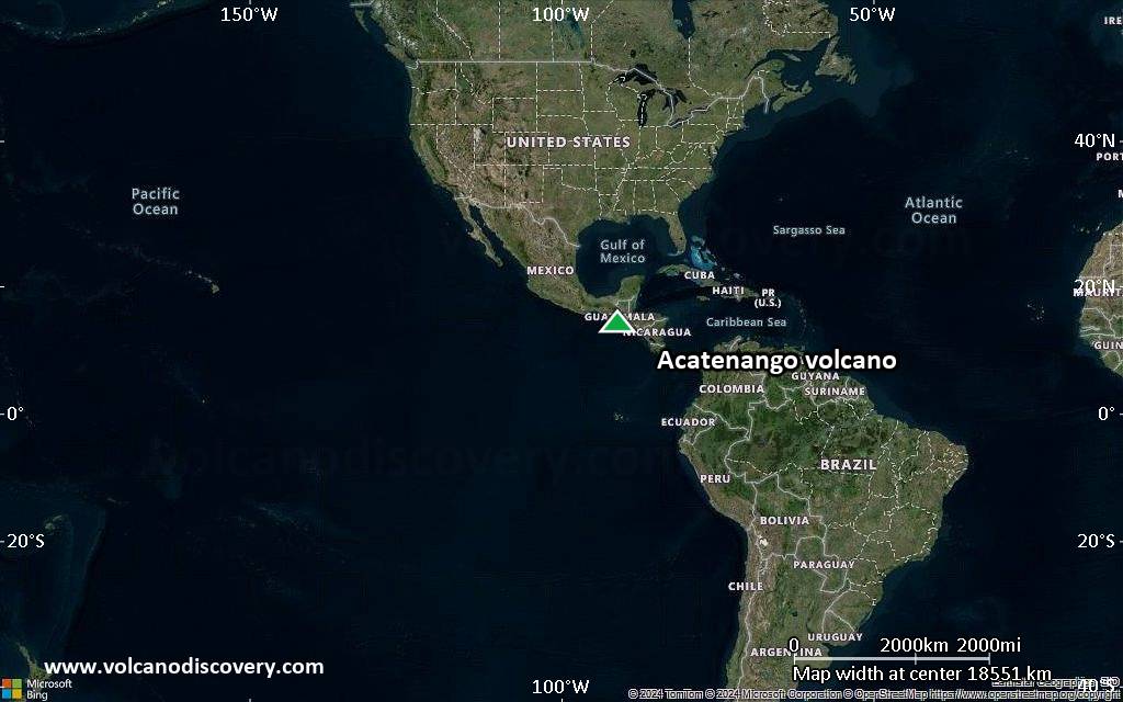
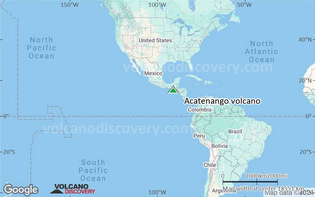
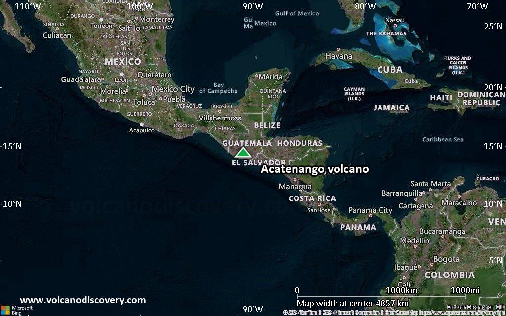
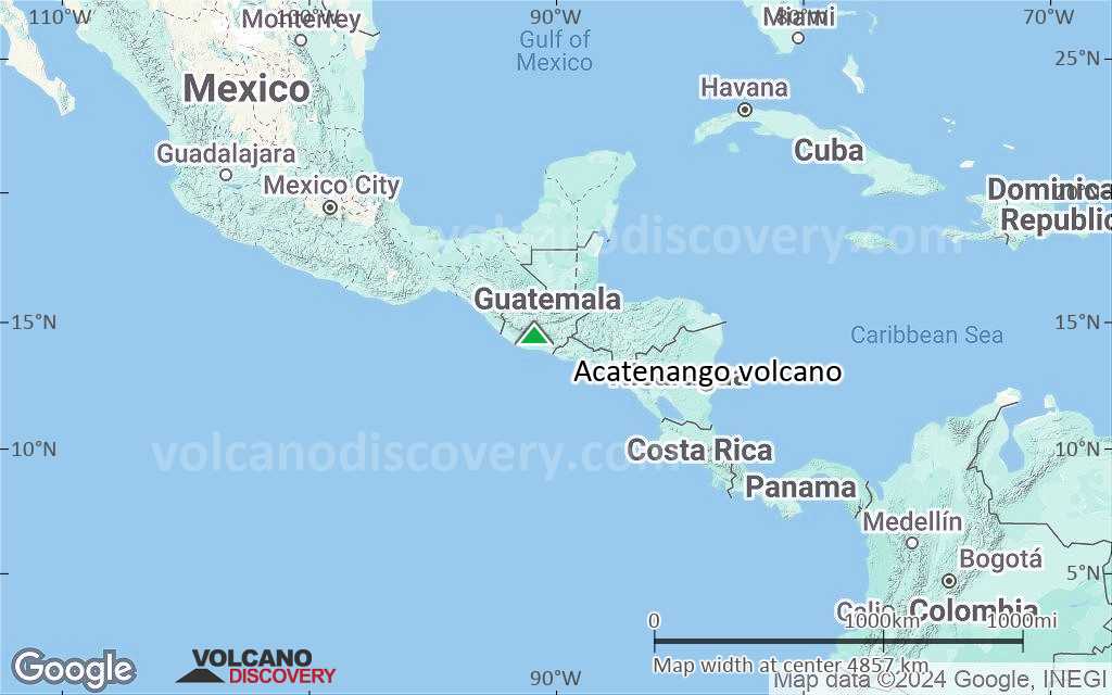
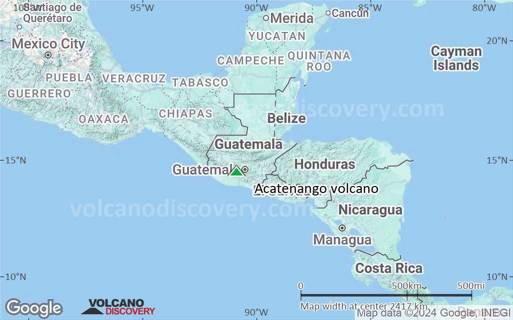
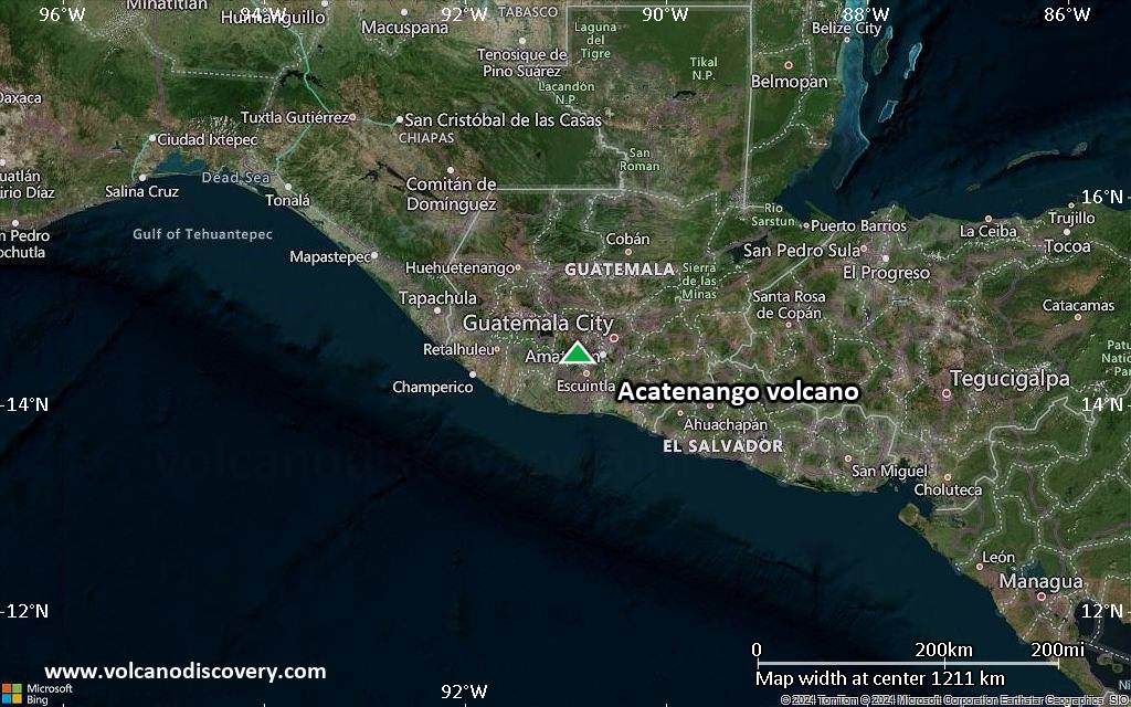
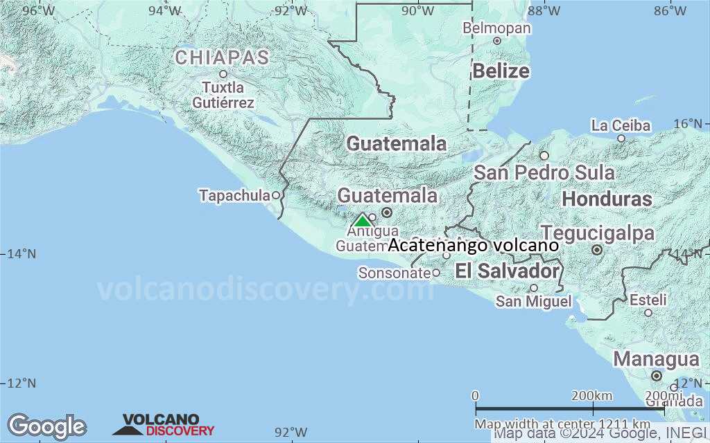
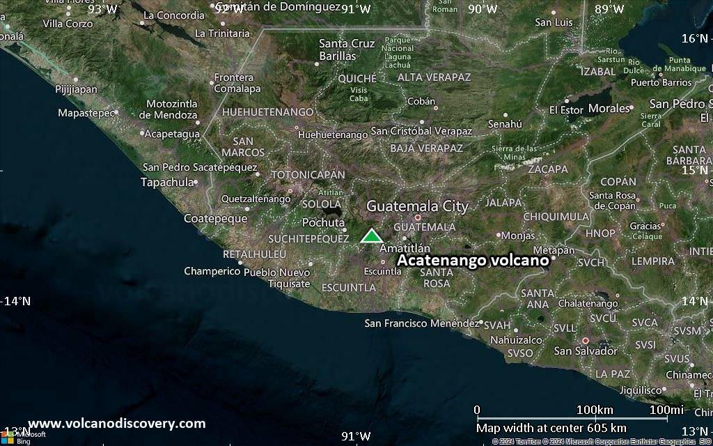
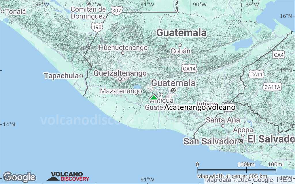
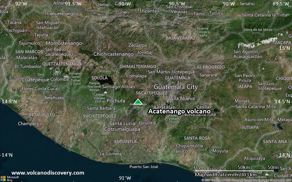
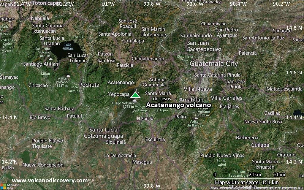
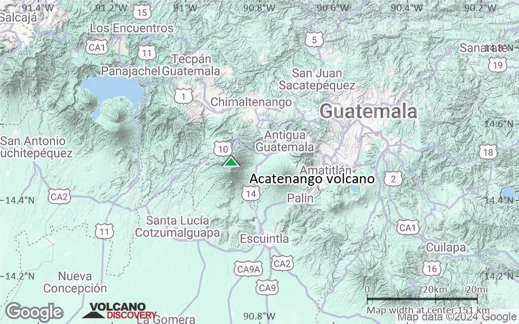
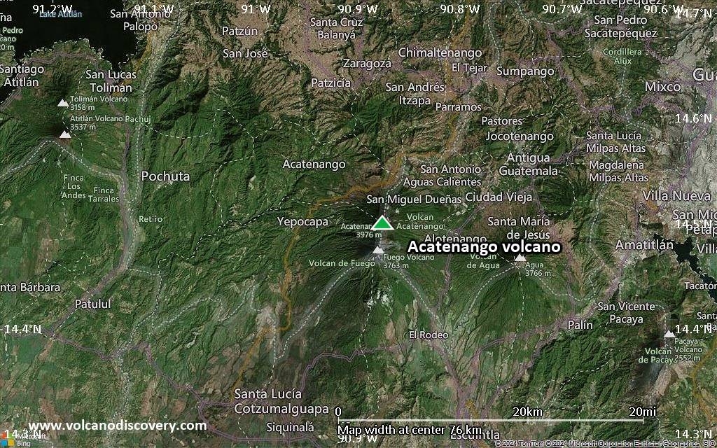
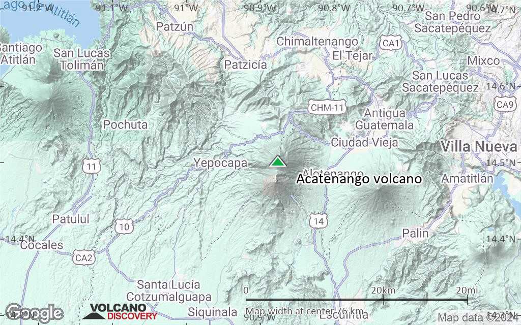
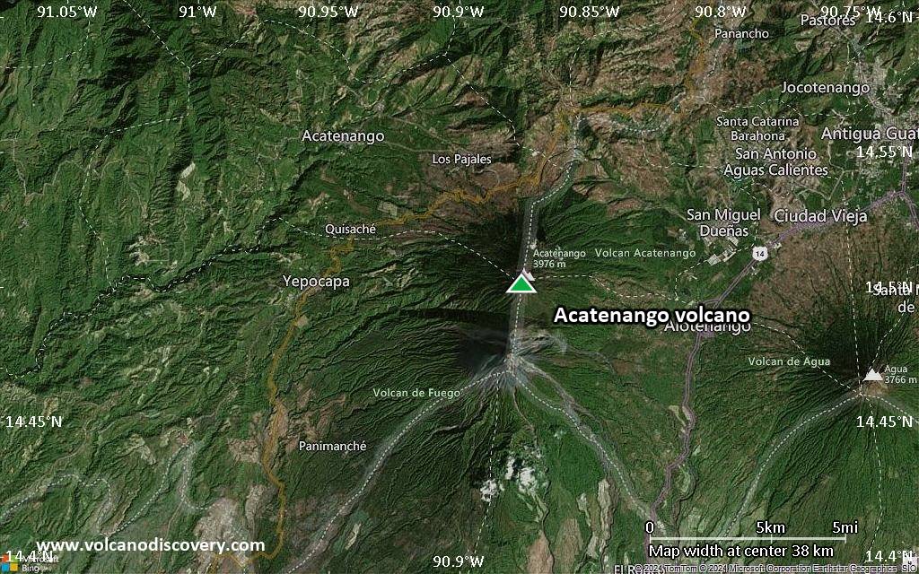
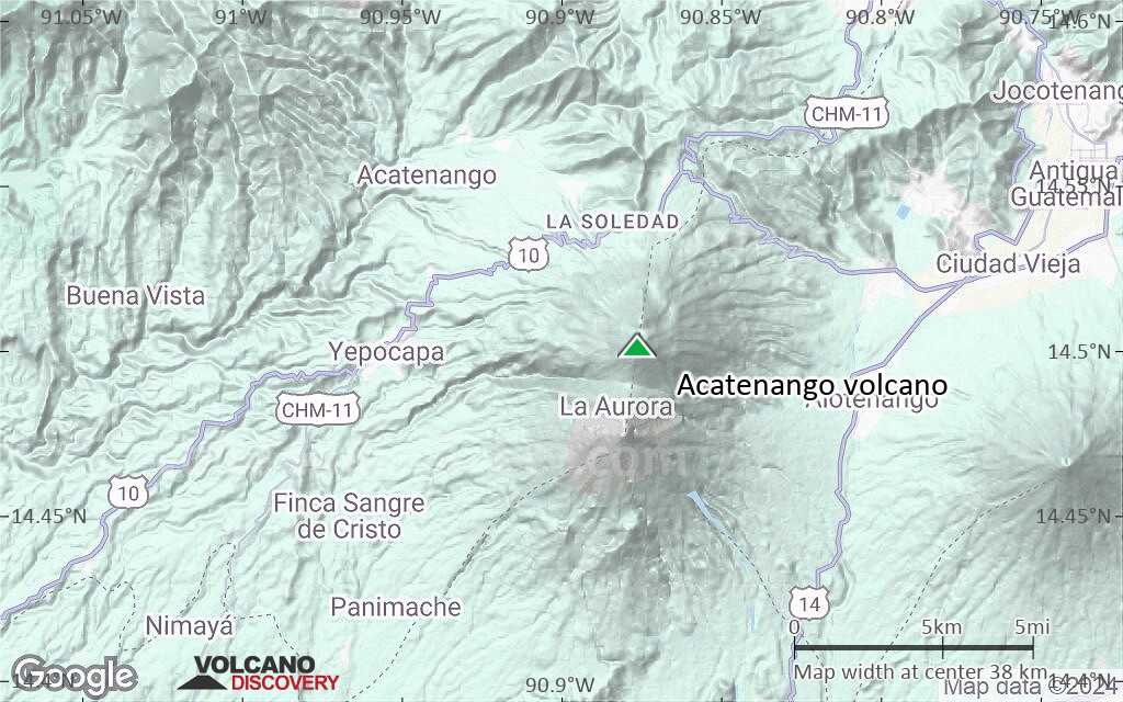
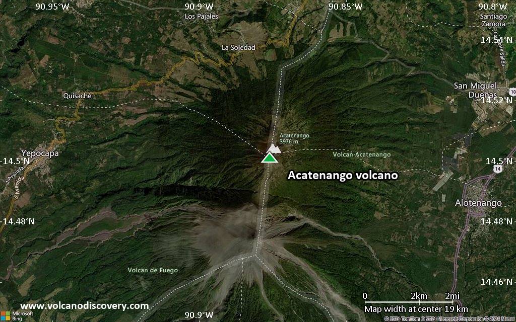
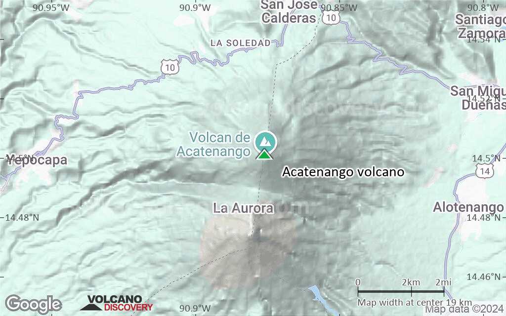
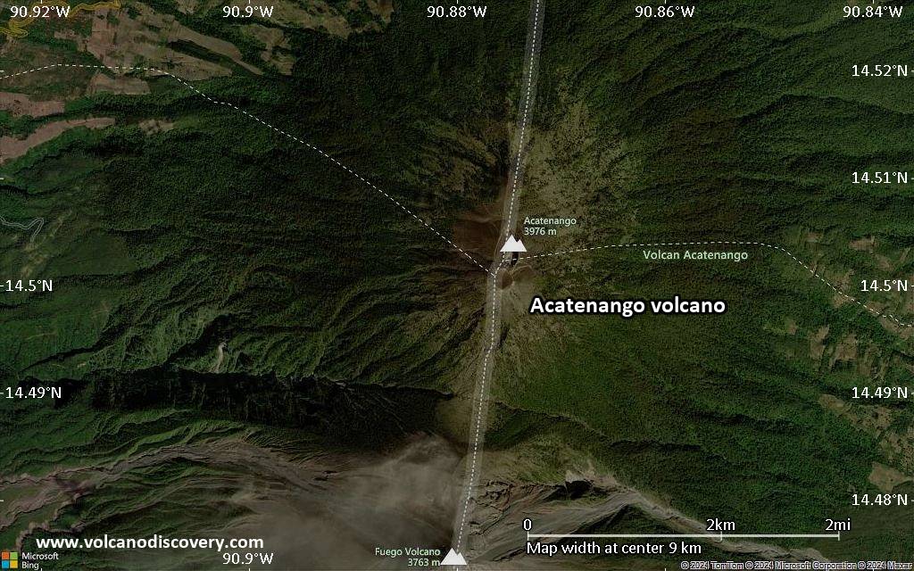
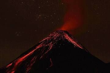
| RSS | EN | DE | EL | ES | FR | IT | RU

Acatenango Vulkan

Updated: 16. Jul. 2025 20:43 GMT -
Stratovolcano
Guatemala, 14.5°N / -90.88°W
Summit height: 3976 m / 13,044 ft
Aktueller Status: normal / ruhend (1 von 5)

[smaller] [larger]
Typische Aktivität: unspecified
Ausbrüche des Acatenango: 1972 

Letzte Erdbeben in der Nähe

Datum und UhrzeitMag / TiefeDistanz / Ort
16. Jul. 03:06 (GMT -6)
2.1

4 km
29 km östlich 20 km Al Sureste De Antigua Guatemala, Guatemala Info
16. Jul. 01:10 (GMT -6)
2.4

8 km
28 km östlich 18 km Al Sureste De Antigua Guatemala, Guatemala Info
15. Jul. 22:41 (GMT -6)
2.3

17 km
27 km östlich 12 km Al Norte De Antigua Guatemala, Guatemala Info
15. Jul. 21:23 (GMT -6)
2.4

6 km
26 km östlich 12 km Al Sureste De Antigua Guatemala, Guatemala Info
Dienstag, 15. Juli 2025 GMT (2 Beben)
15. Jul. 06:10 (Guatemala)
3.2

6 km
22 km östlich Guatemala  I FELT IT - 3 BerichteInfo
15. Jul. 11:33 (Weltzeit)
2.5

1 km
26 km südöstlich Guatemala 2 BerichteInfo
Montag, 14. Juli 2025 GMT (1 Beben)
14. Jul. 14:39 (Guatemala)
2.8

8 km
21 km östlich Guatemala  I FELT IT Info
Dienstag, 8. Juli 2025 GMT (6 Beben)
8. Jul. 16:39 (Guatemala)
4.1

4 km
16 km östlich 8 km Al Sur De Antigua Guatemala, Guatemala 7 BerichteInfo
8. Jul. 15:54 (Guatemala)
4.8

10 km
16 km südöstlich 6 km NW of Palín, Guatemala 9 BerichteInfo

Beschreibung

Acatenango, along with its twin volcano to the south, Volcán Fuego, overlooks the historic former capital city of Antigua, Guatemala. Acatenango, which has two principal summits, was constructed during three eruptive periods post-dating the roughly 85,000-year-old Los Chocoyos tephra from Atitlán caldera. An ancestral Acatenango volcano collapsed to the south sometime prior to 43,000 years ago, forming La Democracia debris-avalanche deposit, which covers a wide area of the Pacific coastal plain. Construction of Yepocapa, the northern summit of Acatenango, was completed about 20,000 years ago, after which growth of the southern and highest cone, Pico Central (also known as Pico Mayor), began. The first well-documented eruptions of Acatenango took place from 1924 to 1927, although earlier historical eruptions may have occurred. Francisco Vasquez, writing in 1690, noted that in 1661 a volcano that lay aside of Fuego "opened a smoking mouth and still gives off smoke from another three, but without noise."
---
Smithsonian / GVP volcano information

Acatenango Volcano Photos

Bedeutende Vulkanausbrüche: Acatenango volcano

In the past 10,000 years, Acatenango has had at least 8 confirmed volcanic eruptions, out of which 3 are documented by historical records, while the others can be inferred from geological evidence.

The table below lists all known eruptions (date in bold face) of Acatenango volcano in historic times and during the past 10,000 years. Updates on the most recent volcanic activity of Acatenango can be found on the news page of Acatenango volcano.
DatumHinweisVEITodesopferSchaden
1972 Nov 12 - Dez 16 ±15 d.Pico Central-Yepocapa saddle
Hist. dokumentiert
1
unbekannt
1926 Aug - 1927 Mai 19Pico Central
Hist. dokumentiert
2
unbekannt
1924 Dez 18 - 1925 Jun 7North slope of Pico Central
Hist. dokumentiert
3
unbekannt
1450 ±50 y. AD?
unbekannt
90 ±100 y. ADPico Central?
unbekannt
260 ±75 y. BCPico Central?
unbekannt
370 ±200 y. BCPico Central?
unbekannt
2710 ±75 y. BCYepocapa?
unbekannt
Anmerkung:
Unsere Liste von Vulkanausbrüchen orientiert sich eng an der Datenbank des Global Volcanism Project (GVP) des Smithsonian Instituts, der international anerkanntesten globalen Datenquelle für Vulkanausbrüche. Sie schließt aber auch bedeutende Eruptionsepisoden oder damit zusammenhängende Vulkanereignisse ein. Unter "Vulkanausbrüchen" versteht man in der Regel meist Serien einzelner Eruptionsepisoden, die zeitlich aufeinander folgen oder sich (bei mehreren beteiligten Ausbruchspunkten an einem Vulkan) auch überlappen können und unter Umständen viele Jahre, Jahrzehnte oder noch länger andauern können. So ist z.B. die aktuelle Tätigkeit des Stromboli als ein einziger Ausbruch verstanden, der seit 1934 anhält.
Quellen: NOAA National Centers for Environmental Information (NCEI), Global Significant Volcanic Eruptions Database. doi:10.7289/V5TD9V7K | Global Volcanism Project / Smithsonian Institution

Acatenango Volcano FAQ

+When was the last eruption of Acatenango volcano?

+How often does Acatenango volcano erupt?

+How active is Acatenango volcano at present?

+When was the largest eruption of Acatenango volcano?

Neueste Satellitenbilder

acatenango Satellitenbild sat1acatenango Satellitenbild sat2

Acatenango Vulkan Karten

Below is a selection of maps showing the location and surroundings of the volcano at various resolutions based on aerial-imagery / terrain maps. Feel free to use them for non-commercial purposes on your blog or website as long as you credit them with a link back to this page (click to copy it).
Satellite/aerial-type map of Acatenango volcano (world scale)
Terrain-type map of Acatenango volcano (world scale)
Satellite/aerial-type map of Acatenango volcano (region scale large)
Terrain-type map of Acatenango volcano (region scale large)
Satellite/aerial-type map of Acatenango volcano (region scale medium)
Terrain-type map of Acatenango volcano (region scale medium)
Satellite/aerial-type map of Acatenango volcano (region scale small)
Terrain-type map of Acatenango volcano (region scale small)
Satellite/aerial-type map of Acatenango volcano (local scale large)
Terrain-type map of Acatenango volcano (local scale large)
Satellite/aerial-type map of Acatenango volcano (local scale medium)
Terrain-type map of Acatenango volcano (local scale medium)
Satellite/aerial-type map of Acatenango volcano (local scale small)
Terrain-type map of Acatenango volcano (local scale small)
Satellite/aerial-type map of Acatenango volcano (scale of 10s of km)
Terrain-type map of Acatenango volcano (scale of 10s of km)
Satellite/aerial-type map of Acatenango volcano (scale of 20-40 km)
Terrain-type map of Acatenango volcano (scale of 20-40 km)
Satellite/aerial-type map of Acatenango volcano (scale of approx. 10-20 km)
Terrain-type map of Acatenango volcano (scale of approx. 10-20 km)
Satellite/aerial-type map of Acatenango volcano (scale of 5-10 km)
Satellite/aerial-type map of Acatenango volcano (scale of few kilometers)
Volcanoes & Earthquakes - new app for Android
Garantierte Reisen
1.-17. Aug 2025: Volcanoes and Spices - N-Sulawesi + Halmahera (Indonesien)
1.-14. Okt 2025: Wüste, Salz und Vulkane - Danakilwüste (Äthiopien)
4.-12. Okt 2025: Feuerberge Siziliens - vom Stromboli zum Ätna - Äolische Inseln + Ätna
6.-21. Okt 2025: Von Krakatau bis Bali - Java (Indonesien)
3.-19. Nov 2025: Volcanoes and Spices - N-Sulawesi + Halmahera (Indonesien)
= Plätze frei   = garantiert   = Wenig freie Plätze   = Ausgebucht
News

No news in this list.

Auf dieser Seite:

Try our free app!
Volcanoes & Earthquakes - new app for Android
Android | iOS version

More on VolcanoDiscovery

Warum gibt es Werbung auf dieser Seite?

Unterstützen Sie unsere Arbeit!

Diese Webseite und die dazugehörigen Apps und Tools instandzuhalten und kostenlos Nachrichten zu Vulkanen, Erdbeben und anderen Themen bereitzustellen, verschlingt enorm viel Zeit und auch Geld.
Wenn Sie die Infos mögen und uns in der Arbeit dazu unterstützen wollen, würden wir uns über eine Spende (über PayPal) sehr freuen.
Online Zahlung (Kreditkarte)
Damit können wir Ihnen auch in Zukunft neue Features entwickeln und Bestehende laufend verbessern.Vielen Dank!
Sources: VolcanoDiscovery / VolcanoAdventures and other sources as noted.
Use of material: Most text and images on our websites are owned by us. Re-use is generally not permitted without authorization. Contact us for licensing rights.
Volcanoes & Earthquakes
VolcanoDiscovery Home
Vulkane | Erdbeben | Fotos | News | | Shop | App
Adventure & Study Travel
Reisen zu Vulkanen und Vulkangebieten: Wanderreisen, Studienreisen, Fotoreisen
Tours & Dates | FAQ | About us
Get our newsletter!
Company info
Kontakt | Impressum | AGB
Follow us
Follow us on facebook Follow us on Instagram Follow us on Bluesky Follow us on Twitter Visit our Youtube channel
EN | DE | EL | ES | FR | IT | RU
VolcanoDiscovery GmbH, Germany, Reg. nr.: HRB 103744, EU Tax Id: DE 297 465 123 owned and created by
Dr. Tom Pfeiffer, volcanologist, volcano photographer, tour organizer member of
IAVCEI
IAVCEI
Vulkanologische Gesellschaft
Volcanological Society
Ecotourism Greece
Ecotourism Greece
RUV insurance
Insured by R+V
VolcanoDiscovery © 2004- All Rights Reserved | Datenschutz - Cookie Einstellungen