Akyarlar Volcano
Updated: 28. Apr. 2024 00:10 GMT -
lava domes 172 m
Türkei, 36.98°N / 27.31°E
Aktueller Status: normal / ruhend (1 von 5)
Türkei, 36.98°N / 27.31°E
Aktueller Status: normal / ruhend (1 von 5)
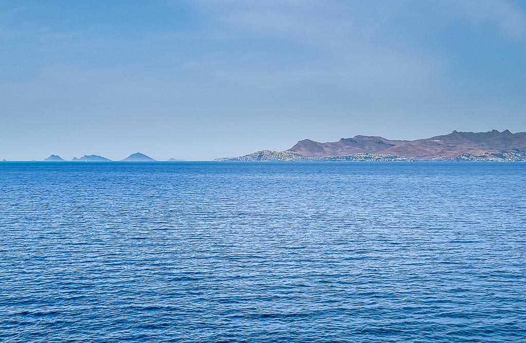
Volcanic cones and domes of Akyarlar volcanic field on the Bodrum peninsula of southwestern Turkey seen from Kos Island, Greece.
The Bodrum & Akyarlar volcanics belong to the area of the active Cos volcanic complex and are the most western volcanics of Turkey.
[smaller] [larger]
Ausbrüche des Akyarlar: none in historic times
Letzte Erdbeben in der Nähe
| Uhrzeit | Mag. / Tiefe | Entfernung / Ort | |||
| 22. Apr. 16:35 (Istanbul) | 1.8 7 km | 28 km östlich | Info | ||
| Dienstag, 16. April 2024 GMT (1 Beben) | |||||
| 16. Apr. 05:16 (Istanbul) | 1.5 5.9 km | 18 km östlich | Info | ||
Beschreibung
The peninsula of Bodrum and Akyarlar is dominated by old dacitic andesitic lava extrusions and lava domes. Their age is probably Pleistocene and the first eruptions took place +- 2-3 mil. years ago.Latest satellite images