Gareloi Volcano
Updated: Apr 28, 2024 10:08 GMT -
Stratovolcano 1573 m / 5,161 ft
United States, Aleutian Islands, 51.79°N / -178.79°W
Current status: normal or dormant (1 out of 5)
United States, Aleutian Islands, 51.79°N / -178.79°W
Current status: normal or dormant (1 out of 5)
Last update: 6 Mar 2024 (Smithsonian / USGS Weekly Volcanic Activity Report)
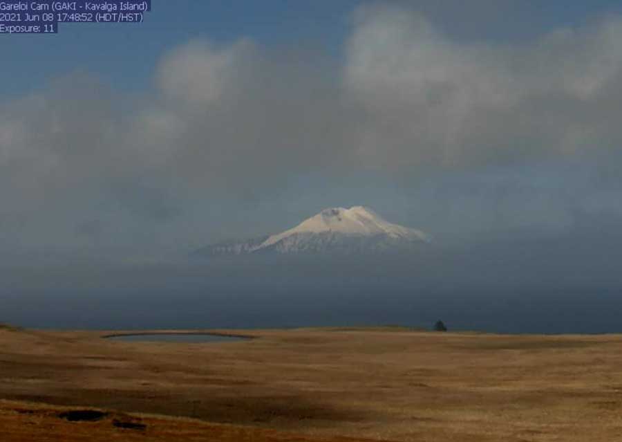
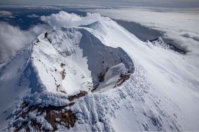
Gareloi volcano from the webcam on 8 June 2021
[smaller] [larger]
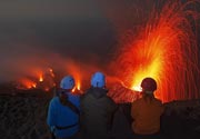
Gareloi volcano eruptions: 1989
Latest nearby earthquakes
| Time | Mag. / Depth | Distance / Location | |||
| Apr 21, 04:38 am (Adak) | 1.0 7.4 km | Info | |||
| Saturday, April 20, 2024 GMT (1 quake) | |||||
| Apr 20, 02:12 am (Adak) | 0.8 10.1 km | Info | |||
| Thursday, April 18, 2024 GMT (2 quakes) | |||||
| Apr 18, 03:38 am (Adak) | 1.0 17 km | Info | |||
| Apr 17, 07:09 pm (Adak) | 0.8 13 km | Info | |||
| Wednesday, April 17, 2024 GMT (2 quakes) | |||||
| Apr 17, 02:13 pm (GMT +0) | 1.8 7.8 km | 19 km (12 mi) to the W | Info | ||
| Apr 16, 04:43 pm (Adak) | 0.9 5.4 km | Info | |||
Background
The 8 x 10 km diameter Gareloi Island, the northernmost volcano of the Delarof Group at the western end of the Andreanof Islands, consists of a stratovolcano with two summits and a SE-trending fissure. This prominent fissure was formed during an eruption in 1929 and extends from the southern summit to the sea. Steep sea cliffs that are cut into rocks of an older, eroded center are found on the SW coast, and submarine deposits of three debris avalanches produced by edifice collapse are found offshore. Young lava flows cover the older volcano from the 1573-m-high summit of Gareloi to the coast along three broad axes trending NW, ENE, and south. The 1929 eruption originated from 13 craters along a 4-km-long fissure. Phreatic explosions were followed by the ejection of glassy pumice, lapilli, scoria, and older blocks, as well as by the emission of four short, steep lava flows, one of which reached the SE coast.---
Smithsonian / GVP volcano information
Latest satellite images