Griggs Volcano
Updated: Apr 28, 2024 06:47 GMT -
Stratovolcano 2317 m / 7,602 ft
United States, Alaska Peninsula, 58.35°N / -155.09°W
Current status: normal or dormant (1 out of 5)
United States, Alaska Peninsula, 58.35°N / -155.09°W
Current status: normal or dormant (1 out of 5)
[smaller] [larger]
Griggs volcano eruptions: 1790 BC ± 40 years
Latest nearby earthquakes
| Time | Mag. / Depth | Distance / Location | |||
| Apr 24, 05:28 am (Anchorage) | 2.2 131 km | 27 km (17 mi) to the N | Info | ||
| Tuesday, April 23, 2024 GMT (1 quake) | |||||
| Apr 23, 03:27 am (Anchorage) | 0.9 98 km | Info | |||
| Sunday, April 21, 2024 GMT (1 quake) | |||||
| Apr 21, 02:23 pm (Anchorage) | 2.1 104 km | 28 km (18 mi) to the E | Info | ||
| Friday, April 19, 2024 GMT (1 quake) | |||||
| Apr 19, 01:30 am (Anchorage) | 2.4 4.1 km | 28 km (17 mi) to the E | Info | ||
| Thursday, April 18, 2024 GMT (1 quake) | |||||
| Apr 18, 01:04 pm (Anchorage) | 1.1 1.1 km | 14 km (8.6 mi) to the S | Info | ||
| Wednesday, April 17, 2024 GMT (1 quake) | |||||
| Apr 17, 01:18 am (Anchorage) | 1.0 5.5 km | Info | |||
Background
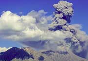
The summit of Mount Griggs towers above Knife Creek on the NE side of the Valley of Ten Thousand Smokes. The volcano is uniquely offset west of the NE-trending alignment of volcanoes in the Katmai area. The broad, 2317-m-high stratovolcano, formerly known as Knife Peak, consists of a late-Pleistocene volcano with glacial valleys on the north that was truncated on its SW side by an early Holocene edifice collapse. A Holocene volcano was subsequently constructed within the 1.5-km-wide scarp left by the emplacement of a large SW-flank debris avalanche. Nested cones with three concentric craters mostly fill the scarp, and thick, blocky lava flows blanket the SW flanks of the volcano below the collapse scarp. In contrast to the more silicic centers of the Katmai area along the crest of the range, lava flows from Griggs are dominantly andesitic in composition, and dacitic lava flows are uncommon. No historical eruptions have occurred from Griggs, but noisy fumarolic jets near the summit can be heard from the valley floor, 1750 m below.---
Smithsonian / GVP volcano information
Latest satellite images