| RSS | EN | DE | EL | ES | FR | IT | RU

Vulcani nella Turchia (25)

[nascondi/mostra sismi] | [più piccolo] [più grande]

Eruzioni vulcaniche significative: Turchia

In historic times, at least 3 volcanoes have been active nella Turchia, including Tendürek Dağ, Ararat e Nemrut Dagi volcanoes. A total of 6 eruptions have been witnessed and documented since intorno 1111 AD.
The table below lists volcanic eruptions, significant eruptive episodes or related events nella Turchia during geologically recent times.
DataVulcanoVEIRegioneDecedutiDanni
1855Tendürek Dağ?Turkey
sconosciuto
1840 Lug 2Ararat
Upper northern flank
3?Turkey
sconosciuto
1650 AD Ott 27Nemrut Dagi
East flank (Lake Van)
?Turkey
sconosciuto
1597 o prima ADNemrut Dagi?Turkey
sconosciuto
1441 ADNemrut Dagi
North flank (Nemrut Boynu)
?Turkey
sconosciuto
1111 ADNemrut Dagi
East flank (Lake Van)
?Turkey
sconosciuto
Remark:
Our list of volcanic eruptions closely follows the database of eruptions of the Smithsonian's Global Volcanism Project (GVP), the internationally most recognized data source for volcanic eruptions, but also includes significant eruptive episodes or related volcano events. "Volcanic eruptions" are usually to be understood as sequences of individual eruptive episodes that can follow each other, or even overlap (if several vents are involved), and can last many years, decades or even longer. For example, the current activity of Stromboli volcano is understood as a single eruption that has been ongoing since 1934.
Fonti: NOAA National Centers for Environmental Information (NCEI), Global Significant Volcanic Eruptions Database. doi:10.7289/V5TD9V7K | Global Volcanism Project / Smithsonian Institution

Turchia FAQ

+When was the last volcanic eruption nella Turchia?

+When was the first documented volcanic eruption nella Turchia?

+How often do volcanoes nella Turchia erupt?

+When was the largest volcanic eruption nella Turchia?

Ultimi sismi: Turkey

Negli ultimi 7 giorni, Turkey ha avuto 13 sismi di magnitudo 4.0 o superiore, 64 sismi di magnitudo 3+ e 388 sismi di magnitudo 2+. C'erano anche 2,034 sismi piccoli sotto magnitudo 2.0 que normalmente non si sentono.
Un Grandezza 4.9 sismo è stato avvertito in provincia di Balıkesir, Turchia .
Grandezza 4.9 Sismo provincia di Balıkesir, Turchia widely felt -
Data e oraMag / Prof.Vulcano più vicino / Posizione
15 nov 11:46 (Istanbul)
4.4

12 km
60 km N daSındırgı (Balıkesir)  I FELT IT - 2 reportsInfo
giovedì, 13 novembre 2025 GMT (2 sismi)
13 nov 06:21 (Istanbul)
4.2

7.9 km
72 km N daSındırgı (Balıkesir)  I FELT IT - 3 reportsInfo
13 nov 06:16 (Istanbul)
4.7

12 km
74 km N daSındırgı (Balıkesir)  I FELT IT - 13 reportsInfo
martedì, 11 novembre 2025 GMT (1 sismo)
11 nov 04:57 (Istanbul)
4.4

10 km
59 km N daWestern Turkey  I FELT IT - 1 reportInfo
lunedì, 10 novembre 2025 GMT (2 sismi)
11 nov 00:02 (Istanbul)
4.3

7 km
72 km N daSındırgı (Balıkesir)  I FELT IT - 10 reportsInfo
10 nov 21:20 (Istanbul)
4.9

9.6 km
73 km N daSındırgı (Balıkesir)  I FELT IT - 53 reportsInfo

Terremoti significativi nella Turchia dal 1900


TIl terremoto più mortale nella Turchia dal 1900 è stato the magnitude 7.8 earthquake nella  Turchia, provincia di Gaziantep on febbraio, 6, 2023. Ha causato 56,697 vittime e 119,200 feriti. Anche uno tsunami è stato generato dal terremoto e ha contribuito ai suoi effetti distruttivi. Questo era il 6° terremoto più disastroso mai avvenuto nella Turchia. Questo è stato anche il terremoto più dannoso avvenuto in questo periodo: le perdite economiche totali sono state stimate nell'equivalente di $42.9 miliardi di dollari americani. Più di 542,000 case e altri edifici furono distrutti e più di 1,470,000 danneggiati.

DataMagRegioneDecedutiDanni
2023 Feb 67.8 Kahramanmaras; Syria56,697
catastrofico
Info
1999 Nov 127.2 Bolu-duzce-kaynasli, Adapazari, Zonguldak894
catastrofico
Info
1999 Aug 177.6 Istanbul, Kocaeli, Sakarya17,118
catastrofico
Info
1992 Mar 136.9 Erzincan653
molto pesante
Info
1983 Oct 306.9 Erzurum, Kars, Khorasan, Pasinler, Narman1,342
pesante
Info
1976 Nov 247.0 Muradiye5,000
pesante
Info
1975 Sep 66.7 Lice2,311
pesante
Info
1971 May 226.7 Bingol1,000
moderato
Info
1970 Mar 287.2 Gediz1,086
pesante
Info
1966 Aug 196.8 Varto2,394
pesante
Info
1953 Mar 187.3 Yenice, Onon1,070
moderato
Info
1946 May 315.9 Ustukran840
moderato
Info
1944 Feb 17.6Turkey2,381
pesante
Info
1943 Nov 267.5 Ladik, Samsun, Havza4,020
molto pesante
Info
1942 Dec 207.0 Niksar, Erbaa1,000
molto pesante
Info
1939 Dec 267.8 Erzincan32,700
pesante
Info
1914 Oct 37.0 Burdur, Kilinc, Keciborlu, Isparta4,000
molto pesante
Info
1912 Aug 97.2 Marmara Sea2,800
molto pesante
Info
1903 May 285.8 Varginis, Cardahli, Mehkerek1,000
pesante
Info
1903 Apr 286.3 Malazgirt3,560
molto pesante
Info
Fonte: NOAA National Centers for Environmental Information (NCEI), Global Significant Earthquake Database. doi:10.7289/V5TD9V7K

Carta

Sismi più vecchi (fino a 1960) mostrati in giallo, quelli più recenti (2000 e dopo) in rosso.
[sismi -] [sismi +] [più piccolo] [più grande]

Terremoti significativi nella Turchia FAQ

+Qual è stato il terremoto più mortale nella Turchia dal 1900?

+Quante persone sono state uccise dai terremoti nella Turchia dal 1900?

+Quanti danni hanno causato i terremoti nella Turchia dal 1900?

Elenco vulcani

Acigöl-Nevsehir

(caldera, lava domes 1689 m)
Google Earth View image of the caldera of Acigöl-Nevsehir
The big caldera of Acigöl-Nevsehir is located in central Turkey and has a size of 7-8 km diameter. [Ulteriori info]

Akyarlar

(lava domes 172 m)
Volcanic cones and domes of Akyarlar volcanic field on the Bodrum peninsula of southwestern Turkey seen from Kos Island, Greece.
The Bodrum & Akyarlar volcanics belong to the area of the active Cos volcanic complex and are the most western volcanics of Turkey. [Ulteriori info]

Ararat

(stratovolcano 5165 m)
The 5165-m-high, double-peaked stratovolcano Mount Ararat, also known as Agri Dagi, is Turkey's highest, largest volume, and easternmost volcano. [Ulteriori info]

Arpacay

(Volcanic field unknown)
[Ulteriori info]

Ceyhan-Osmaniye

(Volcanic field 424 m / 1391 ft)
[Ulteriori info]

Erciyes Dagi

(stratovolcano 3916 m)
Erciyes Dağ or Erciyes Dagi volcano is a massive, eroded stratovolcano that dominates the northern end of the Sultansazligi Basin in central Anatolia. It covers an area of about 1300 sq km. [Ulteriori info]

Etrusk

(Stratovolcano 3100 m / 10171 ft)
[Ulteriori info]

Girekol

(stratovolcano 2323 m)
A huge volcano north of Van lake with a great eruption crater towards south-east. [Ulteriori info]

Gölcük

(Caldera unknown)
[Ulteriori info]

Göllü Dağ

(stratovolcano 2143 m)
Göllü Dağ, a 2143-m-high rhyolitic-to-rhyodacitic lava dome complex in central Anatolia, lies between the Hasan Dağ and Acigöl-Nevsehir volcanic complexes. [Ulteriori info]

Hasan Dagi

(stratovolcano 3253 m)
The Hasan Dagi is a huge stratovolcano on which caldera collapses took place in ca. 7500-7600 years ago. [Ulteriori info]

Karaca Dağ

(shieldvolcano 1957 m)
The huge Karaca Dağ volcano is a 1957 m high basaltic shield volcano in SE-Turkey near the Syrian border. It is situated on the Arabian foreland and about 150 km of the boundary of the Anatolian plate. It has been active since the Pliocene and also in historic times eruptions occ... [Ulteriori info]

Karadağ

(stratovolcano, lava domes 2265 m)
A huge volcanic complex near the village Madenşehri with a huge crater. [Ulteriori info]

Karapinar

(cinder cones, maar 1086 m)
The Karapinar volcanic field is one of the most interesting areas in south-western Turkey. [Ulteriori info]

Karasu Rift

(Volcanic field 486 m / 1594 ft)
[Ulteriori info]

Kargapazari Dagi

(Unknown 2089 m / 6854 ft)
[Ulteriori info]

Kars

(stratovolcano ca. 3000 m)
The Kars Plateau is a broad calc-alkaline to alkaline volcanic field of largely Pliocene to mid-Pleistocene age in the NE corner of Turkey (Innocenti et al., 1982; Yilmaz, 1990). [Ulteriori info]

Kenger

(cinder cone 745 m)
The Kenger volcano belongs to the fault system that created also the Kula cinder cones in western Turkey. [Ulteriori info]

Kisir Dagi

(Unknown 3192 m / 10472 ft)
[Ulteriori info]

Koruhüyüğü

(cinder cones 433 m)
A serial of cinder cones in the "graben" structure in the area north of Kirikhan town in Turkey. [Ulteriori info]

Kula

(cinder cones, maars 740 m)
The Kula volcanic field in western Turkey near the city Selendi had the last eruptions probably more than 10.000 years ago. [Ulteriori info]

Nemrut Dagi

(caldera 2948 m)
The summit of Nemrut Dagi is truncated by a 5 x 9 km caldera near Lake Van in eastern Turkey. A lake that partially fills the western side of the caldera is constrained by post-caldera eruptions that produced glassy obsidian lava flows from domes on the eastern caldera floor. A series of scoria cones and lava domes were erupted along N-S-trending fissures on the northern flank. Ash layers in Lake Van document numerous Holocene eruptions from Nemrut Dagi. (Image: NASA International Space Station image ISS001-E-6354, 2001, http://eol.jsc.nasa.gov/).
Nemrut Dağ (or Nemrut Dagi) volcano is the westernmost of a group of volcanoes near Lake Van in eastern Anatolia, and the only one that has erupted in historical time. It contains a 9 x 5 km caldera partially filled on its western side by a caldera lake. [Ulteriori info]

Sandal

(cinder cone 855 m)
The Sandal volcano belongs to the Kula volcanic area. [Ulteriori info]

Süphan Dağ

(lava dome, strato volcano, pyroclatsic flows 4158 m)
The huge lava dome and strato-volcano is situated north of the famous lake Van. [Ulteriori info]

Tendürek Dağ

(stratovolcano 3584 m)
Tendürek Dağ, also written as Tendürük Dagi, is an elongated shield volcano that rises 1800 m above the plain of Dogubayazit, near the Iranian border, south of Mount Ararat. [Ulteriori info]
Volcanoes & Earthquakes - new app for Android
Tour garantiti
20 nov - 3 dic 2025: Desert, salt and volcanoes - Danakil desert (Ethiopia)
2-10 mag 2026: From Stromboli to Etna - Eolian Islands + Etna volcano
= spaces available   = guaranteed   = few spaces left   = booked out
Ultime notizie

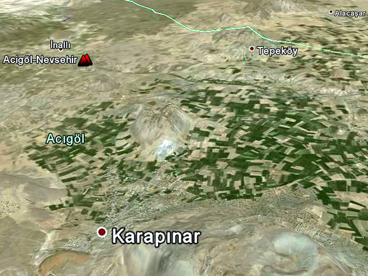
Eruzione vulcanica segnalata dal monte Göksun Kuşkayası, Turchia, 11 febbraio 2023

TP
In Turchia si sta diffondendo la notizia che un nuovo vulcano potrebbe essersi formato su una montagna chiamata Kuşyakası, vicino al villaggio di Büyükkızılcık nel distretto di Göksun nella provincia …
Try our free app!
Volcanoes & Earthquakes - new app for Android
Android | iOS version

More on VolcanoDiscovery

Why is there advertising on this site?

Supportaci – aiutaci a migliorare i nostri servizi!

Amiamo davvero lavorare per offrirti gli ultimi dati su vulcani e terremoti da tutto il mondo. Tuttavia, mantenere il nostro sito web e le app gratuite richiede un considerevole impegno di tempo e risorse.
Abbiamo bisogno di finanziamenti per aumentare la capacità hardware e software e per supportare il nostro team di redazione. Puntiamo a garantire un servizio ininterrotto ovunque si verifichi un terremoto o un’eruzione vulcanica, e le tue donazioni possono renderlo possibile! Ogni contributo è molto apprezzato. Se trovi utili le informazioni e vuoi supportare il nostro team nell’integrare nuove funzionalità, scrivere contenuti di qualità e migliorare hardware e software, per favore fai una donazione:

Usa PayPal:

Funzionalità pianificate:

Grazie alle tue donazioni precedenti, sono state aggiunte recentemente queste funzionalità:
Scarica e aggiorna l’app Vulcani e Terremoti per ricevere tra le notifiche più rapide su attività sismica e eruzioni vulcaniche online:
Android | iOS
Grazie per il tuo supporto!
Sources: VolcanoDiscovery / VolcanoAdventures and other sources as noted.
Use of material: Most text and images on our websites are owned by us. Re-use is generally not permitted without authorization. Contact us for licensing rights.
Volcanoes & Earthquakes
VolcanoDiscovery Home
Vulcani | Earthquakes | Photos | News | | Shop | App
Adventure & Study Travel
Tours to Volcanoes and Volcanic Areas: walking tours, photo tours, study tours
Tours & Dates | FAQ | About us
Get our newsletter!
Company info
Contact | Legal info | Terms & conditions
Follow us
Follow us on facebook Follow us on Instagram Follow us on Bluesky Follow us on Twitter Visit our Youtube channel
EN | DE | EL | ES | FR | IT | RU
VolcanoDiscovery GmbH, Germany, Reg. nr.: HRB 103744, EU Tax Id: DE 297 465 123 owned and created by
Dr. Tom Pfeiffer, volcanologist, volcano photographer, tour organizer member of
IAVCEI
IAVCEI
Vulkanologische Gesellschaft
Volcanological Society
Ecotourism Greece
Ecotourism Greece
RUV insurance
Insured by R+V
VolcanoDiscovery © 2004- All Rights Reserved | Privacy - Cookie Settings