Maroa Volcano
Updated: Aug 4, 2025 17:30 GMT -
Calderas
New Zealand, -38.42°S / 176.08°E 
Summit height: 1156 m / 3,793 ft
Current status: normal or dormant (1 out of 5)
Last update: 12 Dec 2021 (Smithsonian / USGS Weekly Volcanic Activity Report)
[smaller] [larger]
Maroa volcano eruptions: 180 AD (?)
Latest nearby earthquakes
| Date and Time | Mag / Depth | Distance / Location | |||
|---|---|---|---|---|---|
| Aug 5, 01:09 am (GMT +12) | 1.5 8 km | 25 km (16 mi) to the S | Info | ||
| Aug 5, 01:07 am (GMT +12) | 1.7 8.1 km | 23 km (14 mi) to the S | Info | ||
| Aug 4, 08:30 pm (GMT +12) | 2.0 3.6 km | 26 km (16 mi) to the S | Info | ||
| Aug 4, 08:27 pm (GMT +12) | 1.8 4.5 km | 26 km (16 mi) to the S | Info | ||
| Aug 4, 07:51 pm (GMT +12) | 1.8 156 km | 23 km (14 mi) to the W | Info | ||
| Sunday, August 3, 2025 GMT (2 quakes) | |||||
| Aug 4, 05:08 am (GMT +12) | 2.5 147 km | 20 km (13 mi) to the W | Info | ||
| Aug 4, 12:23 am (GMT +12) | 2.3 6.9 km | 19 km (12 mi) to the SE | Info | ||
| Thursday, July 31, 2025 GMT (1 quake) | |||||
| Aug 1, 11:02 am (GMT +12) | 2.7 185 km | 25 km (16 mi) to the S | Info | ||
| Wednesday, July 30, 2025 GMT (1 quake) | |||||
| Jul 31, 11:07 am (GMT +12) | 2.7 154 km | 15 km (9.6 mi) to the W | Info | ||
Background
The 16 x 25 km Maroa caldera formed sometime after 230 thousand years ago (ka) in the NE corner of the 30 x 40 km Whakamaru caldera, which is the largest of the Taupo volcanic zone. The Whakamaru caldera partially overlaps with the Taupo caldera on the south and was formed during the eruption of the Whakamaru Group ignimbrites between about 340 and 330 ka. The Maroa caldera was subsequently filled by at least 70 rhyolitic lava domes or flows, mostly erupted along a SW-NE trend. Lesser amounts of basalt were also erupted. The latest dated magmatic eruption took place about 14 ka, when the rhyolitic Puketarata tuff ring and lava domes were formed (Brooker et al., 1993). The Orakeikorako, Ngatamariki, Rotokaua, and Wairakei hydrothermal areas are located within or adjacent to the Whakamaru caldera. Large hydrothermal eruptions have occurred at the Orakeikorako thermal area during the Holocene, the latest immediately prior to the 1800-year-old Taupo eruption.---
Smithsonian / GVP volcano information
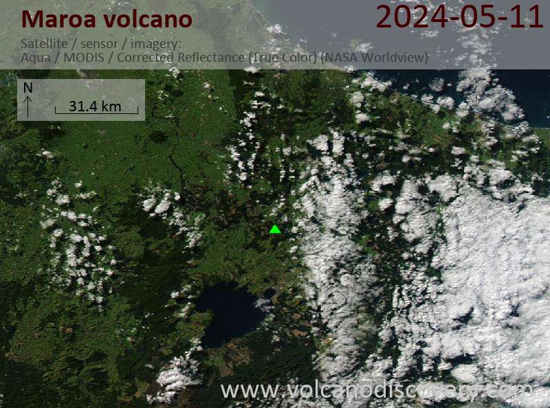
Latest satellite images
Maroa Volcano Maps
Below is a selection of maps showing the location and surroundings of the volcano at various resolutions based on aerial-imagery / terrain maps. Feel free to use them for non-commercial purposes on your blog or website as long as you credit them with a link back to this page (click to copy it).

Satellite/aerial-type map of Maroa volcano (world scale)

Terrain-type map of Maroa volcano (world scale)

Satellite/aerial-type map of Maroa volcano (region scale large)

Terrain-type map of Maroa volcano (region scale large)

Satellite/aerial-type map of Maroa volcano (region scale medium)

Terrain-type map of Maroa volcano (region scale medium)

Satellite/aerial-type map of Maroa volcano (region scale small)

Terrain-type map of Maroa volcano (region scale small)

Satellite/aerial-type map of Maroa volcano (local scale large)

Terrain-type map of Maroa volcano (local scale large)

Satellite/aerial-type map of Maroa volcano (local scale medium)

Terrain-type map of Maroa volcano (local scale medium)

Satellite/aerial-type map of Maroa volcano (local scale small)

Terrain-type map of Maroa volcano (local scale small)

Satellite/aerial-type map of Maroa volcano (scale of 10s of km)

Terrain-type map of Maroa volcano (scale of 10s of km)

Satellite/aerial-type map of Maroa volcano (scale of 20-40 km)

Terrain-type map of Maroa volcano (scale of 20-40 km)

Satellite/aerial-type map of Maroa volcano (scale of approx. 10-20 km)

Terrain-type map of Maroa volcano (scale of approx. 10-20 km)

Satellite/aerial-type map of Maroa volcano (scale of 5-10 km)

Satellite/aerial-type map of Maroa volcano (scale of few kilometers)