Ubinas Volcano
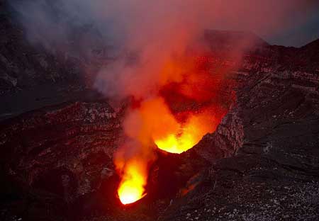
Ubinas is Peru's most active volcano. A small, 1.4-km-wide caldera cuts the top of the volcano. The steep-walled, 150-m-deep summit caldera contains an ash cone with a 500-m-wide and 200 m deep crater Debris-avalanche deposits from the collapse of the SE flank of Ubinas about 3700 years ago extend 10 km from the volcano. Widespread plinian pumice-fall deposits from Ubinas include one of Holocene age about 1000 years ago. Holocene lava flows are visible on the volcano's flanks, but historical activity, documented since the 16th century, has consisted of intermittent minor-to-moderate explosive eruptions.
---
Source: abbreviated from Global Volcanism Program information on Ubinas
Ubinas volcano eruptions: 2014-16, 2009-2010, 2006-08, 1969, 1956, 1951, 1937, 1907, 1906, 1869, 1867, 1865, 1862, 1830, 1826(?), 1784, 1677, 1662, 1600, 1550 ± 50y
Latest nearby earthquakes
| Date and Time | Mag / Depth | Distance / Location | |||
|---|---|---|---|---|---|
Significant volcanic eruptions: Ubinas volcano
Additionally, there are 3 uncertain or discredited eruptions from Ubinas volcano.
| Date | Note | VEI | Deaths | Damage | |
|---|---|---|---|---|---|
Historical obs./docs. | ? | ||||
Historical obs./docs. | 3 | ||||
Historical obs./docs. | 2 | ||||
| Summit crater Historical obs./docs. | 2 | ||||
| Summit crater Historical obs./docs. | 2 | ||||
| 2013 Sep 1 (eruption | Historical obs./docs. | 0 | light | Info | |
?? | Uncertain Eruption Historical obs./docs. | 1? | |||
Historical obs./docs. | 2 | ||||
Historical obs./docs. | 2? | ||||
Historical obs./docs. | 2 | ||||
Historical obs./docs. | 2 | ||||
Historical obs./docs. | 2 | ||||
Historical obs./docs. | 2 | ||||
Historical obs./docs. | 2 | ||||
Historical obs./docs. | 2 | ||||
Historical obs./docs. | 2 | ||||
Historical obs./docs. | 2 | ||||
Historical obs./docs. | 2 | ||||
Historical obs./docs. | 2 | ||||
?? | Uncertain Eruption | ? | |||
Historical obs./docs. | 2 | ||||
Ubinas Volcano FAQ
+When was the last eruption of Ubinas volcano?
The last confirmed eruption of Ubinas occurred in 2024.
+How often does Ubinas volcano erupt?
Since 1550 AD, Ubinas volcano has had at least 22 historically documented eruptions. This means that it erupts on average every 21.6 years.
Many eruptions of Ubinas have lasted more than one year. In total, the volcano has been in eruption during 28 out of 475 years until now. In other words, Ubinas has been active at least one in 17 years on average. Note that this value is likely an underestimate, because the known history of eruptions from Ubinas is likely incomplete, especially further back in time.
+How active is Ubinas volcano at present?
Ubinas volcano is relatively active: Since 1900, it has had 18 eruptions, and been active during 18 years out of 126 as of now. This means, Ubinas has been in eruption one in 7 years on average. The last eruption was in 2024 and ended 11 months ago.
+When was the largest eruption of Ubinas volcano?
The largest eruption known from the younger geological history of Ubinas volcano occurred around 1082 AD. It ranks as a "vulcanian" eruption with a magnitude 3 on the VEI (Volcanic Explosivity Index) scale.
Latest satellite images
Ubinas Volcano Maps


