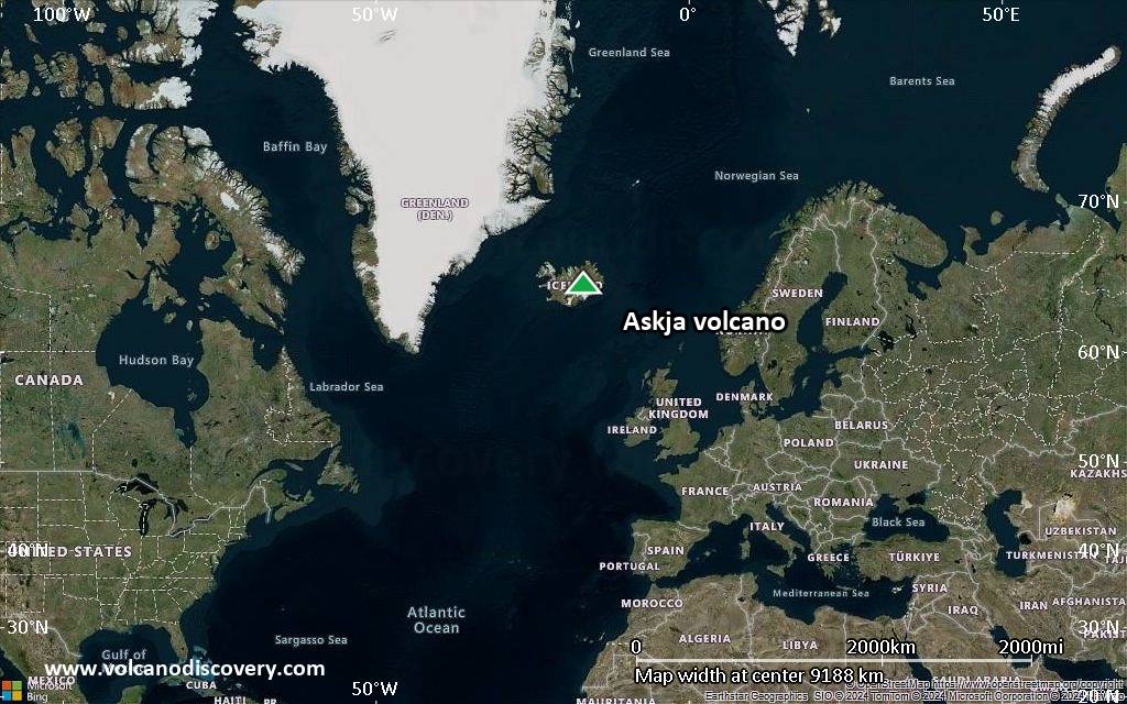
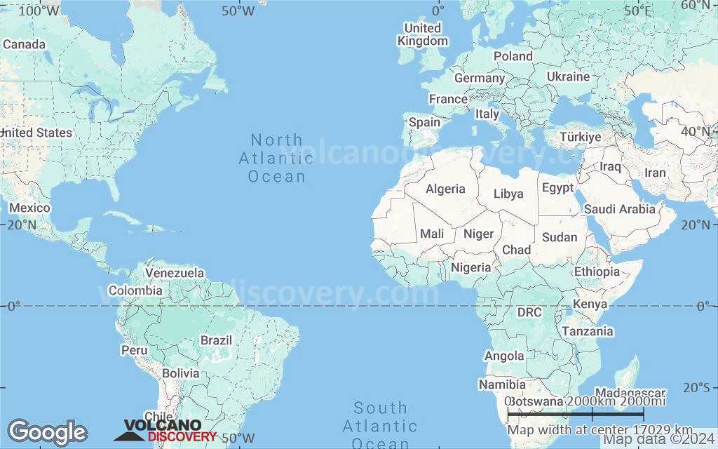
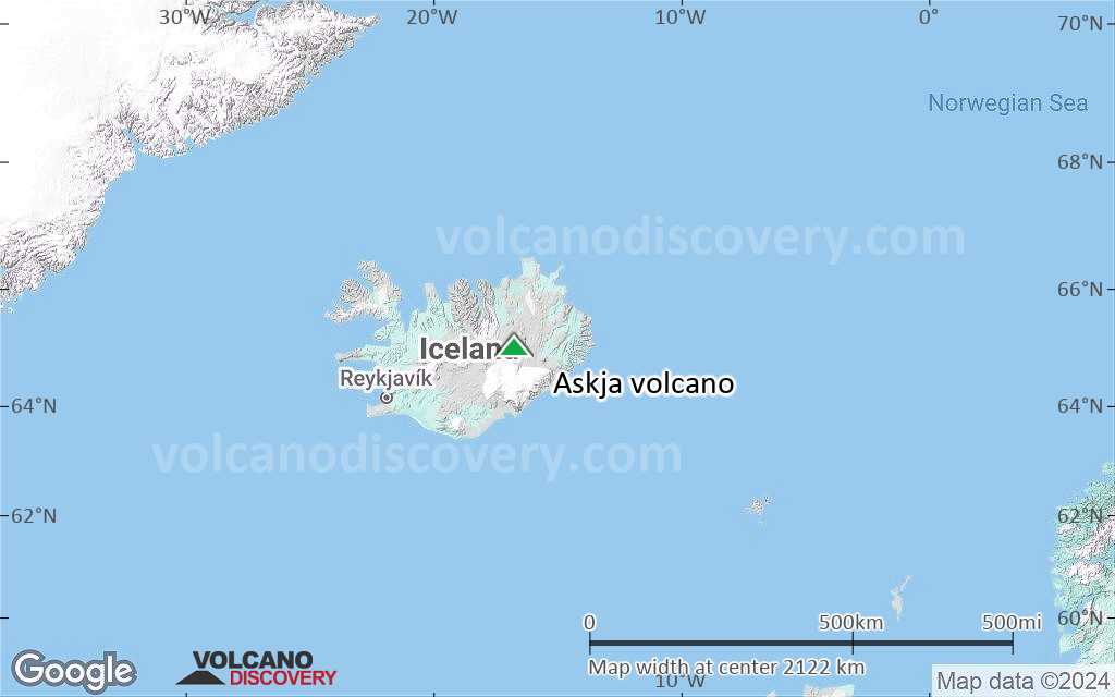
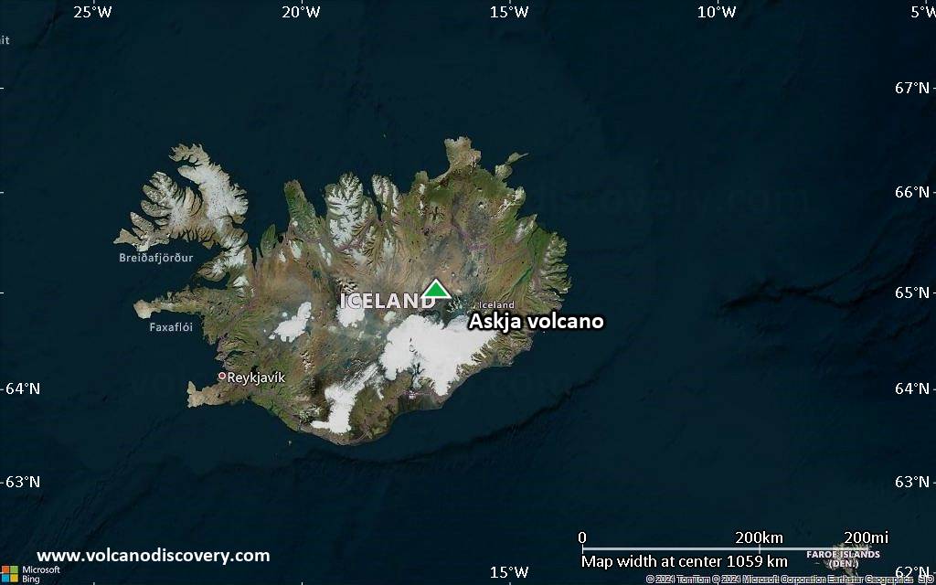
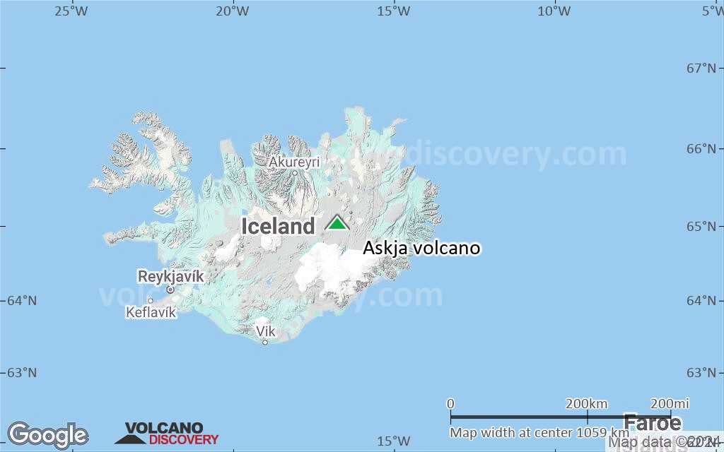
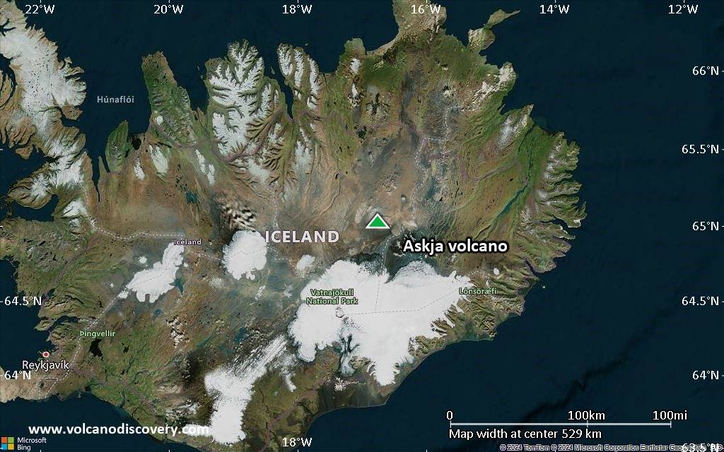
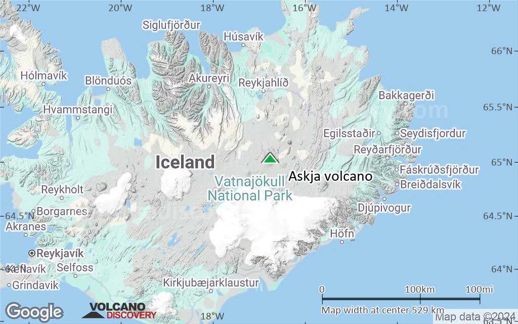
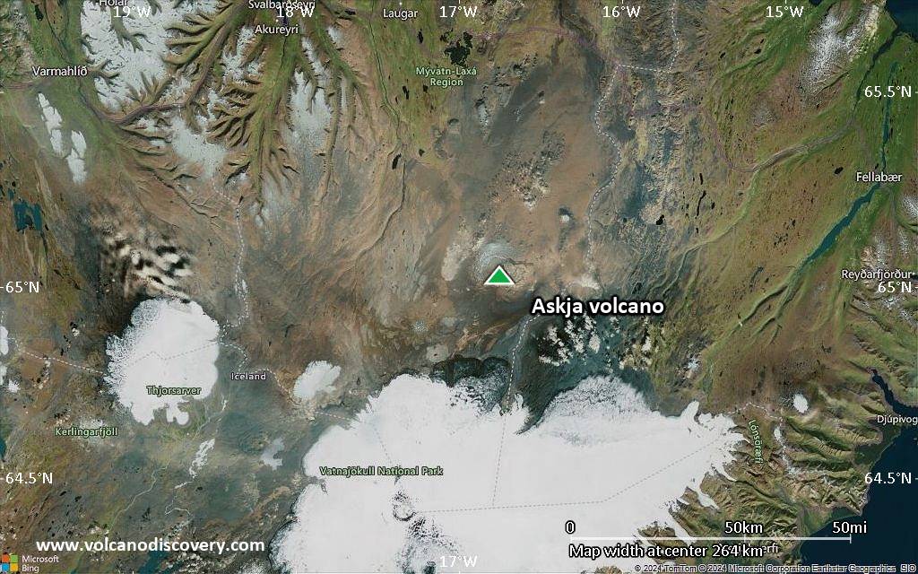
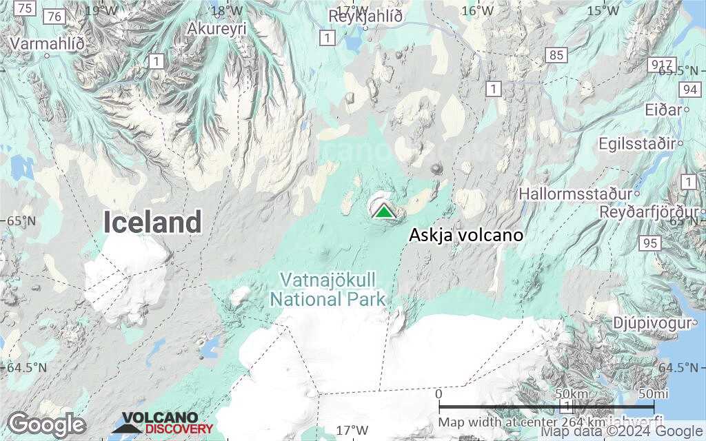
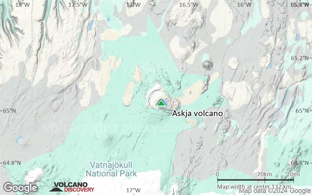
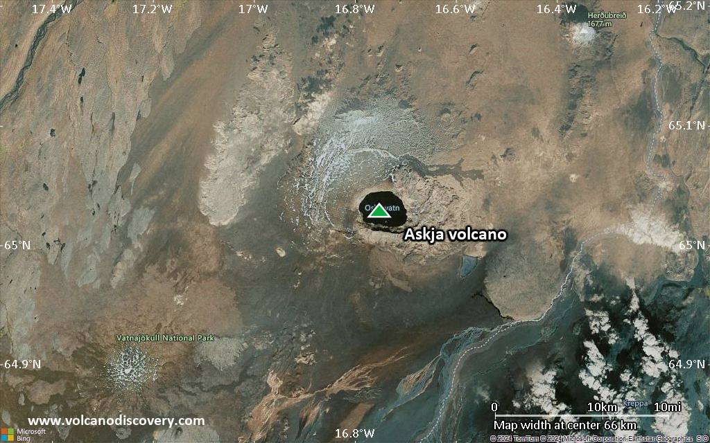
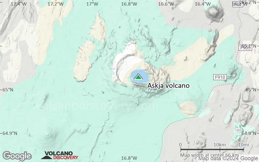
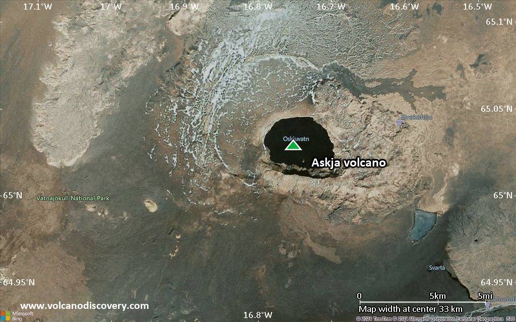
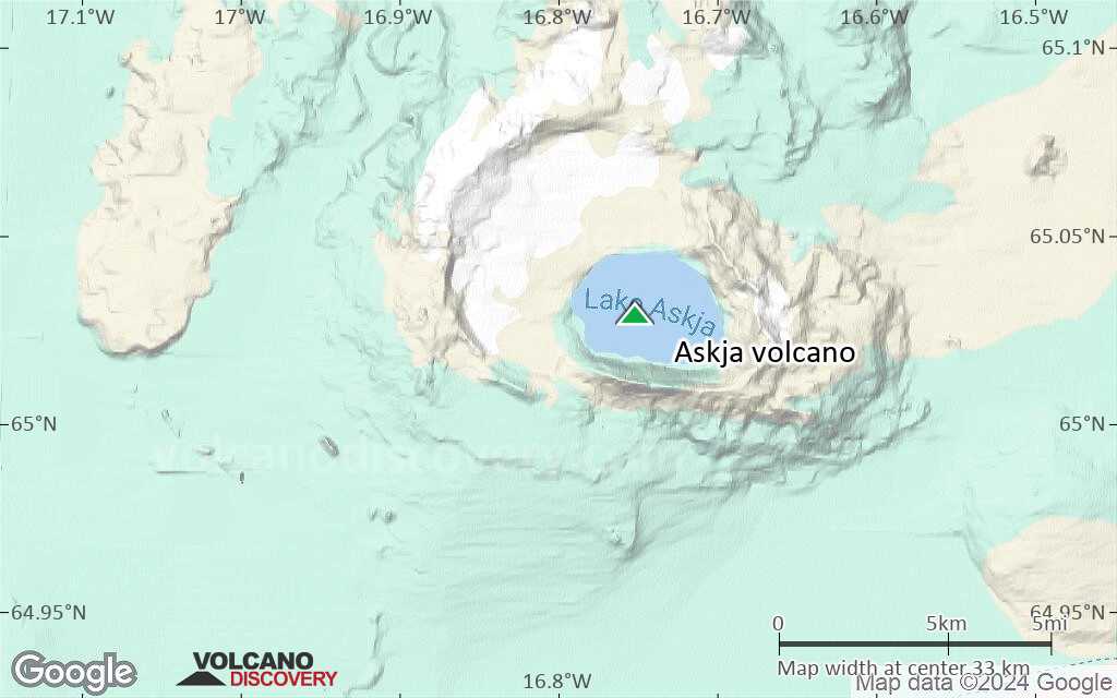
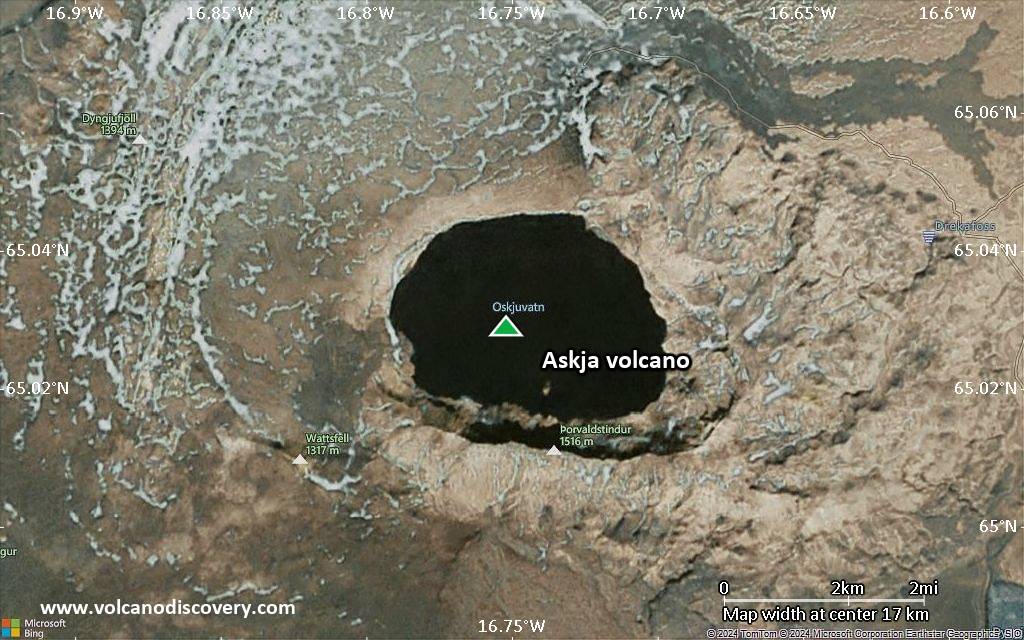
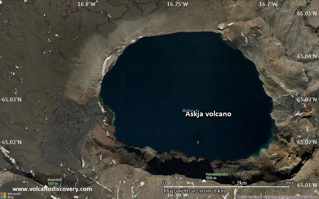
| RSS | EN | DE | EL | ES | FR | IT | RU

Askja Volcano

Updated: May 1, 2025 11:43 GMT -
Stratovolcano
Central Iceland, 65.03°N / -16.75°W
Summit height: 1516 m (4,974 ft)
Current status: normal or dormant (1 out of 5)
Last update: 27 Mar 2024 (seismic swarm yesterday)

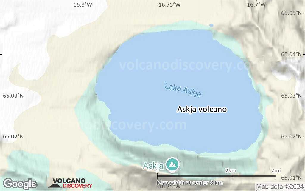
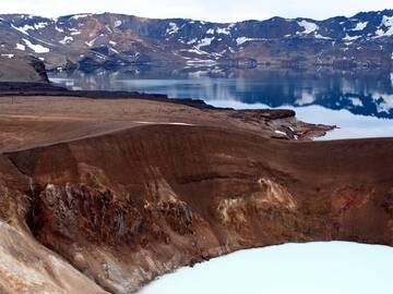
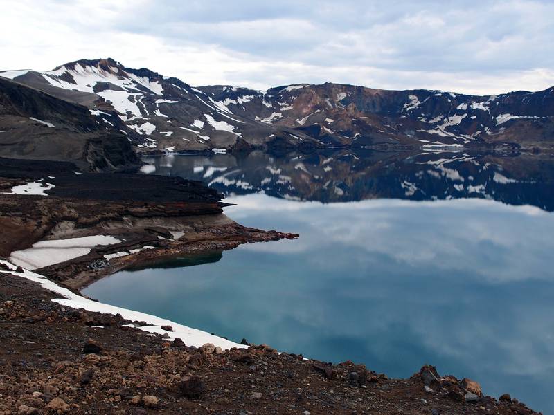
Askja is a large basaltic central volcano that forms the Dyngjufjöll massif. It is truncated by three overlapping calderas, the largest of which is 8 km wide and may have been produced primarily from subglacial ring-fracture eruptions rather than by subsidence.

[smaller] [larger]
Typical eruption style: explosive + effusive
Askja volcano eruptions: 1797(?), 1875, 1919, 1921, 1922, 1923, 1924(?), 1926, 1938, 1961

Latest nearby earthquakes

Date and TimeMag / DepthDistance / Location
May 1, 06:54 am (Reykjavik)
0.3

5 km
5.7 km (3.5 mi) to the N Iceland: 2.6 km E of Jónsskarð Info
May 1, 06:37 am (Reykjavik)
0.5

10.3 km
21 km (13 mi) to the NE Iceland: 4.1 km SSW of Herðubreið Info
May 1, 06:08 am (Universal Time)
0.3

9.8 km
21 km (13 mi) to the NE 4.0 km SSW of Herðubreið Info
May 1, 05:14 am (Universal Time)
1.8

3.5 km
1.2 km (0.7 mi) to the NW 2.1 km NE of Mývetningahraun Info
May 1, 03:59 am (Reykjavik)
0.4

8.9 km
27 km (17 mi) to the NE Iceland: 3.8 km N of Herðubreið Info
Wednesday, April 30, 2025 GMT (3 quakes)
Apr 30, 10:25 pm (Reykjavik)
0.4

9.7 km
28 km (17 mi) to the NE Iceland: 4.2 km N of Herðubreið Info
Apr 30, 09:24 pm (Reykjavik)
0.3

8.4 km
28 km (18 mi) to the NE Iceland: 4.8 km N of Herðubreið Info
Apr 30, 05:16 pm (Universal Time)
1.9

4.7 km
5.9 km (3.7 mi) to the N 2.6 km E of Jónsskarð Info
Saturday, April 26, 2025 GMT (1 quake)
Apr 26, 10:12 am (Universal Time)
1.6

4.1 km
3.6 km (2.2 mi) to the E 1.4 km NE of Suðurbotnar Info

Background

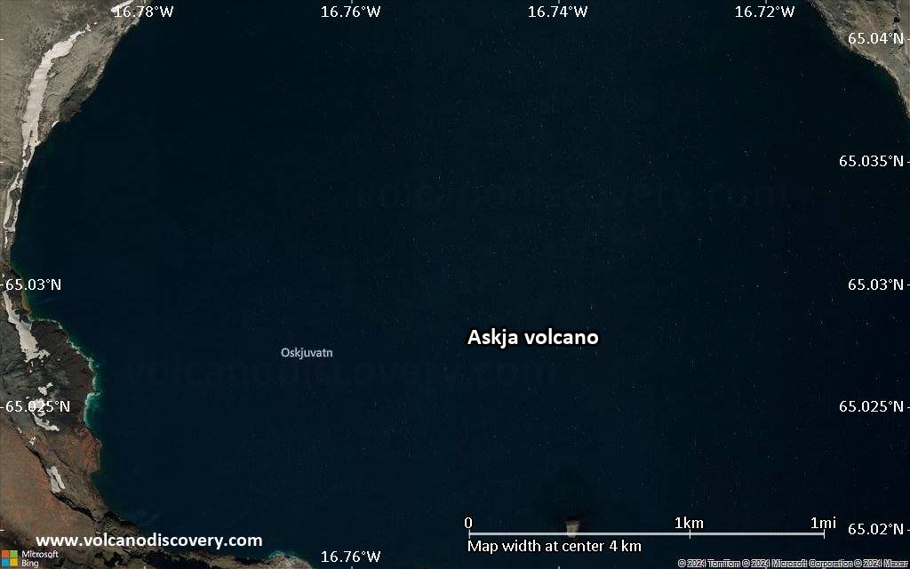
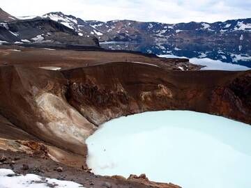
A major rhyolitic explosive eruption from Dyngjufjöll about 10,000 years ago was in part associated with the formation of Askja caldera. Many postglacial eruptions also occurred along the ring-fracture. A major explosive eruption on the SE caldera margin in 1875 was one of Iceland's largest during historical time. It resulted in the formation of a smaller 4.5-km-wide caldera, now filled by Öskjuvatn lake, that truncates the rim of the larger central caldera. The 100-km-long Askja fissure swarm, which includes the Sveinagja graben, is also related to the Askja volcanic system, as are several small shield volcanoes such as Kollatadyngja. Twentieth-century eruptions at Askja have produced lava flows from vents located mostly near Öskjuvatn lake.

---
Source: GVP, Smithsonian Institution

Askja Volcano Photos

Significant volcanic eruptions: Askja volcano

In the past 10,000 years, Askja has had at least 14 confirmed volcanic eruptions, out of which 10 are documented by historical records, while the others can be inferred from geological evidence.
The table below lists all known eruptions (date in bold face) of Askja volcano in historic times and during the past 10,000 years. Updates on the most recent volcanic activity of Askja can be found on the news page of Askja volcano.
DateNoteVEIDeathsDamage
1961 Oct 26 - Dec 5 ±4 d.North of Öskjuvatn lake (Vikraborgir)
Historical obs./docs.
2
1938 Dec 19 ?South shore of Öskjuvatn lake
Historical obs./docs.
2
1926 Jul 15 ±45 d.South end of Öskjuvatn lake
Historical obs./docs.
2?
1924 ?South flank of Dyngjufjöll massif
Historical obs./docs.
?
1923 Jan 15 ±45 d.SE corner of Öskjuvatn Caldera
Historical obs./docs.
?
1922 Nov1 km SW of Öskjuvatn Caldera
Historical obs./docs.
?
1921 MarNE caldera wall, 0.6 km SE of Viti
Historical obs./docs.
?
1919Dyngjufjöll
Historical obs./docs.
2
1875 Jan 1 - Oct 17Öskjuvatn Caldera, Viti, Sveinagja
Historical obs./docs.
5
1875 Mar 29
(eruption 1875 Jan 1 - Oct 17)
Historical obs./docs.
5
light
Info
1797 ?Holuhraun
Historical obs./docs.
?
1300 ? ADSouth of Dyngjufjöll Ytri1
1250 ±300 y. BCLitladynga and Askja?
2050 ±500 y. BCFlatadyngja, other areas NE of Dyngjufjöll?
8910 ±200 y. BCSE part of Askja caldera5
Remark:
Our list of volcanic eruptions closely follows the database of eruptions of the Smithsonian's Global Volcanism Project (GVP), the internationally most recognized data source for volcanic eruptions, but also includes significant eruptive episodes or related volcano events. "Volcanic eruptions" are usually to be understood as sequences of individual eruptive episodes that can follow each other, or even overlap (if several vents are involved), and can last many years, decades or even longer. For example, the current activity of Stromboli volcano is understood as a single eruption that has been ongoing since 1934.
Sources: NOAA National Centers for Environmental Information (NCEI), Global Significant Volcanic Eruptions Database. doi:10.7289/V5TD9V7K | Global Volcanism Project / Smithsonian Institution

Askja Volcano FAQ

+When was the last eruption of Askja volcano?

+How often does Askja volcano erupt?

+How active is Askja volcano at present?

+When was the largest eruption of Askja volcano?

Latest satellite images

Askja satellite image sat1Askja satellite image sat2

Askja Volcano Maps

Below is a selection of maps showing the location and surroundings of the volcano at various resolutions based on aerial-imagery / terrain maps. Feel free to use them for non-commercial purposes on your blog or website as long as you credit them with a link back to this page (click to copy it).
Satellite/aerial-type map of Askja volcano (world scale)
Terrain-type map of Askja volcano (world scale)
Satellite/aerial-type map of Askja volcano (region scale large)
Terrain-type map of Askja volcano (region scale large)
Satellite/aerial-type map of Askja volcano (region scale medium)
Terrain-type map of Askja volcano (region scale medium)
Satellite/aerial-type map of Askja volcano (region scale small)
Terrain-type map of Askja volcano (region scale small)
Satellite/aerial-type map of Askja volcano (local scale large)
Terrain-type map of Askja volcano (local scale large)
Satellite/aerial-type map of Askja volcano (local scale medium)
Terrain-type map of Askja volcano (local scale medium)
Satellite/aerial-type map of Askja volcano (local scale small)
Terrain-type map of Askja volcano (local scale small)
Satellite/aerial-type map of Askja volcano (scale of 10s of km)
Terrain-type map of Askja volcano (scale of 10s of km)
Satellite/aerial-type map of Askja volcano (scale of 20-40 km)
Terrain-type map of Askja volcano (scale of 20-40 km)
Satellite/aerial-type map of Askja volcano (scale of approx. 10-20 km)
Terrain-type map of Askja volcano (scale of approx. 10-20 km)
Satellite/aerial-type map of Askja volcano (scale of 5-10 km)
Satellite/aerial-type map of Askja volcano (scale of few kilometers)
Volcanoes & Earthquakes - new app for Android
Guaranteed tours
9-25 Jun 2025: Volcanoes and Spices - Sulawesi/Halmahera (Indonesia)
7-22 Jul 2025: From Krakatau to Bali - Java (Indonesia)
7-23 Jul 2025: Volcanoes and Spices - Sulawesi/Halmahera (Indonesia)
1-17 Aug 2025: Volcanoes and Spices - Sulawesi/Halmahera (Indonesia)
1-14 Oct 2025: Desert, salt and volcanoes - Danakil desert (Ethiopia)
4-12 Oct 2025: From Stromboli to Etna - Sicily and Eolian Islands (Italy)
6-21 Oct 2025: From Krakatau to Bali - Java (Indonesia)
3-19 Nov 2025: Volcanoes and Spices - Sulawesi/Halmahera (Indonesia)
= spaces available   = guaranteed   = few spaces left   = booked out
Wed, 27 Mar 2024, 03:46

Askja volcano (Central Iceland): seismic swarm yesterday

The deformation plot depicts various movements of the ground at Tanni GNSS station located on the northern rim of the caldera (image: IMO)
A seismic swarm occurred at the volcano yesterday. ... Read all
Thu, 5 Oct 2023, 05:17

Askja volcano (Central Iceland): uplift slowed down

The plot shows the  cGNSS data from the station KASC located within Askja caldera. The time series shows the trend of the deformation since November 2022 in the North, East and Up components, and the green dot shows the latest measurement acquired (image: IMO)
The latest deformation data (cGNSS) revealed a subsidence of the edifice since early August. ... Read all

On this page:

Try our free app!
Volcanoes & Earthquakes - new app for Android
Android | iOS version

More on VolcanoDiscovery

Why is there advertising on this site?

Support us - Help us upgrade our services!

We truly love working to bring you the latest volcano and earthquake data from around the world. Maintaining our website and our free apps does require, however, considerable time and resources.
We need financing to increase hard- and software capacity as well as support our editor team. We're aiming to achieve uninterrupted service wherever an earthquake or volcano eruption unfolds, and your donations can make it happen! Every donation will be highly appreciated. If you find the information useful and would like to support our team in integrating further features, write great content, and in upgrading our soft- and hardware, please make a donation (PayPal).

Planned features:Thanks to your past donations, these features have been added recently:
Download and Upgrade the Volcanoes & Earthquakes app to get one of the fastest seismic and volcano alerts online:
Android | IOS
Thank you!
Sources: VolcanoDiscovery / VolcanoAdventures and other sources as noted.
Use of material: Most text and images on our websites are owned by us. Re-use is generally not permitted without authorization. Contact us for licensing rights.
Volcanoes & Earthquakes
VolcanoDiscovery Home
Volcanoes | Earthquakes | Photos | Volcano News | | Shop | App
Adventure & Study Travel
Tours to Volcanoes and Volcanic Areas: walking tours, photo tours, study tours
Tours & Dates | FAQ | About us
Get our newsletter!
Company info
Contact | Legal info | Terms & conditions
Follow us
Follow us on facebook Follow us on Instagram Follow us on Bluesky Follow us on Twitter Visit our Youtube channel
EN | DE | EL | ES | FR | IT | RU
VolcanoDiscovery GmbH, Germany, Reg. nr.: HRB 103744, EU Tax Id: DE 297 465 123 owned and created by
Dr. Tom Pfeiffer, volcanologist, volcano photographer, tour organizer member of
IAVCEI
IAVCEI
Vulkanologische Gesellschaft
Volcanological Society
Ecotourism Greece
Ecotourism Greece
RUV insurance
Insured by R+V
VolcanoDiscovery © 2004- All Rights Reserved | Privacy - Cookie Settings