Black Peak Volcano
Updated: Apr 28, 2024 00:37 GMT -
Stratovolcano 1032 m / 3,386 ft
United States, Alaska Peninsula, 56.55°N / -158.79°W
Current status: normal or dormant (1 out of 5)
United States, Alaska Peninsula, 56.55°N / -158.79°W
Current status: normal or dormant (1 out of 5)
[smaller] [larger]
Black Peak volcano eruptions: 1900 BC ± 150 years
Latest nearby earthquakes
| Time | Mag. / Depth | Distance / Location | |||
| Apr 18, 02:07 pm (Anchorage) | 0.4 8.5 km | 30 km (19 mi) to the SW | Info | ||
| Monday, April 15, 2024 GMT (1 quake) | |||||
| Apr 15, 03:09 am (Anchorage) | 0.5 7 km | 27 km (17 mi) to the SW | Info | ||
Background
The highly eroded stratovolcano and lava dome complex of Black Peak was constructed within an ice-free mid-Holocene caldera with two small caldera lakes on the northern and eastern sides. The pre-caldera volcano consists of andesitic-dacitic lava domes, lava flows, and volcaniclastic rocks that were constructed over a basement of Pliocene volcanogenic sedimentary rocks. Ash-flow tuffs and block-and-ash-flow deposits from the >10 cu km caldera-forming eruption, which occurred less than about 4000 years ago, fill the Ash Creek and Bluff Creek valleys to the west and north to depths of as much as 100 m. Most of the 3.5-km-wide caldera floor is occupied by a complex of nested dacitic lava domes and associated lava flows centered in the southern part of the caldera.---
Smithsonian / GVP volcano information
Black Peak Volcano Photos

Life and lava (Photo: Tom Pfeiffer)

Black cat from Nisyros (Photo: Tom Pfeiffer)
Multiple mirrors formed by pebbles. (c)
Waves hit the beach pebble of Vlyhada beach (Photo: Tobias Schorr)
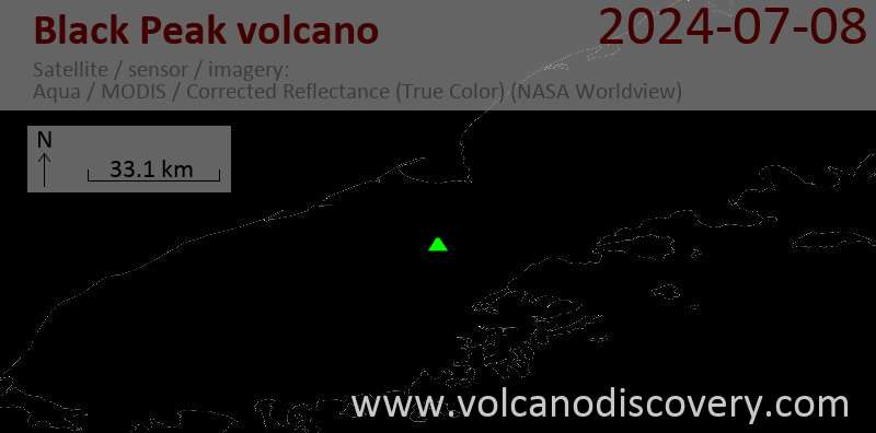
Latest satellite images