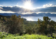
Carrizozo Volcano
Updated: May 1, 2025 07:03 GMT -
cinder cones
New Mexico (Canada and USA (mainland)), 33.78°N / -105.93°W 
Summit height: 1731 m / 5,679 ft
Current status: normal or dormant (1 out of 5)
The massive Carrizozo lava flow is one of Earth's longest known lava flows that were erupted in the past 10,000 years. The basalt flow is 50 m thick, 75 km long, 1-5 km wide and was mainly fed by lava tubes.
[smaller] [larger]
Carrizozo volcano eruptions: 3250 BC ± 500 years
Latest nearby earthquakes
| Date and Time | Mag / Depth | Distance / Location | |||
|---|---|---|---|---|---|
Background
The vent of the Carrizozo lava flow is a broad low basaltic shield on the floor of the Tularosa Basin, east of the Rio Grande Rift, topped by Little Black Peak, a small cinder cone with 3 nested craters and a frozen lava lake.The flow reached a length of 75 km extending into the Tularosa Basin of south-central New Mexico. Its total volume is estimated 4.3 cubic km.
It is similar to the presently active lava flow field of Kilauea volcano on Hawai'i, and believed to have been produced by a persistent single eruption that might have lasted a few decades.
A surface exposure age of about 5200 years Before Present was obtained for the Carrizozo lava flow, the second youngest in New Mexico. An older lava flow traveled 16 km south and 11 km east from Broken Back crater.
---
Source: GVP Carrizozo volcano information
Significant volcanic eruptions: Carrizozo volcano
No historic eruptions are known from Carrizozo volcano, but at least one eruption around 3250 BC can be inferred from geological evidence.
The table below lists all known eruptions (date in bold face) of Carrizozo volcano in historic times and during the past 10,000 years. Updates on the most recent volcanic activity of Carrizozo can be found on the news page of Carrizozo volcano.
| Date | Note | VEI | Deaths | Damage | |
|---|---|---|---|---|---|
| Little Black Peak | ? | ||||
Remark:
Our list of volcanic eruptions closely follows the database of eruptions of the Smithsonian's Global Volcanism Project (GVP), the internationally most recognized data source for volcanic eruptions, but also includes significant eruptive episodes or related volcano events. "Volcanic eruptions" are usually to be understood as sequences of individual eruptive episodes that can follow each other, or even overlap (if several vents are involved), and can last many years, decades or even longer. For example, the current activity of Stromboli volcano is understood as a single eruption that has been ongoing since 1934.
Sources: NOAA National Centers for Environmental Information (NCEI), Global Significant Volcanic Eruptions Database. doi:10.7289/V5TD9V7K | Global Volcanism Project / Smithsonian Institution
Carrizozo Volcano FAQ
+When was the last eruption of Carrizozo volcano?
The last confirmed eruption of Carrizozo occurred around 3250 BC.
Latest satellite images
Carrizozo Volcano Maps
Below is a selection of maps showing the location and surroundings of the volcano at various resolutions based on aerial-imagery / terrain maps. Feel free to use them for non-commercial purposes on your blog or website as long as you credit them with a link back to this page (click to copy it).

Satellite/aerial-type map of Carrizozo volcano (world scale)

Terrain-type map of Carrizozo volcano (world scale)

Satellite/aerial-type map of Carrizozo volcano (region scale large)

Terrain-type map of Carrizozo volcano (region scale large)

Satellite/aerial-type map of Carrizozo volcano (region scale medium)

Terrain-type map of Carrizozo volcano (region scale medium)

Satellite/aerial-type map of Carrizozo volcano (region scale small)

Terrain-type map of Carrizozo volcano (region scale small)

Satellite/aerial-type map of Carrizozo volcano (local scale large)

Terrain-type map of Carrizozo volcano (local scale large)

Satellite/aerial-type map of Carrizozo volcano (local scale medium)

Terrain-type map of Carrizozo volcano (local scale medium)

Satellite/aerial-type map of Carrizozo volcano (local scale small)

Terrain-type map of Carrizozo volcano (local scale small)

Satellite/aerial-type map of Carrizozo volcano (scale of 10s of km)

Terrain-type map of Carrizozo volcano (scale of 10s of km)

Satellite/aerial-type map of Carrizozo volcano (scale of 20-40 km)

Terrain-type map of Carrizozo volcano (scale of 20-40 km)

Satellite/aerial-type map of Carrizozo volcano (scale of approx. 10-20 km)

Terrain-type map of Carrizozo volcano (scale of approx. 10-20 km)

Satellite/aerial-type map of Carrizozo volcano (scale of 5-10 km)

Satellite/aerial-type map of Carrizozo volcano (scale of few kilometers)