Kakuto Volcano
Updated: 29. Apr. 2024 17:34 GMT -
Caldera unknown
Japan, 32.04°N / 130.77°E
Aktueller Status: (wahrscheinlich) erloschen (0 von 5)
Japan, 32.04°N / 130.77°E
Aktueller Status: (wahrscheinlich) erloschen (0 von 5)
[smaller] [larger]
Ausbrüche des Kakuto: None during the past 10,000 years
Less than few million years ago (Pleistocene)
Letzte Erdbeben in der Nähe
| Uhrzeit | Mag. / Tiefe | Entfernung / Ort | |||
| 24. Apr. 10:14 (GMT +9) | 2.9 8.5 km | 27 km südöstlich | Info | ||
| Dienstag, 23. April 2024 GMT (1 Beben) | |||||
| 24. Apr. 02:26 (GMT +9) | 2.5 10.2 km | 24 km südöstlich | Info | ||
| Sonntag, 21. April 2024 GMT (1 Beben) | |||||
| 22. Apr. 03:49 (GMT +9) | 2.8 8.6 km | 21 km nordwestlich | Info | ||
Beschreibung
Kakuto is a large figure-eight shaped caldera north of Kirishima that consists of the overlapping Kakuto and Kobayashi calderas, formed about 0.4-0.5 and 0.3 Ma, respectively (Nakano et al., 2001-). Major explosive eruptions have occurred around 110,000, 65,000 and 12,000 years ago (Newhall and Dzurisin, 1988).---
Source: Smithsonian / GVP volcano information
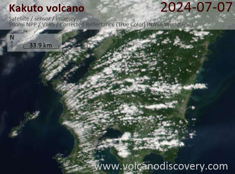
Latest satellite images