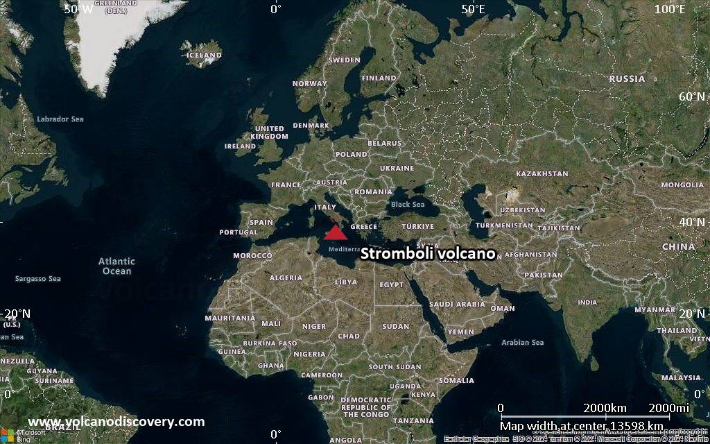
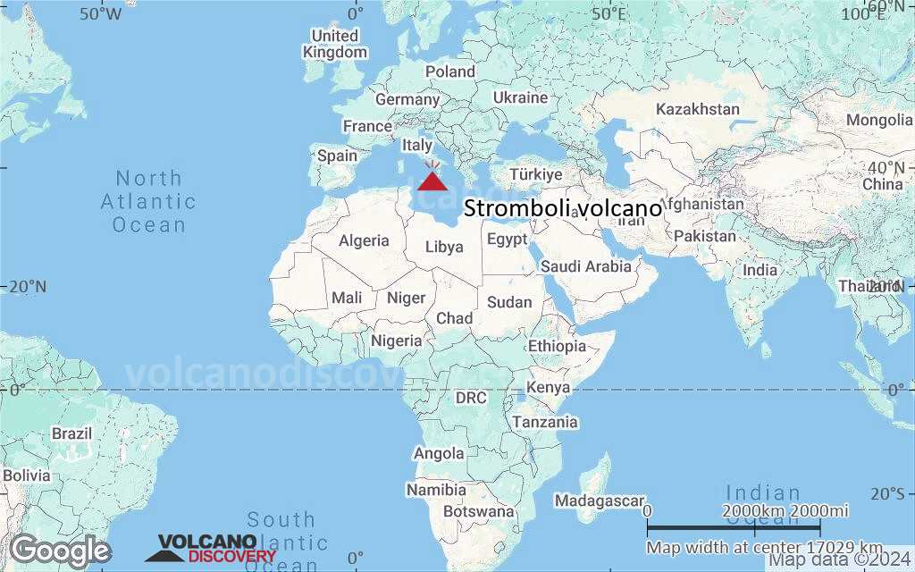
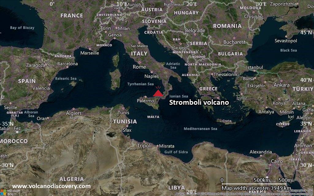
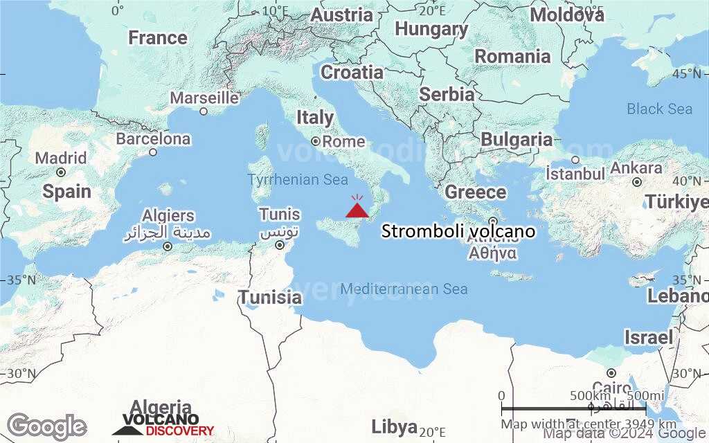
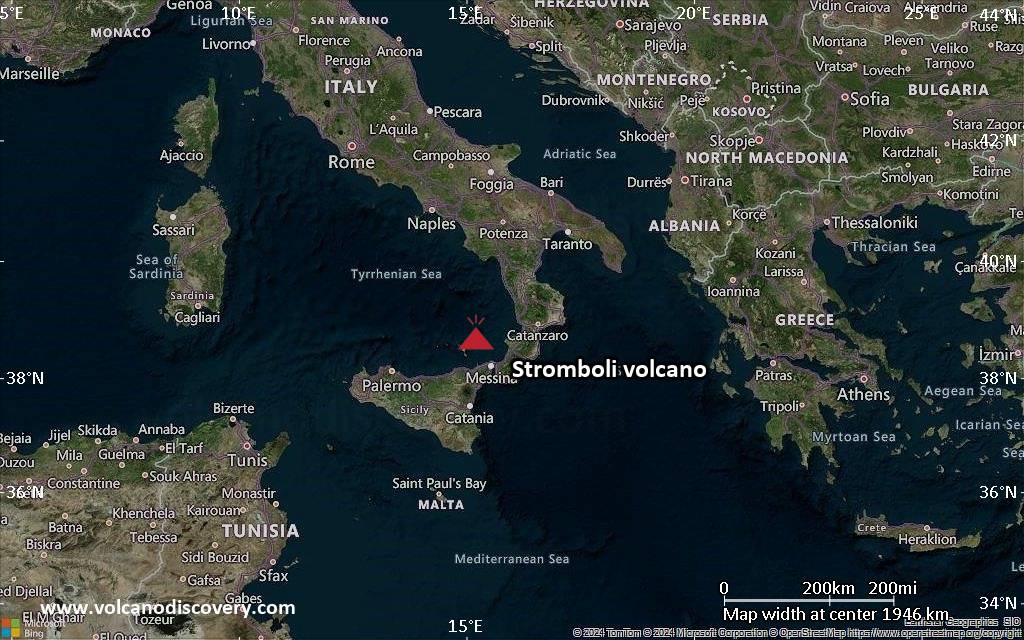
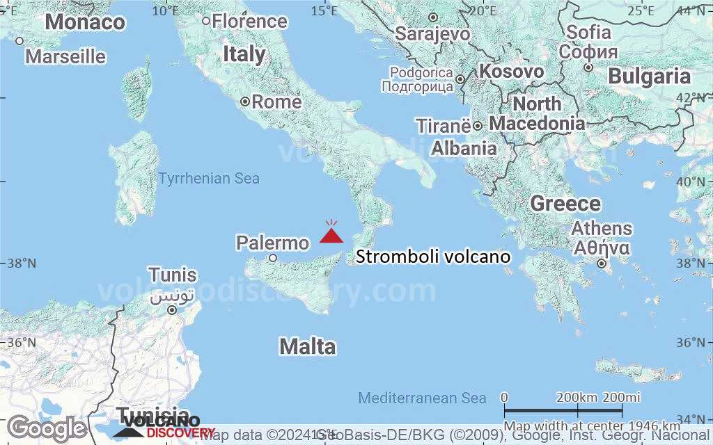
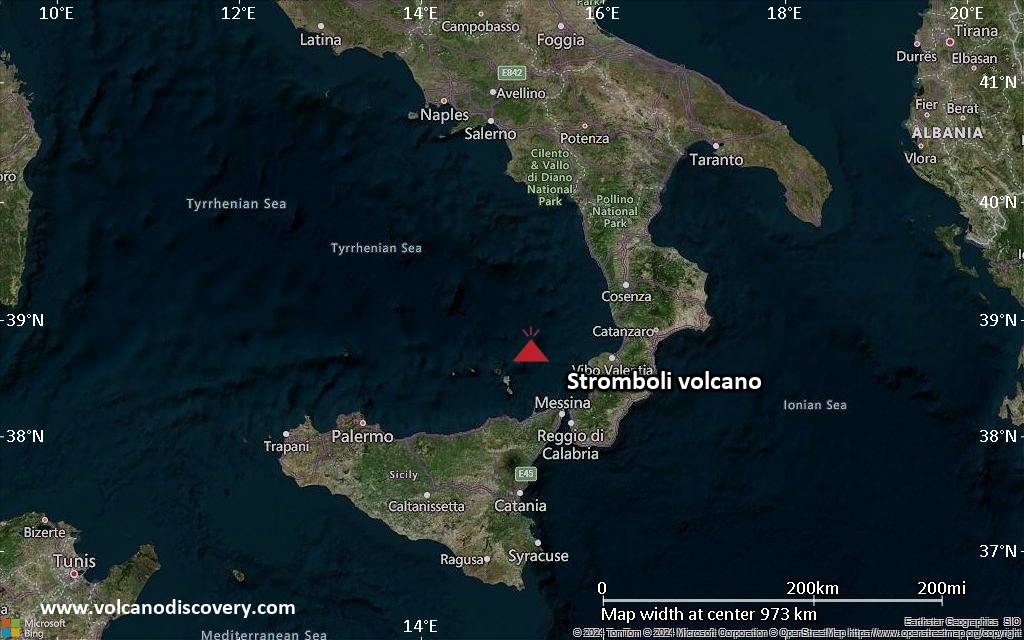
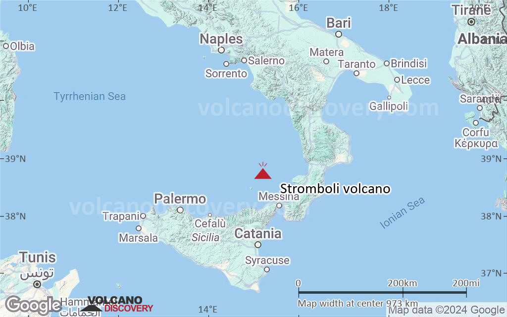
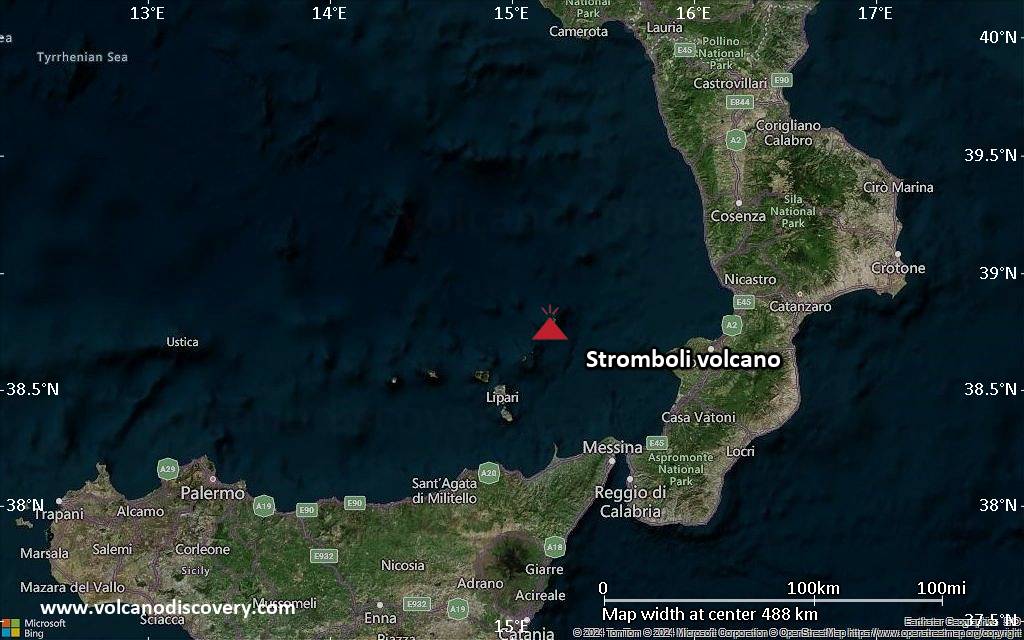
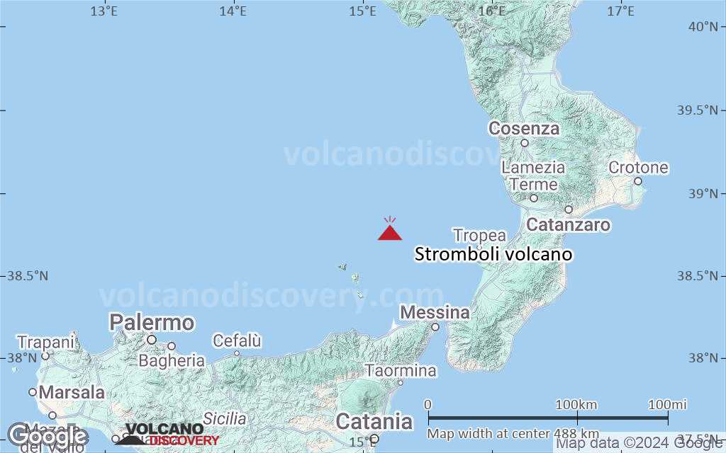
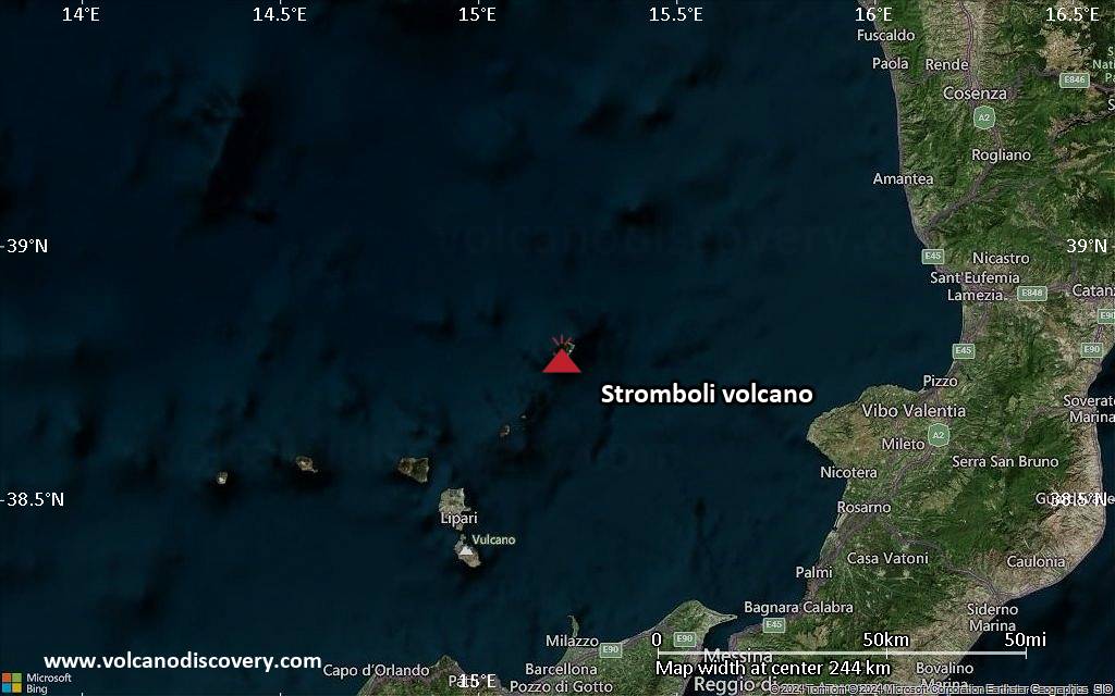
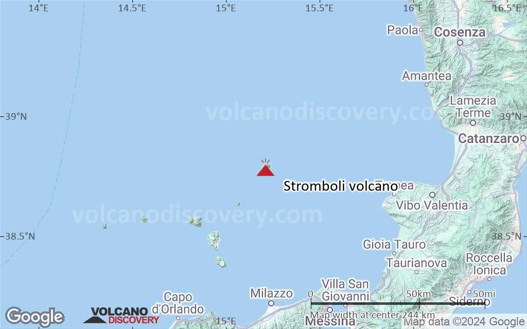
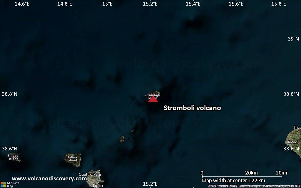
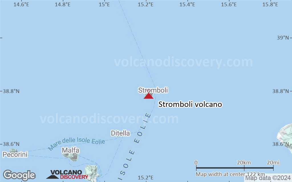
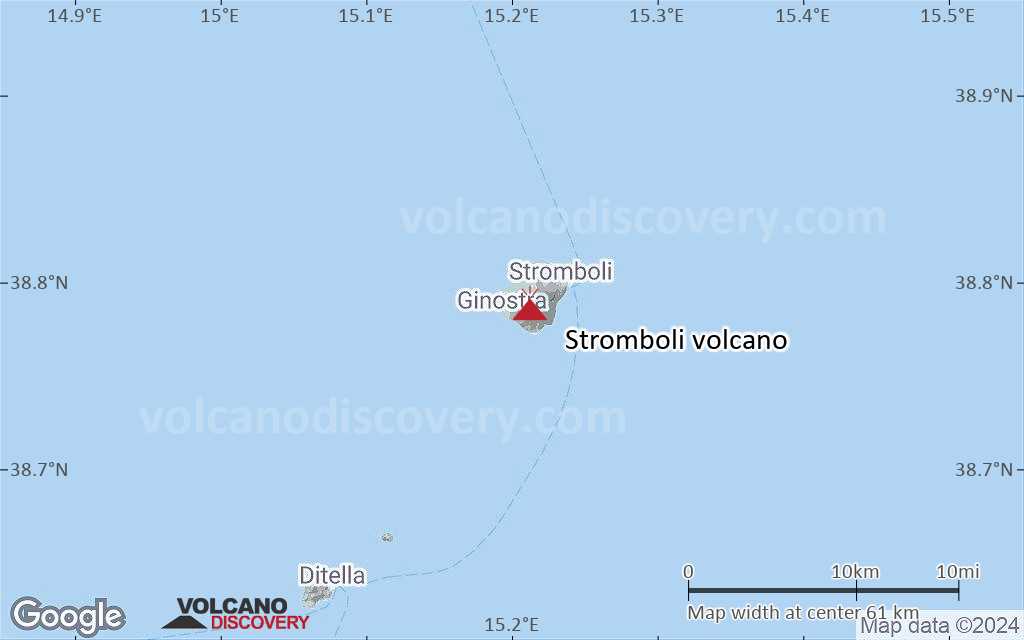
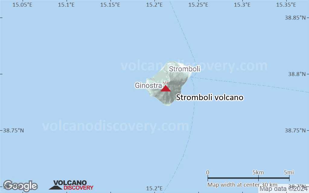
| RSS | EN | DE | EL | ES | FR | IT | RU

Stromboli Vulkan

Updated: 1. Mai 2025 09:09 GMT -
Stratovulkan
Eolian Islands, Italy, 38.79°N / 15.21°E
Summit height: 926 m
Aktueller Status: Ausbruch (4 von 5)
Last update: 16 Apr 2025 (Smithsonian / USGS Weekly Volcanic Activity Report)
Ein kräftiger Ausbruch am Stromboli

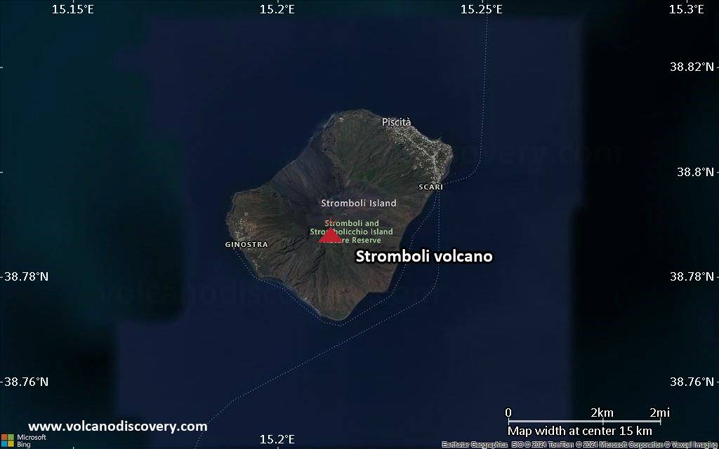
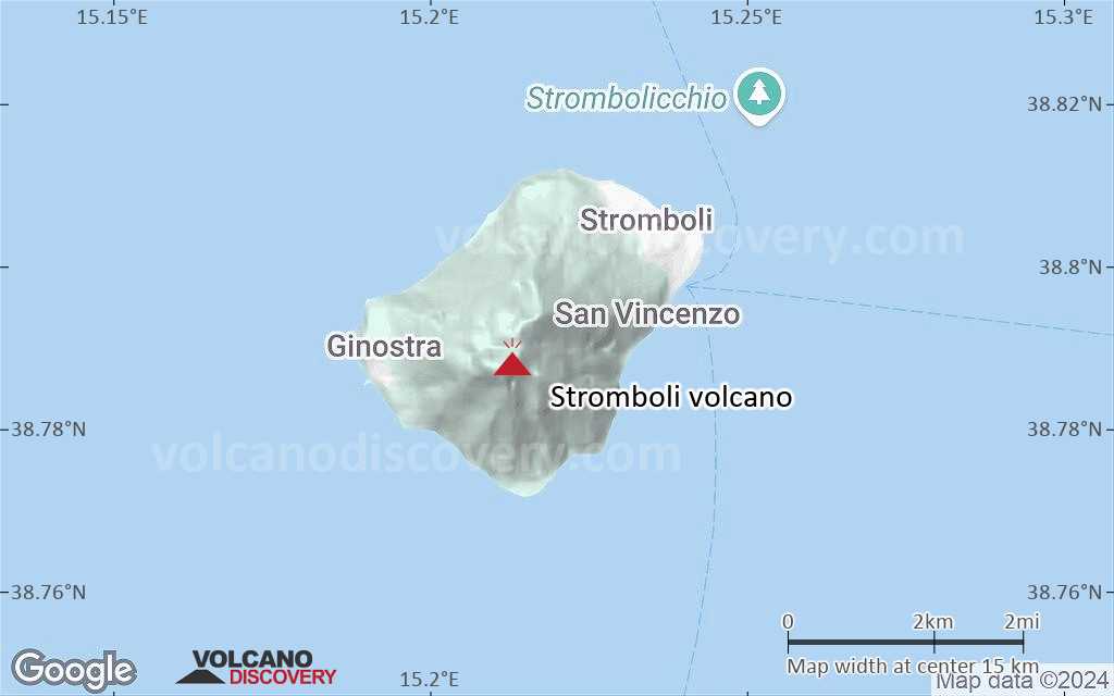
Stromboli ist die nördlichste der 7 Äolischen Inseln im Norden von Sizilien. Der gleichnamige Vulkan ist einer der berühmtesten der Erde, bekannt durch seine seit Jahrhunderten andauernde explosive Daueraktivität, die nach ihm als "strombolianisch" bezeichnet wird.
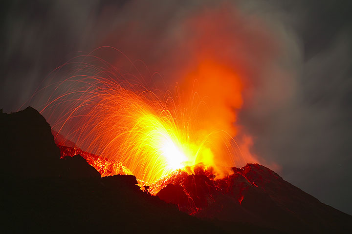
Der Stromboli ist einer der weltweit ganz wenigen daueraktiven Vulkane. Der vorherrschende strombolianische Ausbruchstyp besteht aus kleinen regelmäßigen Explosionen von relativ flüssiger Lava, die durch rhythmische Entgasungsvorgänge im magmagefüllten Schlot hervorgerufen werden.

[smaller] [larger]
Typische Aktivität: Kleine, explosive strombolische Eruptionen, die typischerweise alle 20-30 Minuten stattfinden. Alle 5-20 Jahre gibt es meist kleinere effusive Eruptionen mit Lavaströmen und 2-5 mal im Jahr größere Explosionen.
Ausbrüche des Stromboli: Fast konstante Aktivität in den letzten 2000-3000 Jahren. Lavastrom und Eruption z.B. im Dezember 2002 - Juli 2003, März 2007, August 2014.

Letzte Erdbeben in der Nähe

Datum und UhrzeitMag / TiefeDistanz / Ort

Beschreibung

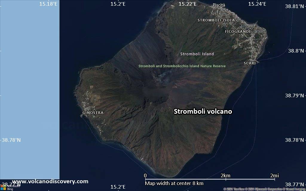
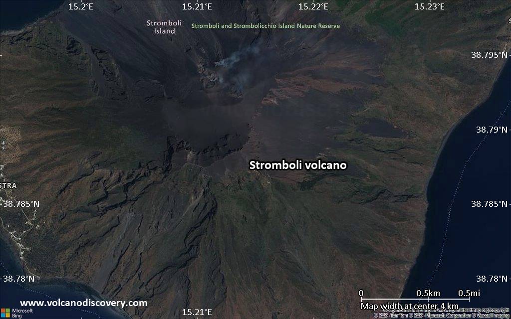
Die nördlichste der Äolischen Inseln, Stromboli, ist für seinen gleichnamigen Vulkan mit seinen regelmäßigen Ausbrüchen berühmt, die diesem Typ von Tätigkeit den Namen "strombolianisch" geliehen haben.
Schon in der Atike war die Insel als "Leuchtturm des Tyrrhenischen Meers" bekannt. Es gibt weltweit nur ganz wenige Vulkane, die in solcher Regelmäßigkeit aktiv sind wie der Stromboli - und die Aufzeichnungen reichen weit in die Antike zurück!
Meistens sind es kleine Explosionen, die Lavafragmente in gerade Höhen von ca. 100-200 m schiessen und selten außerhalb der Kraterränder niederfallen. Jedoch gibt es ab und zu stärkere Eruptionen oder Perioden mit fortwährender, starker Aktivität. Die gewalttätigsten Eruptionen in den letzten Jahrhunderten waren 1919, 1930 und zuletzt 2003. Sie richteten teilweise beträchtlichen Schäden in den beiden Dörfern der Insel. In Zeiten starker Tätigkeit ist der Gipfel normalerweise für Besucher gesperrt.
Zusätzlich zu den Gipfeleruptionen gibt es Zeiten, in denen Lavaströme ins Meer fliessen. Diese Aktivitäten können sich über einige Jahre oder Jahrzehnte erstrecken. Die letzten Ausbruchsphasen mit Lavaströmen waren vom 28.12.2002 - Juli 2003 und im März 2007.

Für Besucher bietet Stromboli die einzigartige Möglichkeit, Ausbrüche aus der Nähe vom Rand eines älteren Kraters aus relativ sicherer Entfernung zu beobachten. Trotz der großen Besuchermenge hat es bisher relativ wenig Unfälle gegeben, die meist auf das unvorsichtige Verhalten der Besucher zurückzuführen waren.
Stromboli ist nicht nur für Vulkanologen interessant, sondern auch für Naturfreunde und Erholungssüchtige: üppige Vegetation, angenehmes Klima, reizvolle Dörfer, viel Ruhe und eine schwer wiederzugebende eigene Atmosphäre erwarten den Besucher, der sich Zeit nimmt zu verweilen. Viele kommen daher immer wieder.

Stromboli Volcano Photos

Bedeutende Vulkanausbrüche: Stromboli volcano

In the past 10,000 years, Stromboli has had at least 22 confirmed volcanic eruptions, out of which 14 are documented by historical records, while the others can be inferred from geological evidence.

The table below lists all known eruptions (date in bold face) of Stromboli volcano in historic times and during the past 10,000 years. Updates on the most recent volcanic activity of Stromboli can be found on the news page of Stromboli volcano.
DatumHinweisVEITodesopferSchaden
1934 Feb 2 - anhaltendSummit craters and Sciara del Fuoco
Hist. dokumentiert
2
unbekannt
2022 Dez 4
(Ausbruch 1934 Feb 2 - anhaltend)
Tsunami aufgezeichnet
Hist. dokumentiert
2
unbekannt
Info
2022 Okt 9
(Ausbruch 1934 Feb 2 - anhaltend)
Tsunami aufgezeichnet
Hist. dokumentiert
2
unbekannt
Info
2021 Mai 19
(Ausbruch 1934 Feb 2 - anhaltend)
Tsunami aufgezeichnet
Hist. dokumentiert
2
unbekannt
2019 Aug 28
(Ausbruch 1934 Feb 2 - anhaltend)
Tsunami aufgezeichnet
Hist. dokumentiert
2
unbekannt
Info
2019 Jul 3
(Ausbruch 1934 Feb 2 - anhaltend)
Tsunami aufgezeichnet
Hist. dokumentiert
21
unbekannt
Info
2002 Dez 30
(Eruptionsepisode 2002 Dez 28 - Dez 30)
Tsunami aufgezeichnet
Hist. dokumentiert
0
leicht
Info
2001 Okt 20
(Ausbruch 1934 Feb 2 - anhaltend)
Hist. dokumentiert
21
unbekannt
Info
1986 Jul 24
(Eruptionsepisode 1985 Dez 06 - 1986 Jul 24)
Hist. dokumentiert
21
unbekannt
Info
1954 Feb
(Ausbruch 1934 Feb 2 - anhaltend)
Tsunami aufgezeichnet
Hist. dokumentiert
0
leicht
Info
1944 Aug 20
(Ausbruch 1934 Feb 2 - anhaltend)
Tsunami aufgezeichnet
Hist. dokumentiert
2
leicht
Info
1932 Jun 3
Hist. dokumentiert
2
unbekannt
1910 Mai - 1931 JulSummit craters and Sciara del Fuoco
Hist. dokumentiert
3
unbekannt
1930 Sep 11
(Ausbruch 1910 Mai - 1931 Jul)
Tsunami aufgezeichnet
Hist. dokumentiert
36
mittel
Info
1919 Mai 22
(Ausbruch 1910 Mai - 1931 Jul)
Tsunami aufgezeichnet
Hist. dokumentiert
34
leicht
Info
1916 Jul 3
(Ausbruch 1910 Mai - 1931 Jul)
Tsunami aufgezeichnet
Hist. dokumentiert
3
leicht
Info
1890 - 1907 Mai 29
Hist. dokumentiert
3
unbekannt
1857 - 1889 Jun 26Summit craters and Sciara del Fuoco
Hist. dokumentiert
3
unbekannt
1879 Feb 4
(Eruptionsepisode 1879 Feb 4)
Tsunami aufgezeichnet
Hist. dokumentiert
2
unbekannt
Info
1558 oder davor AD - 1857Summit craters and Sciara del Fuoco
Hist. dokumentiert
3
unbekannt
950 ±50 y. ADSummit area
Hist. dokumentiert
2
unbekannt
550 ±50 y. AD
Hist. dokumentiert
3
unbekannt
250 ±50 y. AD
Hist. dokumentiert
2
unbekannt
150 ±50 y. AD
Hist. dokumentiert
2
unbekannt
50 ±50 y. AD
Hist. dokumentiert
2
unbekannt
Anmerkung:
Unsere Liste von Vulkanausbrüchen orientiert sich eng an der Datenbank des Global Volcanism Project (GVP) des Smithsonian Instituts, der international anerkanntesten globalen Datenquelle für Vulkanausbrüche. Sie schließt aber auch bedeutende Eruptionsepisoden oder damit zusammenhängende Vulkanereignisse ein. Unter "Vulkanausbrüchen" versteht man in der Regel meist Serien einzelner Eruptionsepisoden, die zeitlich aufeinander folgen oder sich (bei mehreren beteiligten Ausbruchspunkten an einem Vulkan) auch überlappen können und unter Umständen viele Jahre, Jahrzehnte oder noch länger andauern können. So ist z.B. die aktuelle Tätigkeit des Stromboli als ein einziger Ausbruch verstanden, der seit 1934 anhält.
Quellen: NOAA National Centers for Environmental Information (NCEI), Global Significant Volcanic Eruptions Database. doi:10.7289/V5TD9V7K | Global Volcanism Project / Smithsonian Institution

Stromboli Volcano FAQ

+When was the last eruption of Stromboli volcano?

+How often does Stromboli volcano erupt?

+How active is Stromboli volcano at present?

+When was the largest eruption of Stromboli volcano?

Neueste Satellitenbilder

Stromboli Satellitenbild sat1Stromboli Satellitenbild sat2
Stromboli Vulkanreisen
14-tägige Studienreise zu den aktiven Vulkanen Italiens
14 Tage (13 Nächte) - Leicht bis mittel
Preis 3890 €
3.-17. Okt 2025
2.-16. Okt 2026
9-tägige Vulkan-Georeise zu den Vulkanen Vulcano, Stromboli, Lipari und Ätna
9 Tage / 8 Nächte - Leicht bis mittel
Preis 2950 €
3.-11. Mai 2025
4.-12. Okt 2025

Stromboli Vulkan Karten

Below is a selection of maps showing the location and surroundings of the volcano at various resolutions based on aerial-imagery / terrain maps. Feel free to use them for non-commercial purposes on your blog or website as long as you credit them with a link back to this page (click to copy it).
Satellite/aerial-type map of Stromboli volcano (world scale)
Terrain-type map of Stromboli volcano (world scale)
Satellite/aerial-type map of Stromboli volcano (region scale large)
Terrain-type map of Stromboli volcano (region scale large)
Satellite/aerial-type map of Stromboli volcano (region scale medium)
Terrain-type map of Stromboli volcano (region scale medium)
Satellite/aerial-type map of Stromboli volcano (region scale small)
Terrain-type map of Stromboli volcano (region scale small)
Satellite/aerial-type map of Stromboli volcano (local scale large)
Terrain-type map of Stromboli volcano (local scale large)
Satellite/aerial-type map of Stromboli volcano (local scale medium)
Terrain-type map of Stromboli volcano (local scale medium)
Satellite/aerial-type map of Stromboli volcano (local scale small)
Terrain-type map of Stromboli volcano (local scale small)
Satellite/aerial-type map of Stromboli volcano (scale of 10s of km)
Terrain-type map of Stromboli volcano (scale of 10s of km)
Satellite/aerial-type map of Stromboli volcano (scale of 20-40 km)
Terrain-type map of Stromboli volcano (scale of 20-40 km)
Satellite/aerial-type map of Stromboli volcano (scale of approx. 10-20 km)
Terrain-type map of Stromboli volcano (scale of approx. 10-20 km)
Satellite/aerial-type map of Stromboli volcano (scale of 5-10 km)
Satellite/aerial-type map of Stromboli volcano (scale of few kilometers)
Volcanoes & Earthquakes - new app for Android
Garantierte Reisen
9.-25. Jun 2025: Volcanoes and Spices - N-Sulawesi + Halmahera (Indonesien)
7.-22. Jul 2025: Von Krakatau bis Bali - Java (Indonesien)
7.-23. Jul 2025: Volcanoes and Spices - N-Sulawesi + Halmahera (Indonesien)
1.-17. Aug 2025: Volcanoes and Spices - N-Sulawesi + Halmahera (Indonesien)
1.-14. Okt 2025: Wüste, Salz und Vulkane - Danakilwüste (Äthiopien)
4.-12. Okt 2025: Feuerberge Siziliens - vom Stromboli zum Ätna - Äolische Inseln + Ätna
6.-21. Okt 2025: Von Krakatau bis Bali - Java (Indonesien)
3.-19. Nov 2025: Volcanoes and Spices - N-Sulawesi + Halmahera (Indonesien)
= Plätze frei   = garantiert   = Wenig freie Plätze   = Ausgebucht
Mi, 16. Apr 2025, 14:00

Stromboli volcano (Italy) - Smithsonian / USGS Weekly Volcanic Activity Report for 9 April-15 April 2025 (Continuing Activity)

The Sezione di Catania - Osservatorio Etneo (INGV) reported that eruptive activity continued at Stromboli during 7-13 April. Webcam images showed Strombolian activity at four vents in Area N within the upper part of the Sciara del Fuoco and from at least two vents in Area C-S (South-Central Crater) on the crater terrace. The vents in Area N continued to produce low-to-medium-intensity explosions at a rate of 5-15 events per hour, ejecting lapilli and bombs less than 150 m above the vents. ... Alles lesen
Mi, 9. Apr 2025, 14:00

Stromboli volcano (Italy) - Smithsonian / USGS Weekly Volcanic Activity Report for 2 April-8 April 2025 (Continuing Activity)

The Sezione di Catania - Osservatorio Etneo (INGV) reported that eruptive activity continued at Stromboli during 31 March-6 April. Webcam images showed Strombolian activity at four vents in Area N within the upper part of the Sciara del Fuoco and from at least two vents in Area C-S (South-Central Crater) on the crater terrace. The vents in Area N continued to produce low- to medium-intensity explosions at a rate of 8-12 events per hour, ejecting lapilli and bombs less than 150 m above the vents. ... Alles lesen

Auf dieser Seite:

Try our free app!
Volcanoes & Earthquakes - new app for Android
Android | iOS version

More on VolcanoDiscovery

Warum gibt es Werbung auf dieser Seite?

Unterstützen Sie unsere Arbeit!

Diese Webseite und die dazugehörigen Apps und Tools instandzuhalten und kostenlos Nachrichten zu Vulkanen, Erdbeben und anderen Themen bereitzustellen, verschlingt enorm viel Zeit und auch Geld.
Wenn Sie die Infos mögen und uns in der Arbeit dazu unterstützen wollen, würden wir uns über eine Spende (über PayPal) sehr freuen.
Online Zahlung (Kreditkarte)
Damit können wir Ihnen auch in Zukunft neue Features entwickeln und Bestehende laufend verbessern.Vielen Dank!
Sources: VolcanoDiscovery / VolcanoAdventures and other sources as noted.
Use of material: Most text and images on our websites are owned by us. Re-use is generally not permitted without authorization. Contact us for licensing rights.
Volcanoes & Earthquakes
VolcanoDiscovery Home
Vulkane | Erdbeben | Fotos | News | | Shop | App
Adventure & Study Travel
Reisen zu Vulkanen und Vulkangebieten: Wanderreisen, Studienreisen, Fotoreisen
Tours & Dates | FAQ | About us
Get our newsletter!
Company info
Kontakt | Impressum | AGB
Follow us
Follow us on facebook Follow us on Instagram Follow us on Bluesky Follow us on Twitter Visit our Youtube channel
EN | DE | EL | ES | FR | IT | RU
VolcanoDiscovery GmbH, Germany, Reg. nr.: HRB 103744, EU Tax Id: DE 297 465 123 owned and created by
Dr. Tom Pfeiffer, volcanologist, volcano photographer, tour organizer member of
IAVCEI
IAVCEI
Vulkanologische Gesellschaft
Volcanological Society
Ecotourism Greece
Ecotourism Greece
RUV insurance
Insured by R+V
VolcanoDiscovery © 2004- All Rights Reserved | Datenschutz - Cookie Einstellungen