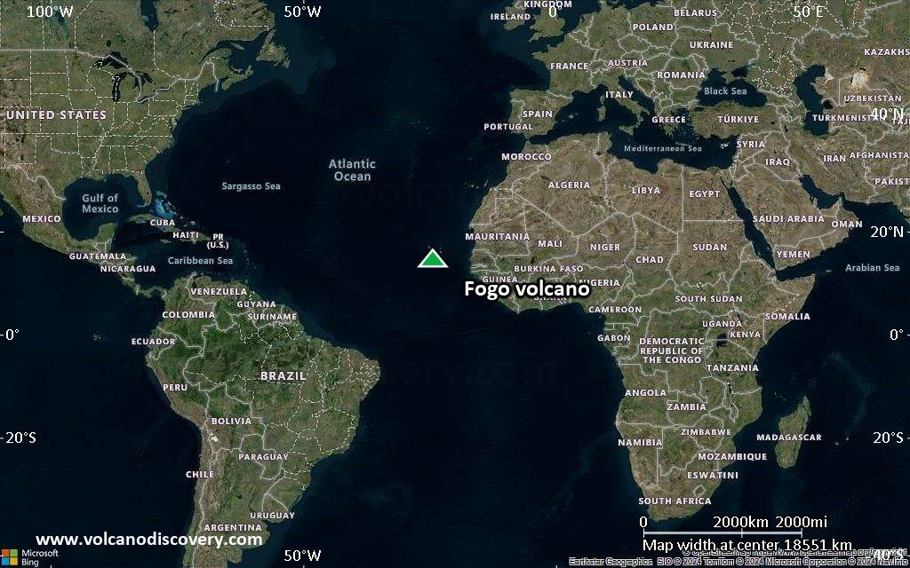
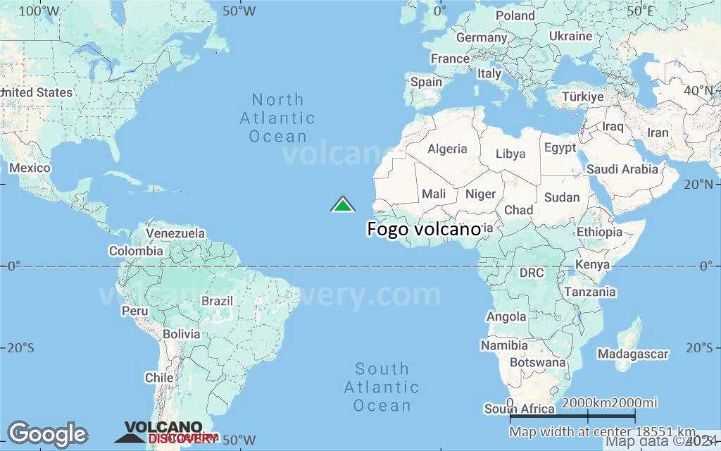
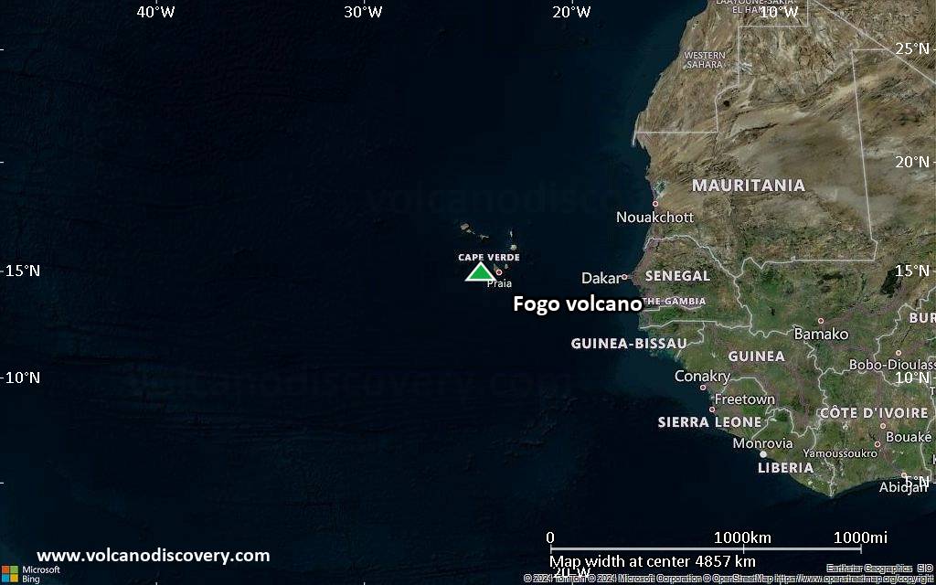
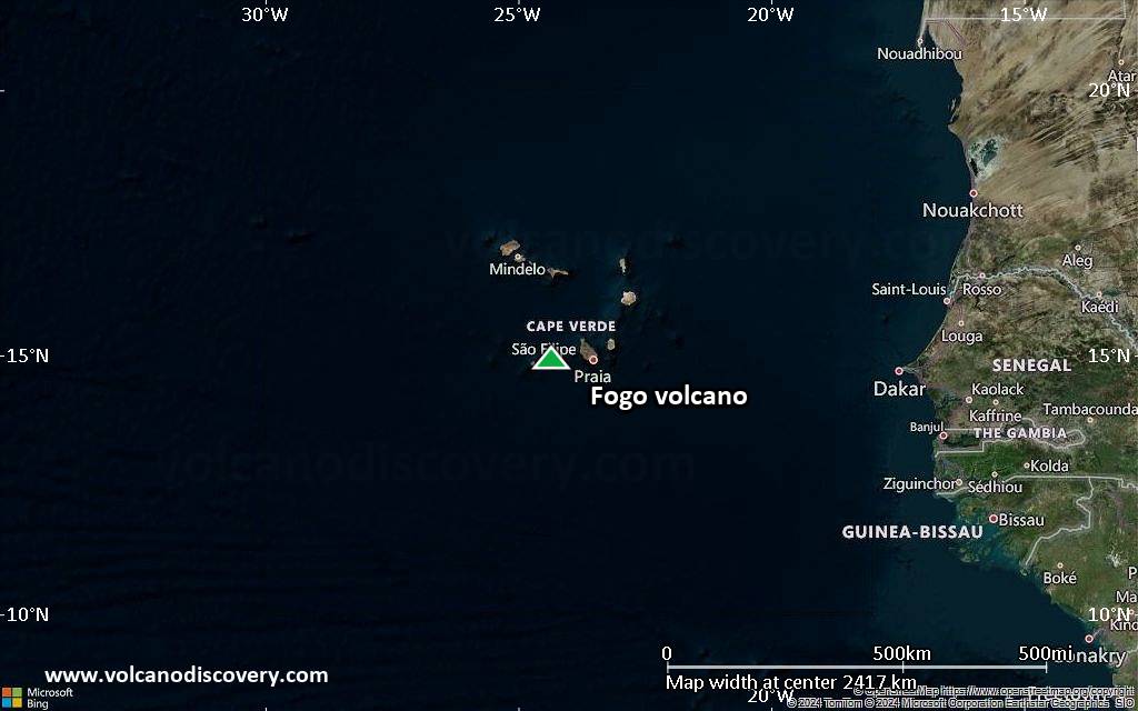
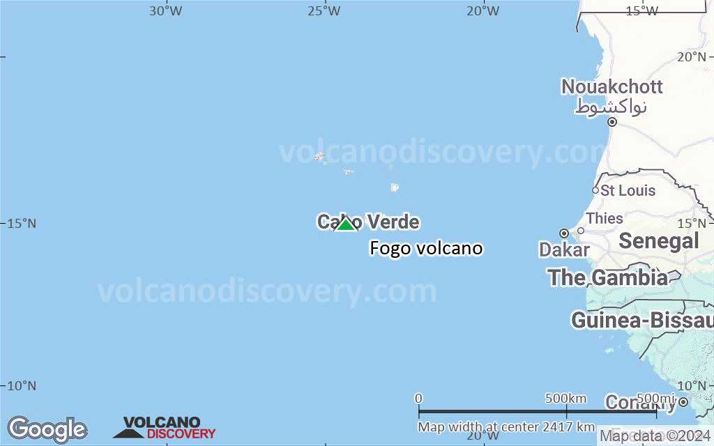
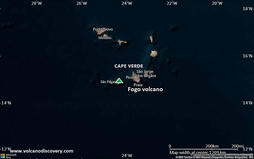
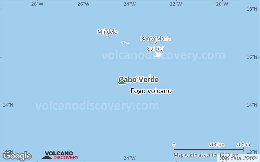
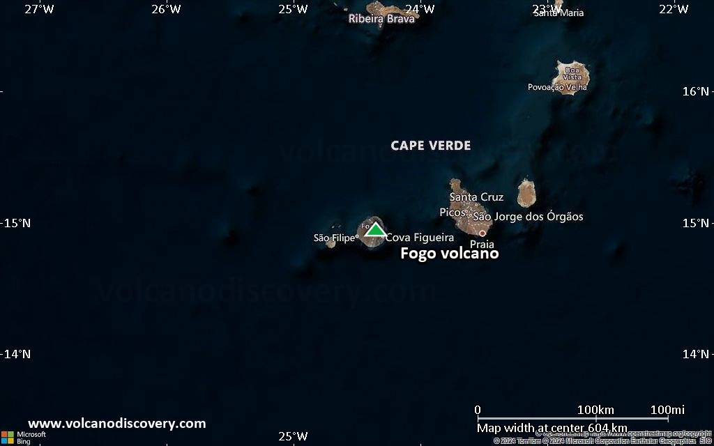
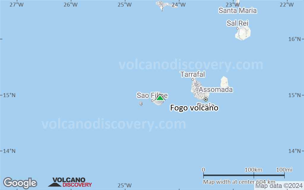
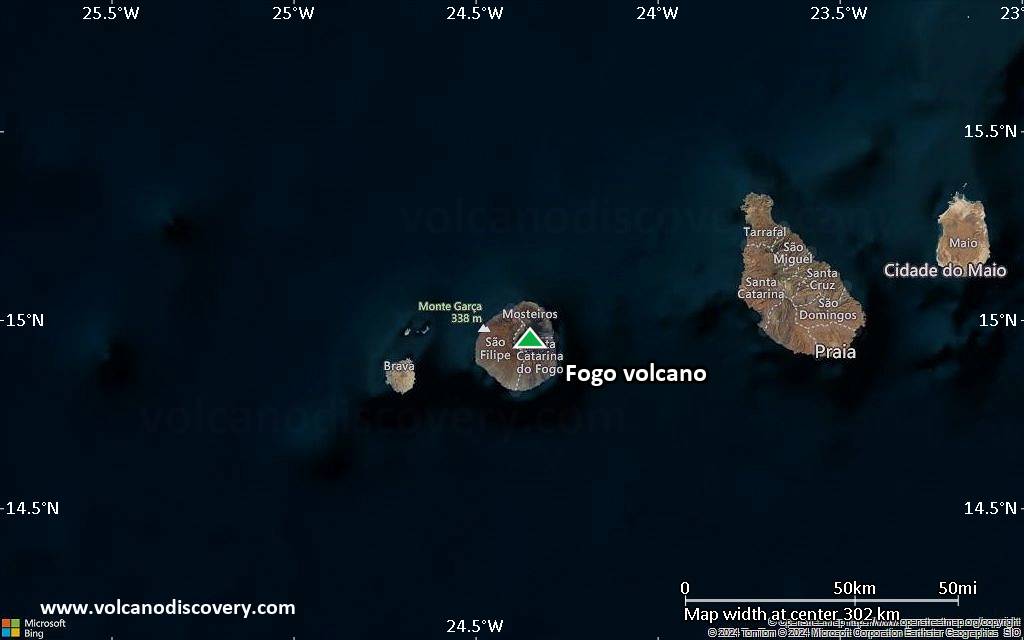
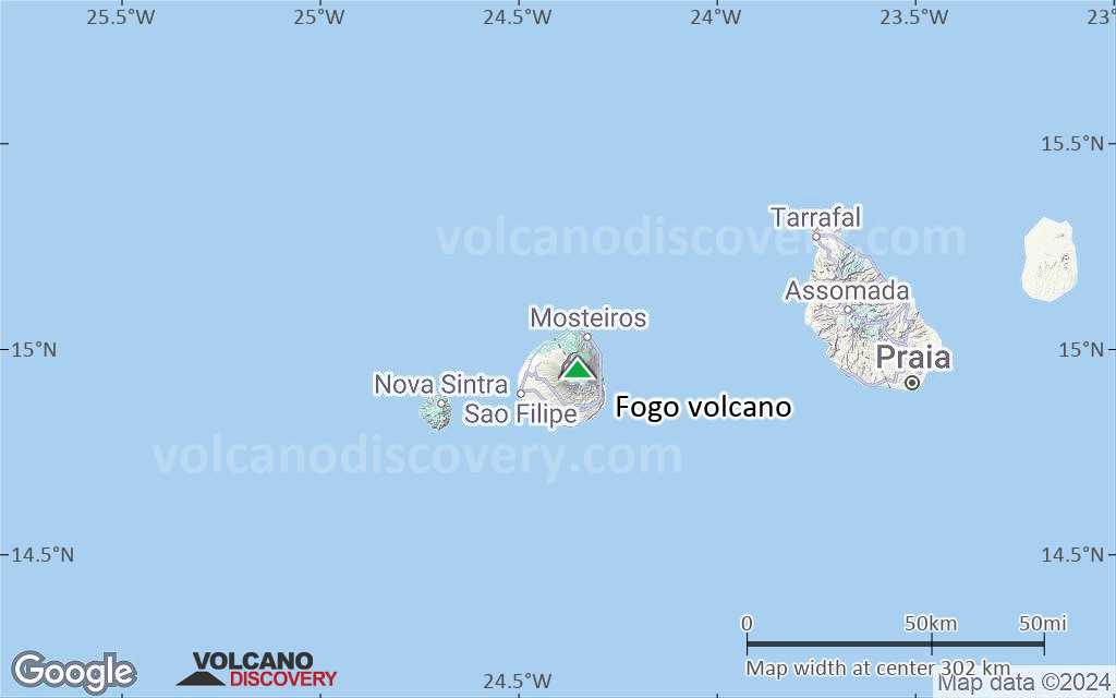
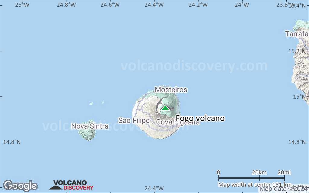
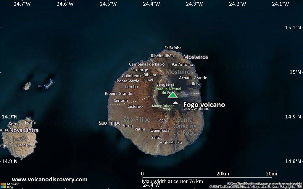
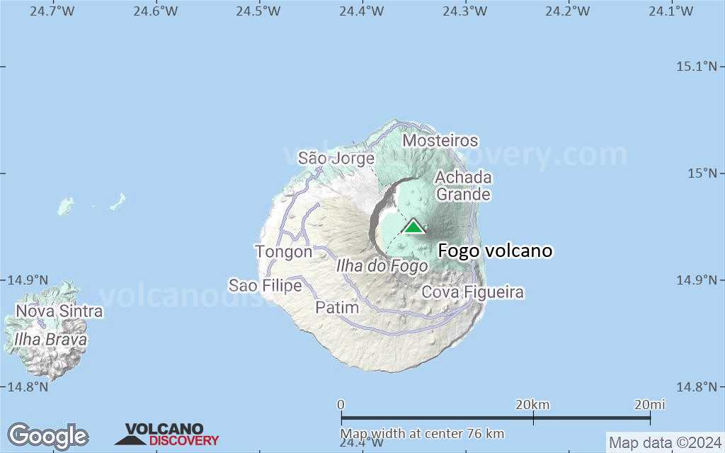
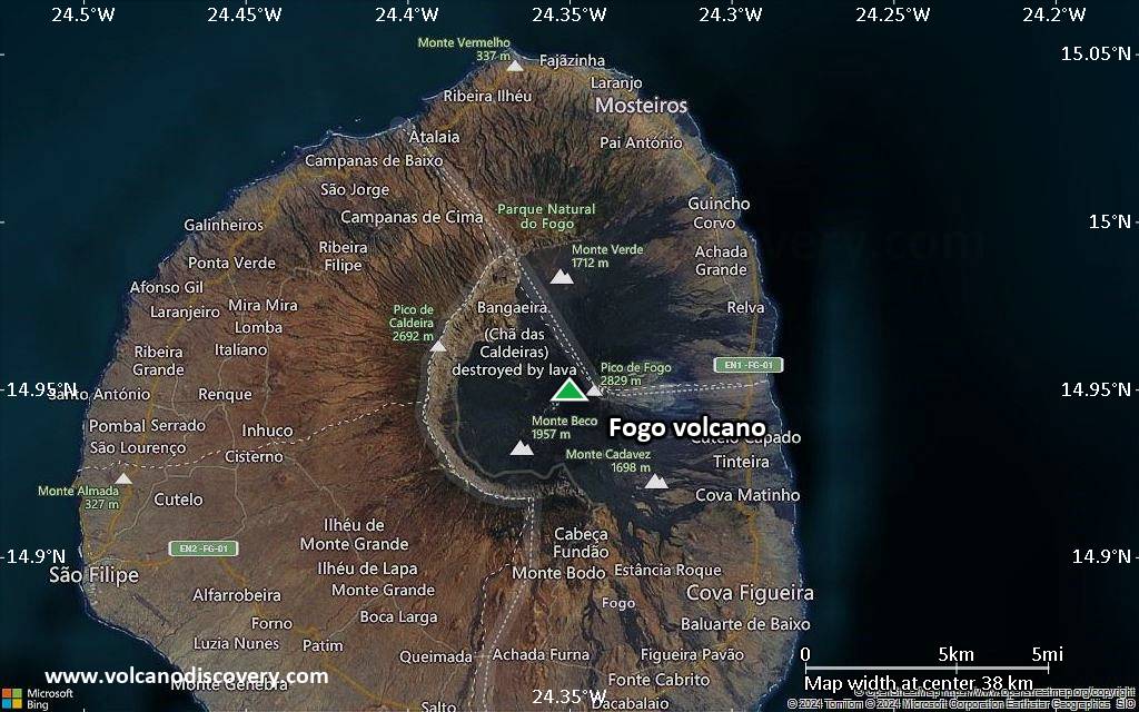
Fogo Volcano
The island of Fogo consists of a single massive stratovolcano that is the most prominent of the Cape Verde Islands. Fogo is the most active volcano in the Cape Verde.
Fogo volcano eruptions: 2014-15, 1995, 1951
Latest nearby earthquakes
| Date and Time | Mag / Depth | Distance / Location | |||
|---|---|---|---|---|---|
Background
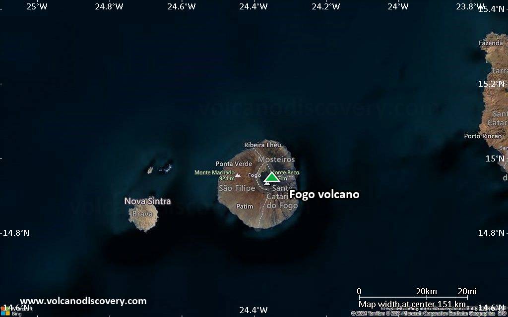
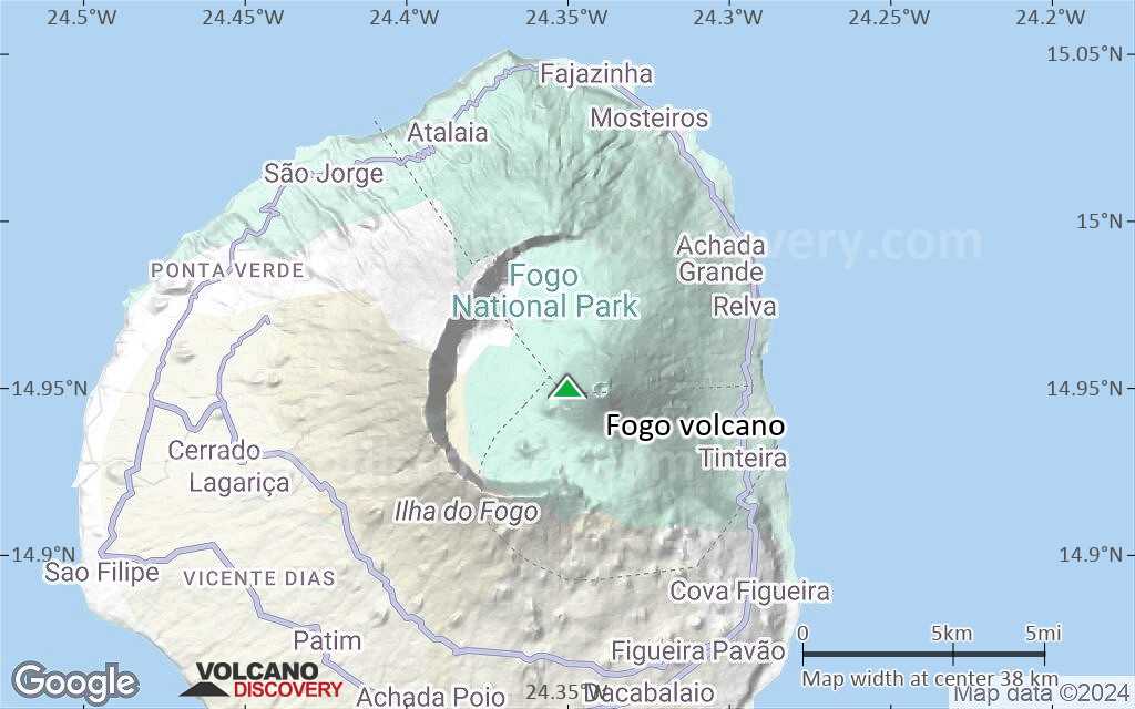
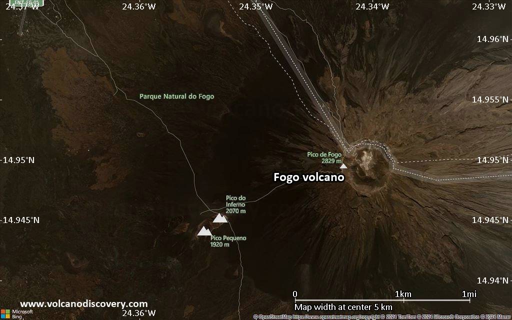
The roughly circular 25-km-wide island is truncated by a large 9-km-wide caldera that is breached to the east and has a headwall 1 km high. The caldera is located asymmetrically NE of the center of the island and was formed as a result of massive lateral collapse of the ancestral Monte Armarelo edifice. A very youthful steep-sided central cone, Pico, rises more than 1 km above the caldera floor to about 100 m above the caldera rim, forming the 2829 m high point of the island. Pico, which is capped by a 500-m-wide, 150-m-deep summit crater, was apparently in almost continuous activity from the time of Portuguese settlement in 1500 AD until around 1760. Later historical lava flows, some from vents on the caldera floor, reached the eastern coast below the breached caldera.---
Smithsonian / GVP volcano information
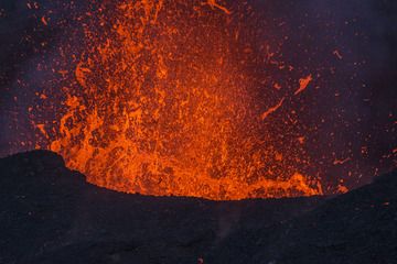
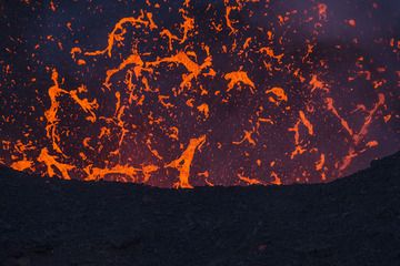
Fogo Volcano Photos
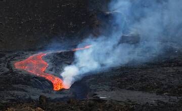
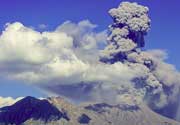
2014-2015 eruption (23 November 2014 to 08 February 2015).Image taken December 4, 19h 20m local time. 14 56 35 N, 24 21 20 W.
Mario M...
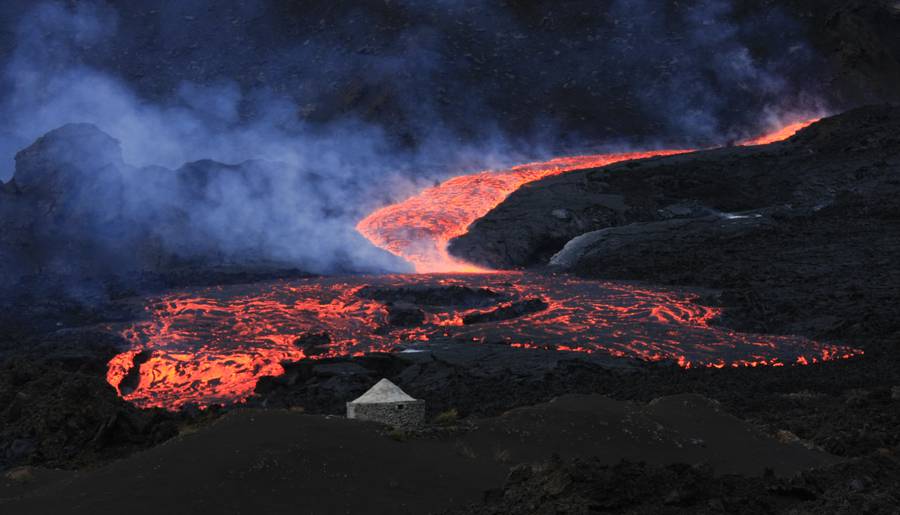
2014-2015 eruption (23 November 2014 to 08 February 2015).Image taken 05 December, 19h 40m local time. 14º56'35" N, 24º21'20" W. (Photo: Ma...
Significant volcanic eruptions: Fogo volcano
| Date | Note | VEI | Deaths | Damage | |
|---|---|---|---|---|---|
| WSW base of Pico Historical obs./docs. | 2 | ||||
| 2014 Nov 23 (eruption | Historical obs./docs. | 0 | moderate | Info | |
| WSW flank of Pico Historical obs./docs. | 2 | ||||
| 1995 Apr 2 (eruption | Historical obs./docs. | 2 | light | Info | |
| Northwest and south caldera floor Historical obs./docs. | 2 | ||||
Historical obs./docs. | ? | ||||
| SSE caldera floor Historical obs./docs. | 2 | ||||
| NNW caldera floor Historical obs./docs. | 2 | ||||
| North caldera floor Historical obs./docs. | 2 | ||||
| 1847 Apr 9 (eruption | Historical obs./docs. | 2 | 1-50 (*) | Info | |
Historical obs./docs. | ? | ||||
| North caldera floor Historical obs./docs. | 2 | ||||
| North caldera floor Historical obs./docs. | 2 | ||||
| SW side Historical obs./docs. | ? | ||||
| Pico Historical obs./docs. | 1 | ||||
Fogo Volcano FAQ
+When was the last eruption of Fogo volcano?
The last confirmed eruption of Fogo occurred during 2014 - 2015.
+How often does Fogo volcano erupt?
Fogo volcano erupts almost every year. Since its first historically documented eruption 1500 AD, Fogo has often been near-continuously active. The Global Volcanism Project counts 12 historic eruptions until now, spanning a total of 274 out of 525 years. In other words, Fogo is active roughly every one in 1.9 years on average. This value is likely an underestimate, because the known history of eruption might not contain all eruptions, especially further back in time. The last eruption of Fogo
+How active is Fogo volcano at present?
Fogo volcano is occasionally active: Since 1900, it has had 5 eruptions, and been active during 5 years out of 126 as of now. This means, Fogo has been in eruption one in 25.2 years on average. The last eruption was from 2014 until 2015 and ended 10 years ago.
+When was the largest eruption of Fogo volcano?
The largest eruption of Fogo volcano in historic times occurred during 2014 - 2015. It ranks as a strombolian to vulcanian eruption with a magnitude 2 on the VEI (Volcanic Explosivity Index) scale.
Latest satellite images
Fogo Volcano Maps