Granada Volcano
Updated: May 8, 2024 20:43 GMT -
fissure vents 300+ m / 984 ft
Nicaragua, 11.92°N / -85.98°W
Current status: normal or dormant (1 out of 5)
Nicaragua, 11.92°N / -85.98°W
Current status: normal or dormant (1 out of 5)
Granada volcano is a system of N-S trending fissure vents, cinder cones and craters located in western Nicaragua between the city of Granada (the oldest city founded by Europeans on the American continent) on the northwestern shore of Lake Nicaragua and the northern flanks of Mombacho volcano.
The earliest eruptions were dated to about 12,000 years ago and the latest activity could be as recent as 2000 years.
A prominent feature is the La Joya explosions craters SW of Granada town. Current activity is limited to hot springs and areas of hot ground at the western shore of Laguna Apoyo, but future eruptions are possible and pose a significant hazard to Granada town.
[smaller] [larger]
Granada volcano eruptions: less than 10,000 years ago
Latest nearby earthquakes
| Time | Mag. / Depth | Distance / Location | |||
| May 8, 07:20 am (Managua) | 1.9 6 km | 27 km (17 mi) to the W | Info | ||
| Monday, May 6, 2024 GMT (1 quake) | |||||
| May 6, 04:45 pm (Managua) | 2.1 8 km | 22 km (14 mi) to the NW | Info | ||
Background
The lineament (also known as the La Joya alignment, after La Joya explosions craters SW of Granada) is similar to Nejapa-Miraflores alignment and cuts across the flanks of Apoyo caldera only 2 km from its rim.The volcanic system has erupted basaltic lavas and tephras similar to those from mid-ocean ridges. A series of interconnecting collapse-explosion pits lies immediately east of the Granada cinder cone alignment.
Apoyo caldera
Apoyo caldera (Laguna Apolyo) near Granada is a lake-filled, nearly circular 7x6.5 km wide and at least 600 m deep caldera in western Nicaragua between Lakes Managua and Nicaragua. It belongs to Nicaragua's NW-SE chain of young volcanoes and is located at the western margin of the Nicaraguan depression, a broad shallow NW-SE oriented graben.
The caldera formed during at least 2 plinian eruptions beginning about 23,000 years ago and erupted about 7-11 cubic km of dacitic pumice and ash in a sequence of fall and flow deposits. The eruptions that produced the Apoyo caldera represent the largest silicic eruptions known in Nicaragua during the Quarternary (past 2.5 million years).
Sources
- Smithsonian / GVP volcano information
- Sussman D (1985) "Apoyo Caldera, Nicaragua: a major Quaternary silicic eruptive center", J Volc Geotherm Res, v 24, pp. 249-282
Granada Volcano Photos
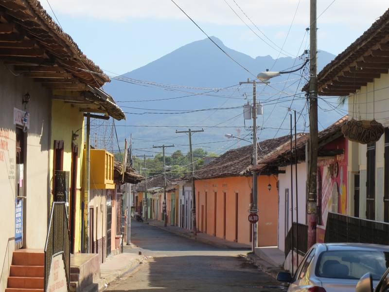
Mombacho stratovolcano, view from Granada, Nicaragua (Photo: WNomad)

Mombacho stratovolcano, near Granada, Nicaragua (Photo: WNomad)
Latest satellite images