Jabal Haylan Volcano
Updated: Jul 15, 2025 14:36 GMT -
volcanic field
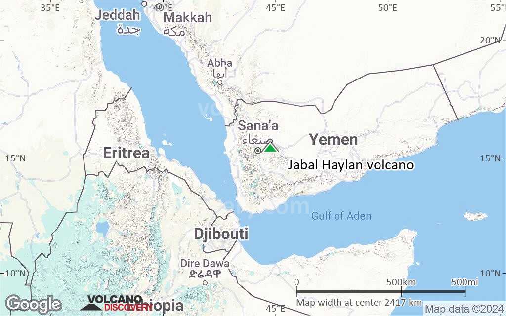
Arabian Peninsula (World), 15.43°N / 44.78°E 
Summit height: 1550 m / 5,085 ft
Current status: normal or dormant (1 out of 5)
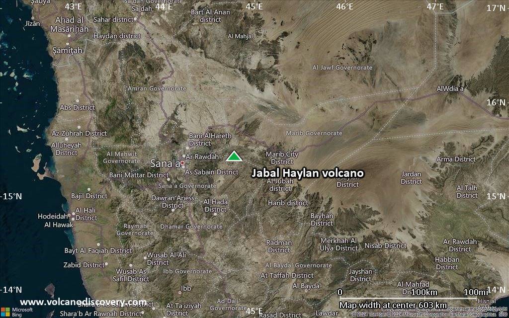
Jabal Haylan volcano is a 75 km long chain of volcanic vents, cinder cones and lava flows, located about 70 km east of Yemen's capital Sana'a.
The latest eruption from Jabal Haylan must have occurred less than about 3000 years ago.
[smaller] [larger]
Jabal Haylan volcano eruptions: around 3200 years ago
Latest nearby earthquakes
| Date and Time | Mag / Depth | Distance / Location | |||
|---|---|---|---|---|---|
Background
The lava flows of Jabal Haylan contain olivine and the chain of volcanoes crosses a regional NW-SE-trending fault between the highlands and the desert lowlands to the east.One of the lava flows covers alluvial terraces that accumulated behind man-made dams dating back to about 800-1200 BC, indicating that the volcanic system is still active.
(Source: GVP)
Significant volcanic eruptions: Jabal Haylan volcano
No historic eruptions are known from Jabal Haylan volcano, but at least one eruption in 1200 BC can be inferred from geological evidence.
The table below lists all known eruptions (date in bold face) of Jabal Haylan volcano in historic times and during the past 10,000 years. Updates on the most recent volcanic activity of Jabal Haylan can be found on the news page of Jabal Haylan volcano.
| Date | Note | VEI | Deaths | Damage | |
|---|---|---|---|---|---|
| West of Sirwan | 0? | ||||
Remark:
Our list of volcanic eruptions closely follows the database of eruptions of the Smithsonian's Global Volcanism Project (GVP), the internationally most recognized data source for volcanic eruptions, but also includes significant eruptive episodes or related volcano events. "Volcanic eruptions" are usually to be understood as sequences of individual eruptive episodes that can follow each other, or even overlap (if several vents are involved), and can last many years, decades or even longer. For example, the current activity of Stromboli volcano is understood as a single eruption that has been ongoing since 1934.
Sources: NOAA National Centers for Environmental Information (NCEI), Global Significant Volcanic Eruptions Database. doi:10.7289/V5TD9V7K | Global Volcanism Project / Smithsonian Institution
Jabal Haylan Volcano FAQ
+When was the last eruption of Jabal Haylan volcano?
The last confirmed eruption of Jabal Haylan occurred in 1200 BC.
Latest satellite images
Jabal Haylan Volcano Maps
Below is a selection of maps showing the location and surroundings of the volcano at various resolutions based on aerial-imagery / terrain maps. Feel free to use them for non-commercial purposes on your blog or website as long as you credit them with a link back to this page (click to copy it).

Satellite/aerial-type map of Jabal Haylan volcano (world scale)

Terrain-type map of Jabal Haylan volcano (world scale)

Satellite/aerial-type map of Jabal Haylan volcano (region scale large)

Terrain-type map of Jabal Haylan volcano (region scale large)

Satellite/aerial-type map of Jabal Haylan volcano (region scale medium)
Terrain-type map of Jabal Haylan volcano (region scale medium)

Satellite/aerial-type map of Jabal Haylan volcano (region scale small)

Terrain-type map of Jabal Haylan volcano (region scale small)
Satellite/aerial-type map of Jabal Haylan volcano (local scale large)

Terrain-type map of Jabal Haylan volcano (local scale large)

Satellite/aerial-type map of Jabal Haylan volcano (local scale medium)

Terrain-type map of Jabal Haylan volcano (local scale medium)

Satellite/aerial-type map of Jabal Haylan volcano (local scale small)

Terrain-type map of Jabal Haylan volcano (local scale small)

Satellite/aerial-type map of Jabal Haylan volcano (scale of 10s of km)

Terrain-type map of Jabal Haylan volcano (scale of 10s of km)

Satellite/aerial-type map of Jabal Haylan volcano (scale of 20-40 km)

Terrain-type map of Jabal Haylan volcano (scale of 20-40 km)

Satellite/aerial-type map of Jabal Haylan volcano (scale of approx. 10-20 km)

Terrain-type map of Jabal Haylan volcano (scale of approx. 10-20 km)

Satellite/aerial-type map of Jabal Haylan volcano (scale of 5-10 km)

Satellite/aerial-type map of Jabal Haylan volcano (scale of few kilometers)