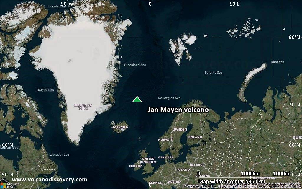
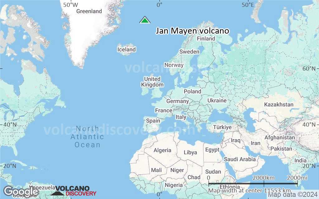
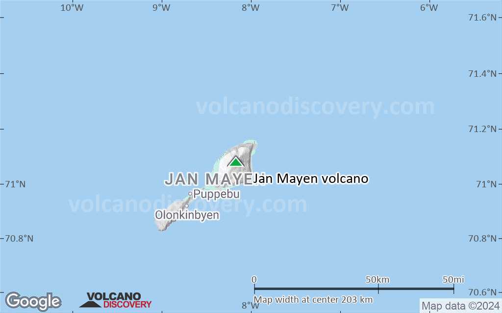
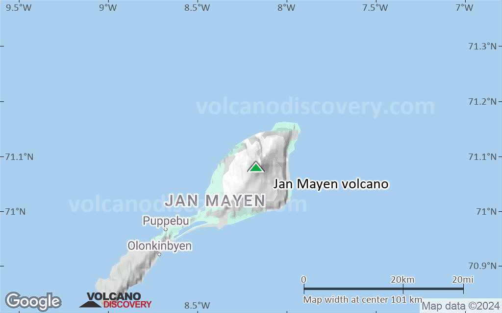
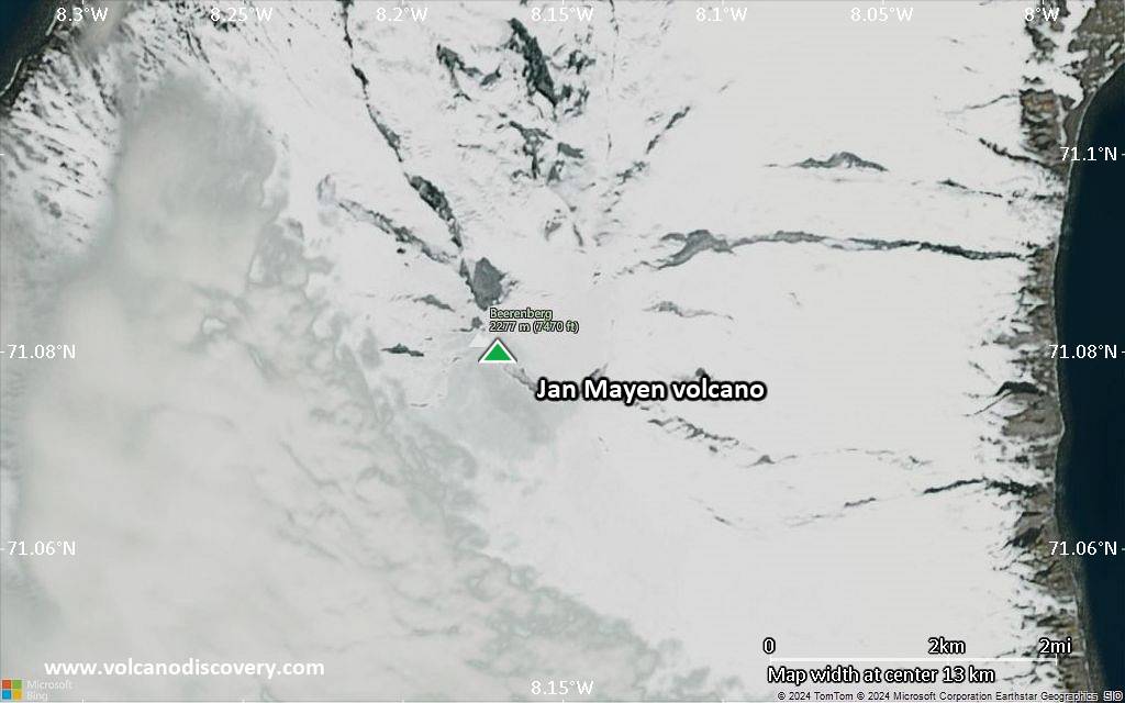
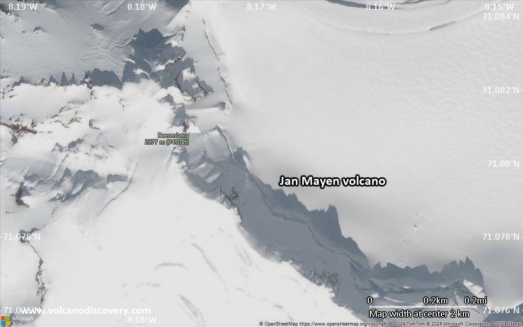
Jan Mayen Volcano
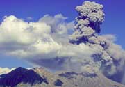
Jan Mayen volcano eruptions: 1985
Latest nearby earthquakes
| Date and Time | Mag / Depth | Distance / Location | |||
|---|---|---|---|---|---|
| May 27, 05:13 pm (GMT +2) | 1.3 3.1 km | 24 km (15 mi) to the SE | Info | ||
| May 27, 04:05 pm (GMT +2) | 1.3 0 km | 9.1 km (5.7 mi) to the NE | Info | ||
| Monday, May 26, 2025 GMT (2 quakes) | |||||
| May 26, 02:20 pm (Universal Time) | 1.1 0 km | 17 km (10.5 mi) to the E | Info | ||
| May 26, 09:13 am (GMT +2) | 1.6 3.1 km | 20 km (13 mi) to the NE | Info | ||
| Sunday, May 25, 2025 GMT (1 quake) | |||||
| May 25, 09:44 am (Universal Time) | 2.0 0 km | 13 km (7.8 mi) to the E | Info | ||
| Saturday, May 24, 2025 GMT (3 quakes) | |||||
| May 24, 03:32 am (Universal Time) | 1.5 34 km | 14 km (8.9 mi) to the N | Info | ||
| May 24, 03:18 am (Universal Time) | 1.4 33 km | 15 km (9.3 mi) to the N | Info | ||
| May 24, 01:15 am (Universal Time) | 1.8 17 km | 6.9 km (4.3 mi) to the N | Info | ||
| Thursday, May 22, 2025 GMT (1 quake) | |||||
| May 22, 10:55 am (Universal Time) | 2.0 21 km | 12 km (7.5 mi) to the NW | Info | ||
Background
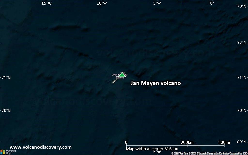
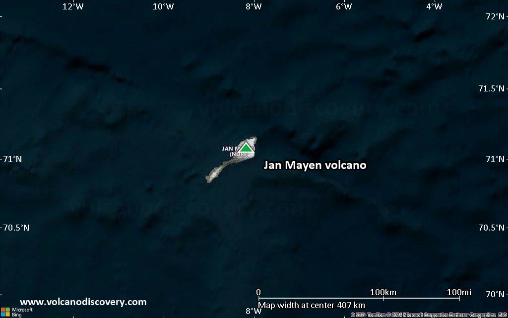
Remote Jan Mayen Island, located in the Norwegian Sea along the Mid-Atlantic Ridge about 650 km NE of Iceland, consists of two volcanic complexes separated by a narrow isthmus. The large Beerenberg basaltic stratovolcano (Nord-Jan) forms the NE end of the 40-km-long island, which is ringed by high cliffs. Beerenberg is a large 2277-m-high glacier-covered stratovolcano with a 1-km-wide summit crater and numerous cinder cones that were erupted along flank fissures. It is composed primarily of basaltic lava flows with minor amounts of tephra. Historical eruptions at Beerenberg date back to the 18th century. The Sor-Jan group of pyroclastic cones and lava domes occupies the SW tip of Jan Mayen. The Holocene Sor-Jan cinder cones, tephra rings, and trachytic lava domes were erupted from short fissures with a NE-SW trend.---
Smithsonian / GVP volcano information
Significant volcanic eruptions: Jan Mayen volcano
There is one uncertain or discredited eruption in 1558 AD from Jan Mayen volcano.
| Date | Note | VEI | Deaths | Damage | |
|---|---|---|---|---|---|
| Beerenberg (NE flank, 0-200 m) Historical obs./docs. | 0 | ||||
| Beerenberg (NE flank, Skrukkelia) Historical obs./docs. | 1 | ||||
| Beerenberg (NE & SW flanks, summit) Historical obs./docs. | 3 | ||||
| Beerenberg (Kokssletta, NE flank) Historical obs./docs. | ? | ||||
| Beerenberg (Dagnyhaugen, SW flank) Historical obs./docs. | 3? | ||||
| Beerenberg (Eggoya, SW flank) Historical obs./docs. | 4 | ||||
?? | Uncertain Eruption | ? | |||
| Beerenberg (Eggoya, SW flank) | ? | ||||
Jan Mayen Volcano FAQ
+When was the last eruption of Jan Mayen volcano?
The last confirmed eruption of Jan Mayen occurred in 1985.
+How often does Jan Mayen volcano erupt?
Since 1732, Jan Mayen volcano has had at least 6 historically documented eruptions. This means that it erupts on average every 49 years.
Many eruptions of Jan Mayen have lasted more than one year. In total, the volcano has been in eruption during 8 out of 293 years until now. In other words, Jan Mayen has been active at least one in 36.6 years on average. Note that this value is likely an underestimate, because the known history of eruptions from Jan Mayen is likely incomplete, especially further back in time.
+How active is Jan Mayen volcano at present?
Jan Mayen volcano is occasionally active: Since 1900, it has had 5 eruptions, and been active during 5 years out of 126 as of now. This means, Jan Mayen has been in eruption one in 25.2 years on average. The last eruption was in 1985 and ended 40 years ago.
+When was the largest eruption of Jan Mayen volcano?
The largest eruption of Jan Mayen volcano in historic times occurred in 1732. It ranks as a sub-plinian eruption with a magnitude 4 on the VEI (Volcanic Explosivity Index) scale.
Latest satellite images

Jan Mayen Volcano Maps