| RSS | EN | DE | EL | ES | FR | IT | RU

Kendang Volcano

Updated: Apr 28, 2025 11:14 GMT -
stratovolcano
West Java (Indonesia), -7.23°S / 107.72°E
Summit height: 2608 m / 8,556 ft
Current status: (probably) extinct (0 out of 5)

Kendang volcano lies 8 km north of Papandayan volcano in West Java. It is known for its 4 fumarole fields, in particular Kawah Manuk with its solfataras, mud pools and hot springs in a 2.75 km wide crater-like depression.
No historic eruptions are known from Kendang volcano, but it is considered active and its youngest products are a rhyolitic lava dome and obsidian lava flows of Holocene age (<10,000 years old).

[smaller] [larger]
Typical eruption style: Explosive
Kendang volcano eruptions:

Latest nearby earthquakes

Date and TimeMag / DepthDistance / Location
Apr 27, 07:20 am (Universal Time)
2.3

10 km
21 km (13 mi) to the SW Kabupaten Garut, 21 km southeast of Banjar, Indonesia Info

Background

The Quaternary Gunung Kendang volcano (also spelled Kendeng) is located immediately north of Papandayan volcano. Kendang contains four fumarole fields, the most prominent of which is Kawah Manuk, located in a broad 2.75-km-wide crater-like depression. Thermal activity consists of fumaroles with sulfur sublimation, mud pots, and hot water pools with occasional mild water ejections. The Darajat geothermal field is located on the eastern flank of Gunung Kendang. The geothermal field is located along the Kendang fault, which extends NE to the Kawah Kamojang geothermal field. The latest eruptions of Kendang volcano produced the very young Kiamis rhyolitic lava dome and obsidian lava flows. Gunung Kiamis was labeled as Recent on a map of Whittome and Salveson (1990) and is located 2 km NE of the Darajat geothermal field.
---
(from: GVP

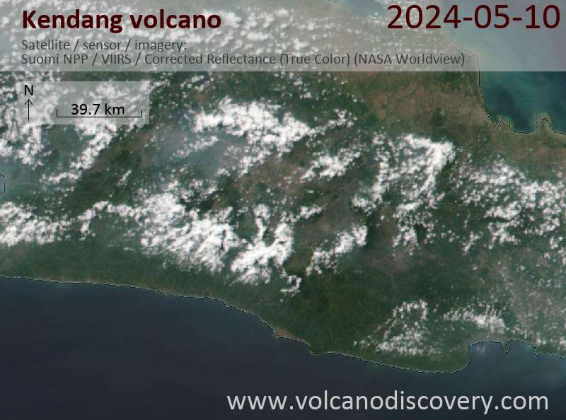
Latest satellite images

Kendang satellite image sat1Kendang satellite image sat2

Kendang Volcano Maps

Below is a selection of maps showing the location and surroundings of the volcano at various resolutions based on aerial-imagery / terrain maps. Feel free to use them for non-commercial purposes on your blog or website as long as you credit them with a link back to this page (click to copy it).
Satellite/aerial-type map of Kendang volcano (world scale)
Terrain-type map of Kendang volcano (world scale)
Satellite/aerial-type map of Kendang volcano (region scale large)
Terrain-type map of Kendang volcano (region scale large)
Satellite/aerial-type map of Kendang volcano (region scale medium)
Terrain-type map of Kendang volcano (region scale medium)
Satellite/aerial-type map of Kendang volcano (region scale small)
Terrain-type map of Kendang volcano (region scale small)
Satellite/aerial-type map of Kendang volcano (local scale large)
Terrain-type map of Kendang volcano (local scale large)
Satellite/aerial-type map of Kendang volcano (local scale medium)
Terrain-type map of Kendang volcano (local scale medium)
Satellite/aerial-type map of Kendang volcano (local scale small)
Terrain-type map of Kendang volcano (local scale small)
Satellite/aerial-type map of Kendang volcano (scale of 10s of km)
Terrain-type map of Kendang volcano (scale of 10s of km)
Satellite/aerial-type map of Kendang volcano (scale of 20-40 km)
Terrain-type map of Kendang volcano (scale of 20-40 km)
Satellite/aerial-type map of Kendang volcano (scale of approx. 10-20 km)
Terrain-type map of Kendang volcano (scale of approx. 10-20 km)
Satellite/aerial-type map of Kendang volcano (scale of 5-10 km)
Satellite/aerial-type map of Kendang volcano (scale of few kilometers)
Volcanoes & Earthquakes - new app for Android
Guaranteed tours
9-25 Jun 2025: Volcanoes and Spices - Sulawesi/Halmahera (Indonesia)
27 Jun - 6 Jul 2025: Iceland Volcano Special - Iceland
7-22 Jul 2025: From Krakatau to Bali - Java (Indonesia)
7-23 Jul 2025: Volcanoes and Spices - Sulawesi/Halmahera (Indonesia)
1-17 Aug 2025: Volcanoes and Spices - Sulawesi/Halmahera (Indonesia)
1-14 Oct 2025: Desert, salt and volcanoes - Danakil desert (Ethiopia)
4-12 Oct 2025: From Stromboli to Etna - Sicily and Eolian Islands (Italy)
6-21 Oct 2025: From Krakatau to Bali - Java (Indonesia)
3-19 Nov 2025: Volcanoes and Spices - Sulawesi/Halmahera (Indonesia)
= spaces available   = guaranteed   = few spaces left   = booked out

No news in this list.

On this page:

Try our free app!
Volcanoes & Earthquakes - new app for Android
Android | iOS version

More on VolcanoDiscovery

Why is there advertising on this site?

Support us - Help us upgrade our services!

We truly love working to bring you the latest volcano and earthquake data from around the world. Maintaining our website and our free apps does require, however, considerable time and resources.
We need financing to increase hard- and software capacity as well as support our editor team. We're aiming to achieve uninterrupted service wherever an earthquake or volcano eruption unfolds, and your donations can make it happen! Every donation will be highly appreciated. If you find the information useful and would like to support our team in integrating further features, write great content, and in upgrading our soft- and hardware, please make a donation (PayPal).

Planned features:Thanks to your past donations, these features have been added recently:
Download and Upgrade the Volcanoes & Earthquakes app to get one of the fastest seismic and volcano alerts online:
Android | IOS
Thank you!
Sources: VolcanoDiscovery / VolcanoAdventures and other sources as noted.
Use of material: Most text and images on our websites are owned by us. Re-use is generally not permitted without authorization. Contact us for licensing rights.
Volcanoes & Earthquakes
VolcanoDiscovery Home
Volcanoes | Earthquakes | Photos | Volcano News | | Shop | App
Adventure & Study Travel
Tours to Volcanoes and Volcanic Areas: walking tours, photo tours, study tours
Tours & Dates | FAQ | About us
Get our newsletter!
Company info
Contact | Legal info | Terms & conditions
Follow us
Follow us on facebook Follow us on Instagram Follow us on Bluesky Follow us on Twitter Visit our Youtube channel
EN | DE | EL | ES | FR | IT | RU
VolcanoDiscovery GmbH, Germany, Reg. nr.: HRB 103744, EU Tax Id: DE 297 465 123 owned and created by
Dr. Tom Pfeiffer, volcanologist, volcano photographer, tour organizer member of
IAVCEI
IAVCEI
Vulkanologische Gesellschaft
Volcanological Society
Ecotourism Greece
Ecotourism Greece
RUV insurance
Insured by R+V
VolcanoDiscovery © 2004- All Rights Reserved | Privacy - Cookie Settings