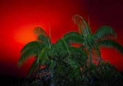
| RSS | EN | DE | EL | ES | FR | IT | RU

Mount Baker Volcano

Updated: May 1, 2025 12:02 GMT -
stratovolcano
Washington State (Canada and USA (mainland)), 48.78°N / -121.81°W
Summit height: 3285 m / 10,777 ft
Current status: normal or dormant (1 out of 5)

Mt Baker 50 km east of Bellingham, Washington, is the northernmost of Washington's volcanoes and one of the lesser known ones in the Cascade Range.
Mt Baker Volcano has been very active during the last centuries, but has been in repose now for more than 130 years.
Early settlers in the Puget Sound region observed 19th-century activity, which consisted of relatively small phreatic eruptions. Sherman Crater, the historically active crater immediately south of the summit, started to emit steam since 1975, but no other signs suggest a reawakening in the near future.
The main hazard from Mt Baker are lahars, caused by melting of glacial ice covering the upper slopes. Baker is drained in the north by North Fork Nooksack River, in the west by Middle Fork Nooksack River, and east by Baker River. These valley are at risk of such lahars in case of a new eruption.
The eruption in 1843 killed fish in Baker River, ignited forest and caused minor ash fall in nearby areas. Steam emissions continued at the Sherman Crater and Dorr fumarole field on the north flank until the 1940's and 1950's.

[smaller] [larger]
Typical eruption style: Explosive
Mount Baker volcano eruptions: 1884(?), 1880, 1870, 1869(?), 1867(?), 1865(?), 1863, 1860(?), 1859-60, 1858, 1856(?), 1854, 1852-53, 1850(?), 1846(?), 1843, 1820(?), 1792

Latest nearby earthquakes

Date and TimeMag / DepthDistance / Location
Apr 29, 11:17 pm (Universal Time)
0.4

4.2 km
22 km (13 mi) to the SE 19 km NNW of Marblemount, Washington Info

Background

Mount Baker is an andesitic stratovolcano constructed above the east flank of an older eroded volcano (Black Buttes volcano) and SW of the early Pleistocene 4.5 x 8 km rhyodacitic Kulshan caldera.
The Schreibers Meadow cinder cone on the SE flank erupted about 9800 years ago. All other historic activity within the past 10,000 years seem to have taken place on the summit vent. A major magmatic eruption at Mount Baker occurred about 6500 years ago. It was followed by caldera collapse and left large lahar deposits in the Nooksack river valley.

Significant volcanic eruptions: Mount Baker volcano

In the past 10,000 years, Mount Baker has had at least 11 confirmed volcanic eruptions, out of which 9 are documented by historical records, while the others can be inferred from geological evidence.
Additionally, there are 9 uncertain or discredited eruptions from Mount Baker volcano.
The table below lists all known eruptions (date in bold face) of Mount Baker volcano in historic times and during the past 10,000 years. Updates on the most recent volcanic activity of Mount Baker can be found on the news page of Mount Baker volcano.
DateNoteVEIDeathsDamage
?? 1884
Uncertain Eruption
?
1880 Sep 7 - Nov 27Sherman Crater
Historical obs./docs.
2
1870Sherman Crater
Historical obs./docs.
2
?? 1869 Jun
Uncertain Eruption
?
?? 1867 Mar
Uncertain Eruption
?
?? 1865
Uncertain Eruption
?
1863 JulSherman Crater
Historical obs./docs.
2
?? 1860 Dec
Uncertain Eruption
?
1859 Nov - 1860 Apr 26 ?Sherman Crater
Historical obs./docs.
2
1858Sherman Crater
Historical obs./docs.
2
?? 1856
Uncertain Eruption
?
1854Sherman Crater
Historical obs./docs.
2
1852 Dec 1 ±30 d. - 1853 JanSherman Crater
Historical obs./docs.
2
?? 1850 Mar
Uncertain Eruption
?
?? 1846
Uncertain Eruption
?
1843Sherman Crater
Historical obs./docs.
3?
1820 ?
Historical obs./docs.
2
?? 1792 Jun
Uncertain Eruption
?
4550 ? BCSherman Crater?3?
7850 ? BCSouth flank (Schreibers Meadow Cone)?
Remark:
Our list of volcanic eruptions closely follows the database of eruptions of the Smithsonian's Global Volcanism Project (GVP), the internationally most recognized data source for volcanic eruptions, but also includes significant eruptive episodes or related volcano events. "Volcanic eruptions" are usually to be understood as sequences of individual eruptive episodes that can follow each other, or even overlap (if several vents are involved), and can last many years, decades or even longer. For example, the current activity of Stromboli volcano is understood as a single eruption that has been ongoing since 1934.
Sources: NOAA National Centers for Environmental Information (NCEI), Global Significant Volcanic Eruptions Database. doi:10.7289/V5TD9V7K | Global Volcanism Project / Smithsonian Institution

Mount Baker Volcano FAQ

+When was the last eruption of Mount Baker volcano?

+How often does Mount Baker volcano erupt?

+When was the largest eruption of Mount Baker volcano?

Latest satellite images

MountBaker satellite image sat1MountBaker satellite image sat2

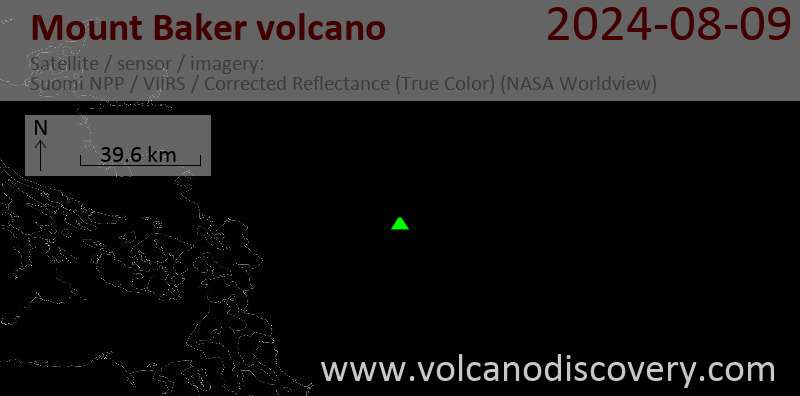
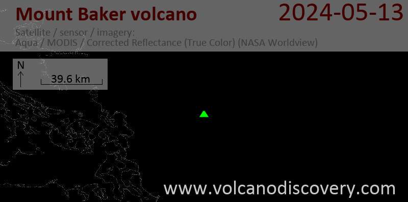
Mount Baker Volcano Maps

Below is a selection of maps showing the location and surroundings of the volcano at various resolutions based on aerial-imagery / terrain maps. Feel free to use them for non-commercial purposes on your blog or website as long as you credit them with a link back to this page (click to copy it).
Satellite/aerial-type map of Mount Baker volcano (world scale)
Terrain-type map of Mount Baker volcano (world scale)
Satellite/aerial-type map of Mount Baker volcano (region scale large)
Terrain-type map of Mount Baker volcano (region scale large)
Satellite/aerial-type map of Mount Baker volcano (region scale medium)
Terrain-type map of Mount Baker volcano (region scale medium)
Satellite/aerial-type map of Mount Baker volcano (region scale small)
Terrain-type map of Mount Baker volcano (region scale small)
Satellite/aerial-type map of Mount Baker volcano (local scale large)
Terrain-type map of Mount Baker volcano (local scale large)
Satellite/aerial-type map of Mount Baker volcano (local scale medium)
Terrain-type map of Mount Baker volcano (local scale medium)
Satellite/aerial-type map of Mount Baker volcano (local scale small)
Terrain-type map of Mount Baker volcano (local scale small)
Satellite/aerial-type map of Mount Baker volcano (scale of 10s of km)
Terrain-type map of Mount Baker volcano (scale of 10s of km)
Satellite/aerial-type map of Mount Baker volcano (scale of 20-40 km)
Terrain-type map of Mount Baker volcano (scale of 20-40 km)
Satellite/aerial-type map of Mount Baker volcano (scale of approx. 10-20 km)
Terrain-type map of Mount Baker volcano (scale of approx. 10-20 km)
Satellite/aerial-type map of Mount Baker volcano (scale of 5-10 km)
Satellite/aerial-type map of Mount Baker volcano (scale of few kilometers)
Features around Mt Baker volcano
Black Buttes: An eroded rest of a former stratovolcano 3 km west of Mt. Baker.

Dorr Fumaroles: 
A field of fumaroles NE of the summit of Mt Baker.

Kulshan Caldera:
A large caldera NE of the volcano formed by collapse of the magma chamber after a large ancient eruption.

Mazama Ash:
Ash layers on the south flank of Mt Baker, probably deposited during an explosive eruption 6,000 years ago.

Schriebers Meadow Cinder Cone:
A cinder cone which formed about 9,800 years ago, 100 m high and 750 m wide. A lava flow 11 km long was erupted from the same vent.

Sherman Crater: A lateral crater 800 south of the summit. It is partially filled with ice. Snow avalanches have descended down Boulder Glacier at least 6 times since 1958.
Volcanoes & Earthquakes - new app for Android
Guaranteed tours
9-25 Jun 2025: Volcanoes and Spices - Sulawesi/Halmahera (Indonesia)
7-22 Jul 2025: From Krakatau to Bali - Java (Indonesia)
7-23 Jul 2025: Volcanoes and Spices - Sulawesi/Halmahera (Indonesia)
1-17 Aug 2025: Volcanoes and Spices - Sulawesi/Halmahera (Indonesia)
1-14 Oct 2025: Desert, salt and volcanoes - Danakil desert (Ethiopia)
4-12 Oct 2025: From Stromboli to Etna - Sicily and Eolian Islands (Italy)
6-21 Oct 2025: From Krakatau to Bali - Java (Indonesia)
3-19 Nov 2025: Volcanoes and Spices - Sulawesi/Halmahera (Indonesia)
= spaces available   = guaranteed   = few spaces left   = booked out

No news in this list.

On this page:

Try our free app!
Volcanoes & Earthquakes - new app for Android
Android | iOS version

More on VolcanoDiscovery

Why is there advertising on this site?

Support us - Help us upgrade our services!

We truly love working to bring you the latest volcano and earthquake data from around the world. Maintaining our website and our free apps does require, however, considerable time and resources.
We need financing to increase hard- and software capacity as well as support our editor team. We're aiming to achieve uninterrupted service wherever an earthquake or volcano eruption unfolds, and your donations can make it happen! Every donation will be highly appreciated. If you find the information useful and would like to support our team in integrating further features, write great content, and in upgrading our soft- and hardware, please make a donation (PayPal).

Planned features:Thanks to your past donations, these features have been added recently:
Download and Upgrade the Volcanoes & Earthquakes app to get one of the fastest seismic and volcano alerts online:
Android | IOS
Thank you!
Sources: VolcanoDiscovery / VolcanoAdventures and other sources as noted.
Use of material: Most text and images on our websites are owned by us. Re-use is generally not permitted without authorization. Contact us for licensing rights.
Volcanoes & Earthquakes
VolcanoDiscovery Home
Volcanoes | Earthquakes | Photos | Volcano News | | Shop | App
Adventure & Study Travel
Tours to Volcanoes and Volcanic Areas: walking tours, photo tours, study tours
Tours & Dates | FAQ | About us
Get our newsletter!
Company info
Contact | Legal info | Terms & conditions
Follow us
Follow us on facebook Follow us on Instagram Follow us on Bluesky Follow us on Twitter Visit our Youtube channel
EN | DE | EL | ES | FR | IT | RU
VolcanoDiscovery GmbH, Germany, Reg. nr.: HRB 103744, EU Tax Id: DE 297 465 123 owned and created by
Dr. Tom Pfeiffer, volcanologist, volcano photographer, tour organizer member of
IAVCEI
IAVCEI
Vulkanologische Gesellschaft
Volcanological Society
Ecotourism Greece
Ecotourism Greece
RUV insurance
Insured by R+V
VolcanoDiscovery © 2004- All Rights Reserved | Privacy - Cookie Settings