| RSS | EN | DE | EL | ES | FR | IT | RU

Ofu-Olosega Volcano

Updated: Sep 12, 2025 07:27 GMT -
Shield volcanoes
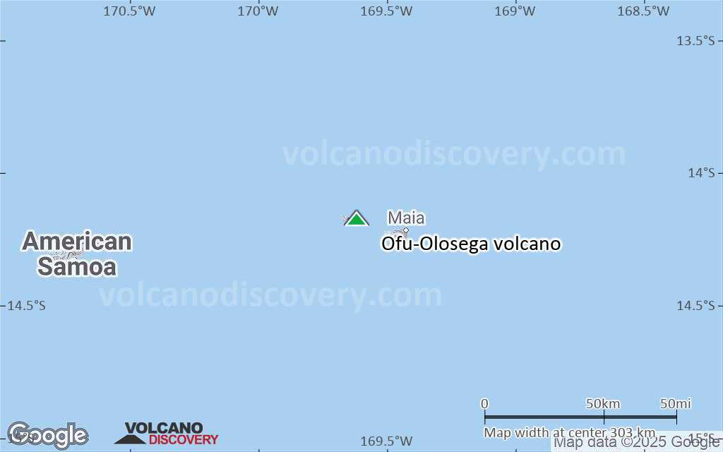
United States, Samoan Islands, -14.18°S / -169.62°W
Summit height: 639 m / 2,096 ft
Current status: normal or dormant (1 out of 5)
Last update: 31 Aug 2022 (Smithsonian / USGS Weekly Volcanic Activity Report)

[smaller] [larger]
Typical eruption style: unspecified
Ofu-Olosega volcano eruptions: 1866 

Latest nearby earthquakes

Date and TimeMag / DepthDistance / Location

Background

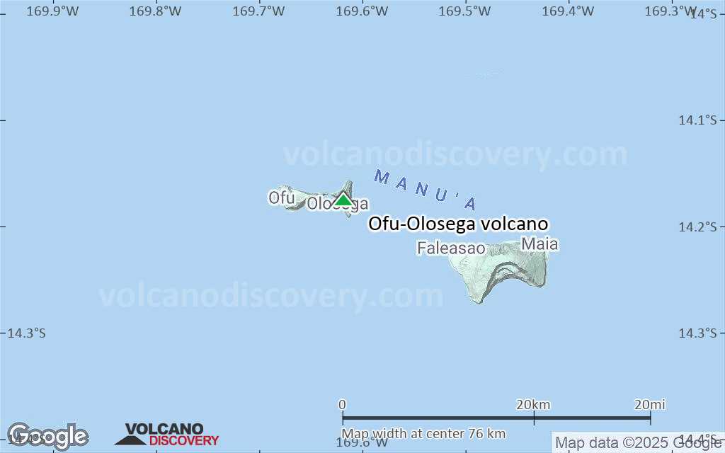
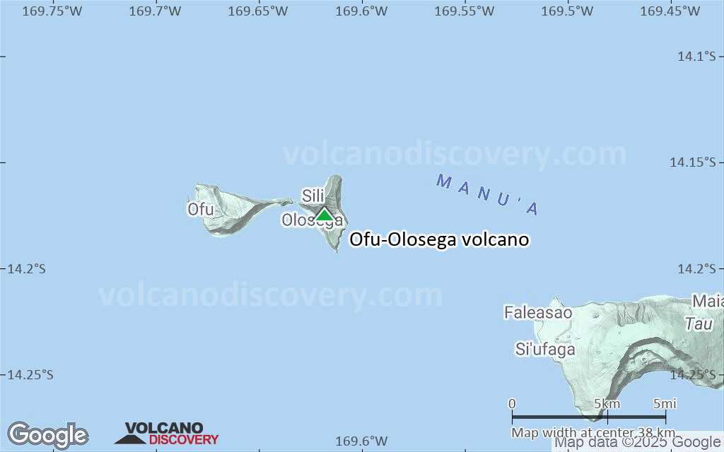
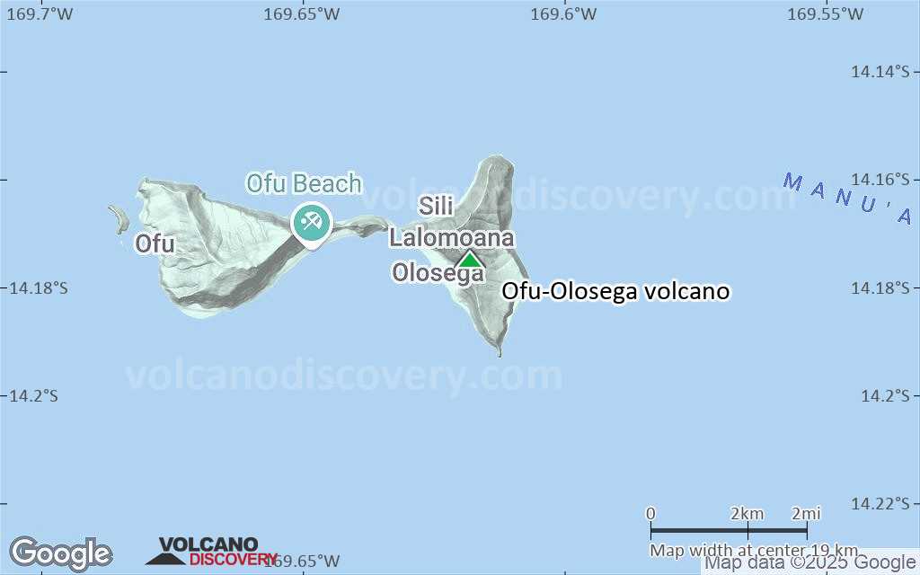
The two triangle-shaped islands of Ofu and Olosega in eastern Samoa, with a combined length of 6 km, are separated by a narrow strait. The islands are formed by two eroded, coalescing basaltic shield volcanoes whose slopes dip to the east and west. Steep cliffs up to 600-m high truncate the northern and southern sides of the islands. The narrow, steep-sided ridge forming the eastern tip of Ofu Island consists of a dike complex. The shield volcano on Ofu is cut on the north by the A'ofa caldera; bathymetry suggests that a caldera may also exist on the Sili shield volcano of Olosega. The Nu'utele tuff cone, forming a small crescent-shaped island immediately off the west end of Ofu Island, is Holocene in age. A submarine eruption took place in 1866 at the opposite end of the two islands, 3 km SE of Olosega, along the ridge connecting Olosega with Ta'u Island.
---
Smithsonian / GVP volcano information

Ofu-Olosega Volcano Photos

Significant volcanic eruptions: Ofu-Olosega volcano

In the past 10,000 years, Ofu-Olosega has had only one confirmed historic eruption in 1866.
The table below lists all known eruptions (date in bold face) of Ofu-Olosega volcano in historic times and during the past 10,000 years. Updates on the most recent volcanic activity of Ofu-Olosega can be found on the news page of Ofu-Olosega volcano.
DateNoteVEIDeathsDamage
1866 Sep 12 - Nov 15 ±5 d.Submarine vent 3 km SE of Olosega
Historical obs./docs.
2
1866 Sep 12
(eruption 1866 Sep 12 - Nov 15 ±5 d.)
Tsunami recorded
Historical obs./docs.
2
Info
Remark:
Our list of volcanic eruptions closely follows the database of eruptions of the Smithsonian's Global Volcanism Project (GVP), the internationally most recognized data source for volcanic eruptions, but also includes significant eruptive episodes or related volcano events. "Volcanic eruptions" are usually to be understood as sequences of individual eruptive episodes that can follow each other, or even overlap (if several vents are involved), and can last many years, decades or even longer. For example, the current activity of Stromboli volcano is understood as a single eruption that has been ongoing since 1934.
Sources: NOAA National Centers for Environmental Information (NCEI), Global Significant Volcanic Eruptions Database. doi:10.7289/V5TD9V7K | Global Volcanism Project / Smithsonian Institution

Ofu-Olosega Volcano FAQ

+When was the last eruption of Ofu-Olosega volcano?

+How often does Ofu-Olosega volcano erupt?

+When was the largest eruption of Ofu-Olosega volcano?

Latest satellite images

ofuolosega satellite image sat1ofuolosega satellite image sat2

Ofu-Olosega Volcano Maps

Below is a selection of maps showing the location and surroundings of the volcano at various resolutions based on aerial-imagery / terrain maps. Feel free to use them for non-commercial purposes on your blog or website as long as you credit them with a link back to this page (click to copy it).
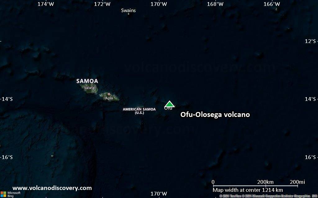
Satellite/aerial-type map of Ofu-Olosega volcano (world scale)
Terrain-type map of Ofu-Olosega volcano (world scale)
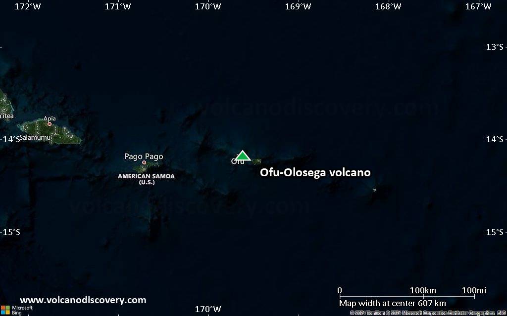
Satellite/aerial-type map of Ofu-Olosega volcano (region scale large)
Terrain-type map of Ofu-Olosega volcano (region scale large)
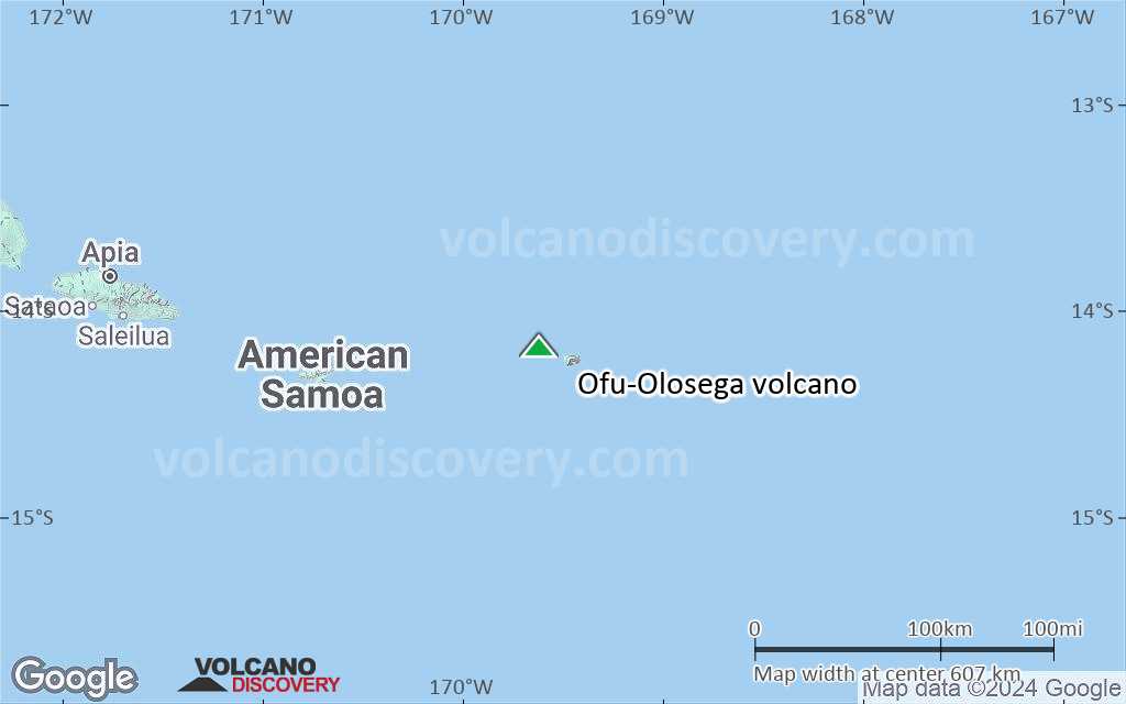
Satellite/aerial-type map of Ofu-Olosega volcano (region scale medium)
Terrain-type map of Ofu-Olosega volcano (region scale medium)
Satellite/aerial-type map of Ofu-Olosega volcano (region scale small)
Terrain-type map of Ofu-Olosega volcano (region scale small)
Satellite/aerial-type map of Ofu-Olosega volcano (local scale large)
Terrain-type map of Ofu-Olosega volcano (local scale large)
Satellite/aerial-type map of Ofu-Olosega volcano (local scale medium)
Terrain-type map of Ofu-Olosega volcano (local scale medium)
Satellite/aerial-type map of Ofu-Olosega volcano (local scale small)
Terrain-type map of Ofu-Olosega volcano (local scale small)
Satellite/aerial-type map of Ofu-Olosega volcano (scale of 10s of km)
Terrain-type map of Ofu-Olosega volcano (scale of 10s of km)
Satellite/aerial-type map of Ofu-Olosega volcano (scale of 20-40 km)
Terrain-type map of Ofu-Olosega volcano (scale of 20-40 km)
Satellite/aerial-type map of Ofu-Olosega volcano (scale of approx. 10-20 km)
Terrain-type map of Ofu-Olosega volcano (scale of approx. 10-20 km)
Satellite/aerial-type map of Ofu-Olosega volcano (scale of 5-10 km)
Satellite/aerial-type map of Ofu-Olosega volcano (scale of few kilometers)
Volcanoes & Earthquakes - new app for Android
Guaranteed tours
6-21 Oct 2025: From Krakatau to Bali - Java (Indonesia)
3-19 Nov 2025: Volcanoes and Spices - Sulawesi/Halmahera (Indonesia)
9-19 Nov 2025: Guatemala Volcano Special - Guatemala
20 Nov - 3 Dec 2025: Desert, salt and volcanoes - Danakil desert (Ethiopia)
2-10 May 2026: From Stromboli to Etna - Sicily and Eolian Islands (Italy)
= spaces available   = guaranteed   = few spaces left   = booked out
Wed, 31 Aug 2022, 14:00

Ofu-Olosega volcano (American Samoa, SW Pacific) - Smithsonian / USGS Weekly Volcanic Activity Report for 24 August-30 August 2022 (New Activity / Unrest)

Data from seismometers recently installed on Tutuila, Ta'u, and Ofu-Olosega islands of American Samoa to monitor an ongoing seismic swarm indicated that the events were related to Ta'u Island and not Ofu-Olosega. HVO lowered the Volcano Alert Level to Normal and the Aviation Color Code to Green on 26 August. The report warned residents of Ofu-Olosega that they could still be significantly affected by events that may take place on or around Ta'u Island. ... Read all
Wed, 24 Aug 2022, 14:00

Ofu-Olosega volcano (American Samoa, SW Pacific) - Smithsonian / USGS Weekly Volcanic Activity Report for 17 August-23 August 2022 (New Activity / Unrest)

HVO reported that an earthquake swarm in the Manu'a Islands of American Samoa continued to be recorded and felt by residents of Ta'u Island and Ofu-Olosega. About 20 earthquakes per hour were recorded by four microseismometers distributed on Tutuila, Ta'u, and Ofu-Olosega Islands. The largest events were estimated to be between magnitudes 2 and 3; most events are too small to be felt. ... Read all

On this page:

Try our free app!
Volcanoes & Earthquakes - new app for Android
Android | iOS version

More on VolcanoDiscovery

Why is there advertising on this site?

Support Us – Help Us Enhance Our Services!

We’re passionate about delivering the latest volcano and earthquake data from around the globe — just for you. However, maintaining our website and free apps requires significant time, effort, and resources.
Your support helps us expand our hardware and software capabilities and empowers our dedicated editorial team. Our mission is to provide uninterrupted, real-time updates whenever an earthquake strikes or a volcano erupts — and your donations make this possible. Every contribution, big or small, is deeply appreciated. If you find our information valuable and want to help us add new features, create compelling content, and improve our technology, please consider making a donation:

Donate with Card or Apple/Google Pay:

Send €5 payment link to support VolcanoDiscovery with 5 EUR
€10 payment link to support VolcanoDiscovery with 10 EUR
€25 payment link to support VolcanoDiscovery with 25 EUR
€50 payment link to support VolcanoDiscovery with 50 EUR
€100 payment link to support VolcanoDiscovery with 100 EUR
€250 payment link to support VolcanoDiscovery with 250 EUR

Donate with PayPal:

Planned Features:

Thanks to your past donations, we have recently added:
Download the Volcanoes & Earthquakes app to stay among the first to receive the fastest seismic and volcano alerts online:
Android | iOS
Thank you for being part of our mission!
Sources: VolcanoDiscovery / VolcanoAdventures and other sources as noted.
Use of material: Most text and images on our websites are owned by us. Re-use is generally not permitted without authorization. Contact us for licensing rights.
Volcanoes & Earthquakes
VolcanoDiscovery Home
Volcanoes | Earthquakes | Photos | Volcano News | | Shop | App
Adventure & Study Travel
Tours to Volcanoes and Volcanic Areas: walking tours, photo tours, study tours
Tours & Dates | FAQ | About us
Get our newsletter!
Company info
Contact | Legal info | Terms & conditions
Follow us
Follow us on facebook Follow us on Instagram Follow us on Bluesky Follow us on Twitter Visit our Youtube channel
EN | DE | EL | ES | FR | IT | RU
VolcanoDiscovery GmbH, Germany, Reg. nr.: HRB 103744, EU Tax Id: DE 297 465 123 owned and created by
Dr. Tom Pfeiffer, volcanologist, volcano photographer, tour organizer member of
IAVCEI
IAVCEI
Vulkanologische Gesellschaft
Volcanological Society
Ecotourism Greece
Ecotourism Greece
RUV insurance
Insured by R+V
VolcanoDiscovery © 2004- All Rights Reserved | Privacy - Cookie Settings