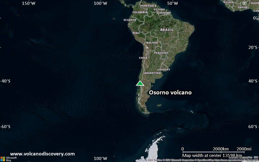
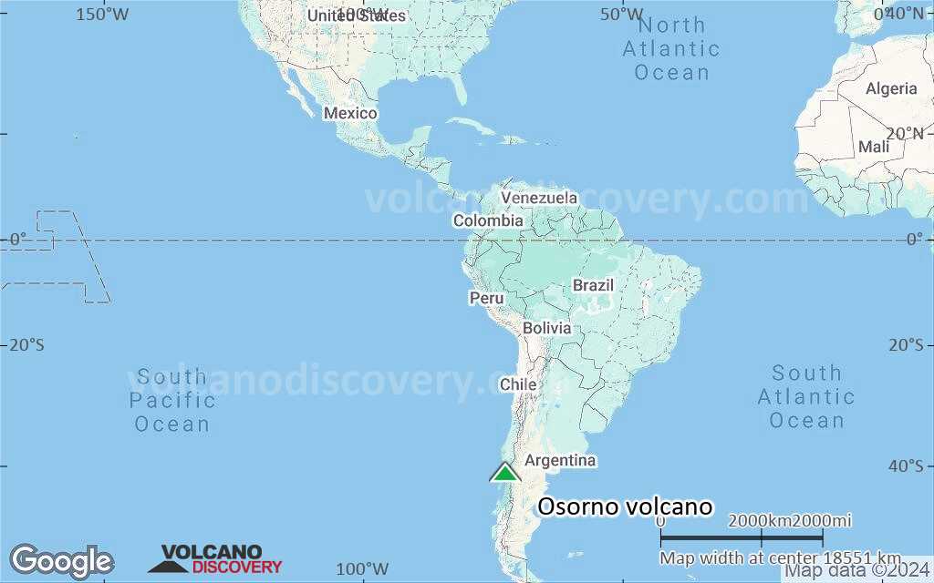
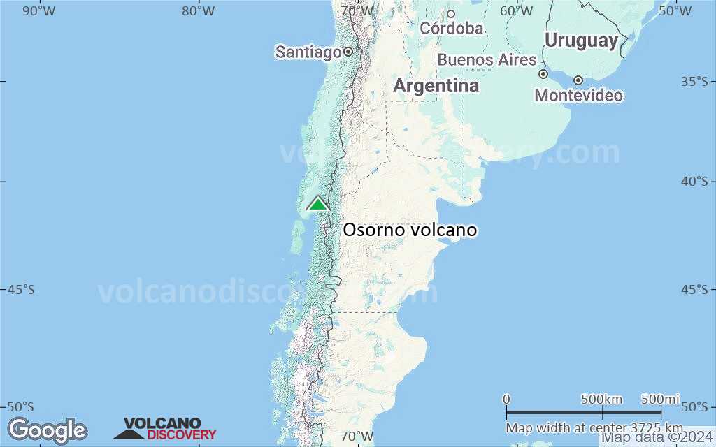
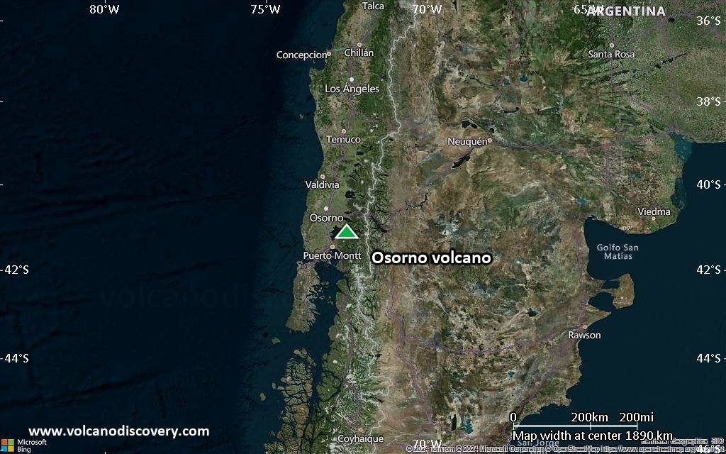
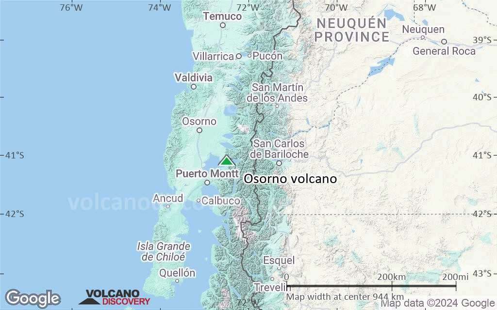
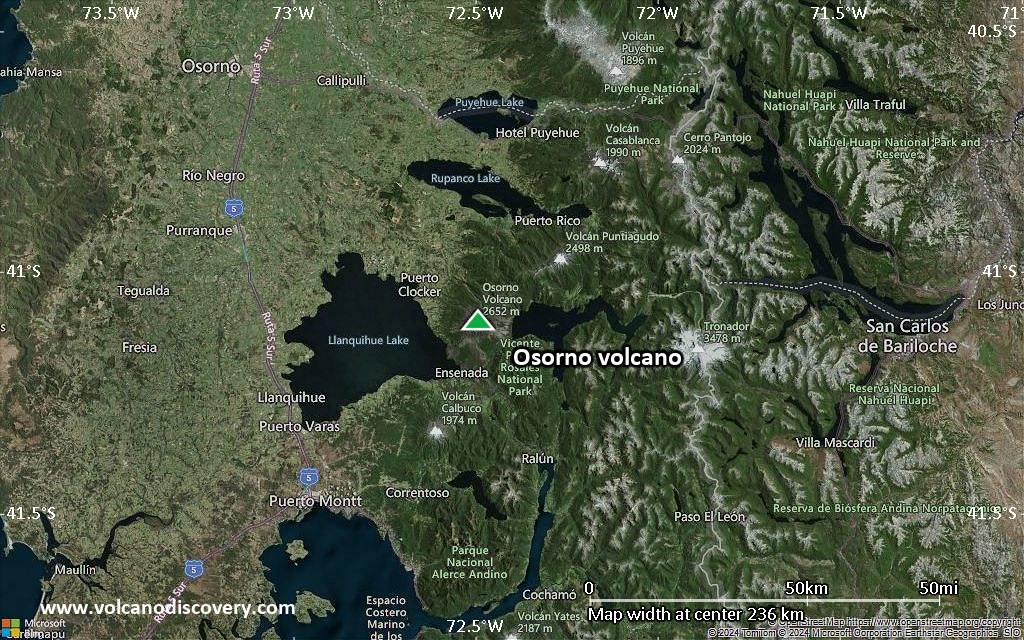
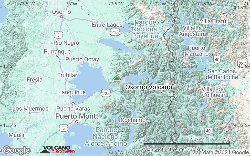
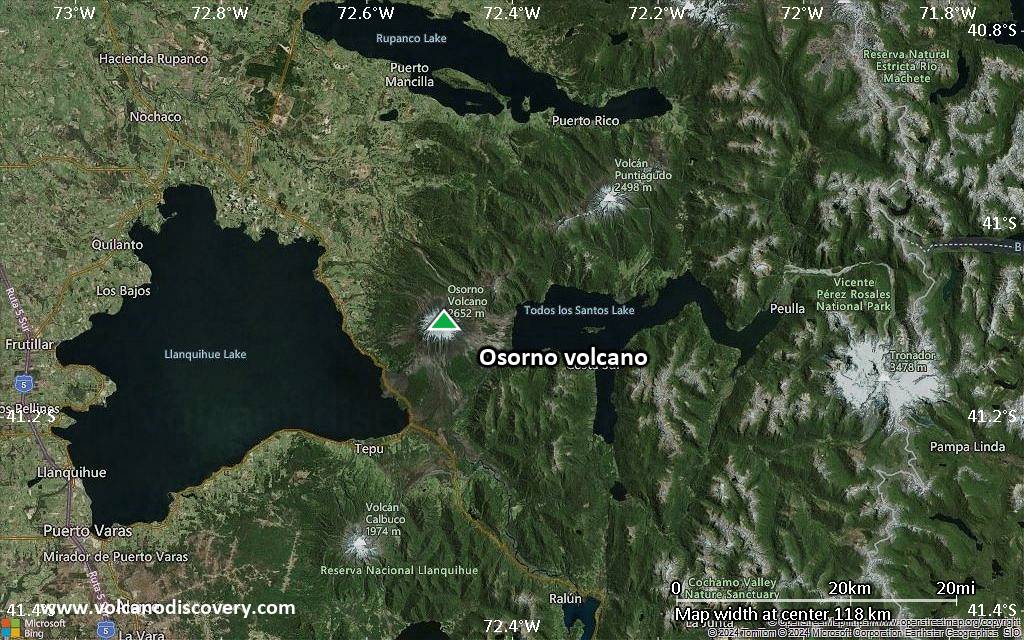
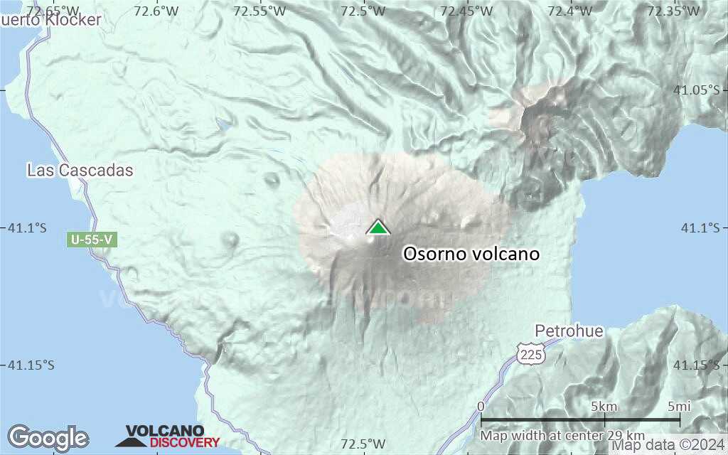
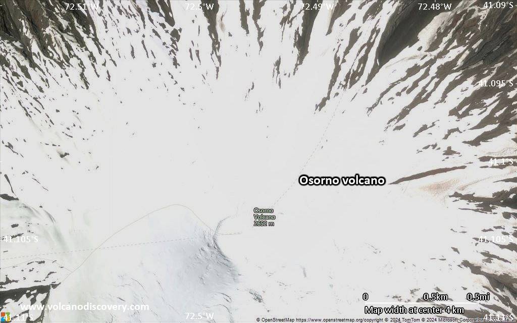
| RSS | EN | DE | EL | ES | FR | IT | RU

Osorno Volcano

Updated: Oct 28, 2025 23:42 GMT -
stratovolcano
Southern Chile and Argentina (South America), -41.1°S / -72.49°W
Summit height: 2652 m / 8,701 ft
Current status: normal or dormant (1 out of 5)
Last update: 22 Dec 2021 (seismic unrest)

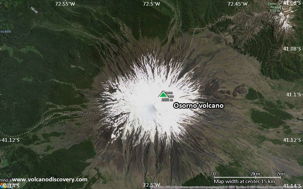
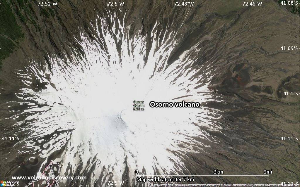
Osorno volcano is a symmetrical, glacier-covered stratovolcano in southern Chile, rising above Todos los Santos and Llanquihué lakes.
Osorno is one of the most active volcanoes of Chile. Historical eruptions have often produced produced lava flows. Many eruptions have occurred from both summit and flank vents and fissures, the latter mostly on the west and SW sides. Lava flows from its eruptions have reached Todos los Santos and Llanquihué lakes.
While its historic activity was dominantly effusive, many explosive eruptions which generated pyroclastic flows and surges have been identified to have occurred during the past 14,000 years.

[smaller] [larger]
Typical eruption style: effusive
Osorno volcano eruptions: 1869, 1855, 1851, 1837, 1834-35, 1790-91, 1765, 1719, 1644(?), 1640(?), 1575(?), 1310

Latest nearby earthquakes

Date and TimeMag / DepthDistance / Location

Background

Osorno volcano almost exclusively consists of basaltic to basaltic-andesitic lavas, with the exception of 2 small dacitic lava domes on the NW and SSE flanks.
Geology of Osorno volcano
The present-day cone of Osorno was constructed partly above a roughly 250,000-year-old eroded stratovolcano, La Picada, which has a mostly buried 6-km-wide caldera. La Picada underlies Osorno on the NE and has postglacial maars and scoria cones.
Source: Smithsonian / GVP volcano information

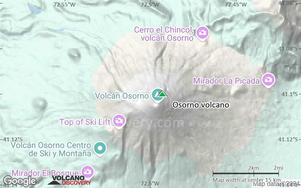
Osorno Volcano Photos

Significant volcanic eruptions: Osorno volcano

In the past 10,000 years, Osorno has had at least 17 confirmed volcanic eruptions, out of which 11 are documented by historical records, while the others can be inferred from geological evidence.
There is one uncertain or discredited eruption in 1852 from Osorno volcano.
The table below lists all known eruptions (date in bold face) of Osorno volcano in historic times and during the past 10,000 years. Updates on the most recent volcanic activity of Osorno can be found on the news page of Osorno volcano.
DateNoteVEIDeathsDamage
1869
Historical obs./docs.
2
1855
Historical obs./docs.
2?
1852
Discredited Eruption
1851
Historical obs./docs.
2?
1837 Nov 7
Historical obs./docs.
2
1834 Nov 29 - 1835 Feb 24 ±4 d.Summit & SSW side (Negrillar de Ensenada)
Historical obs./docs.
3?
1790 Mar 9 - 1791 Dec 26 ±5 d.SE base
Historical obs./docs.
2
1765 ±14 y.
Historical obs./docs.
1
1719
Historical obs./docs.
2
1644 AD
Historical obs./docs.
2
1640 AD
Historical obs./docs.
2
1575 AD
Historical obs./docs.
2
1310 ±75 y. AD?
1220 ±100 y. AD?
910 ±100 y. AD?
420 ±100 y. AD4?
210 ±75 y. BC?
1710 ±75 y. BC?
Remark:
Our list of volcanic eruptions closely follows the database of eruptions of the Smithsonian's Global Volcanism Project (GVP), the internationally most recognized data source for volcanic eruptions, but also includes significant eruptive episodes or related volcano events. "Volcanic eruptions" are usually to be understood as sequences of individual eruptive episodes that can follow each other, or even overlap (if several vents are involved), and can last many years, decades or even longer. For example, the current activity of Stromboli volcano is understood as a single eruption that has been ongoing since 1934.
Sources: NOAA National Centers for Environmental Information (NCEI), Global Significant Volcanic Eruptions Database. doi:10.7289/V5TD9V7K | Global Volcanism Project / Smithsonian Institution

Osorno Volcano FAQ

+When was the last eruption of Osorno volcano?

+How often does Osorno volcano erupt?

+When was the largest eruption of Osorno volcano?

Latest satellite images

Osorno satellite image sat1Osorno satellite image sat2

Osorno Volcano Maps

Below is a selection of maps showing the location and surroundings of the volcano at various resolutions based on aerial-imagery / terrain maps. Feel free to use them for non-commercial purposes on your blog or website as long as you credit them with a link back to this page (click to copy it).
Satellite/aerial-type map of Osorno volcano (world scale)
Terrain-type map of Osorno volcano (world scale)
Satellite/aerial-type map of Osorno volcano (region scale large)
Terrain-type map of Osorno volcano (region scale large)
Satellite/aerial-type map of Osorno volcano (region scale medium)
Terrain-type map of Osorno volcano (region scale medium)
Satellite/aerial-type map of Osorno volcano (region scale small)
Terrain-type map of Osorno volcano (region scale small)
Satellite/aerial-type map of Osorno volcano (local scale large)
Terrain-type map of Osorno volcano (local scale large)
Satellite/aerial-type map of Osorno volcano (local scale medium)
Terrain-type map of Osorno volcano (local scale medium)
Satellite/aerial-type map of Osorno volcano (local scale small)
Terrain-type map of Osorno volcano (local scale small)
Satellite/aerial-type map of Osorno volcano (scale of 10s of km)
Terrain-type map of Osorno volcano (scale of 10s of km)
Satellite/aerial-type map of Osorno volcano (scale of 20-40 km)
Terrain-type map of Osorno volcano (scale of 20-40 km)
Satellite/aerial-type map of Osorno volcano (scale of approx. 10-20 km)
Terrain-type map of Osorno volcano (scale of approx. 10-20 km)
Satellite/aerial-type map of Osorno volcano (scale of 5-10 km)
Satellite/aerial-type map of Osorno volcano (scale of few kilometers)
Volcanoes & Earthquakes - new app for Android
Guaranteed tours
3-19 Nov 2025: Volcanoes and Spices - Sulawesi/Halmahera (Indonesia)
3-19 Nov 2025: From Krakatau to Bali - Java (Indonesia)
20 Nov - 3 Dec 2025: Desert, salt and volcanoes - Danakil desert (Ethiopia)
2-10 May 2026: From Stromboli to Etna - Sicily and Eolian Islands (Italy)
= spaces available   = guaranteed   = few spaces left   = booked out
Wed, 15 May 2019, 12:05

Osorno volcano (Chile): alert level raised due to increased seismic activity

Servicio Nacional de Geología and Minería (SERNAGEOMIN) Observatorio Volcanológico de Los Andes del Sur (OVDAS) raised the Alert Level for Osorno to Yellow (the second lowest level on a four-color scale) on 8 May, due to a gradual increase in the number and magnitude of seismic events recorded during 1-30 April. Read all

On this page:

Try our free app!
Volcanoes & Earthquakes - new app for Android
Android | iOS version

More on VolcanoDiscovery

Why is there advertising on this site?

Support Us – Help Us Enhance Our Services!

We’re passionate about delivering the latest volcano and earthquake data from around the globe — just for you. However, maintaining our website and free apps requires significant time, effort, and resources.
Your support helps us expand our hardware and software capabilities and empowers our dedicated editorial team. Our mission is to provide uninterrupted, real-time updates whenever an earthquake strikes or a volcano erupts — and your donations make this possible. Every contribution, big or small, is deeply appreciated. If you find our information valuable and want to help us add new features, create compelling content, and improve our technology, please consider making a donation:

Donate with PayPal:

Planned Features:

Thanks to your past donations, we have recently added:
Download the Volcanoes & Earthquakes app to stay among the first to receive the fastest seismic and volcano alerts online:
Android | iOS
Thank you for being part of our mission!
Sources: VolcanoDiscovery / VolcanoAdventures and other sources as noted.
Use of material: Most text and images on our websites are owned by us. Re-use is generally not permitted without authorization. Contact us for licensing rights.
Volcanoes & Earthquakes
VolcanoDiscovery Home
Volcanoes | Earthquakes | Photos | Volcano News | | Shop | App
Adventure & Study Travel
Tours to Volcanoes and Volcanic Areas: walking tours, photo tours, study tours
Tours & Dates | FAQ | About us
Get our newsletter!
Company info
Contact | Legal info | Terms & conditions
Follow us
Follow us on facebook Follow us on Instagram Follow us on Bluesky Follow us on Twitter Visit our Youtube channel
EN | DE | EL | ES | FR | IT | RU
VolcanoDiscovery GmbH, Germany, Reg. nr.: HRB 103744, EU Tax Id: DE 297 465 123 owned and created by
Dr. Tom Pfeiffer, volcanologist, volcano photographer, tour organizer member of
IAVCEI
IAVCEI
Vulkanologische Gesellschaft
Volcanological Society
Ecotourism Greece
Ecotourism Greece
RUV insurance
Insured by R+V
VolcanoDiscovery © 2004- All Rights Reserved | Privacy - Cookie Settings