Pinta Volcano
Updated: May 21, 2025 09:39 GMT -
Shield volcano
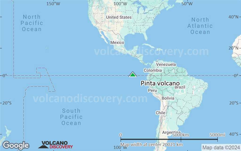
Galápagos Islands, Ecuador, 0.58°N / -90.75°W 
Summit height: 780 m / 2,559 ft
Current status: normal or dormant (1 out of 5)
[smaller] [larger]
Pinta volcano eruptions: 1928
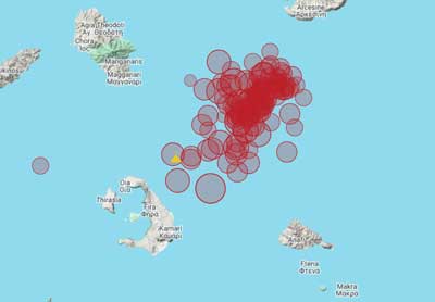
Latest nearby earthquakes
| Date and Time | Mag / Depth | Distance / Location | |||
|---|---|---|---|---|---|
Background
The elongated island of Pinta is the northernmost of the active Galápagos volcanoes. Pinta is a shield volcano with numerous young cones and lava flows originating from NNW-trending fissures. A steep sea cliff truncates the western side of the volcano, which lacks the prominent summit caldera of Fernandina and Isabela Island volcanoes. The fresh, unvegetated lava flows that cover the SE and northern flanks appear to have been erupted during the past few thousand or few hundred years (McBirney and Williams 1969). An eruption of uncertain nature was reported in 1928 (Catalog of Active Volcanoes of the World).---
Smithsonian / GVP volcano information
Pinta Volcano Photos
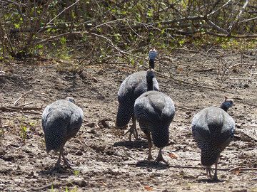
DAY 2: Short safari in Awash National Park - a confusion of guinea fowls (classic bum shot) (Photo: Ingrid)
Significant volcanic eruptions: Pinta volcano
In the past 10,000 years, Pinta has had only one confirmed historic eruption in 1928.
The table below lists all known eruptions (date in bold face) of Pinta volcano in historic times and during the past 10,000 years. Updates on the most recent volcanic activity of Pinta can be found on the news page of Pinta volcano.
| Date | Note | VEI | Deaths | Damage | |
|---|---|---|---|---|---|
Historical obs./docs. | ? | ||||
Remark:
Our list of volcanic eruptions closely follows the database of eruptions of the Smithsonian's Global Volcanism Project (GVP), the internationally most recognized data source for volcanic eruptions, but also includes significant eruptive episodes or related volcano events. "Volcanic eruptions" are usually to be understood as sequences of individual eruptive episodes that can follow each other, or even overlap (if several vents are involved), and can last many years, decades or even longer. For example, the current activity of Stromboli volcano is understood as a single eruption that has been ongoing since 1934.
Sources: NOAA National Centers for Environmental Information (NCEI), Global Significant Volcanic Eruptions Database. doi:10.7289/V5TD9V7K | Global Volcanism Project / Smithsonian Institution
Pinta Volcano FAQ
+When was the last eruption of Pinta volcano?
The last confirmed eruption of Pinta occurred in 1928.
+How often does Pinta volcano erupt?
There are no known historic eruptions, but evidence from geologic records shows that it has had at least 1 eruptions over the past 10,000 years. This number is likely much higher because many past eruptions might not have left evidence recognizeable today and/or the volcano might not have been studied in too much detail. Using the available data, a very conservative estimate is that Pinta volcano erupts every 10,000 years.
+How active is Pinta volcano at present?
Pinta volcano is occasionally active: Since 1900, it has had one eruption, which occurred in 1928.
Latest satellite images

Pinta Volcano Maps
Below is a selection of maps showing the location and surroundings of the volcano at various resolutions based on aerial-imagery / terrain maps. Feel free to use them for non-commercial purposes on your blog or website as long as you credit them with a link back to this page (click to copy it).

Satellite/aerial-type map of Pinta volcano (world scale)
Terrain-type map of Pinta volcano (world scale)

Satellite/aerial-type map of Pinta volcano (region scale large)

Terrain-type map of Pinta volcano (region scale large)

Satellite/aerial-type map of Pinta volcano (region scale medium)

Terrain-type map of Pinta volcano (region scale medium)

Satellite/aerial-type map of Pinta volcano (region scale small)

Terrain-type map of Pinta volcano (region scale small)

Satellite/aerial-type map of Pinta volcano (local scale large)

Terrain-type map of Pinta volcano (local scale large)

Satellite/aerial-type map of Pinta volcano (local scale medium)

Terrain-type map of Pinta volcano (local scale medium)

Satellite/aerial-type map of Pinta volcano (local scale small)

Terrain-type map of Pinta volcano (local scale small)

Satellite/aerial-type map of Pinta volcano (scale of 10s of km)

Terrain-type map of Pinta volcano (scale of 10s of km)

Satellite/aerial-type map of Pinta volcano (scale of 20-40 km)

Terrain-type map of Pinta volcano (scale of 20-40 km)

Satellite/aerial-type map of Pinta volcano (scale of approx. 10-20 km)

Terrain-type map of Pinta volcano (scale of approx. 10-20 km)

Satellite/aerial-type map of Pinta volcano (scale of 5-10 km)

Satellite/aerial-type map of Pinta volcano (scale of few kilometers)