


Santa Isabel Volcano
Updated: Jun 11, 2025 04:11 GMT -
shield volcano
Equatorial Guinea, 3.59°N / 8.76°E 
Summit height: 2,999 m / 9,839 ft
Current status: normal or dormant (1 out of 5)
Santa Isabel is the largest and highest of three coalescing basaltic shield volcanoes forming Bioko (Fernando Poo) Island.
[smaller] [larger]
Santa Isabel volcano eruptions: 1923, 1903, 1898(?)
Latest nearby earthquakes
| Date and Time | Mag / Depth | Distance / Location | |||
|---|---|---|---|---|---|
Background
Lying on the continental shelf along the Cameroon Line, this volcano is modified by the same NNE faults as Mt. Cameroon across the Gulf of Guinea on the African mainland. It contains numerous satellitic cinder cones and is the only Bioko Island volcano with reported historical eruptions, although they are poorly documented. Three eruptions, during the late-19th and early-20th centuries, have been reported from SE flank vents.Significant volcanic eruptions: Santa Isabel volcano
In the past 10,000 years, Santa Isabel has had at least 3 confirmed eruptions, all documented by historical records or observations.
The table below lists all known eruptions (date in bold face) of Santa Isabel volcano in historic times and during the past 10,000 years. Updates on the most recent volcanic activity of Santa Isabel can be found on the news page of Santa Isabel volcano.
| Date | Note | VEI | Deaths | Damage | |
|---|---|---|---|---|---|
| SE flank Historical obs./docs. | ? | ||||
| SE flank, near Bahu Historical obs./docs. | ? | ||||
| SE flank Historical obs./docs. | ? | ||||
Remark:
Our list of volcanic eruptions closely follows the database of eruptions of the Smithsonian's Global Volcanism Project (GVP), the internationally most recognized data source for volcanic eruptions, but also includes significant eruptive episodes or related volcano events. "Volcanic eruptions" are usually to be understood as sequences of individual eruptive episodes that can follow each other, or even overlap (if several vents are involved), and can last many years, decades or even longer. For example, the current activity of Stromboli volcano is understood as a single eruption that has been ongoing since 1934.
Sources: NOAA National Centers for Environmental Information (NCEI), Global Significant Volcanic Eruptions Database. doi:10.7289/V5TD9V7K | Global Volcanism Project / Smithsonian Institution
Santa Isabel Volcano FAQ
+When was the last eruption of Santa Isabel volcano?
The last confirmed eruption of Santa Isabel occurred in 1923.
+How often does Santa Isabel volcano erupt?
Since 1898, Santa Isabel volcano has had at least 3 historically documented eruptions. This means that it erupts on average every 42 years.
+How active is Santa Isabel volcano at present?
Santa Isabel volcano is occasionally active: Since 1900, it has had 2 eruptions, and been active during 2 years out of 126 as of now. This means, Santa Isabel has been in eruption one in 63 years on average. The last eruption was in 1923 and ended 103 years ago.
Latest satellite images


Santa Isabel Volcano Maps
Below is a selection of maps showing the location and surroundings of the volcano at various resolutions based on aerial-imagery / terrain maps. Feel free to use them for non-commercial purposes on your blog or website as long as you credit them with a link back to this page (click to copy it).

Satellite/aerial-type map of Santa Isabel volcano (world scale)

Terrain-type map of Santa Isabel volcano (world scale)

Satellite/aerial-type map of Santa Isabel volcano (region scale large)

Terrain-type map of Santa Isabel volcano (region scale large)

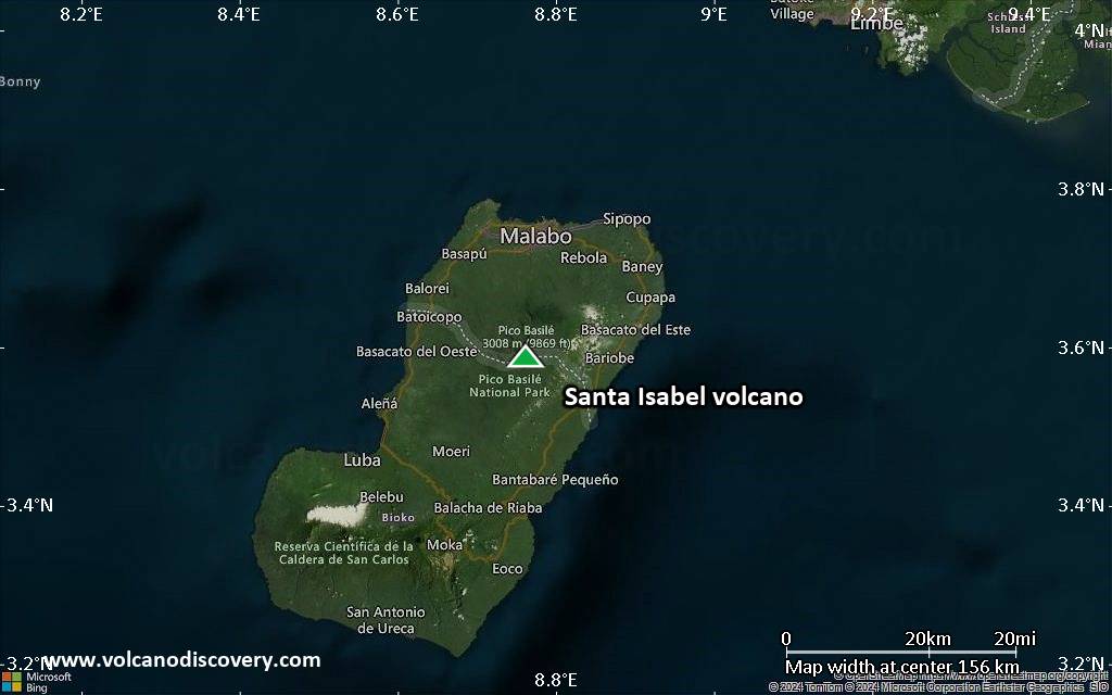
Satellite/aerial-type map of Santa Isabel volcano (region scale medium)

Terrain-type map of Santa Isabel volcano (region scale medium)

Satellite/aerial-type map of Santa Isabel volcano (region scale small)

Terrain-type map of Santa Isabel volcano (region scale small)

Satellite/aerial-type map of Santa Isabel volcano (local scale large)

Terrain-type map of Santa Isabel volcano (local scale large)

Satellite/aerial-type map of Santa Isabel volcano (local scale medium)

Terrain-type map of Santa Isabel volcano (local scale medium)
Satellite/aerial-type map of Santa Isabel volcano (local scale small)

Terrain-type map of Santa Isabel volcano (local scale small)

Satellite/aerial-type map of Santa Isabel volcano (scale of 10s of km)

Terrain-type map of Santa Isabel volcano (scale of 10s of km)

Satellite/aerial-type map of Santa Isabel volcano (scale of 20-40 km)

Terrain-type map of Santa Isabel volcano (scale of 20-40 km)

Satellite/aerial-type map of Santa Isabel volcano (scale of approx. 10-20 km)

Terrain-type map of Santa Isabel volcano (scale of approx. 10-20 km)

Satellite/aerial-type map of Santa Isabel volcano (scale of 5-10 km)

Satellite/aerial-type map of Santa Isabel volcano (scale of few kilometers)


