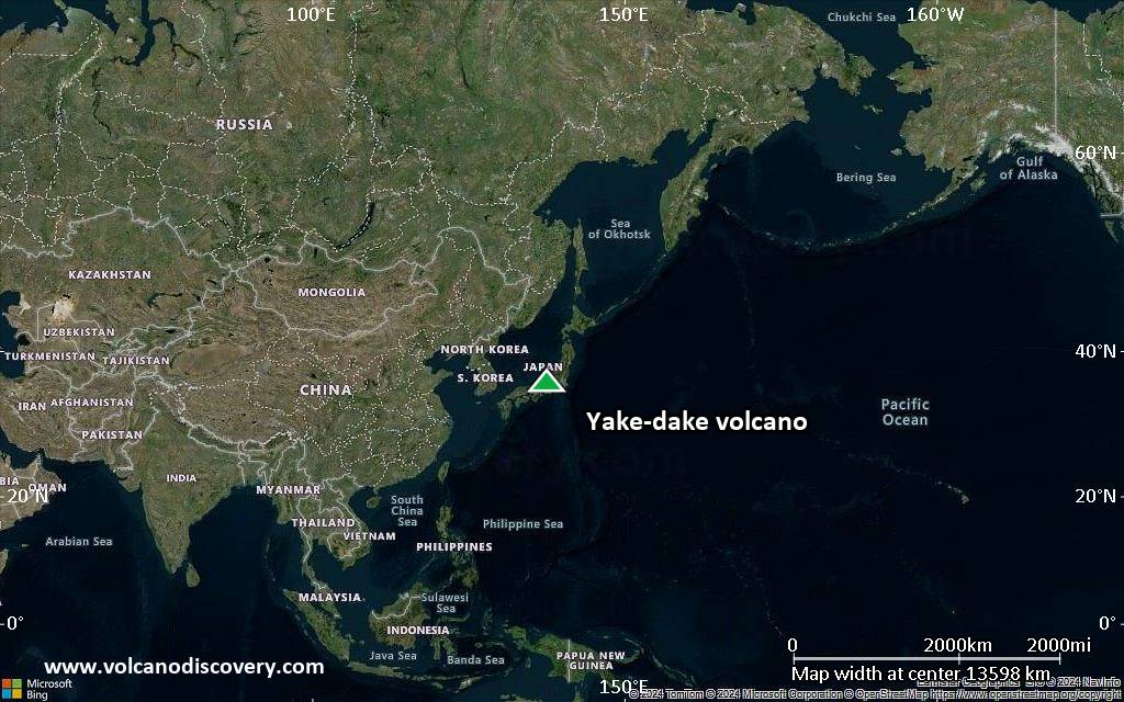
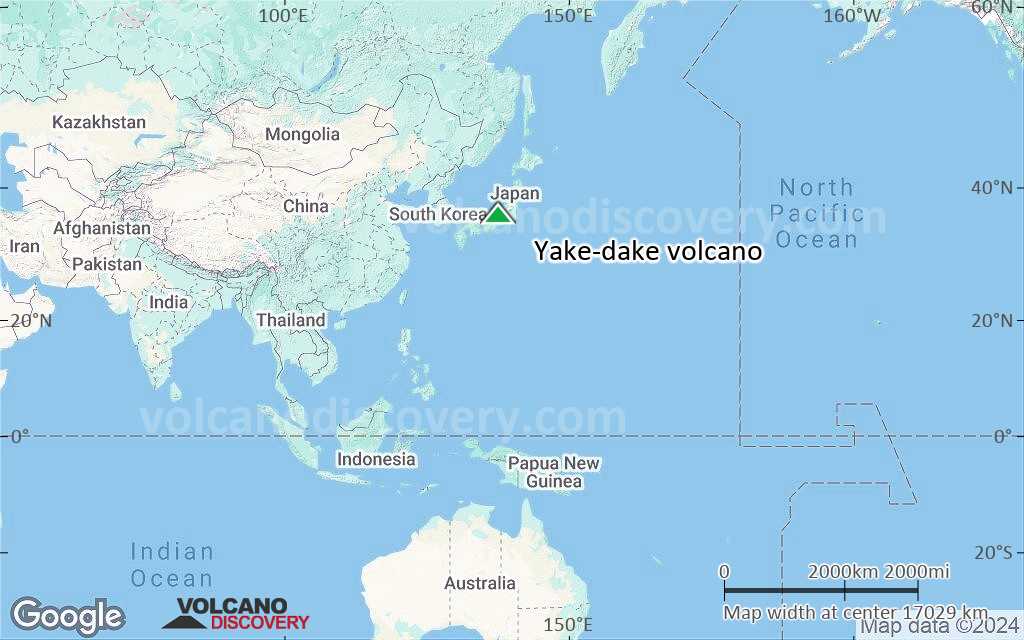
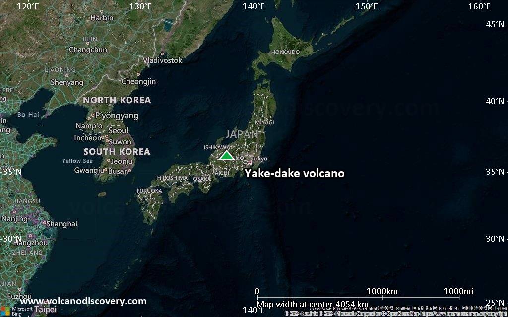
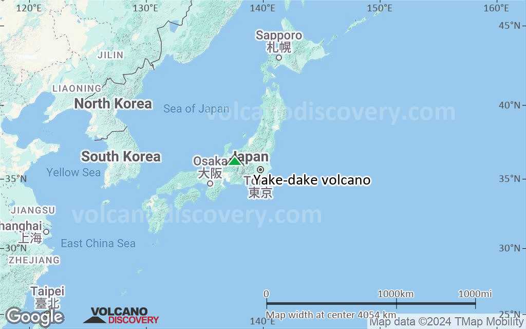
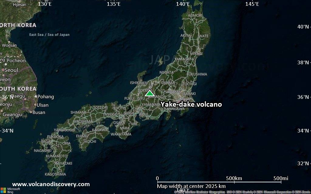
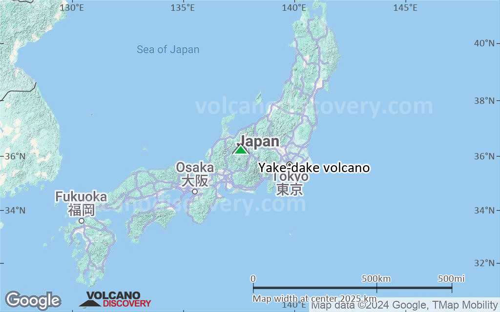
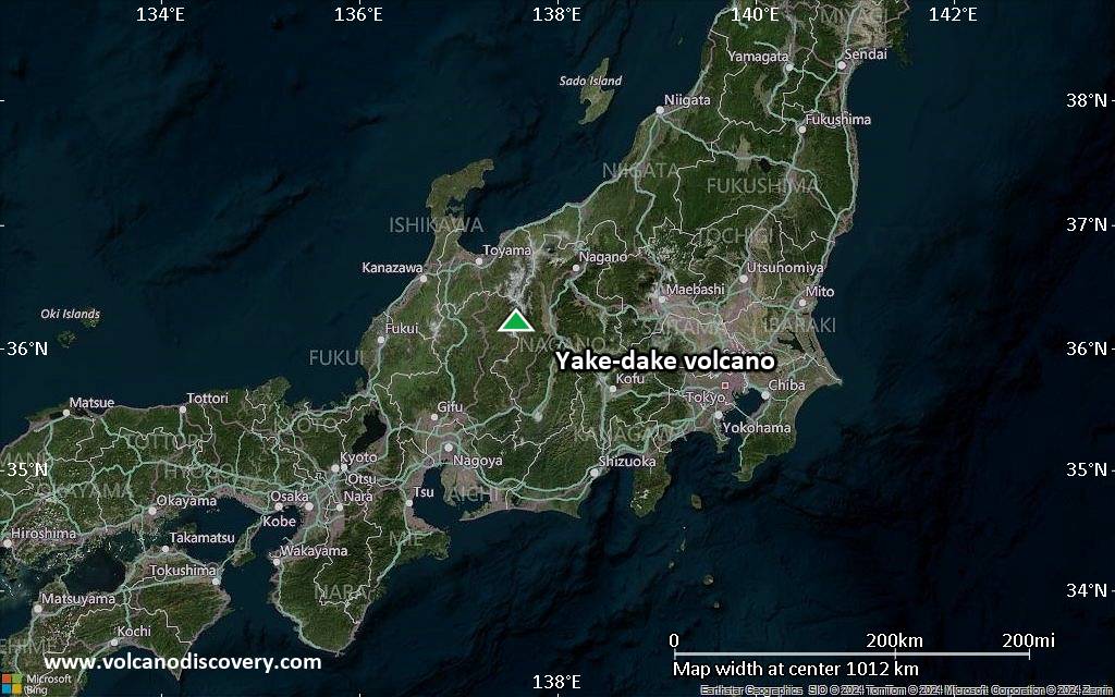
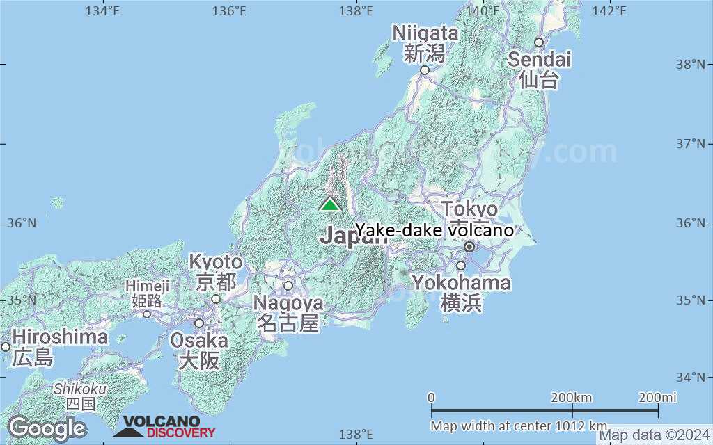
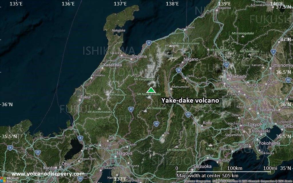
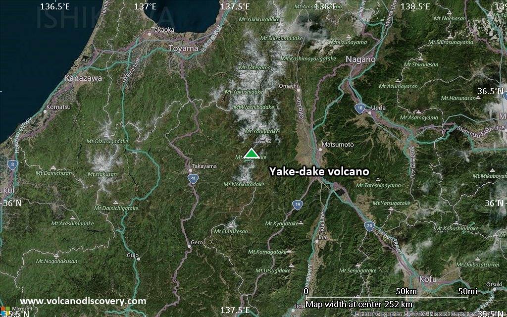
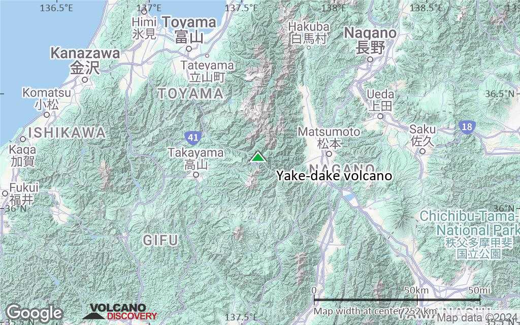
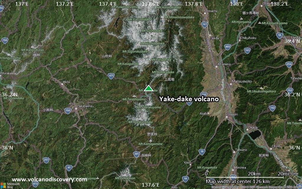
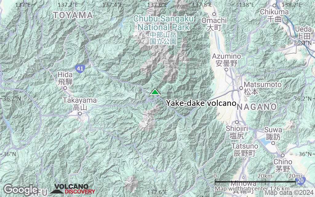
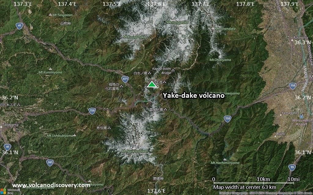
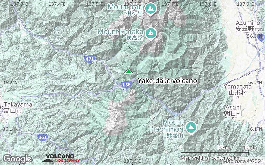
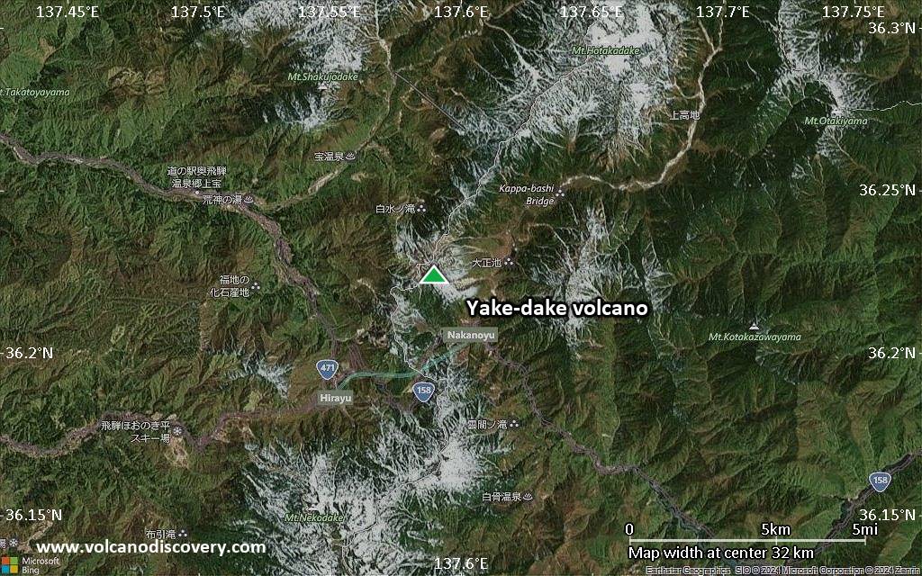
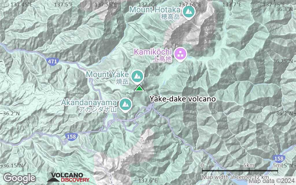
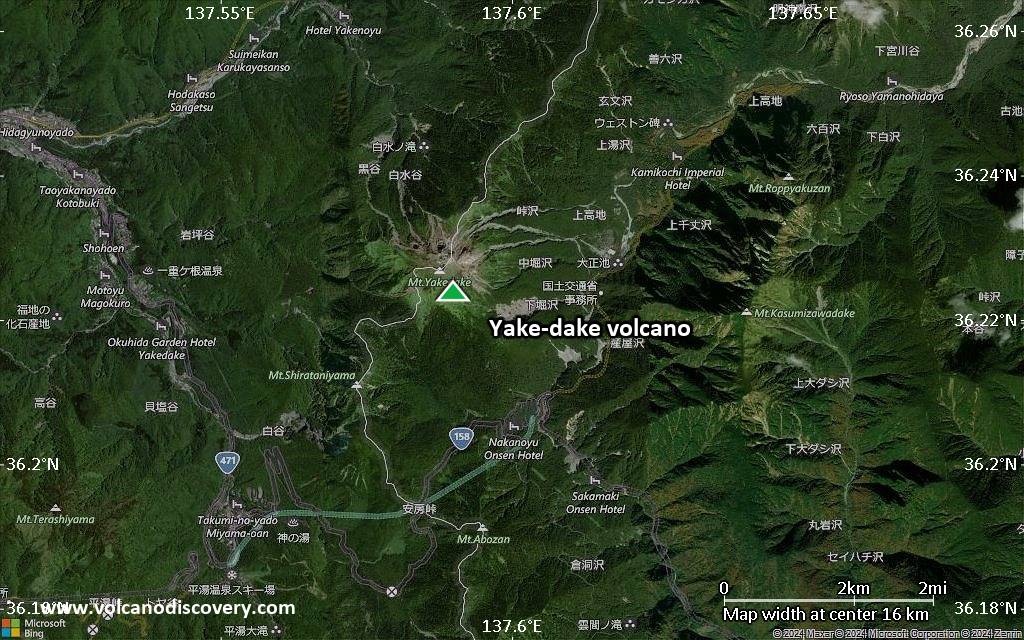
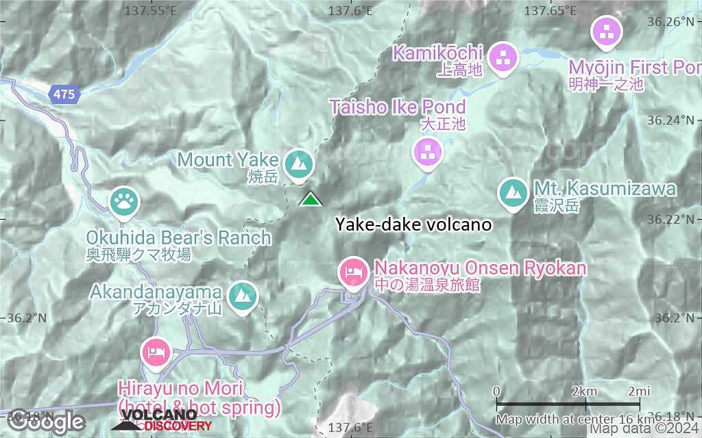
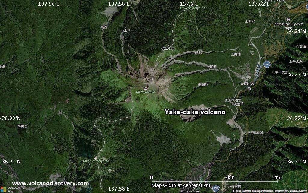
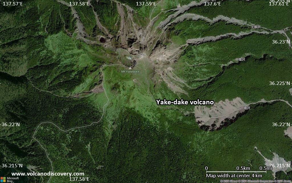
| RSS | EN | DE | EL | ES | FR | IT | RU

Yake-dake Volcano

Updated: Jun 13, 2025 15:32 GMT -
stratovolcanoes
Honshu (Japan), 36.22°N / 137.59°E
Summit height: 2455 m / 8,054 ft
Current status: normal or dormant (1 out of 5)
Last update: 23 Apr 2025 (Smithsonian / USGS Weekly Volcanic Activity Report)

Yake-dake volcano is a small stratovolcano near the popular resort of Kamikochi in the Northern Japan Alps. It is one of several Japanese volcanoes named Yake-dake or Yake-yama ("Burning Peak" or "Burning Mountain").
It has had frequent small to moderate phreatic eruptions in the 20th century. A small hydrothermal explosion in a hydrothermal area killed 2 persons on 11 Feb 1995 at a highway construction site.

[smaller] [larger]
Typical eruption style: phreatic explosions
Yake-dake volcano eruptions: 1995, 1962-63, 1939, 1935, 1932, 1931, 1930, 1929, 1927, 1927, 1924-26, 1923, 1922, 1921, 1920, 1919, 1918, 1917, 1916, 1915, 1913, 1912, 1911, 1910, 1907-09, 1585, 686

Latest nearby earthquakes

Date and TimeMag / DepthDistance / Location
Jun 13, 08:23 pm (GMT +9)
0.3

7.1 km
8.6 km (5.4 mi) to the SE Japan: Hida Mountains Region Info
Jun 13, 08:22 pm (GMT +9)
0.5

7.4 km
8.6 km (5.3 mi) to the SE Japan: Hida Mountains Region Info
Jun 13, 12:45 pm (GMT +9)
0.1

5.6 km
16 km (9.8 mi) to the N Japan: Hida Mountains Region Info
Thursday, June 12, 2025 GMT (2 quakes)
Jun 13, 02:21 am (GMT +9)
0.1

6.1 km
8.6 km (5.3 mi) to the SE Japan: Hida Mountains Region Info
Jun 12, 06:20 pm (GMT +9)
0.9

6 km
9.2 km (5.7 mi) to the SE Japan: Hida Mountains Region Info
Wednesday, June 11, 2025 GMT (1 quake)
Jun 11, 09:41 pm (GMT +9)
0.5

9 km
25 km (15 mi) to the SW Japan: Northern Gifu Pref Info
Tuesday, June 10, 2025 GMT (3 quakes)
Jun 11, 07:33 am (GMT +9)
0.4

4 km
27 km (17 mi) to the S Japan: Western Nagano Pref Info
Jun 10, 10:16 pm (GMT +9)
1.2

8.8 km
8.9 km (5.5 mi) to the SE Japan: Hida Mountains Region Info
Jun 10, 07:21 pm (GMT +9)
1.6

6.6 km
21 km (13 mi) to the SW Japan: Northern Gifu Pref Info

Background

The dominantly andesitic Yake-dake was constructed on a N-S-trending ridge between the older volcanoes of Warudani-yama and Shiratani-yama. Akandana-yama, about 4 km SSW of Yake-dake, is a stratovolcano with lava domes that was active into the Holocene. A 300-m-wide crater is located the summit of Yake-dake, and explosion craters are found on the SE and northern flanks.
(Source: Smithsonian / GVP)

Significant volcanic eruptions: Yake-dake volcano

In the past 10,000 years, Yake-dake has had at least 38 confirmed volcanic eruptions, out of which 29 are documented by historical records, while the others can be inferred from geological evidence.
The table below lists all known eruptions (date in bold face) of Yake-dake volcano since around 1900. Updates on the most recent volcanic activity of Yake-dake can be found on the news page of Yake-dake volcano.
DateNoteVEIDeathsDamage
1995 Feb 11SE flank (Azusa-gawa)
Historical obs./docs.
1
1995 Feb 11
Historical obs./docs.
14
Info
1962 Jun 17 - 1963 Jun 29North flank (Kurodani and Nakao-toge)
Historical obs./docs.
2
1939 Jun 4
Historical obs./docs.
2
1935 Sep 11 - Nov 12
Historical obs./docs.
2
1932 Feb 6
Historical obs./docs.
2
1931 Mar 26 - Jun 24
Historical obs./docs.
2
1930 Mar 13 - May 11 ?Inkyo-ko
Historical obs./docs.
2
1929 Apr 17 - Apr 19Summit (Inkyo-ko), NW flank (Kurodani)
Historical obs./docs.
2
1927 Dec 15Summit (Inkyo-ko), NW flank (Kurodani)
Historical obs./docs.
2
1927 Jan 23 - Apr 29Summit (Inkyo-ko), NW flank (Kurodani)
Historical obs./docs.
2
1924 Nov 16 - 1926 Jan 27Summit (Inkyo-ko), NW flank (Kurodani)
Historical obs./docs.
2
1923 Jun 26 - Aug 2NW flank (Kurodani Crater), Inkyo-ko
Historical obs./docs.
2
1922 Mar 10 - Mar 19NW flank (Kurodani Crater), Inkyo-ko
Historical obs./docs.
1?
1921
Historical obs./docs.
?
1920
Historical obs./docs.
?
1919 Nov 1NW flank (Kurodani Crater)
Historical obs./docs.
2
1918Taisho crater
Historical obs./docs.
1
1917Taisho Crater
Historical obs./docs.
1
1916 Mar 17 - Apr 12 ?Taisho Crater, Inkyo-ko
Historical obs./docs.
2
1915 Jun 6 - Jul 161911 summit crater, SE flank (Taisho)
Historical obs./docs.
2
1915 Feb
Historical obs./docs.
2?
1913 Sep 1 ? - 1914 Jan 13Inkyo-ko
Historical obs./docs.
2
1912 Feb 11 - Sep
Historical obs./docs.
2
1911 May 6 - Aug 23 ?New summit crater (Inkyo-ko)
Historical obs./docs.
2
1910 Nov 11 - Nov 30Summit crater (Shoga-ike)
Historical obs./docs.
2
1907 Dec 8 - 1909 Jun 1Summit crater (Shoga-ike)
Historical obs./docs.
2
Remark:
Our list of volcanic eruptions closely follows the database of eruptions of the Smithsonian's Global Volcanism Project (GVP), the internationally most recognized data source for volcanic eruptions, but also includes significant eruptive episodes or related volcano events. "Volcanic eruptions" are usually to be understood as sequences of individual eruptive episodes that can follow each other, or even overlap (if several vents are involved), and can last many years, decades or even longer. For example, the current activity of Stromboli volcano is understood as a single eruption that has been ongoing since 1934.
Sources: NOAA National Centers for Environmental Information (NCEI), Global Significant Volcanic Eruptions Database. doi:10.7289/V5TD9V7K | Global Volcanism Project / Smithsonian Institution

Yake-dake Volcano FAQ

+When was the last eruption of Yake-dake volcano?

+How often does Yake-dake volcano erupt?

+How active is Yake-dake volcano at present?

+When was the largest eruption of Yake-dake volcano?

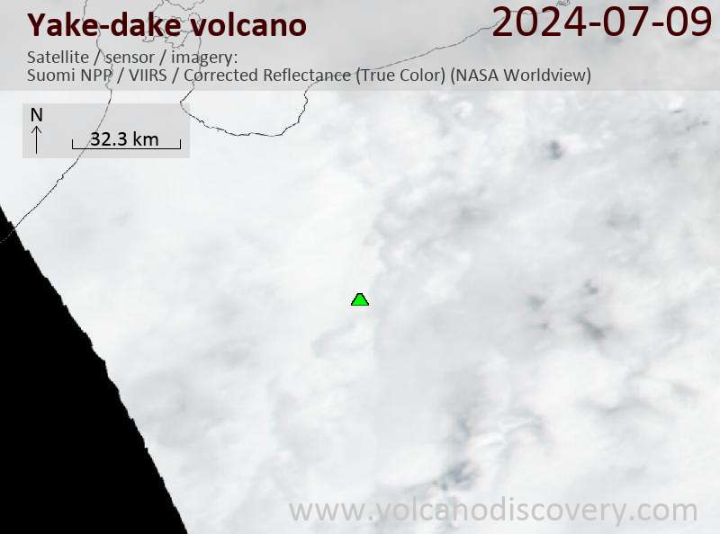
Latest satellite images

Yakedake satellite image sat1Yakedake satellite image sat2

Yake-dake Volcano Maps

Below is a selection of maps showing the location and surroundings of the volcano at various resolutions based on aerial-imagery / terrain maps. Feel free to use them for non-commercial purposes on your blog or website as long as you credit them with a link back to this page (click to copy it).
Satellite/aerial-type map of Yake-dake volcano (world scale)
Terrain-type map of Yake-dake volcano (world scale)
Satellite/aerial-type map of Yake-dake volcano (region scale large)
Terrain-type map of Yake-dake volcano (region scale large)
Satellite/aerial-type map of Yake-dake volcano (region scale medium)
Terrain-type map of Yake-dake volcano (region scale medium)
Satellite/aerial-type map of Yake-dake volcano (region scale small)
Terrain-type map of Yake-dake volcano (region scale small)
Satellite/aerial-type map of Yake-dake volcano (local scale large)
Terrain-type map of Yake-dake volcano (local scale large)
Satellite/aerial-type map of Yake-dake volcano (local scale medium)
Terrain-type map of Yake-dake volcano (local scale medium)
Satellite/aerial-type map of Yake-dake volcano (local scale small)
Terrain-type map of Yake-dake volcano (local scale small)
Satellite/aerial-type map of Yake-dake volcano (scale of 10s of km)
Terrain-type map of Yake-dake volcano (scale of 10s of km)
Satellite/aerial-type map of Yake-dake volcano (scale of 20-40 km)
Terrain-type map of Yake-dake volcano (scale of 20-40 km)
Satellite/aerial-type map of Yake-dake volcano (scale of approx. 10-20 km)
Terrain-type map of Yake-dake volcano (scale of approx. 10-20 km)
Satellite/aerial-type map of Yake-dake volcano (scale of 5-10 km)
Satellite/aerial-type map of Yake-dake volcano (scale of few kilometers)
Volcanoes & Earthquakes - new app for Android
Guaranteed tours
1-17 Aug 2025: Volcanoes and Spices - Sulawesi/Halmahera (Indonesia)
1-14 Oct 2025: Desert, salt and volcanoes - Danakil desert (Ethiopia)
4-12 Oct 2025: From Stromboli to Etna - Sicily and Eolian Islands (Italy)
6-21 Oct 2025: From Krakatau to Bali - Java (Indonesia)
3-19 Nov 2025: Volcanoes and Spices - Sulawesi/Halmahera (Indonesia)
= spaces available   = guaranteed   = few spaces left   = booked out
Wed, 23 Apr 2025, 14:00

Yakedake volcano (Japan) - Smithsonian / USGS Weekly Volcanic Activity Report for 16 April-22 April 2025 (Continuing Activity)

The Japan Meteorological Agency (JMA) lowered the Alert Level for Yakedake to 1 (on a scale of 1-5) at 1100 on 18 April, noting that seismicity has remind at low levels after a period of elevated seismicity was recorded during 3-9 March. JMA warned climbers to be alert to any changes at the volcano and to wear a helmet. ... Read all
Thu, 17 Apr 2025, 10:00

Yakedake volcano (Japan) - Smithsonian / USGS Weekly Volcanic Activity Report for 16 April-22 April 2025 (Continuing Activity)

The Japan Meteorological Agency (JMA) lowered the Alert Level for Yakedake to 1 (on a scale of 1-5) at 1100 on 18 April, noting that seismicity has remind at low levels after a period of elevated seismicity was recorded during 3-9 March. JMA warned climbers to be alert to any changes at the volcano and to wear a helmet. ... Read all

On this page:

Try our free app!
Volcanoes & Earthquakes - new app for Android
Android | iOS version

More on VolcanoDiscovery

Why is there advertising on this site?

Support us - Help us upgrade our services!

We truly love working to bring you the latest volcano and earthquake data from around the world. Maintaining our website and our free apps does require, however, considerable time and resources.
We need financing to increase hard- and software capacity as well as support our editor team. We're aiming to achieve uninterrupted service wherever an earthquake or volcano eruption unfolds, and your donations can make it happen! Every donation will be highly appreciated. If you find the information useful and would like to support our team in integrating further features, write great content, and in upgrading our soft- and hardware, please make a donation (PayPal).

Planned features:Thanks to your past donations, these features have been added recently:
Download and Upgrade the Volcanoes & Earthquakes app to get one of the fastest seismic and volcano alerts online:
Android | IOS
Thank you!
Sources: VolcanoDiscovery / VolcanoAdventures and other sources as noted.
Use of material: Most text and images on our websites are owned by us. Re-use is generally not permitted without authorization. Contact us for licensing rights.
Volcanoes & Earthquakes
VolcanoDiscovery Home
Volcanoes | Earthquakes | Photos | Volcano News | | Shop | App
Adventure & Study Travel
Tours to Volcanoes and Volcanic Areas: walking tours, photo tours, study tours
Tours & Dates | FAQ | About us
Get our newsletter!
Company info
Contact | Legal info | Terms & conditions
Follow us
Follow us on facebook Follow us on Instagram Follow us on Bluesky Follow us on Twitter Visit our Youtube channel
EN | DE | EL | ES | FR | IT | RU
VolcanoDiscovery GmbH, Germany, Reg. nr.: HRB 103744, EU Tax Id: DE 297 465 123 owned and created by
Dr. Tom Pfeiffer, volcanologist, volcano photographer, tour organizer member of
IAVCEI
IAVCEI
Vulkanologische Gesellschaft
Volcanological Society
Ecotourism Greece
Ecotourism Greece
RUV insurance
Insured by R+V
VolcanoDiscovery © 2004- All Rights Reserved | Privacy - Cookie Settings