Barva Volcano
Updated: May 21, 2024 15:00 GMT -
Complex volcano 2906 m / 9,534 ft
Costa Rica, 10.14°N / -84.1°W
Current status: normal or dormant (1 out of 5)
Costa Rica, 10.14°N / -84.1°W
Current status: normal or dormant (1 out of 5)
[smaller] [larger]
Barva volcano eruptions: 6050 BC ± 1000 years
Latest nearby earthquakes
| Time | Mag. / Depth | Distance / Location | |||
| May 18, 09:25 pm (Costa Rica) | 2.7 9 km | Info | |||
| Wednesday, May 15, 2024 GMT (2 quakes) | |||||
| May 15, 02:55 pm (Costa Rica) | 2.8 6 km | Info | |||
| May 15, 08:27 am (Costa Rica) | 3.3 9 km | 15 km (9.4 mi) to the SE | Info | ||
| Saturday, May 11, 2024 GMT (2 quakes) | |||||
| May 11, 03:41 pm (Costa Rica) | 2.9 39 km | 24 km (15 mi) to the SW | Info | ||
| May 11, 12:19 am (Costa Rica) | 2.8 115 km | Info | |||
| Wednesday, May 8, 2024 GMT (1 quake) | |||||
| May 7, 11:36 pm (Costa Rica) | 2.6 89 km | Info | |||
Background
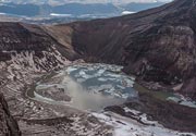
The central and least known of three massive volcanoes towering over the capital city of San José, Volcán Barva (Barba) is a complex volcano with multiple summit and flank vents. Its three principal summits visible from the Central Valley give it the common local name of Las Tres Marías. The voluminous andesitic-to-dacitic Tiribí Tuff, exposed in the Central Valley of Costa Rica, was erupted about 322,000 years ago from the Barva summit caldera. Four pyroclastic cones are constructed within the 2 x 3 km caldera at the central and NW part of the summit. The SW peak contains four cones, one of which has a crater lake. Satellitic cones are found on the northern and southern flanks. Lava flows blanket the south side of Barva volcano. The Los Angeles flow, one of the most recent, descends nearly to the city of Heredia. A large plinian eruption occurred at Barva during the early Holocene. Eruptions were reported in 1760 or 1766, 1776? (also a mudflow), and 1867, but later visits to the summit did not provide evidence of eruptions during historical time.---
Smithsonian / GVP volcano information


