


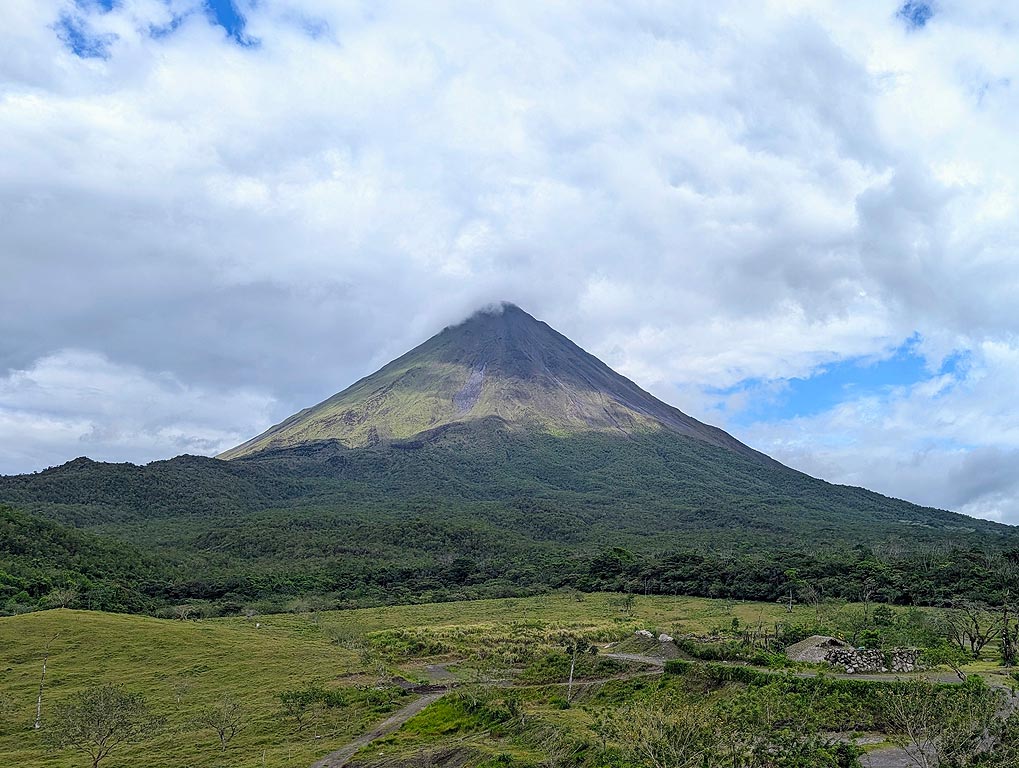

Poás Volcano (Costa Rica) activity update Nov 26, 2025 - Continuing eruption
The Observatorio Vulcanológico y Sismológico de Costa Rica - Universidad Nacional (OVSICORI-UNA) reported that the eruption continued at Poás on 26 November 2025 (local). The alert level remained at "…The Observatorio Vulcanológico y Sismológico de Costa Rica - Universidad Nacional (OVSICORI-UNA) reported that the eruption continued at Poás on 26 November 2025 (local). The alert level remained at "Level 2 - Warning" (on a 0–4 level scale). The aviation alert level remained at "Yellow" (level 2 on a 4-level scale).
Source: Observatorio Vulcanológico y Sismológico de Costa Rica - Universidad Naci…Open article
Source: Observatorio Vulcanológico y Sismológico de Costa Rica - Universidad Naci…Open article
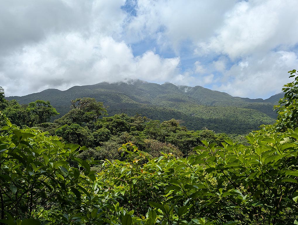
Rincón de la Vieja Volcano (Costa Rica) activity update Nov 26, 2025 - Unrest
The Observatorio Vulcanológico y Sismológico de Costa Rica - Universidad Nacional (OVSICORI-UNA) reported that unrest continued at Rincón de la Vieja on 26 November 2025 (local). The alert level remai…The Observatorio Vulcanológico y Sismológico de Costa Rica - Universidad Nacional (OVSICORI-UNA) reported that unrest continued at Rincón de la Vieja on 26 November 2025 (local). The alert level remained at "Level 2 - Warning" (on a 0–4 level scale). The aviation alert level remained at "Yellow" (level 2 on a 4-level scale).
Source: Observatorio Vulcanológico y Sismológico de Costa Rica - Universi…Open article
Source: Observatorio Vulcanológico y Sismológico de Costa Rica - Universi…Open article
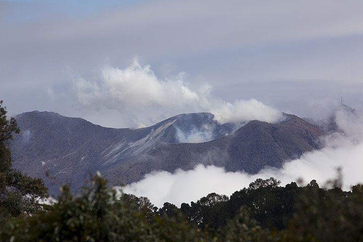
Turrialba Volcano (Costa Rica) activity update Nov 26, 2025 - Unrest
The Observatorio Vulcanológico y Sismológico de Costa Rica - Universidad Nacional (OVSICORI-UNA) reported that unrest continued at Turrialba on 26 November 2025 (local). The alert level remained at "L…The Observatorio Vulcanológico y Sismológico de Costa Rica - Universidad Nacional (OVSICORI-UNA) reported that unrest continued at Turrialba on 26 November 2025 (local). The alert level remained at "Level 2 - Warning" (on a 0–4 level scale).
Source: Observatorio Vulcanológico y Sismológico de Costa Rica - Universidad Nacional (OVSICORI-UNA)
Current Alerts:
Observatory alert level: "Level 2 - Warning…Open article
Source: Observatorio Vulcanológico y Sismológico de Costa Rica - Universidad Nacional (OVSICORI-UNA)
Current Alerts:
Observatory alert level: "Level 2 - Warning…Open article
Poás Volcano (Costa Rica) activity update Nov 25, 2025 - Continuing eruption
The Observatorio Vulcanológico y Sismológico de Costa Rica - Universidad Nacional (OVSICORI-UNA) reported that the eruption continued at Poás on 25 November 2025 (local). The alert level remained at "Level 2 - Warning" (on a 0–4 level scale). The aviation alert level remained at "Yellow" (level 2 on…The Observatorio Vulcanológico y Sismológico de Costa Rica - Universidad Nacional (OVSICORI-UNA) reported that the eruption continued at Poás on 25 November 2025 (local). The alert level remained at "Level 2 - Warning" (on a 0–4 level scale). The aviation alert level remained at "Yellow" (level 2 on a 4-level scale).
Source: Observatorio Vulcanológico y Sismológico de Costa Rica - Universidad Naci…Open article
Source: Observatorio Vulcanológico y Sismológico de Costa Rica - Universidad Naci…Open article
Rincón de la Vieja Volcano (Costa Rica) activity update Nov 25, 2025 - Unrest
The Observatorio Vulcanológico y Sismológico de Costa Rica - Universidad Nacional (OVSICORI-UNA) reported that unrest continued at Rincón de la Vieja on 25 November 2025 (local). The alert level remai…The Observatorio Vulcanológico y Sismológico de Costa Rica - Universidad Nacional (OVSICORI-UNA) reported that unrest continued at Rincón de la Vieja on 25 November 2025 (local). The alert level remained at "Level 2 - Warning" (on a 0–4 level scale). The aviation alert level remained at "Yellow" (level 2 on a 4-level scale).
Source: Observatorio Vulcanológico y Sismológico de Costa Rica - Universi…Open article
Source: Observatorio Vulcanológico y Sismológico de Costa Rica - Universi…Open article


