| RSS | EN | DE | EL | ES | FR | IT | RU

Anatahan Volcano

Updated: Nov 13, 2025 10:31 GMT -
stratovolcano
Northern Marianas (USA), 16.35°N / 145.67°E
Summit height: 790 m / 2,592 ft
Current status: normal or dormant (1 out of 5)
Last update: 9 Dec 2021 (Smithsonian / USGS Weekly Volcanic Activity Report)

Anatahan volcano forms the small 9 x 3.7 E-W elongated Anatahan Island in the northern Marianas, about 120 km north of Saipan, the regional Commonwealth of the Northern Mariana Islands capital.
The volcano is at the southern end of the 1500 km long chain of volcanoes formed by the Izu-Bonin-Mariana subduction-zone volcanic arc.
The island is only a tiny fraction (about 1%) of the volcano's entire volume, which rises 3700 m from the sea floor and has a basal diameter of 35 km. It is topped by a 5x2.3 km wide E-W elongated summit caldera. Its principal crater is a 1.4x1.2 km wide and 200 m deep pit crater in the eastern part of the caldera. The highest point of the island is on the western rim.
The first known volcanic activity occurred in 2003, when the volcano came back to life, and has been in a state of frequent eruptions since then.

[smaller] [larger]
Typical eruption style: explosive
Anatahan volcano eruptions: 2007-08, 2006, 2004-05, 2003

Latest nearby earthquakes

Date and TimeMag / DepthDistance / Location

Background

The caldera consists of an older western and younger eastern part. Ponded lava flows and pyroclastic deposits fill the floor of the western caldera, whose SW side is cut by a fresh-looking smaller crater.
The 2-km-wide eastern portion of the caldera contained a steep-walled inner crater whose floor prior to the 2003 eruption was only 68 m above sea level. A submarine volcano, named NE Anatahan, rises to within 460 m of the sea surface on the NE flank of the volcano, and numerous other submarine vents are found on the NE-to-SE flanks.
Sparseness of vegetation on the most recent lava flows on Anatahan had indicated that they were of Holocene age, but the first historical eruption of Anatahan did not occur until May 2003, when a large explosive eruption took place forming a new crater inside the eastern caldera. (Smithsonian / GVP)

Significant volcanic eruptions: Anatahan volcano

In the past 10,000 years, Anatahan has had at least 4 confirmed eruptions, all documented by historical records or observations.
The table below lists all known eruptions (date in bold face) of Anatahan volcano in historic times and during the past 10,000 years. Updates on the most recent volcanic activity of Anatahan can be found on the news page of Anatahan volcano.
DateNoteVEIDeathsDamage
2007 Nov 27 ±3 d. - 2008 Aug 9 ?
Historical obs./docs.
2
2006 Mar 20 ? - Jun 26 ?East Crater
Historical obs./docs.
2
2004 Apr 12 or before - 2005 Sep 3 ?East Crater
Historical obs./docs.
3?
2003 May 10 - Jul 12 ±3 d.East Crater
Historical obs./docs.
3
Remark:
Our list of volcanic eruptions closely follows the database of eruptions of the Smithsonian's Global Volcanism Project (GVP), the internationally most recognized data source for volcanic eruptions, but also includes significant eruptive episodes or related volcano events. "Volcanic eruptions" are usually to be understood as sequences of individual eruptive episodes that can follow each other, or even overlap (if several vents are involved), and can last many years, decades or even longer. For example, the current activity of Stromboli volcano is understood as a single eruption that has been ongoing since 1934.
Sources: NOAA National Centers for Environmental Information (NCEI), Global Significant Volcanic Eruptions Database. doi:10.7289/V5TD9V7K | Global Volcanism Project / Smithsonian Institution

Anatahan Volcano FAQ

+When was the last eruption of Anatahan volcano?

+How often does Anatahan volcano erupt?

+How active is Anatahan volcano at present?

+When was the largest eruption of Anatahan volcano?

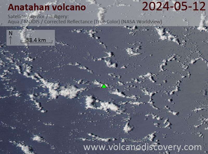
Latest satellite images

Anatahan satellite image sat1Anatahan satellite image sat2

Anatahan Volcano Maps

Below is a selection of maps showing the location and surroundings of the volcano at various resolutions based on aerial-imagery / terrain maps. Feel free to use them for non-commercial purposes on your blog or website as long as you credit them with a link back to this page (click to copy it).
Satellite/aerial-type map of Anatahan volcano (world scale)
Terrain-type map of Anatahan volcano (world scale)
Satellite/aerial-type map of Anatahan volcano (region scale large)
Terrain-type map of Anatahan volcano (region scale large)
Satellite/aerial-type map of Anatahan volcano (region scale medium)
Terrain-type map of Anatahan volcano (region scale medium)
Satellite/aerial-type map of Anatahan volcano (region scale small)
Terrain-type map of Anatahan volcano (region scale small)
Satellite/aerial-type map of Anatahan volcano (local scale large)
Terrain-type map of Anatahan volcano (local scale large)
Satellite/aerial-type map of Anatahan volcano (local scale medium)
Terrain-type map of Anatahan volcano (local scale medium)
Satellite/aerial-type map of Anatahan volcano (local scale small)
Terrain-type map of Anatahan volcano (local scale small)
Satellite/aerial-type map of Anatahan volcano (scale of 10s of km)
Terrain-type map of Anatahan volcano (scale of 10s of km)
Satellite/aerial-type map of Anatahan volcano (scale of 20-40 km)
Terrain-type map of Anatahan volcano (scale of 20-40 km)
Satellite/aerial-type map of Anatahan volcano (scale of approx. 10-20 km)
Terrain-type map of Anatahan volcano (scale of approx. 10-20 km)
Satellite/aerial-type map of Anatahan volcano (scale of 5-10 km)
Satellite/aerial-type map of Anatahan volcano (scale of few kilometers)
Volcanoes & Earthquakes - new app for Android
Guaranteed tours
20 Nov - 3 Dec 2025: Desert, salt and volcanoes - Danakil desert (Ethiopia)
2-10 May 2026: From Stromboli to Etna - Sicily and Eolian Islands (Italy)
= spaces available   = guaranteed   = few spaces left   = booked out

Anatahan volcano (Mariana Islands, USA) - Smithsonian / USGS Weekly Volcanic Activity Report for 1 October-7 October 2008 (Continuing Activity)

Wednesday, Oct 1, 2008 | 17 years ago · VN
On 1 October, the Volcanic Alert Level for Anatahan was lowered to Normal and the Aviation Color Code to Green. Seismicity remained low and there were no recent reports of significant plumes.

Source: E…

Anatahan volcano (Mariana Islands, USA) - Smithsonian / USGS Weekly Volcanic Activity Report for 6 August-12 August 2008 (Continuing Activity)

Wednesday, Aug 6, 2008 | 17 years ago · VN
During 7-8 August, small sulfur dioxide plumes from Anatahan were visible on satellite imagery. On 8 August, seismicity decreased significantly. During 8-9 August, steam plumes with small amounts of a…

On this page:

Try our free app!
Volcanoes & Earthquakes - new app for Android
Android | iOS version

More on VolcanoDiscovery

Why is there advertising on this site?

Support Us – Help Us Enhance Our Services!

We’re passionate about delivering the latest volcano and earthquake data from around the globe — just for you. However, maintaining our website and free apps requires significant time, effort, and resources.
Your support helps us expand our hardware and software capabilities and empowers our dedicated editorial team. Our mission is to provide uninterrupted, real-time updates whenever an earthquake strikes or a volcano erupts — and your donations make this possible. Every contribution, big or small, is deeply appreciated. If you find our information valuable and want to help us add new features, create compelling content, and improve our technology, please consider making a donation:

Donate with PayPal:

Planned Features:

Thanks to your past donations, we have recently added:
Download the Volcanoes & Earthquakes app to stay among the first to receive the fastest seismic and volcano alerts online:
Android | iOS
Thank you for being part of our mission!
Sources: VolcanoDiscovery / VolcanoAdventures and other sources as noted.
Use of material: Most text and images on our websites are owned by us. Re-use is generally not permitted without authorization. Contact us for licensing rights.
Volcanoes & Earthquakes
VolcanoDiscovery Home
Volcanoes | Earthquakes | Photos | Volcano News | | Shop | App
Adventure & Study Travel
Tours to Volcanoes and Volcanic Areas: walking tours, photo tours, study tours
Tours & Dates | FAQ | About us
Get our newsletter!
Company info
Contact | Legal info | Terms & conditions
Follow us
Follow us on facebook Follow us on Instagram Follow us on Bluesky Follow us on Twitter Visit our Youtube channel
EN | DE | EL | ES | FR | IT | RU
VolcanoDiscovery GmbH, Germany, Reg. nr.: HRB 103744, EU Tax Id: DE 297 465 123 owned and created by
Dr. Tom Pfeiffer, volcanologist, volcano photographer, tour organizer member of
IAVCEI
IAVCEI
Vulkanologische Gesellschaft
Volcanological Society
Ecotourism Greece
Ecotourism Greece
RUV insurance
Insured by R+V
VolcanoDiscovery © 2004- All Rights Reserved | Privacy - Cookie Settings