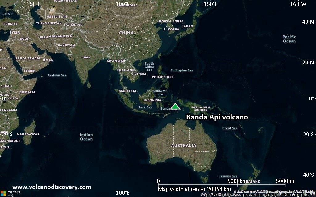
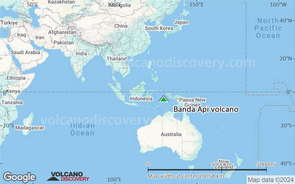
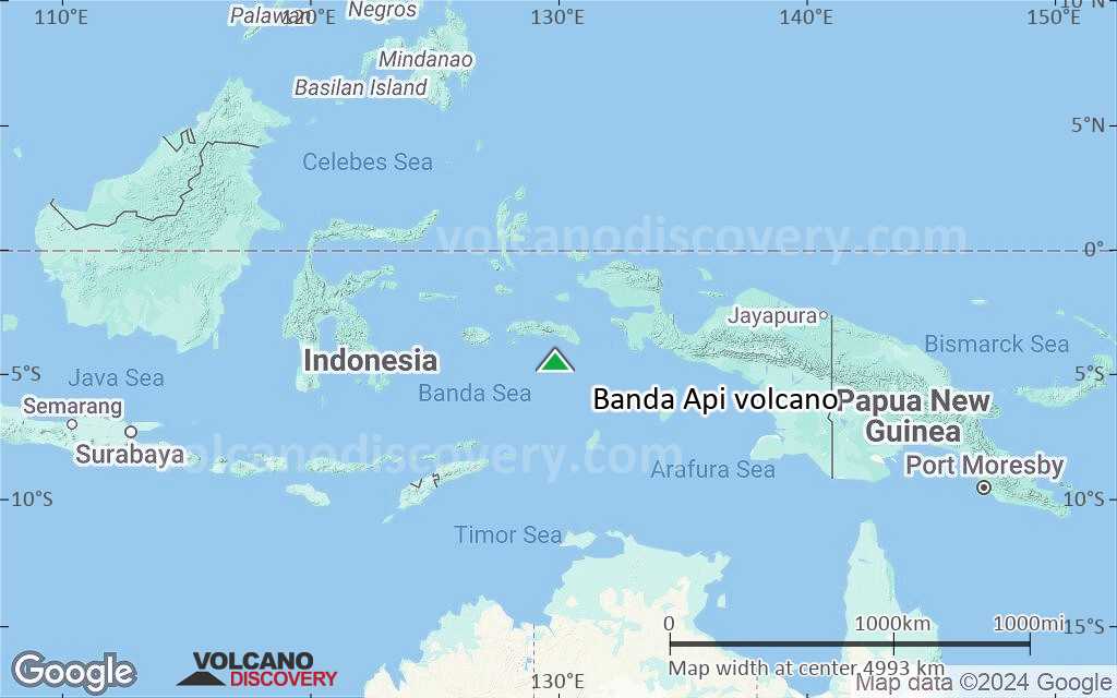
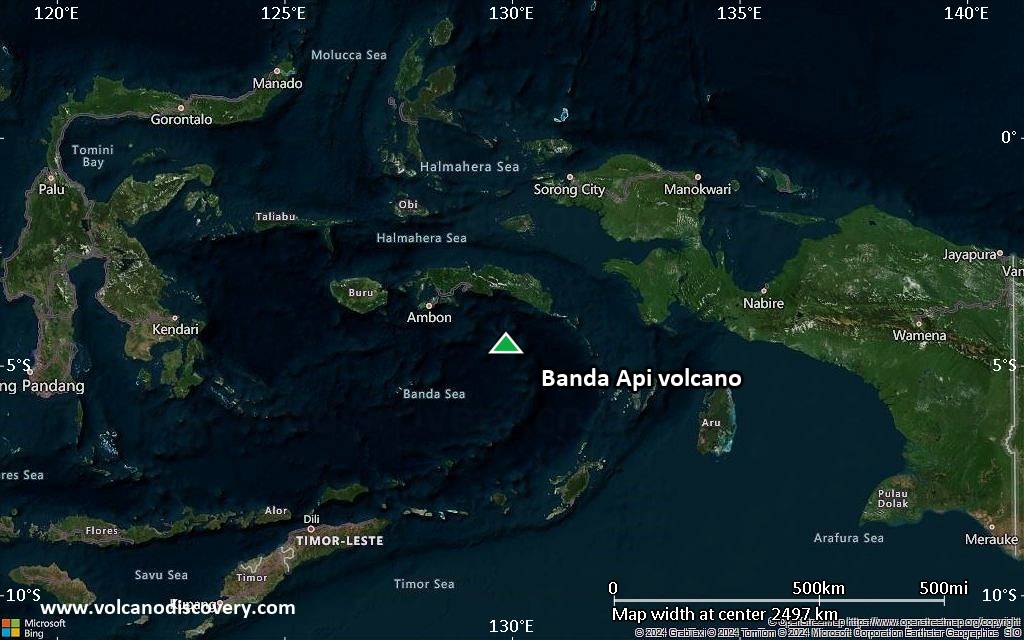
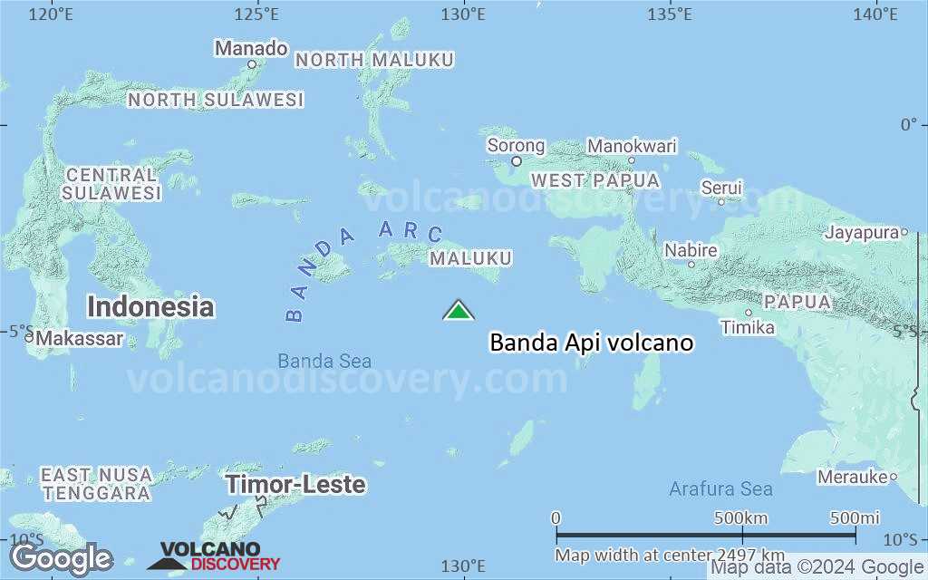
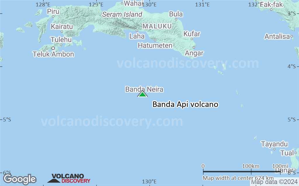
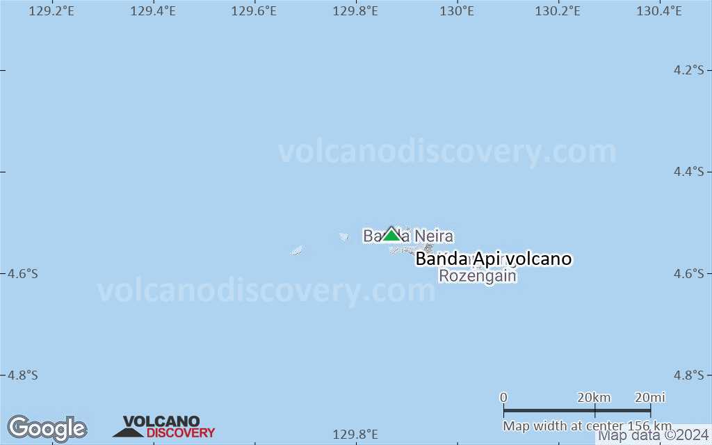
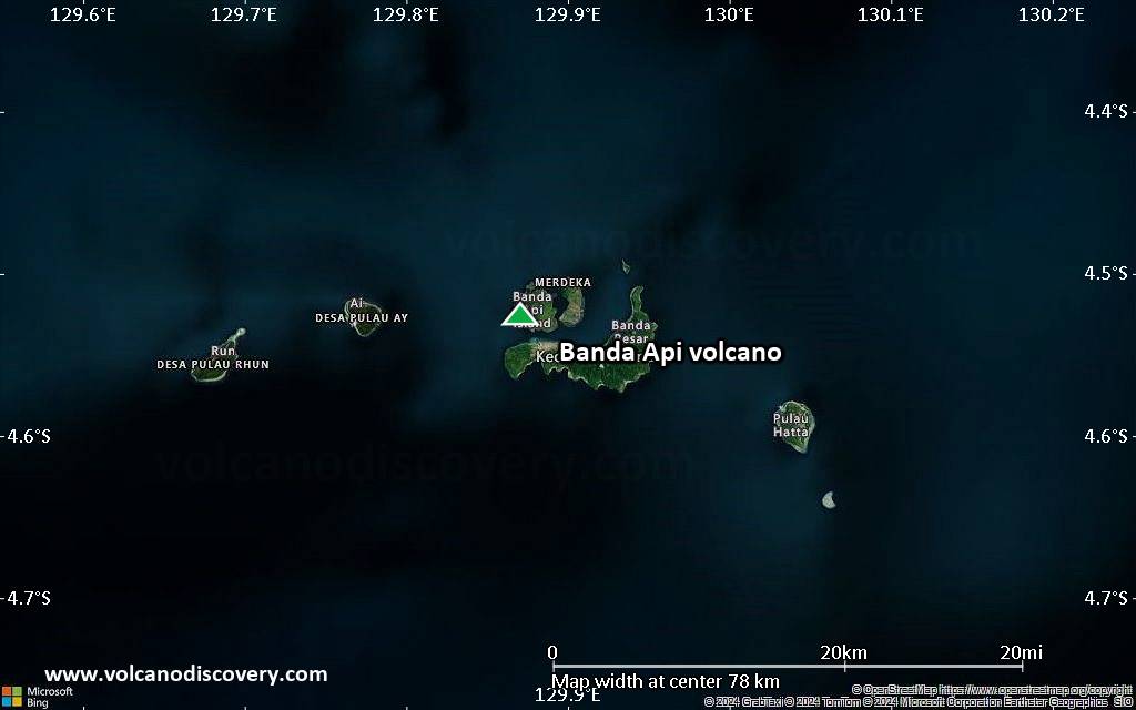
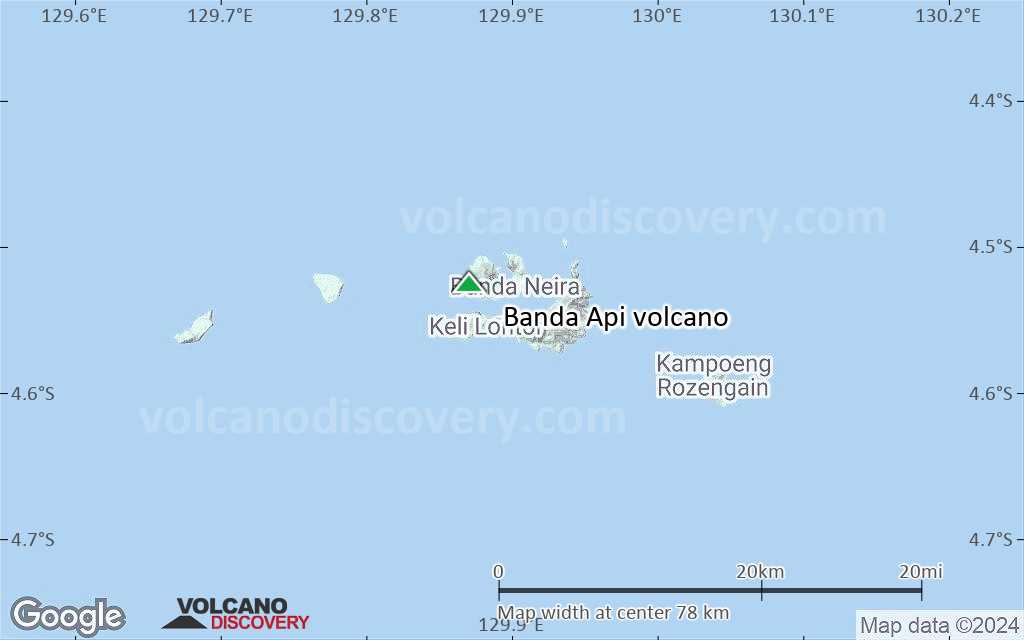
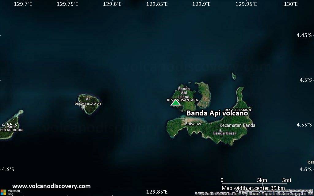
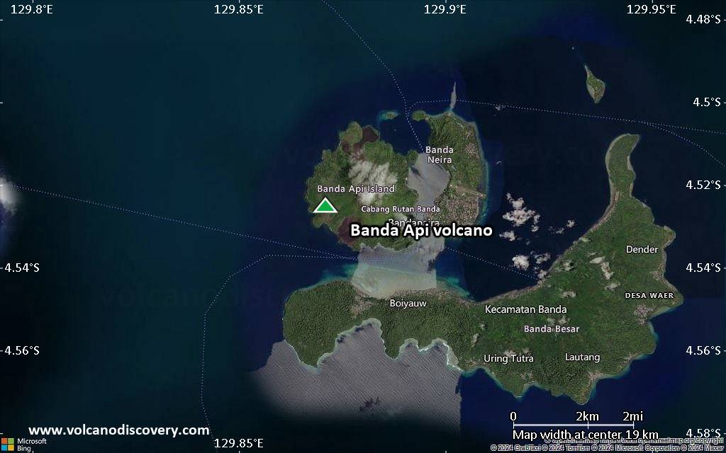
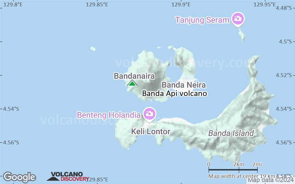
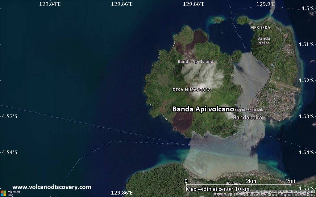
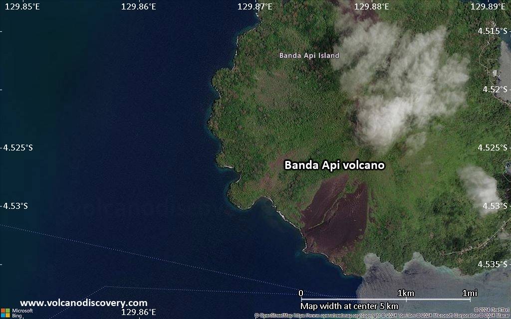
| RSS | EN | DE | EL | ES | FR | IT | RU

Banda Api Volcano

Updated: Aug 23, 2025 05:49 GMT -
caldera
Banda Sea (Indonesia), -4.53°S / 129.87°E
Summit height: 640 m / 2,100 ft
Current status: normal or dormant (1 out of 5)
Last update: 27 Nov 2024 (Smithsonian / USGS Weekly Volcanic Activity Report)
Eruption of Banda Api in 1988 - a large fissure has cut the island in half, producing dense ash emissions and lava flows on both sides that destroyed the village of Batu Angus on the north flank (image: Tom Casadevall / USGS)

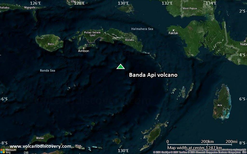
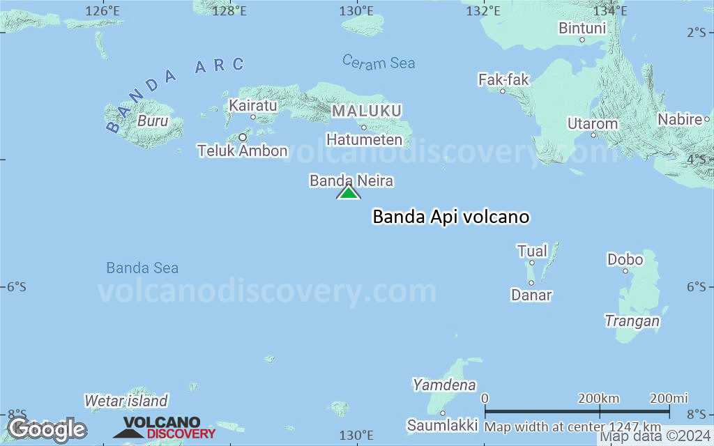
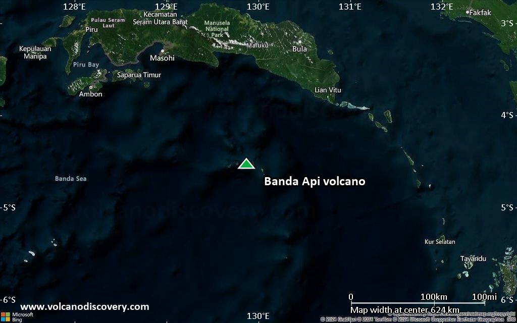
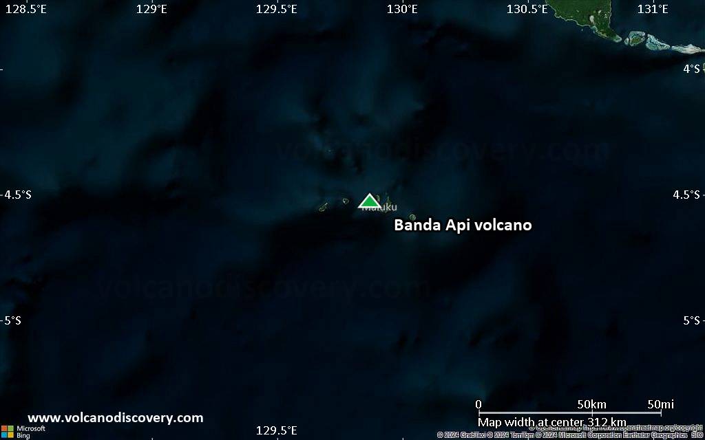
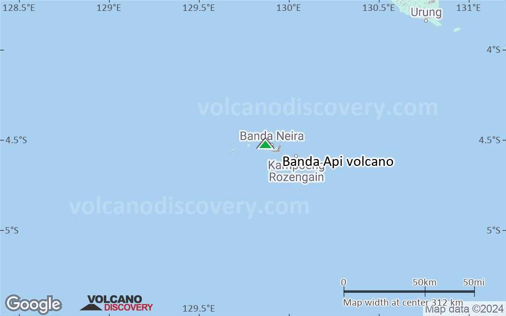
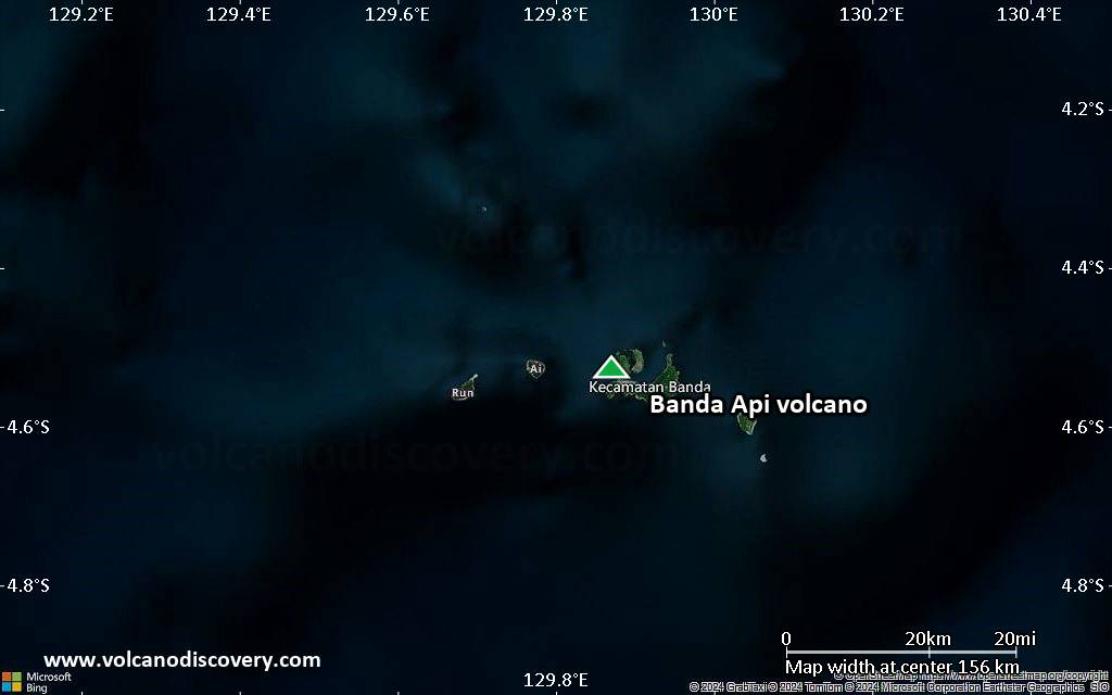
Banda Api volcano forms a small isolated 3-km-wide island in the Banda Sea, Indonesia, 130 km south of Makulu Island. The volcano rises 4000 m from the sea floor and is the most recent and very active cone of a 7 km wide volcanic caldera mostly under water.
It is one of the most active volcanoes in the region and is known for violent activity including tall ash emissions, lava fountaining, strombolian explosions and occasional lava flows, some of which which have reached the sea. Because of its (for Indonesia) unusually effusive behavior and frequent activity, Banda Api has also been given the nickname "Etna of the Banda Sea".

[smaller] [larger]
Typical eruption style: Explosive
Banda Api volcano eruptions: 1988, 1901, 1890, 1855, 1835, 1825 (?), 1824, 1820, 1816, 1778, 1775, 1773,
1765, 1762, 1749, 1722, 1712, 1690, 1683, 1635, 1632, 1615, 1614 (?), 1609, 1598, 1586

Latest nearby earthquakes

Date and TimeMag / DepthDistance / Location

Background

Despite its remote location, Banda Api ranks among the volcanoes in Indonesia with the best documented history (since 1586), thanks to its strategic position at a cross-road of the Portuguese and Dutch spice trade sailing routes.
The caldera has 3 other islands forming the southern and eastern walls: Lonthor, Pisang and Kapal.
Banda Api is the NE-most volcano in the Sunda-Banda volcanic arc. Its lavas are mainly basaltic-to-rhyodacitic in composition.
At least two episodes of caldera formation are believed to have occurred, with the arcuate islands of Lonthor and Neira considered to be remnants of the pre-caldera volcanoes.
Among divers, the surrounding waters are (have been?) famous for the specatcularly large numbers of sea snakes that used to be found here mating in swarms of thousands.

Banda Api Volcano Photos

Significant volcanic eruptions: Banda Api volcano

In the past 10,000 years, Banda Api has had at least 23 confirmed eruptions, all documented by historical records or observations. Additionally, there are 4 uncertain or discredited eruptions from Banda Api volcano.
The table below lists all known eruptions (date in bold face) of Banda Api volcano since around 1000 AD. Updates on the most recent volcanic activity of Banda Api can be found on the news page of Banda Api volcano.
DateNoteVEIDeathsDamage
1988 May 9 - May 17Summit, north and south flanks
Historical obs./docs.
3?
1988 May 9
(eruption 1988 May 9 - May 17)
Historical obs./docs.
34
Info
?? 1902 Mar 20
Uncertain Eruption
?
1901 May 18Summit and north flank
Historical obs./docs.
2
1890 Nov 23
Historical obs./docs.
2
?? 1855 Dec 29 - Dec 30
Uncertain Eruption
?
1835 Nov 1
(eruption 1835 Oct)
Historical obs./docs.
0100-1,000 (*)
moderate
Info
?? 1835 Oct
Uncertain Eruption
?
1825 ? - 1831
Historical obs./docs.
1
1824 Apr 22 - Jun 28North side
Historical obs./docs.
2
1820 Jun 11 - Aug 8Summit, south and NNW flanks
Historical obs./docs.
2
1820 Jun 11
(eruption 1820 Jun 11 - Aug 8)
Historical obs./docs.
21-50 (*)
Info
1816 Oct 11 - Dec
Historical obs./docs.
2
1778
Historical obs./docs.
2
1775
Historical obs./docs.
2
1773 Feb 6
Historical obs./docs.
2
1765 Apr 19 - 1766 Oct
Historical obs./docs.
2
1762
Historical obs./docs.
2
1749
Historical obs./docs.
2
1722
Historical obs./docs.
2
1712 May - Dec
Historical obs./docs.
2
1690 AD - 1696 May 22
Historical obs./docs.
3
1694 AD Nov 20
(eruption 1690 AD - 1696 May 22)
Historical obs./docs.
350-100 (*)
Info
1683 AD
Historical obs./docs.
3
1635 AD Nov 18
Historical obs./docs.
1?
1632 AD Dec 16
Historical obs./docs.
3
1615 AD Mar 16 - Apr
Historical obs./docs.
3
1615 AD Mar
(eruption 1615 AD Mar 16 - Apr)
Historical obs./docs.
3
moderate
Info
?? 1614 AD
Uncertain Eruption
?
1609 AD
Historical obs./docs.
3
1598 AD - 1602
Historical obs./docs.
3
1598 AD
(eruption 1598 AD - 1602)
Historical obs./docs.
31-50 (*)
Info
1586 AD Apr 17
Historical obs./docs.
3
(*) Estimated numbers
Remark:
Our list of volcanic eruptions closely follows the database of eruptions of the Smithsonian's Global Volcanism Project (GVP), the internationally most recognized data source for volcanic eruptions, but also includes significant eruptive episodes or related volcano events. "Volcanic eruptions" are usually to be understood as sequences of individual eruptive episodes that can follow each other, or even overlap (if several vents are involved), and can last many years, decades or even longer. For example, the current activity of Stromboli volcano is understood as a single eruption that has been ongoing since 1934.
Sources: NOAA National Centers for Environmental Information (NCEI), Global Significant Volcanic Eruptions Database. doi:10.7289/V5TD9V7K | Global Volcanism Project / Smithsonian Institution

Eruptions of Banda Api volcano


1988 eruption
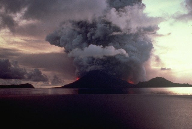
Banda Api erupted explosively on 9 May 1988. An ash plume of 3 km height was produced and large incandescent bombs were ejected. Lava flows traveled east towards Neira Island. A row of 5 vents were active at the summit. During 8-10 May, frequent earthquakes were felt in Neira village 2 km east of the summit.
1800 residents were evacuated to Neira and Lontar Islands, and 5,000 of Neira city's residents were evacuated to safer areas.
Satellite observations showed that the ash from the eruption reached an altitude of 16 km. The eruption ended in August 1988.
---
Source: GVP monthly reports

Banda Api Volcano FAQ

+When was the last eruption of Banda Api volcano?

+How often does Banda Api volcano erupt?

+How active is Banda Api volcano at present?

+When was the largest eruption of Banda Api volcano?

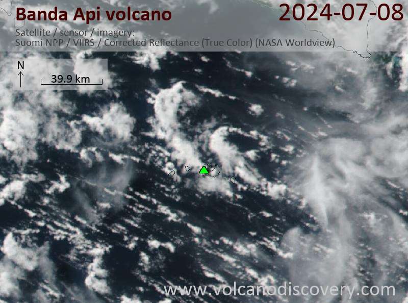
Latest satellite images

BandaApi satellite image sat1BandaApi satellite image sat2

Banda Api Volcano Maps

Below is a selection of maps showing the location and surroundings of the volcano at various resolutions based on aerial-imagery / terrain maps. Feel free to use them for non-commercial purposes on your blog or website as long as you credit them with a link back to this page (click to copy it).
Satellite/aerial-type map of Banda Api volcano (world scale)
Terrain-type map of Banda Api volcano (world scale)
Satellite/aerial-type map of Banda Api volcano (region scale large)
Terrain-type map of Banda Api volcano (region scale large)
Satellite/aerial-type map of Banda Api volcano (region scale medium)
Terrain-type map of Banda Api volcano (region scale medium)
Satellite/aerial-type map of Banda Api volcano (region scale small)
Terrain-type map of Banda Api volcano (region scale small)
Satellite/aerial-type map of Banda Api volcano (local scale large)
Terrain-type map of Banda Api volcano (local scale large)
Satellite/aerial-type map of Banda Api volcano (local scale medium)
Terrain-type map of Banda Api volcano (local scale medium)
Satellite/aerial-type map of Banda Api volcano (local scale small)
Terrain-type map of Banda Api volcano (local scale small)
Satellite/aerial-type map of Banda Api volcano (scale of 10s of km)
Terrain-type map of Banda Api volcano (scale of 10s of km)
Satellite/aerial-type map of Banda Api volcano (scale of 20-40 km)
Terrain-type map of Banda Api volcano (scale of 20-40 km)
Satellite/aerial-type map of Banda Api volcano (scale of approx. 10-20 km)
Terrain-type map of Banda Api volcano (scale of approx. 10-20 km)
Satellite/aerial-type map of Banda Api volcano (scale of 5-10 km)
Satellite/aerial-type map of Banda Api volcano (scale of few kilometers)
Volcanoes & Earthquakes - new app for Android
Guaranteed tours
1-14 Oct 2025: Desert, salt and volcanoes - Danakil desert (Ethiopia)
4-12 Oct 2025: From Stromboli to Etna - Sicily and Eolian Islands (Italy)
6-21 Oct 2025: From Krakatau to Bali - Java (Indonesia)
3-19 Nov 2025: Volcanoes and Spices - Sulawesi/Halmahera (Indonesia)
9-19 Nov 2025: Guatemala Volcano Special - Guatemala
= spaces available   = guaranteed   = few spaces left   = booked out
Wed, 27 Nov 2024, 15:00

Banda Api (Indonesia) volcano - Smithsonian / USGS Weekly Volcanic Activity Report for 20 November-26 November 2024 (Continuing Activity)

According to a news report the coordinator for the Banda Api observation post stated that the climbing route on the volcano was closed on 18 November due to increased seismicity. The coordinator noted that during 1 August-17 November there were 11 shallow volcanic earthquakes, 541 deep volcanic earthquakes, and 46 local and 250 distant tectonic earthquakes, respectively; three of the events were felt. The average number of earthquakes per day was between 13 and 30 events, though the average was as high as 40 per day. ... Read all
Thu, 21 Nov 2024, 11:00

Banda Api (Indonesia) volcano - Smithsonian / USGS Weekly Volcanic Activity Report for 20 November-26 November 2024 (Continuing Activity)

According to a news report the coordinator for the Banda Api observation post stated that the climbing route on the volcano was closed on 18 November due to increased seismicity. The coordinator noted that during 1 August-17 November there were 11 shallow volcanic earthquakes, 541 deep volcanic earthquakes, and 46 local and 250 distant tectonic earthquakes, respectively; three of the events were felt. The average number of earthquakes per day was between 13 and 30 events, though the average was as high as 40 per day. ... Read all
Hazard map of Banda Api volcano (PVMBG)

On this page:

Try our free app!
Volcanoes & Earthquakes - new app for Android
Android | iOS version

More on VolcanoDiscovery

Why is there advertising on this site?

Support Us – Help Us Enhance Our Services!

We’re passionate about delivering the latest volcano and earthquake data from around the globe — just for you. However, maintaining our website and free apps requires significant time, effort, and resources.
Your support helps us expand our hardware and software capabilities and empowers our dedicated editorial team. Our mission is to provide uninterrupted, real-time updates whenever an earthquake strikes or a volcano erupts — and your donations make this possible. Every contribution, big or small, is deeply appreciated. If you find our information valuable and want to help us add new features, create compelling content, and improve our technology, please consider making a donation:

Donate with Card or Apple/Google Pay:

Send €5 payment link to support VolcanoDiscovery with 5 EUR
€10 payment link to support VolcanoDiscovery with 10 EUR
€25 payment link to support VolcanoDiscovery with 25 EUR
€50 payment link to support VolcanoDiscovery with 50 EUR
€100 payment link to support VolcanoDiscovery with 100 EUR
€250 payment link to support VolcanoDiscovery with 250 EUR

Donate with PayPal:

Planned Features:

Thanks to your past donations, we have recently added:
Download the Volcanoes & Earthquakes app to stay among the first to receive the fastest seismic and volcano alerts online:
Android | iOS
Thank you for being part of our mission!
Sources: VolcanoDiscovery / VolcanoAdventures and other sources as noted.
Use of material: Most text and images on our websites are owned by us. Re-use is generally not permitted without authorization. Contact us for licensing rights.
Volcanoes & Earthquakes
VolcanoDiscovery Home
Volcanoes | Earthquakes | Photos | Volcano News | | Shop | App
Adventure & Study Travel
Tours to Volcanoes and Volcanic Areas: walking tours, photo tours, study tours
Tours & Dates | FAQ | About us
Get our newsletter!
Company info
Contact | Legal info | Terms & conditions
Follow us
Follow us on facebook Follow us on Instagram Follow us on Bluesky Follow us on Twitter Visit our Youtube channel
EN | DE | EL | ES | FR | IT | RU
VolcanoDiscovery GmbH, Germany, Reg. nr.: HRB 103744, EU Tax Id: DE 297 465 123 owned and created by
Dr. Tom Pfeiffer, volcanologist, volcano photographer, tour organizer member of
IAVCEI
IAVCEI
Vulkanologische Gesellschaft
Volcanological Society
Ecotourism Greece
Ecotourism Greece
RUV insurance
Insured by R+V
VolcanoDiscovery © 2004- All Rights Reserved | Privacy - Cookie Settings