Chao Volcano
Updated: Jul 4, 2025 02:18 GMT -
lava dome
Northern Chile, Bolivia and Argentina (South America), -22.12°S / -68.15°W 
Summit height: 5100 m / 16,732 ft
Current status: (probably) extinct (0 out of 5)
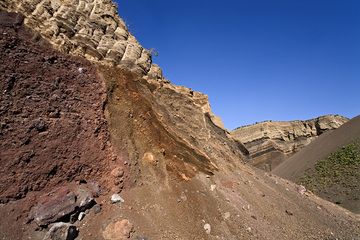
The Chao lava dome in northern Chile near Calama town is one of the largest known lava domes in the world. It measures 14.5 km in length and 350-400 m in height.
[smaller] [larger]
Chao volcano eruptions: None in recent times, possibly within the past 10,000 years
Latest nearby earthquakes
| Date and Time | Mag / Depth | Distance / Location | |||
|---|---|---|---|---|---|
| Jun 20, 05:29 am (Santiago) | 3.1 135 km | 27 km (17 mi) to the SE | Info | ||
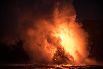
Chao Volcano Photos
Chaotic layers of scoria, ash and lapilli at the quarry of the Eppelsberg volcano (Photo: Tobias Schorr)
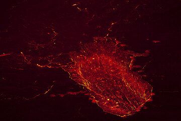
Chaotic crust left after a fountain has died out. (Photo: Tom Pfeiffer)
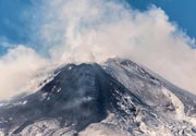
Chaotic red steam clouds hide the view most of the time. (Photo: Tom Pfeiffer)
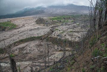
View into where once Sukameriah village was located, around a valley with lush fields inside and on both banks. Part of the pyroclastic flows traveled through this canyon...
Latest satellite images

Chao Volcano Maps
Below is a selection of maps showing the location and surroundings of the volcano at various resolutions based on aerial-imagery / terrain maps. Feel free to use them for non-commercial purposes on your blog or website as long as you credit them with a link back to this page (click to copy it).

Satellite/aerial-type map of Chao volcano (world scale)

Terrain-type map of Chao volcano (world scale)

Satellite/aerial-type map of Chao volcano (region scale large)

Terrain-type map of Chao volcano (region scale large)

Satellite/aerial-type map of Chao volcano (region scale medium)

Terrain-type map of Chao volcano (region scale medium)

Satellite/aerial-type map of Chao volcano (region scale small)

Terrain-type map of Chao volcano (region scale small)

Satellite/aerial-type map of Chao volcano (local scale large)

Terrain-type map of Chao volcano (local scale large)

Satellite/aerial-type map of Chao volcano (local scale medium)

Terrain-type map of Chao volcano (local scale medium)

Satellite/aerial-type map of Chao volcano (local scale small)

Terrain-type map of Chao volcano (local scale small)

Satellite/aerial-type map of Chao volcano (scale of 10s of km)

Terrain-type map of Chao volcano (scale of 10s of km)

Satellite/aerial-type map of Chao volcano (scale of 20-40 km)

Terrain-type map of Chao volcano (scale of 20-40 km)

Satellite/aerial-type map of Chao volcano (scale of approx. 10-20 km)

Terrain-type map of Chao volcano (scale of approx. 10-20 km)

Satellite/aerial-type map of Chao volcano (scale of 5-10 km)

Satellite/aerial-type map of Chao volcano (scale of few kilometers)