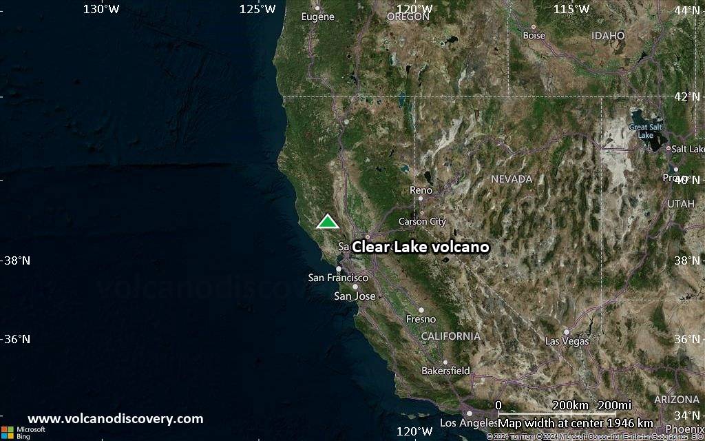
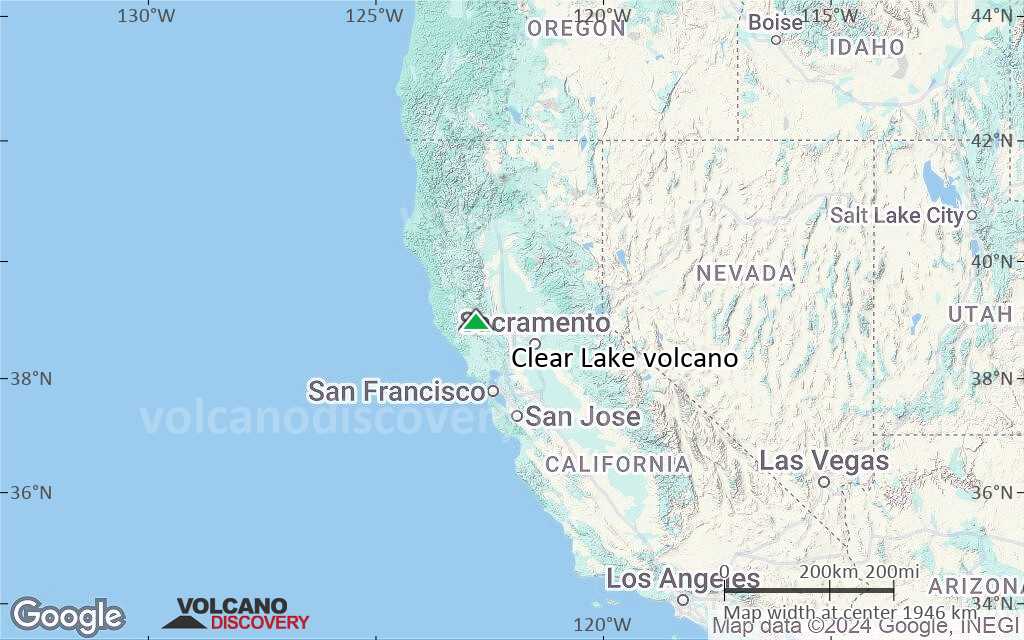
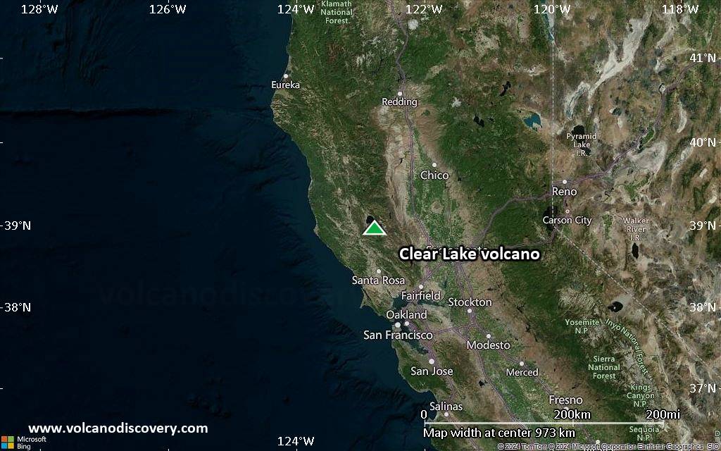
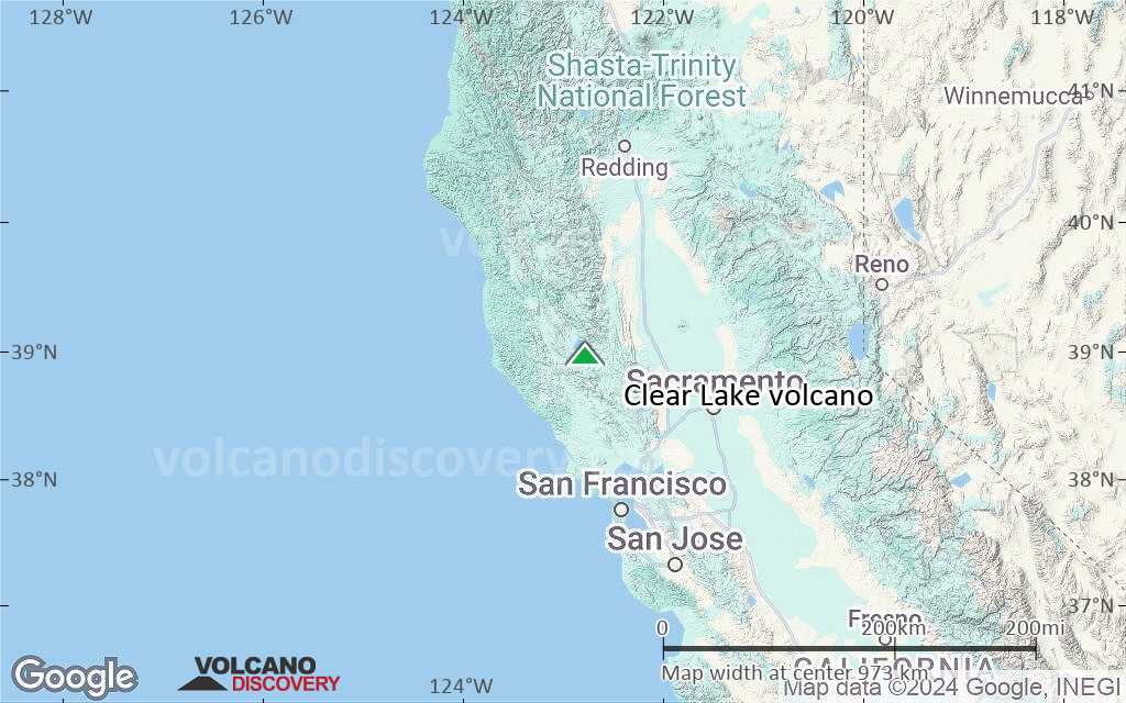
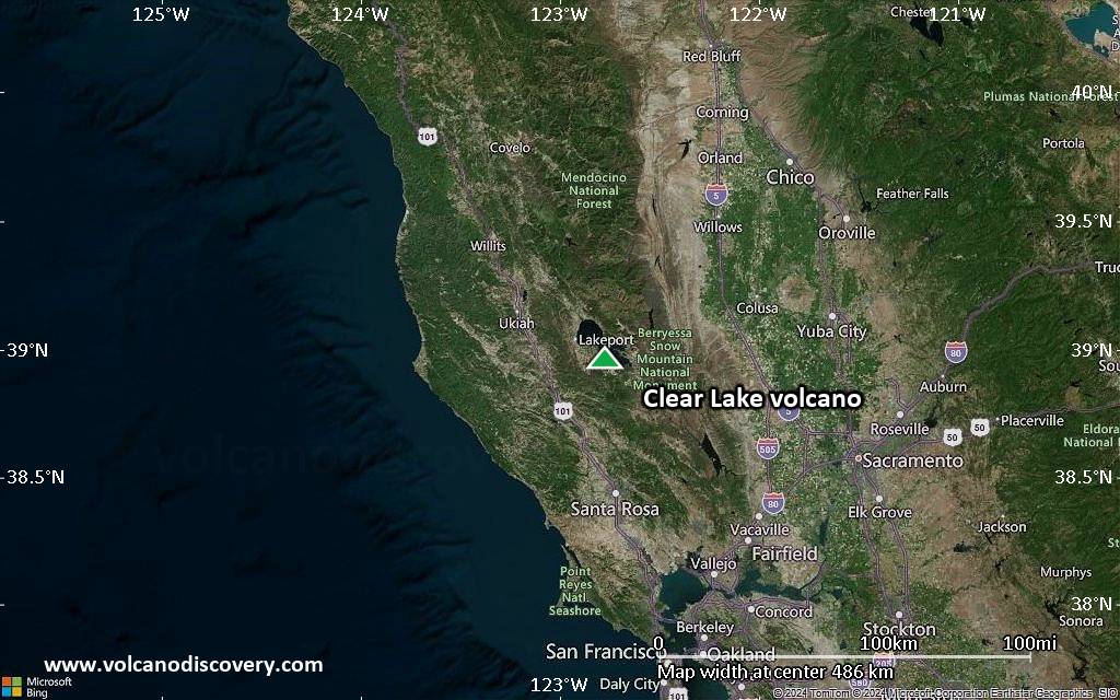
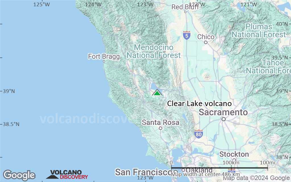
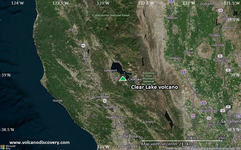
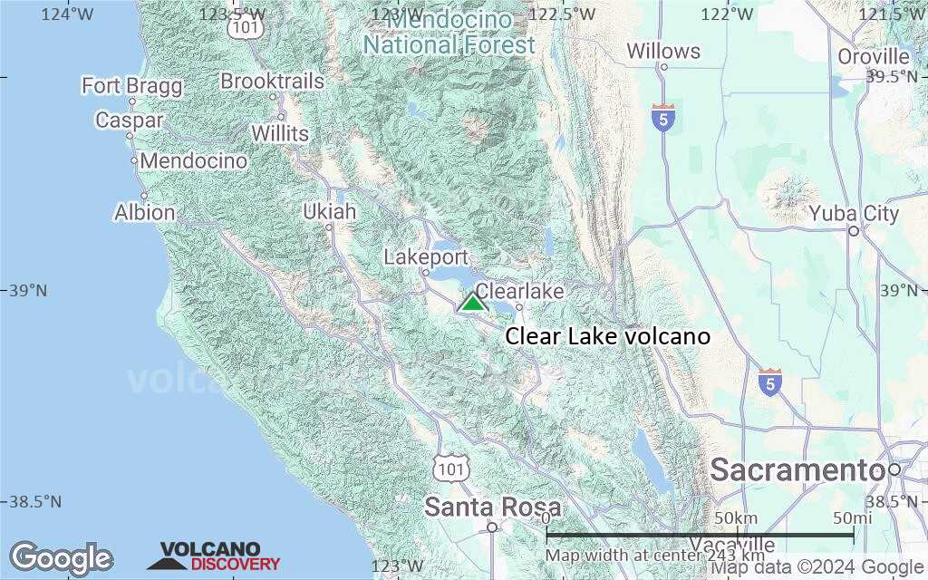
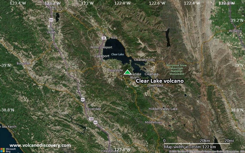
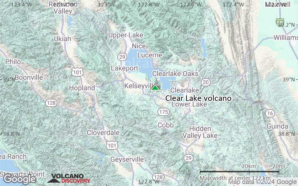
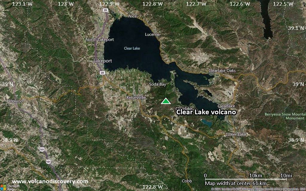
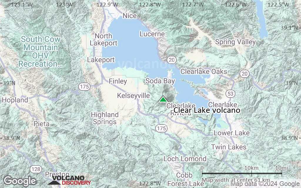
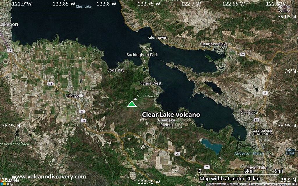
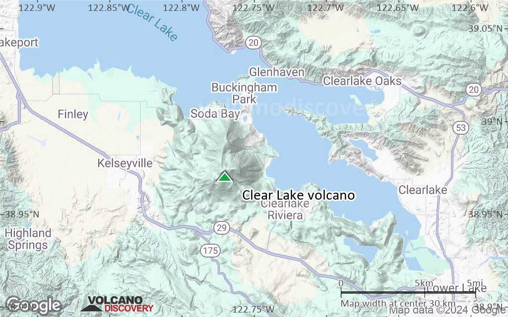
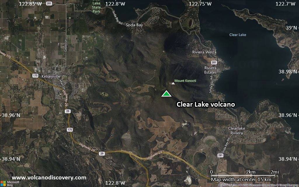
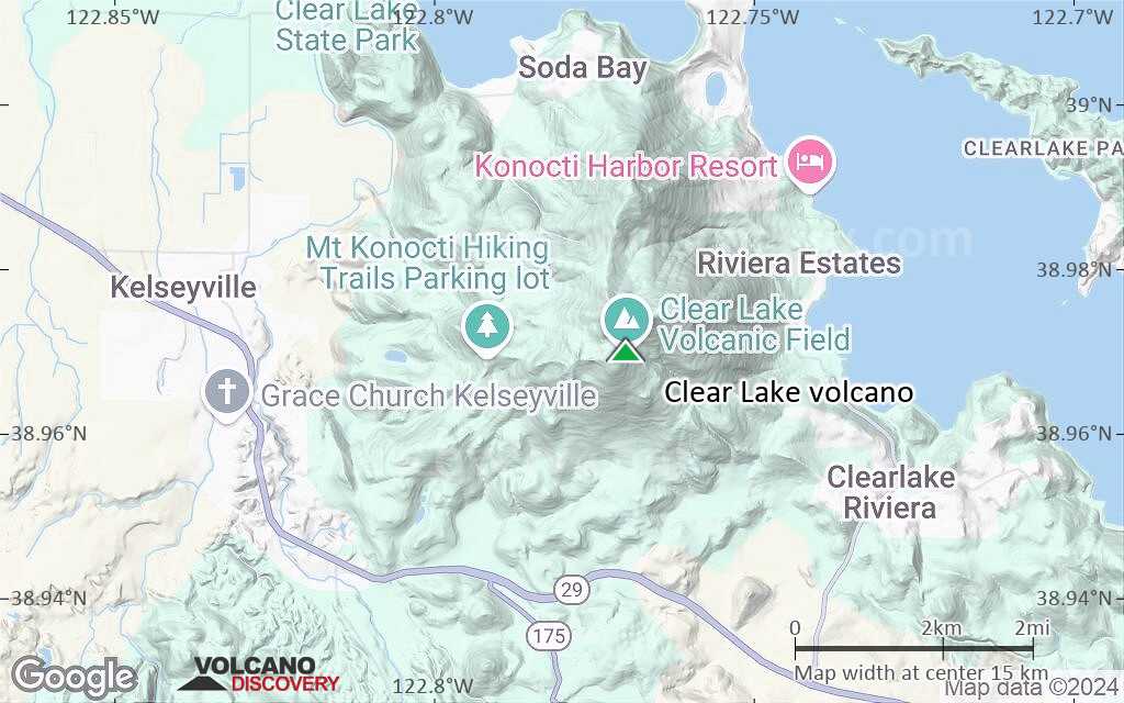
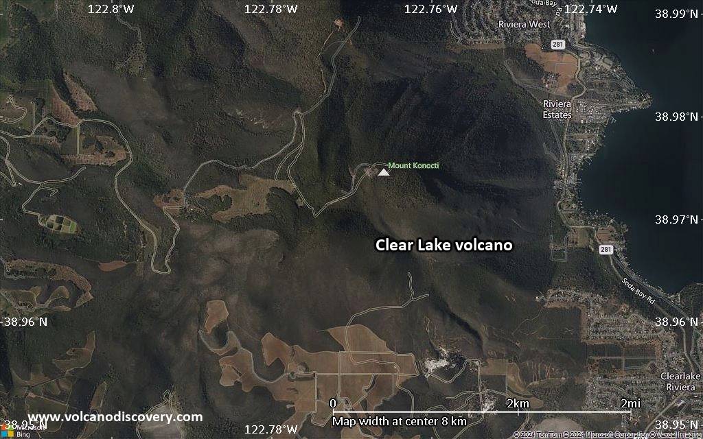
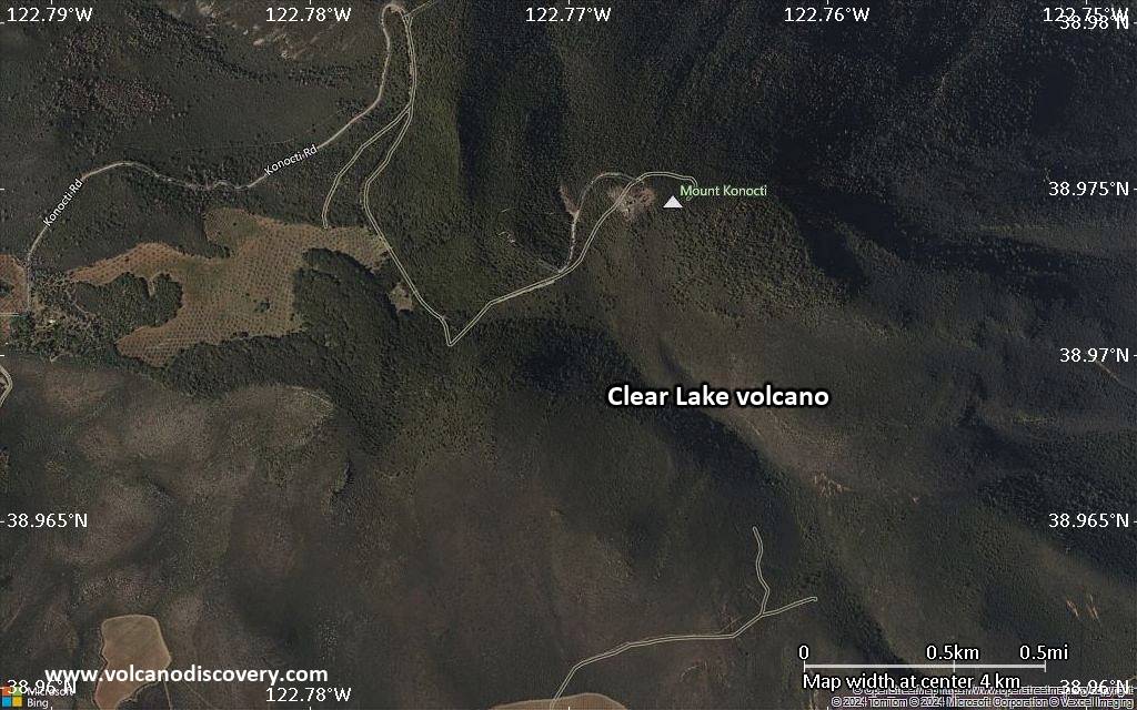
| RSS | EN | DE | EL | ES | FR | IT | RU

Clear Lake Volcano

Updated: Oct 17, 2025 13:30 GMT -
volcanic field
California, USA, 38.97°N / -122.77°W
Summit height: 1439 m / 4,721 ft
Current status: normal or dormant (1 out of 5)

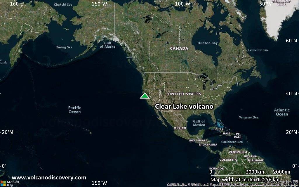
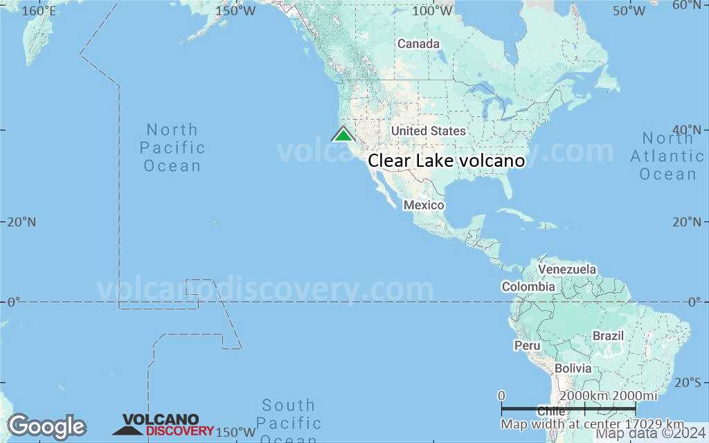
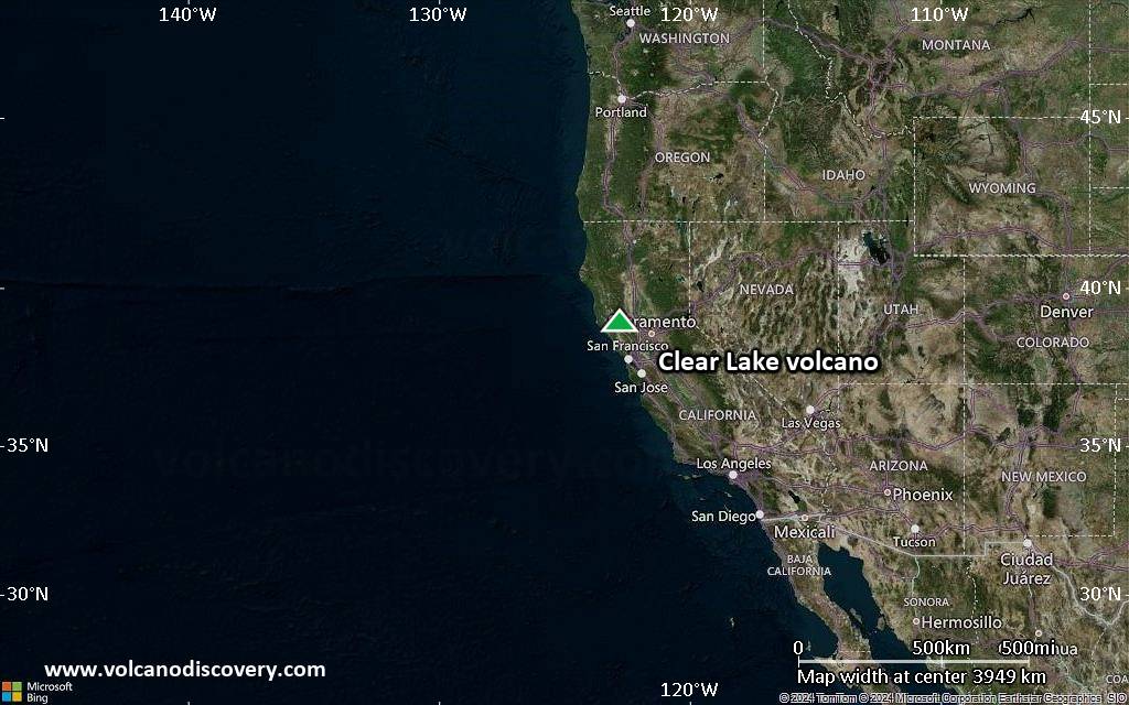
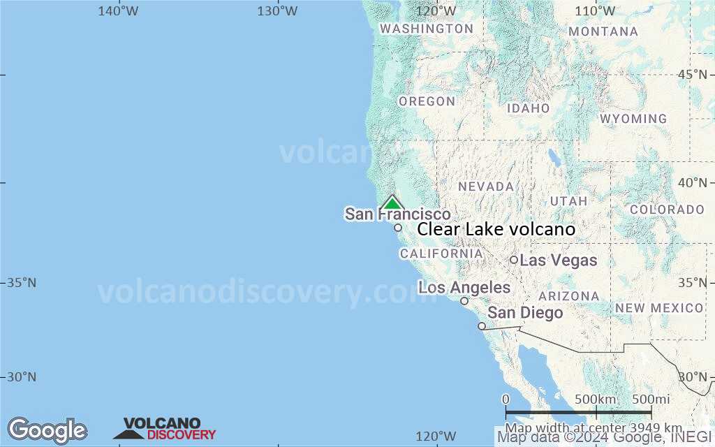
Clear Lake volcanic field lies in the northern Coast Ranges, California, ca. 135 km north of San Francisco. The volcanic field consists of lava dome complexes, cinder cones, and maars of basaltic-to-rhyolitic composition. Mount Konocti, a dacitic lava dome on the south shore of Clear Lake, is the largest volcanic feature.
The area has intense gethermal activity, caused by a large, still hot silicic magma chamber about 14 km wide and 7 km beneath the surface. It provides the heat source for the Geysers, the world's largest producing geothermal field on the SW side of the volcanic field. Its geothermal power plants can generate approximately 2000 megawatts, enough to power two cities the size of San Francisco.
The latest volcanic activity happened about 10,000 years ago and formed maars and cinder cones along the shores of Clear Lake, the larges natural freshwater lake in California. Volcanism around Clear Lake is related to the complex San Andreas transform fault system.

[smaller] [larger]
Typical eruption style: effusive (lava domes)
Clear Lake volcano eruptions: ca. 10,000 years ago

Latest nearby earthquakes

Date and TimeMag / DepthDistance / Location
Oct 17, 12:49 pm (Universal Time)
1.0

2.5 km
16 km (10.1 mi) to the S 6 km W of Cobb, CA Info
Oct 17, 04:34 am (GMT -7)
1.0

2.9 km
17 km (10.9 mi) to the S 7 km NW of the Geysers, CA Info
Oct 17, 09:35 am (Universal Time)
1.0

1.7 km
17 km (10.9 mi) to the S 9 km NW of the Geysers, CA Info
Oct 17, 09:00 am (Universal Time)
1.0

2.6 km
17 km (10.3 mi) to the S 7 km NW of the Geysers, CA Info
Oct 17, 12:26 am (GMT -7)
0.5

7.3 km
16 km (10.2 mi) to the S 9 km NW of the Geysers, CA Info
Oct 17, 12:25 am (GMT -7)
1.0

2 km
16 km (10.1 mi) to the S 8 km NW of the Geysers, CA Info
Oct 17, 05:26 am (Universal Time)
0.6

2.2 km
17 km (10.8 mi) to the SW 10 km WNW of the Geysers, CA Info
Thursday, October 16, 2025 GMT (1 quake)
Oct 16, 05:41 am (Universal Time)
2.0

1.7 km
17 km (10.7 mi) to the S 4 km W of Cobb, CA Info
Wednesday, October 15, 2025 GMT (3 quakes)
Oct 15, 04:56 am (Los Angeles)
2.1

2.7 km
16 km (10.2 mi) to the S 7 km NW of the Geysers, CA Info

Background

Volcanic activity has been largely non-explosive, with the exception of one major explosive eruption that must have occurred and deposited a airfall tuff. Most lavas found here range from basalt through rhyolite in composition, dacite being the most dominant type.

Eruptions at Clear Lake volcanic field:
4 eruptive episodes separated by time gaps of ca. 150-200,000 years have been recognized: 2.1-1.3 million years ago (m.y.), 1.1-0.8 m.y., 0.65-0.30 m.y., and 100,000-10,000 years ago. The total volume of about 100 individual eruptions exceeds 70 cubic kilometers.
Eruptive products from the first activity episode are found in the east of the field. The second activity episode constructed Cobb Mountain (1 million years, Ma) and Mount Hannah (0.9 Ma). The third episode of activity was at the Mount Konocti–Thurston Lake area, the most voluminous dacite and rhyolite feature of the Clear Lake volcanics.
The most recent activity, up to about 10,000 years ago were small mostly basaltic and andesitic eruptions in the north of the field.

Sources: GVP, NCGS (Northern California Geological Society)

Clear Lake Volcano Photos

Latest satellite images

clearlake satellite image sat1clearlake satellite image sat2

Clear Lake Volcano Maps

Below is a selection of maps showing the location and surroundings of the volcano at various resolutions based on aerial-imagery / terrain maps. Feel free to use them for non-commercial purposes on your blog or website as long as you credit them with a link back to this page (click to copy it).
Satellite/aerial-type map of Clear Lake volcano (world scale)
Terrain-type map of Clear Lake volcano (world scale)
Satellite/aerial-type map of Clear Lake volcano (region scale large)
Terrain-type map of Clear Lake volcano (region scale large)
Satellite/aerial-type map of Clear Lake volcano (region scale medium)
Terrain-type map of Clear Lake volcano (region scale medium)
Satellite/aerial-type map of Clear Lake volcano (region scale small)
Terrain-type map of Clear Lake volcano (region scale small)
Satellite/aerial-type map of Clear Lake volcano (local scale large)
Terrain-type map of Clear Lake volcano (local scale large)
Satellite/aerial-type map of Clear Lake volcano (local scale medium)
Terrain-type map of Clear Lake volcano (local scale medium)
Satellite/aerial-type map of Clear Lake volcano (local scale small)
Terrain-type map of Clear Lake volcano (local scale small)
Satellite/aerial-type map of Clear Lake volcano (scale of 10s of km)
Terrain-type map of Clear Lake volcano (scale of 10s of km)
Satellite/aerial-type map of Clear Lake volcano (scale of 20-40 km)
Terrain-type map of Clear Lake volcano (scale of 20-40 km)
Satellite/aerial-type map of Clear Lake volcano (scale of approx. 10-20 km)
Terrain-type map of Clear Lake volcano (scale of approx. 10-20 km)
Satellite/aerial-type map of Clear Lake volcano (scale of 5-10 km)
Satellite/aerial-type map of Clear Lake volcano (scale of few kilometers)
Volcanoes & Earthquakes - new app for Android
Guaranteed tours
3-19 Nov 2025: Volcanoes and Spices - Sulawesi/Halmahera (Indonesia)
3-19 Nov 2025: From Krakatau to Bali - Java (Indonesia)
20 Nov - 3 Dec 2025: Desert, salt and volcanoes - Danakil desert (Ethiopia)
2-10 May 2026: From Stromboli to Etna - Sicily and Eolian Islands (Italy)
= spaces available   = guaranteed   = few spaces left   = booked out

No news in this list.

On this page:

Try our free app!
Volcanoes & Earthquakes - new app for Android
Android | iOS version

More on VolcanoDiscovery

Why is there advertising on this site?

Support Us – Help Us Enhance Our Services!

We’re passionate about delivering the latest volcano and earthquake data from around the globe — just for you. However, maintaining our website and free apps requires significant time, effort, and resources.
Your support helps us expand our hardware and software capabilities and empowers our dedicated editorial team. Our mission is to provide uninterrupted, real-time updates whenever an earthquake strikes or a volcano erupts — and your donations make this possible. Every contribution, big or small, is deeply appreciated. If you find our information valuable and want to help us add new features, create compelling content, and improve our technology, please consider making a donation:

Donate with Card or Apple/Google Pay:

Send €5 payment link to support VolcanoDiscovery with 5 EUR
€10 payment link to support VolcanoDiscovery with 10 EUR
€25 payment link to support VolcanoDiscovery with 25 EUR
€50 payment link to support VolcanoDiscovery with 50 EUR
€100 payment link to support VolcanoDiscovery with 100 EUR
€250 payment link to support VolcanoDiscovery with 250 EUR

Donate with PayPal:

Planned Features:

Thanks to your past donations, we have recently added:
Download the Volcanoes & Earthquakes app to stay among the first to receive the fastest seismic and volcano alerts online:
Android | iOS
Thank you for being part of our mission!
Sources: VolcanoDiscovery / VolcanoAdventures and other sources as noted.
Use of material: Most text and images on our websites are owned by us. Re-use is generally not permitted without authorization. Contact us for licensing rights.
Volcanoes & Earthquakes
VolcanoDiscovery Home
Volcanoes | Earthquakes | Photos | Volcano News | | Shop | App
Adventure & Study Travel
Tours to Volcanoes and Volcanic Areas: walking tours, photo tours, study tours
Tours & Dates | FAQ | About us
Get our newsletter!
Company info
Contact | Legal info | Terms & conditions
Follow us
Follow us on facebook Follow us on Instagram Follow us on Bluesky Follow us on Twitter Visit our Youtube channel
EN | DE | EL | ES | FR | IT | RU
VolcanoDiscovery GmbH, Germany, Reg. nr.: HRB 103744, EU Tax Id: DE 297 465 123 owned and created by
Dr. Tom Pfeiffer, volcanologist, volcano photographer, tour organizer member of
IAVCEI
IAVCEI
Vulkanologische Gesellschaft
Volcanological Society
Ecotourism Greece
Ecotourism Greece
RUV insurance
Insured by R+V
VolcanoDiscovery © 2004- All Rights Reserved | Privacy - Cookie Settings