(volcanic field & cinder cones 288 m / 945 ft)
The Amboy volcanic field covers an area of 70 km2 between Bagdad Dry Lake to the west and Bristol Dry Lake to the east in the Mojave Desert, California. It contains mainly pahoehoe lava flows. Amboy crater proper is a prominant cinder cone in the NE of the lava field. [
more info]
(Pyroclastic cone(s) 1950 m / 6398 ft)
[
more info]
(Pyroclastic cone 813 m / 2667 ft)
[
more info]
(shield volcano 1,174 m / 3,852 ft)
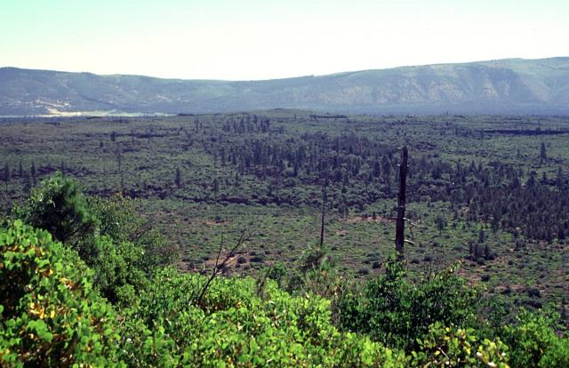
The broad inconspicuous volcano in the center of the photo is Brushy Butte, a small shield volcano SSE of the Medicine Lake Highlands. The Brushy Butte complex has produced a broad apron of basaltic lava flows, seen here from Timbered Crater with the Big Valley Mountain fault scarp in the background. Fresh-looking flows extend preferentially down the regional gradient to the south as far as the Falls River valley, but the age of Brushy Butte is not well known. The volcano may be of late-Pleistocene or early Holocene age. (Photo: Lee Siebert, Smithsonian Institution)
Brushy Butte is a small, poorly studied shield volcano immediately east of Timbered Crater maar, and south-southeast of the Medicine Lake Highlands in northern California, USA. [
more info]
(Volcanic field 2309 m / 7575 ft)
[
more info]
(Volcanic field 1509 m / 4951 ft)
[
more info]
(volcanic field 1439 m / 4,721 ft)
Clear Lake volcanic field lies in the northern Coast Ranges, California, ca. 135 km north of San Francisco. The volcanic field consists of lava dome complexes, cinder cones, and maars of basaltic-to-rhyolitic composition. Mount Konocti, a dacitic lava dome on the south shore of C... [
more info]
(Pyroclastic cone(s) 975 m / 3199 ft)
[
more info]
(stratovolcano 2400 m / 7,874 ft)
The Coso volcanic field is located east of the Sierra Nevada Range at the western edge of the Basin and Range province, California. It consists of 38 old rhyolitic lava domes and basaltic cinder cones covering a 400 sq km area. volcano is located 200 km north of Los Angeles, Cali... [
more info]
(fissure vents 1652 m / 5,420 ft)
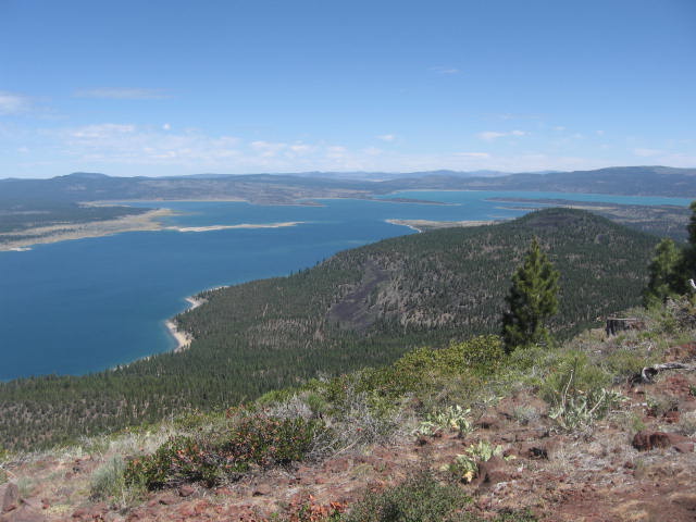
Eagle Lake and some of the cinder cones of the volcanic field (photo: WikiCommons, public domain)
Eagle lake is a volcanic field at the junction of the Sierra Nevada, Cascades, and Basin Range in California, USA. It contains 15 small cinder cones, fissures and lava flows. [
more info]
(Fissure vent(s) 1652 m / 5420 ft)
[
more info]
(volcanic field 2886 m / 9,468 ft)
The Golden Trout Creek volcanic field consists of a group of cinder cones and lava flows in the Toowa Toowa valley of the Sierra Nevada, California, about 25 km south of Mount Whitney.
Toowa valley is a broad and open valley about 8600 feet high, dotted with cones rising 10... [
more info]
(Volcanic field 1703 m / 5587 ft)
[
more info]
(Pyroclastic cone(s) 945 m / 3100 ft)
[
more info]
(lava domes 2629 m / 8,625 ft)
Inyo Craters are a 12-km long field of lava domes at the eastern margin of the Sierra Nevada, California, near the town of Mammoth and south of the similar Mono Craters field. The field contains silicic 6 lava domes, lava flows, and 15 explosion craters (maars) that last erupted ... [
more info]
(stratovolcano 3,189 m / 10,462 ft)
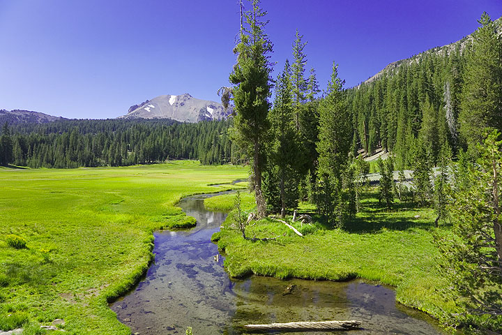
Kings Creek with Lassen Peak on the horizon
Lassen (or Lassen Peak) volcano in northern California is located at the southern end of the Cascade Range. Besides Mt St. Helens, it is the only volcano in the contiguous US that erupted in the 20th century.
Lassen's summit complex is a lava dome that rises 2,000 feet (610... [
more info]
(volcanic field 1495 m / 4,905 ft)
Lavic Lake, a dry lakebed in the Mojave desert, California, is a volcanic field of 4 cinder cones, 3 of which are in the Lavic Lake area and a fourth in the Rodman Maountains 20 km to the west.
Pisgah crater is the main feature, a prominent 100 m high cinder cone north of L... [
more info]
(caldera 3390 m / 11,122 ft)
The large 17 x 32 km Long Valley caldera east of the central Sierra Nevada Range, California, is the result of a giant explosive eruption that happened about 760,000 years ago and formed the widespread and voluminous Bishop Tuff.
The caldera has been showing unrest in recen... [
more info]
(lava domes 3369 m / 11,053 ft)
Mammoth Mountain is a lava-dome complex on the SW rim of Long Valley caldera, California. Despite its close geographic relation, it is believed that it has its own magma chamber different from the ones underlying Long Valley caldera and the Inyo craters. [
more info]
(shield volcano 2,414 m / 7,921 ft)
Medicine Lake is a large shield volcano in northeastern California about 50 km (30 mi) northeast of Mount Shasta, rising about 1,200 metres (3,900 ft) above the Modoc Plateau to an elevation of 2,376 metres (7,795 ft). It contains a 12 km x 7 km wide caldera.
The shield vol... [
more info]
(cinder cones 2121 m / 6,959 ft)
The Mono Lake volcanic field east of Yosemite National Park and north of the Mono Craters in central eastern California is a series of cinder cones in Mono Lake and on its shore. It is one of the most recently active volcanoes in California, the last eruptions having occurred at ... [
more info]
(lava domes 2796 m / 9,173 ft)
The Mono-Inyo Craters for an elongated, 17 km long chain of lava domes, cinder cones and maars on the eastern side of the Sierra Nevada between Mono Lake and Long Valley caldera, California. The last eruption at the Mono Craters took place about 600 years ago, nearly contemporane... [
more info]
(stratovolcano 4,322 m / 14,179 ft)
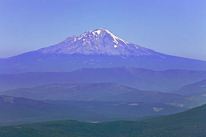
Mount Shasta volcano seen from Lassen Peak
Mt Shasta in Siskiyou County, northen Californian, is the second largest volcano of the Cascade Range. Mount Shasta rises majestically nearly 10,000 ft (3000 m) above the surrounding terrain as it is not connected to any nearby mountain. It has an estimated volume of 350 km3 whic... [
more info]
(Pyroclastic cone 2036 m / 6680 ft)
[
more info]
(lava domes -40 m / -131 feet)
The Salton Buttes volcanic field consist of 5 small rhyolitic lava domes built above sediments of the Colorado River delta within the Salton Sea geothermal field, located at the SE margin of the Salton Sea, California. [
more info]
(cinder cones 1535 m / 5,036 ft)
Silver Lake is one of many volcanic fields northern California. It consists of 3 small explosion craters The volcano consists of 3 small cinder cones and lava lakes. The craters contain lakes: Silver Lake, Author Lake, and Buckhorn Lake. [
more info]
(cinder cones 2191 m / 7,188 ft)
Tumble Buttes is a volcanic field in northern California, consisting of several cinder cones that had been last active about 15,000 years ago. A well-known feature is Devils Rock Garden, a blocky lava flow which extends south of the volcano. [
more info]
(cinder cones 1,631 m / 5,351 ft)
Twin Buttes in northern California is a volcanic field of cinder cones, lava flows and domes. [
more info]
(explosion craters (maars) 752 m / 2,467 ft)
Ubehebe Craters volcano is a group of maars (explosion craters) located at the western margin of Tin Mountain, California, in the northern end of Death Valley. The craters were thought to have last erupted about 6000 years ago, but a recent study suggests that some activity could... [
more info]


