Conchagüita Volcano
Updated: May 2, 2024 10:47 GMT -
stratovolcano 505 m / 1,657 ft
El Salvador, 13.23°N / -87.77°W
Current status: normal or dormant (1 out of 5)
El Salvador, 13.23°N / -87.77°W
Current status: normal or dormant (1 out of 5)
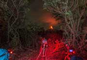
Conchagüita volcano at the SE tip of El Salvador forms a small 4-km-wide island in the Gulf of Fonseca separated from Conchagua volcano across a narrow strait.
The volcano is a sharp-topped cone with a 100-m-wide summit crater at the southern end and contains a young lava delta that forms a peninsula on the island's eastern side.
A crescent-shaped crater open to the west is located at the northern end of the island. The only known historic activity from Conchagüita volcano were small ash emissions in 1892.
[smaller] [larger]
Conchagüita volcano eruptions: 1892
Latest nearby earthquakes
| Time | Mag. / Depth | Distance / Location | |||
| Apr 18, 09:03 pm (El Salvador) | 2.4 169 km | 13 km (8.1 mi) to the S | Info | ||
Latest satellite images