


Cuxliquel Volcano
Updated: May 13, 2025 13:48 GMT -
Lava dome(s)
Guatemala, 14.89°N / -91.4°W 
Summit height: 3029 m / 9938 ft
Current status: (probably) extinct (0 out of 5)
[smaller] [larger]
Cuxliquel volcano eruptions: None during the past 10,000 years
Less than few million years ago (Pleistocene)
Latest nearby earthquakes
| Date and Time | Mag / Depth | Distance / Location | |||
|---|---|---|---|---|---|
Background
A Quaternary lava-dome complex lies in the center of a semi-arcuate depression of uncertain origin near the city of Totonicapán. A small symmetrical lava dome, Cerro de Oro, is located on the ESE flank of the larger edifice, 3029-m-high Cuxliquel. The headwaters of the Río Samalá trace an arcuate path around the dome complex beginning on its SE side around to the north side and then to the SW. Thick Los Chocoyos pyroclastic-flow deposits from the eruption that formed Atitlán caldera to the SE fill much of the basin and extend down the Río Samalá to the SW.---
Source: Smithsonian / GVP volcano information
Latest satellite images
Cuxliquel Volcano Maps
Below is a selection of maps showing the location and surroundings of the volcano at various resolutions based on aerial-imagery / terrain maps. Feel free to use them for non-commercial purposes on your blog or website as long as you credit them with a link back to this page (click to copy it).

Satellite/aerial-type map of Cuxliquel volcano (world scale)

Terrain-type map of Cuxliquel volcano (world scale)

Satellite/aerial-type map of Cuxliquel volcano (region scale large)

Terrain-type map of Cuxliquel volcano (region scale large)

Satellite/aerial-type map of Cuxliquel volcano (region scale medium)

Terrain-type map of Cuxliquel volcano (region scale medium)

Satellite/aerial-type map of Cuxliquel volcano (region scale small)

Terrain-type map of Cuxliquel volcano (region scale small)

Satellite/aerial-type map of Cuxliquel volcano (local scale large)

Terrain-type map of Cuxliquel volcano (local scale large)

Satellite/aerial-type map of Cuxliquel volcano (local scale medium)

Terrain-type map of Cuxliquel volcano (local scale medium)

Satellite/aerial-type map of Cuxliquel volcano (local scale small)

Terrain-type map of Cuxliquel volcano (local scale small)

Satellite/aerial-type map of Cuxliquel volcano (scale of 10s of km)

Terrain-type map of Cuxliquel volcano (scale of 10s of km)
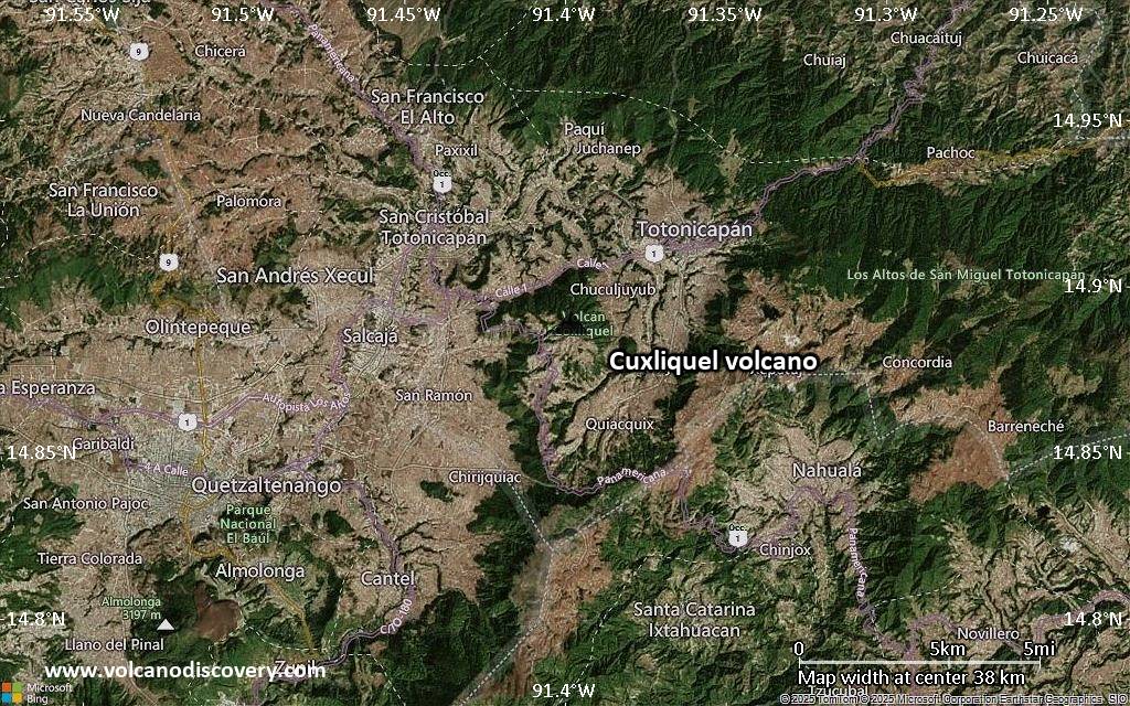
Satellite/aerial-type map of Cuxliquel volcano (scale of 20-40 km)

Terrain-type map of Cuxliquel volcano (scale of 20-40 km)

Satellite/aerial-type map of Cuxliquel volcano (scale of approx. 10-20 km)

Terrain-type map of Cuxliquel volcano (scale of approx. 10-20 km)

Satellite/aerial-type map of Cuxliquel volcano (scale of 5-10 km)

Satellite/aerial-type map of Cuxliquel volcano (scale of few kilometers)


