| RSS | EN | DE | EL | ES | FR | IT | RU

Dallol Volcano

Updated: May 21, 2025 05:07 GMT -
hydrothermal field
Danakil desert, Ethiopia, 14.24°N / 40.3°E
Summit height: -48 m / -157 ft
Current status: normal or dormant (1 out of 5)
Last update: 9 Jan 2025
Bizarre landscape at Dallol volcano

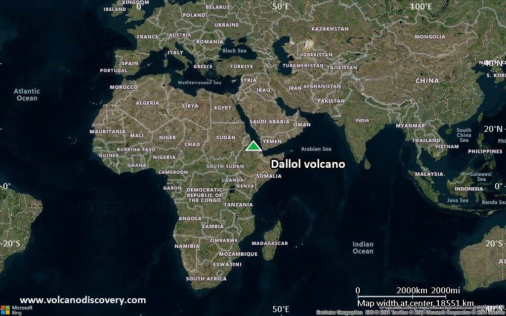
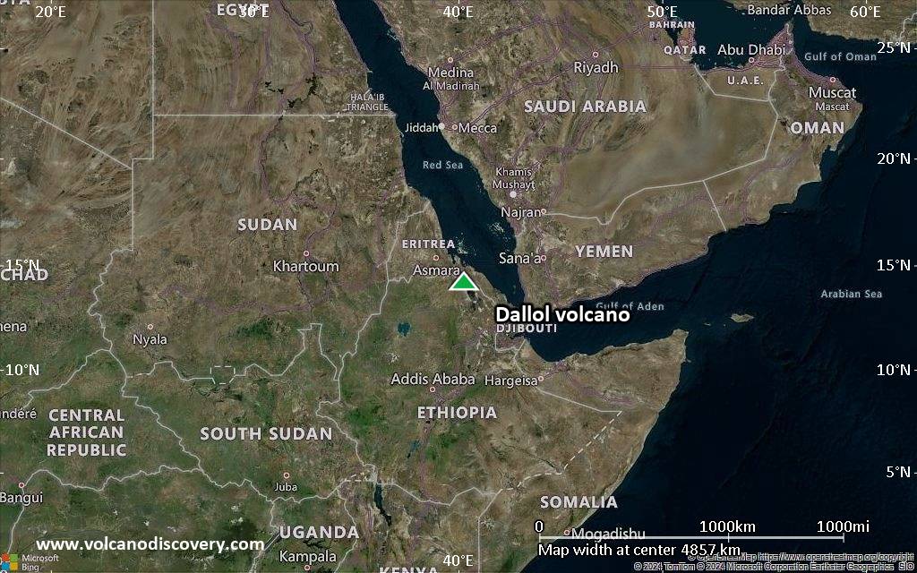
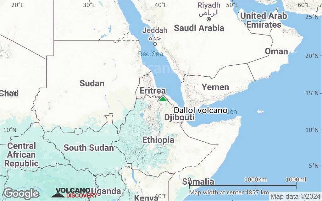
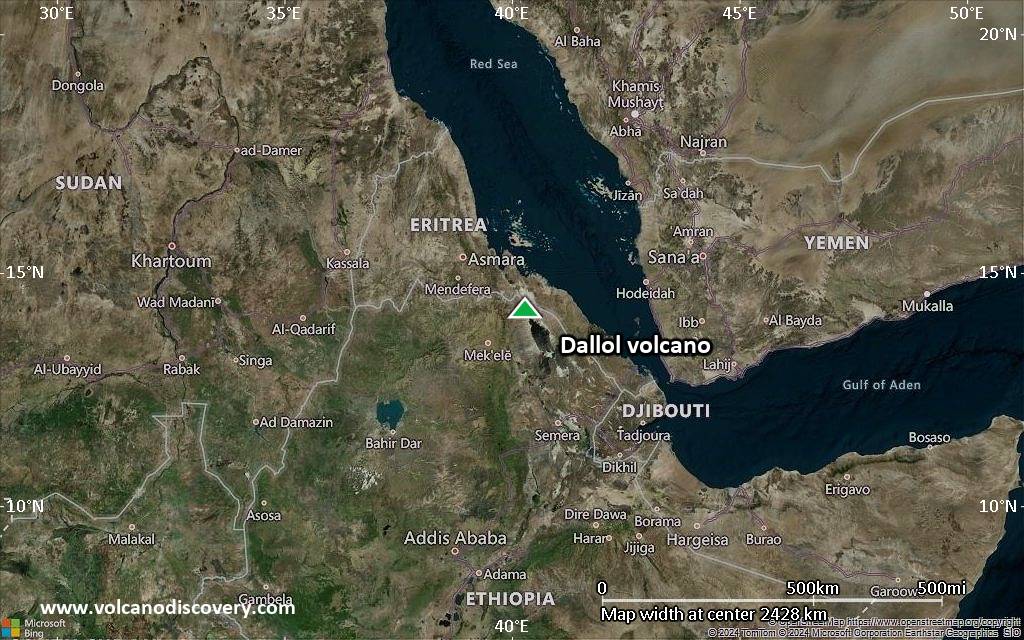
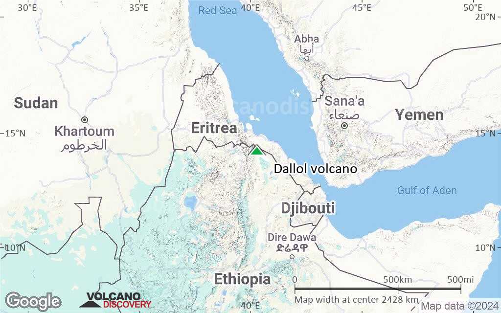
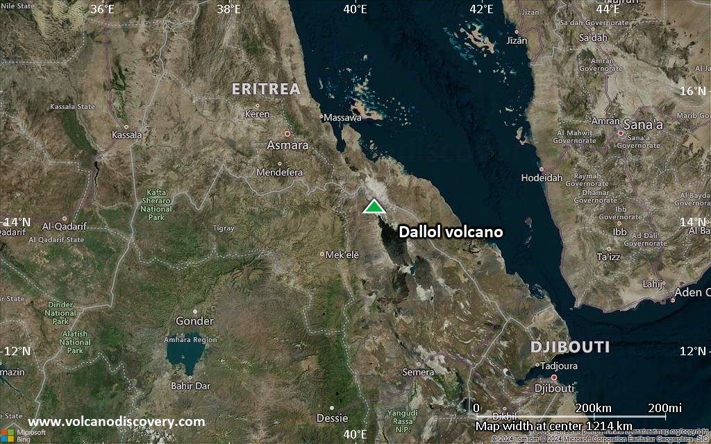
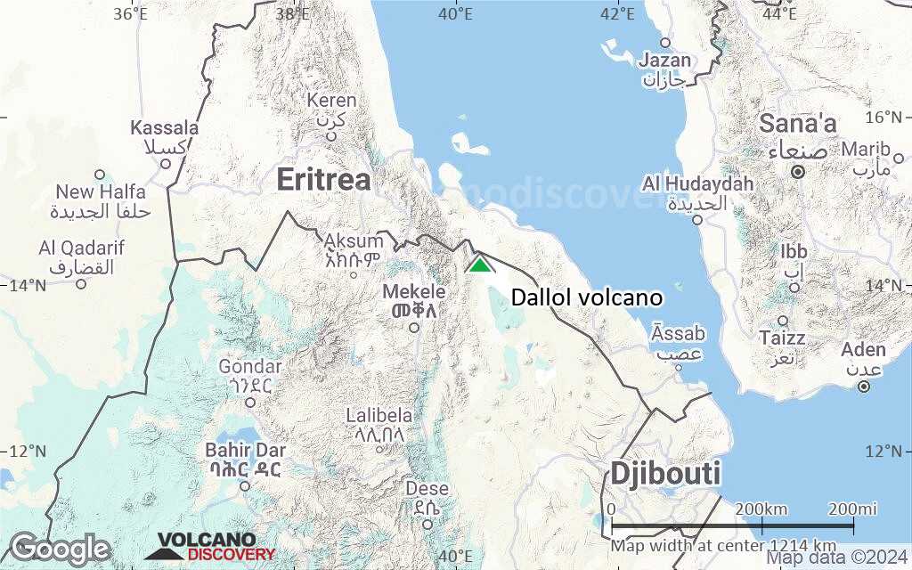
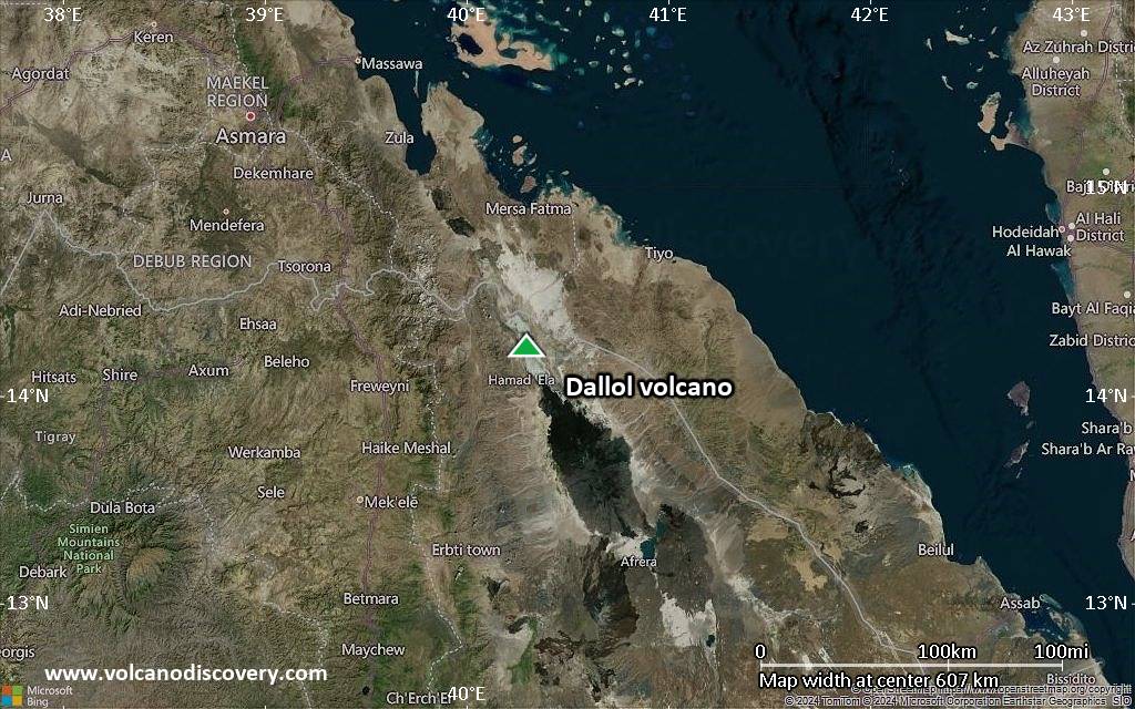
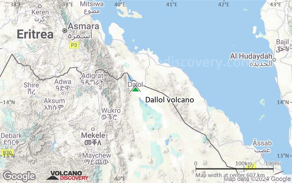
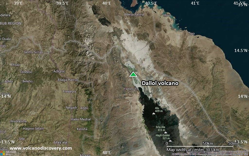
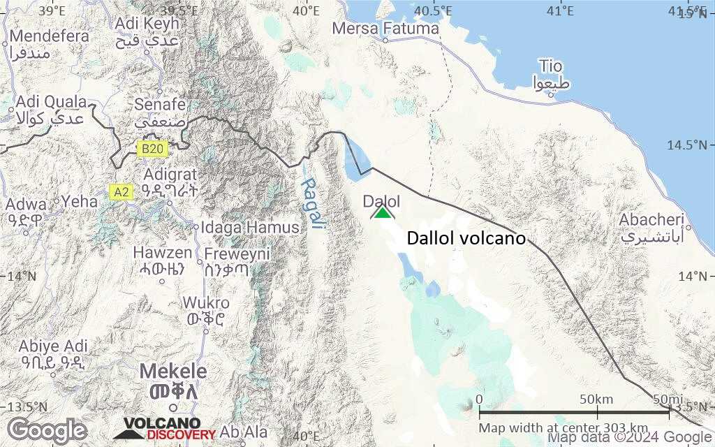
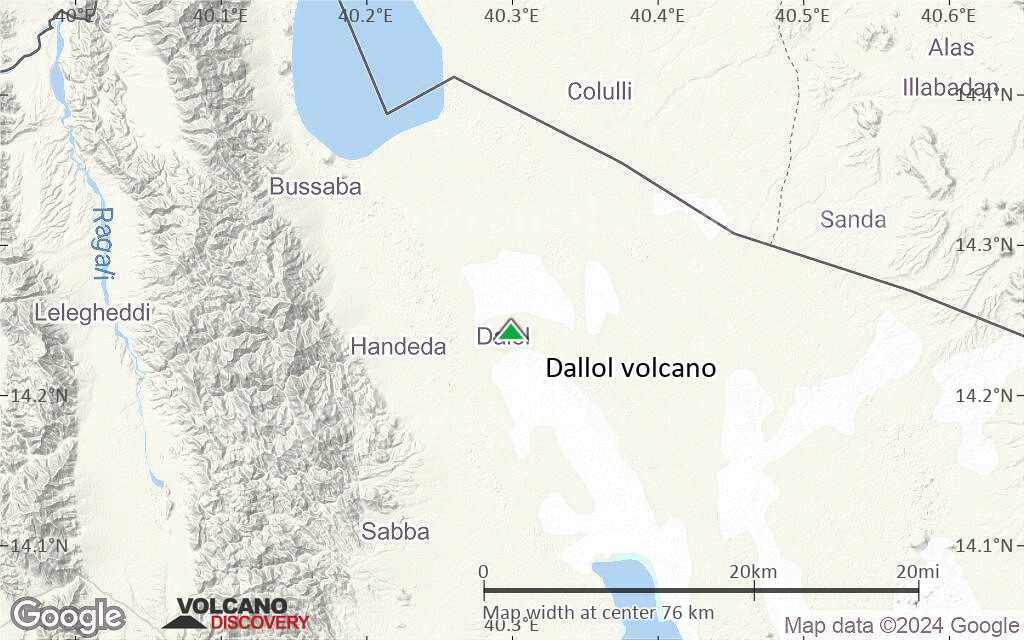
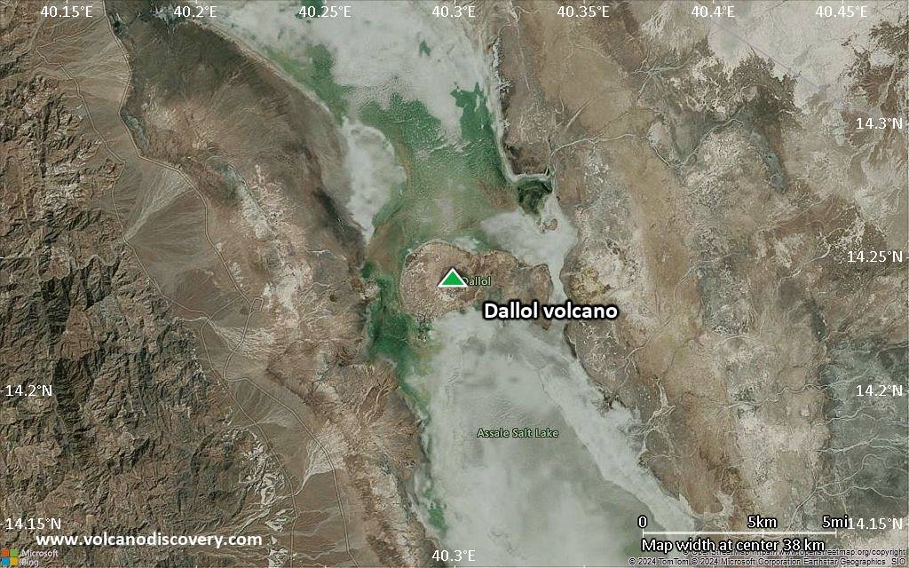
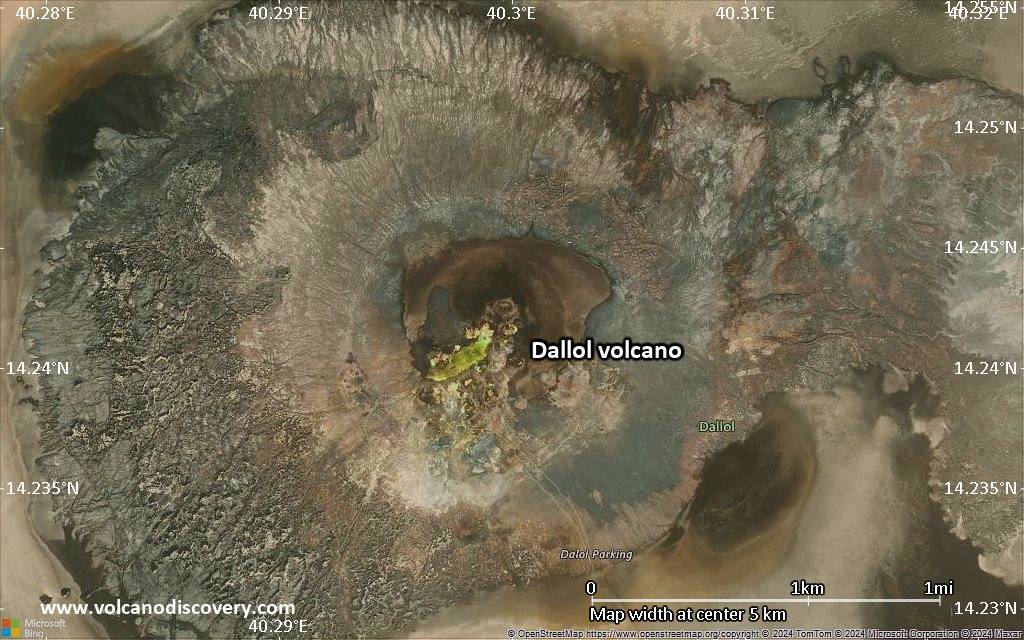
The Dallol volcano, or rather the Dallol hydrothermal field is located in a remote part of the northern Danakil Depression in NE Ethiopia. It is the lowest known sub-aerial volcanic area in the world.
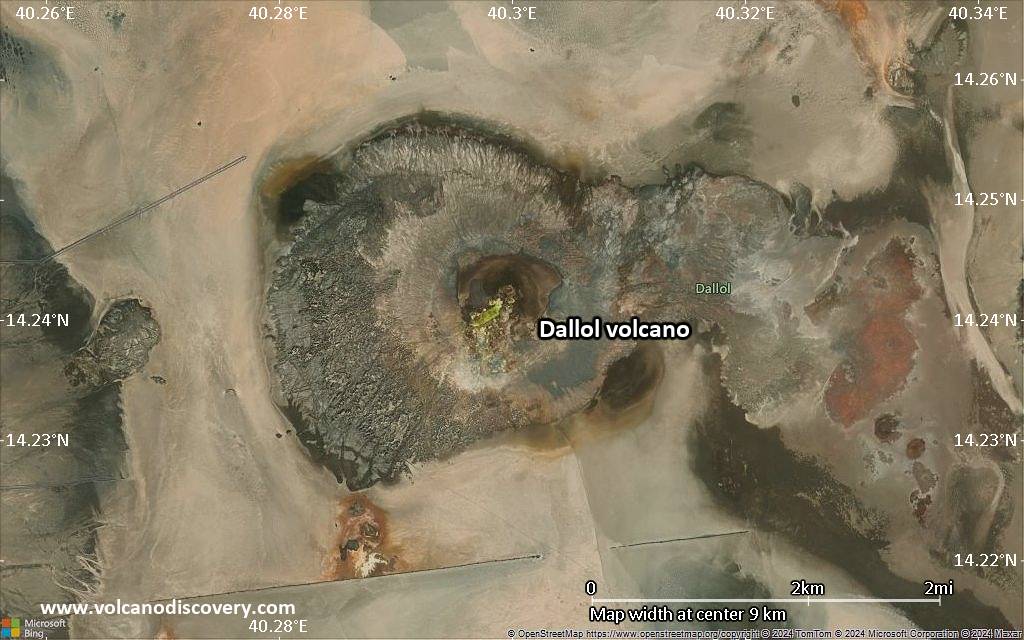
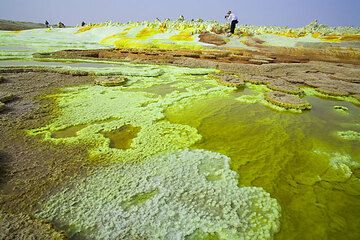
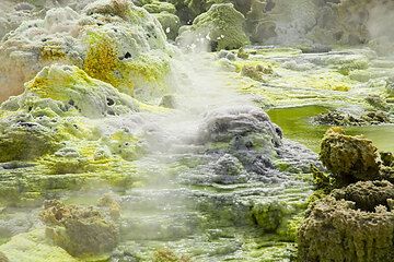
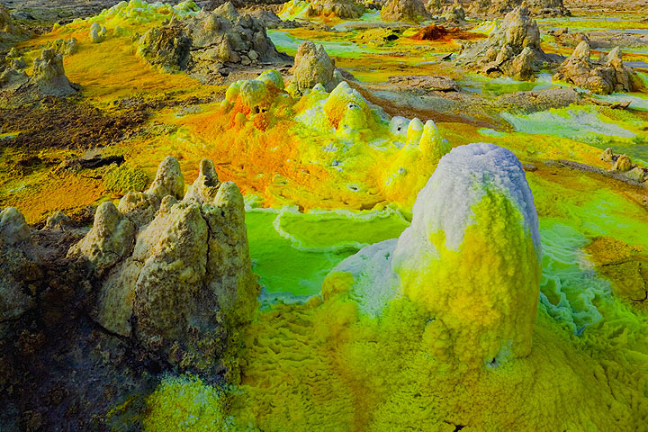
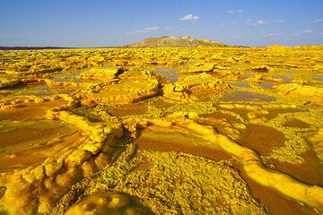
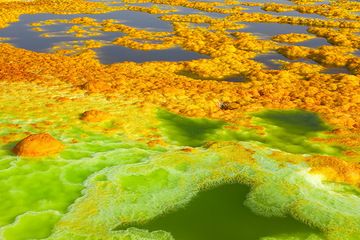
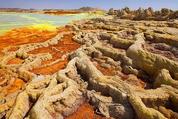
Dallol is one of the world's most spectacular landscape: a vast area of uplifted thick salt deposits affected by intense fumarolic activity, probably caused by an active volcanic system beneath several kilometers of evaporation salt deposits.
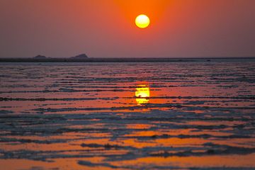
Dallol is said to be the hottest place on the planet, with average annual temperatures well above 30 deg C.
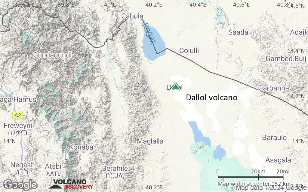
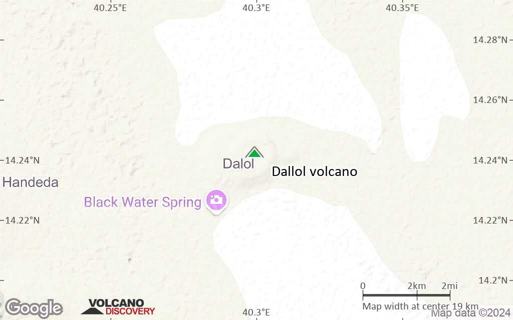
The area commonly referred to Dallol volcano contains the approx. 1.5 x 3 km wide Dallol "mountain" (rising about 50 m above the great salt lake) near the border with Eritrea, and nearby warm springs including the Yellow Lake, the Black Mountain with the Blue Lake, said to be an explosion crater from a hydrothermal eruption in 1926.
Dallol is famous for its hot brine, and multicolored white, pink, red, yellow, green, gray and black salt deposits, hot springs and miniature geysers. These bizarre structures form in a complex interaction of solution and recrystallization processes driven by hydrothermal waters and rapid evaporation.

[smaller] [larger]
Typical eruption style: Phreatic explosions. Strong hydrothermal activity at present.
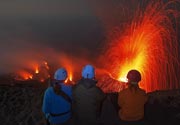
Dallol volcano eruptions: 2011, 1926

Latest nearby earthquakes

Date and TimeMag / DepthDistance / Location

Background

Dallol overlies several km of quaternary evaporates which contain large amounts of potash (potassium carbonate, K2CO3) that were quarried by shifting mining companies for most of the 20th century.
It is believed that Dallol, located on the main rift axis of the Danakil depression, is caused by an active basaltic volcano located under the layers of salt. The roughly circular depression on top of Dallol mountain was suggested to be a collapse crater.
The only known volcanic activity was a phreatic explosion in 1926 that produced a 30 m wide crater at the foot of the Black Mountain.

Dallol Volcano Photos

Significant volcanic eruptions: Dallol volcano

In the past 10,000 years, Dallol has had at least 2 confirmed eruptions, all documented by historical records or observations.
The table below lists all known eruptions (date in bold face) of Dallol volcano in historic times and during the past 10,000 years. Updates on the most recent volcanic activity of Dallol can be found on the news page of Dallol volcano.
DateNoteVEIDeathsDamage
2011 Jan 4 ±3 d.Dallol crater
Historical obs./docs.
0
1926
Historical obs./docs.
1
Remark:
Our list of volcanic eruptions closely follows the database of eruptions of the Smithsonian's Global Volcanism Project (GVP), the internationally most recognized data source for volcanic eruptions, but also includes significant eruptive episodes or related volcano events. "Volcanic eruptions" are usually to be understood as sequences of individual eruptive episodes that can follow each other, or even overlap (if several vents are involved), and can last many years, decades or even longer. For example, the current activity of Stromboli volcano is understood as a single eruption that has been ongoing since 1934.
Sources: NOAA National Centers for Environmental Information (NCEI), Global Significant Volcanic Eruptions Database. doi:10.7289/V5TD9V7K | Global Volcanism Project / Smithsonian Institution

Dallol Volcano FAQ

+When was the last eruption of Dallol volcano?

+How often does Dallol volcano erupt?

+How active is Dallol volcano at present?

+When was the largest eruption of Dallol volcano?

Latest satellite images

Dallol satellite image sat1Dallol satellite image sat2
Dallol Volcano Tours
Danakil desert (Ethiopia)
Desert, salt and volcanoes
14-day expedition to Erta Ale volcano and Dallol hydrothermal field (Danakil desert, Ethiopia)
14 days / 13 nights - Moderate
Price $ 4390
1-14 Oct 2025
20 Nov - 3 Dec 2025
22 Jan - 4 Feb 2026
Danakil desert (Ethiopia)
Erta Ale Volcano Special
8-day expedition to Erta Ale volcano, Ethiopia
8 days - Moderate
Price $ 3190
Custom and group dates
29 Oct - 5 Nov 2025
27 Dec 25 - 3 Jan 2026

Dallol Volcano Maps

Below is a selection of maps showing the location and surroundings of the volcano at various resolutions based on aerial-imagery / terrain maps. Feel free to use them for non-commercial purposes on your blog or website as long as you credit them with a link back to this page (click to copy it).
Satellite/aerial-type map of Dallol volcano (world scale)
Terrain-type map of Dallol volcano (world scale)
Satellite/aerial-type map of Dallol volcano (region scale large)
Terrain-type map of Dallol volcano (region scale large)
Satellite/aerial-type map of Dallol volcano (region scale medium)
Terrain-type map of Dallol volcano (region scale medium)
Satellite/aerial-type map of Dallol volcano (region scale small)
Terrain-type map of Dallol volcano (region scale small)
Satellite/aerial-type map of Dallol volcano (local scale large)
Terrain-type map of Dallol volcano (local scale large)
Satellite/aerial-type map of Dallol volcano (local scale medium)
Terrain-type map of Dallol volcano (local scale medium)
Satellite/aerial-type map of Dallol volcano (local scale small)
Terrain-type map of Dallol volcano (local scale small)
Satellite/aerial-type map of Dallol volcano (scale of 10s of km)
Terrain-type map of Dallol volcano (scale of 10s of km)
Satellite/aerial-type map of Dallol volcano (scale of 20-40 km)
Terrain-type map of Dallol volcano (scale of 20-40 km)
Satellite/aerial-type map of Dallol volcano (scale of approx. 10-20 km)
Terrain-type map of Dallol volcano (scale of approx. 10-20 km)
Satellite/aerial-type map of Dallol volcano (scale of 5-10 km)
Satellite/aerial-type map of Dallol volcano (scale of few kilometers)
Volcanoes & Earthquakes - new app for Android
Guaranteed tours
9-25 Jun 2025: Volcanoes and Spices - Sulawesi/Halmahera (Indonesia)
7-22 Jul 2025: From Krakatau to Bali - Java (Indonesia)
7-23 Jul 2025: Volcanoes and Spices - Sulawesi/Halmahera (Indonesia)
1-17 Aug 2025: Volcanoes and Spices - Sulawesi/Halmahera (Indonesia)
1-14 Oct 2025: Desert, salt and volcanoes - Danakil desert (Ethiopia)
4-12 Oct 2025: From Stromboli to Etna - Sicily and Eolian Islands (Italy)
6-21 Oct 2025: From Krakatau to Bali - Java (Indonesia)
3-19 Nov 2025: Volcanoes and Spices - Sulawesi/Halmahera (Indonesia)
= spaces available   = guaranteed   = few spaces left   = booked out
Tue, 28 Jun 2016, 19:07

Dallol hydrothermal field (Ethiopia): Help to preserve a unique natural site by supporting the production of a film

Dallol at night (photo: Oliver Grunewald)
Help us protect Dallol and have it listed as UNESCO World Heritage Site by contributing to an ambitious and very interesting crowd-sourced project: ... Read all
Mon, 29 Feb 2016, 09:46

Dallol hydrothermal field (Ethiopia): colorful hot springs back to life

Green and yellow salt pond at Dallol (image: Enku Mulugheta)
One of our groups visited Dallol last week during our recent Danakil volcano expedition. The hydrothermal activity was observed to be very intense, with many colorful ponds and hot springs. ... Read all

Desert, Salt & Volcanoes: expedition to Erta Ale & Dallol

On this page:

Try our free app!
Volcanoes & Earthquakes - new app for Android
Android | iOS version

More on VolcanoDiscovery

Why is there advertising on this site?

Support us - Help us upgrade our services!

We truly love working to bring you the latest volcano and earthquake data from around the world. Maintaining our website and our free apps does require, however, considerable time and resources.
We need financing to increase hard- and software capacity as well as support our editor team. We're aiming to achieve uninterrupted service wherever an earthquake or volcano eruption unfolds, and your donations can make it happen! Every donation will be highly appreciated. If you find the information useful and would like to support our team in integrating further features, write great content, and in upgrading our soft- and hardware, please make a donation (PayPal).

Planned features:Thanks to your past donations, these features have been added recently:
Download and Upgrade the Volcanoes & Earthquakes app to get one of the fastest seismic and volcano alerts online:
Android | IOS
Thank you!
Sources: VolcanoDiscovery / VolcanoAdventures and other sources as noted.
Use of material: Most text and images on our websites are owned by us. Re-use is generally not permitted without authorization. Contact us for licensing rights.
Volcanoes & Earthquakes
VolcanoDiscovery Home
Volcanoes | Earthquakes | Photos | Volcano News | | Shop | App
Adventure & Study Travel
Tours to Volcanoes and Volcanic Areas: walking tours, photo tours, study tours
Tours & Dates | FAQ | About us
Get our newsletter!
Company info
Contact | Legal info | Terms & conditions
Follow us
Follow us on facebook Follow us on Instagram Follow us on Bluesky Follow us on Twitter Visit our Youtube channel
EN | DE | EL | ES | FR | IT | RU
VolcanoDiscovery GmbH, Germany, Reg. nr.: HRB 103744, EU Tax Id: DE 297 465 123 owned and created by
Dr. Tom Pfeiffer, volcanologist, volcano photographer, tour organizer member of
IAVCEI
IAVCEI
Vulkanologische Gesellschaft
Volcanological Society
Ecotourism Greece
Ecotourism Greece
RUV insurance
Insured by R+V
VolcanoDiscovery © 2004- All Rights Reserved | Privacy - Cookie Settings