


Fernandina Volcano
Updated: Nov 6, 2025 03:16 GMT -
Shield volcano
Galápagos Islands, Ecuador, -0.37°S / -91.55°W 
Summit height: 1476 m / 4,842 ft
Current status: normal or dormant (1 out of 5)
Last update: 20 Mar 2025 (Smithsonian / USGS Weekly Volcanic Activity Report)
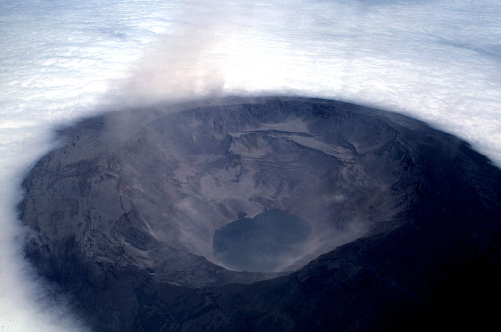
The Fernandina caldera seen on July 4, 1968, about three weeks after a major explosive eruption that was followed by collapse of the caldera floor. Collapse occurred incrementally and asymmetrically, ranging up to about 350 m at the SE end of the caldera, which contains the caldera lake. Photo by Tom Simkin, 1968 (Smithsonian Institution).
[smaller] [larger]
Fernandina volcano eruptions: 2024, 2020, 2018, 2017, 2009
Latest nearby earthquakes
| Date and Time | Mag / Depth | Distance / Location | |||
|---|---|---|---|---|---|
Background
Fernandina, the most active of Galápagos volcanoes and the one closest to the Galápagos mantle plume, is a basaltic shield volcano with a deep 5 x 6.5 km summit caldera. The volcano displays the classic "overturned soup bowl" profile of Galápagos shield volcanoes. Its caldera is elongated in a NW-SE direction and formed during several episodes of collapse. Circumferential fissures surround the caldera and were instrumental in growth of the volcano.Reporting has been poor in this uninhabited western end of the archipelago, and even a 1981 eruption was not witnessed at the time. In 1968 the caldera floor dropped 350 m following a major explosive eruption. Subsequent eruptions, mostly from vents located on or near the caldera boundary faults, have produced lava flows inside the caldera as well as those in 1995 that reached the coast from a SW-flank vent. Collapse of a nearly 1 cu km section of the east caldera wall during an eruption in 1988 produced a debris-avalanche deposit that covered much of the caldera floor and absorbed the caldera lake.
---
Source: Smithsonian / GVP volcano information
Significant volcanic eruptions: Fernandina volcano
In the past 10,000 years, Fernandina has had at least 33 confirmed volcanic eruptions, out of which 29 are documented by historical records, while the others can be inferred from geological evidence.
The table below lists all known eruptions (date in bold face) of Fernandina volcano since around 1900. Updates on the most recent volcanic activity of Fernandina can be found on the news page of Fernandina volcano.
| Date | Note | VEI | Deaths | Damage | |
|---|---|---|---|---|---|
| SE flank Historical obs./docs. | 1 | ||||
Historical obs./docs. | 0 | ||||
Historical obs./docs. | 1 | ||||
| SSW caldera rim and La Cumbre crater Historical obs./docs. | 2 | ||||
| SW flank (400 m) Historical obs./docs. | 2 | ||||
| South caldera rim Historical obs./docs. | 2 | ||||
| SW flank Historical obs./docs. | 2 | ||||
| Base of ESE and NW caldera wall Historical obs./docs. | 2? | ||||
| East caldera wall Historical obs./docs. | 2? | ||||
| NW corner of caldera Historical obs./docs. | 1 | ||||
| South caldera rim Historical obs./docs. | 0 | ||||
| NW caldera bench Historical obs./docs. | 2 | ||||
| SE caldera bench Historical obs./docs. | 1 | ||||
| ESE caldera wall Historical obs./docs. | 2 | ||||
| SE caldera bench Historical obs./docs. | 0 | ||||
| West caldera wall Historical obs./docs. | 4 | ||||
| ESE flank (600 m) Historical obs./docs. | 2 | ||||
| SE flank Historical obs./docs. | 2 | ||||
| SE, SW and west caldera rim Historical obs./docs. | 2 | ||||
Historical obs./docs. | ? | ||||
| South flank near Punta Mangle Historical obs./docs. | ? | ||||
Historical obs./docs. | ? | ||||
| Cape Hammond (SW flank) Historical obs./docs. | ? | ||||
Remark:
Our list of volcanic eruptions closely follows the database of eruptions of the Smithsonian's Global Volcanism Project (GVP), the internationally most recognized data source for volcanic eruptions, but also includes significant eruptive episodes or related volcano events. "Volcanic eruptions" are usually to be understood as sequences of individual eruptive episodes that can follow each other, or even overlap (if several vents are involved), and can last many years, decades or even longer. For example, the current activity of Stromboli volcano is understood as a single eruption that has been ongoing since 1934.
Sources: NOAA National Centers for Environmental Information (NCEI), Global Significant Volcanic Eruptions Database. doi:10.7289/V5TD9V7K | Global Volcanism Project / Smithsonian Institution
Fernandina Volcano FAQ
+When was the last eruption of Fernandina volcano?
The last confirmed eruption of Fernandina occurred in 2024.
+How often does Fernandina volcano erupt?
Since 1813, Fernandina volcano has had at least 29 historically documented eruptions. This means that it erupts on average every 7.3 years.
+How active is Fernandina volcano at present?
Fernandina volcano is relatively active: Since 1900, it has had 22 eruptions, and been active during 22 years out of 126 as of now. This means, Fernandina has been in eruption one in 5.7 years on average. The last eruption was in 2024 and ended 18 months ago.
+When was the largest eruption of Fernandina volcano?
The largest eruption of Fernandina volcano in historic times occurred in 1968. It ranks as a sub-plinian eruption with a magnitude 4 on the VEI (Volcanic Explosivity Index) scale.
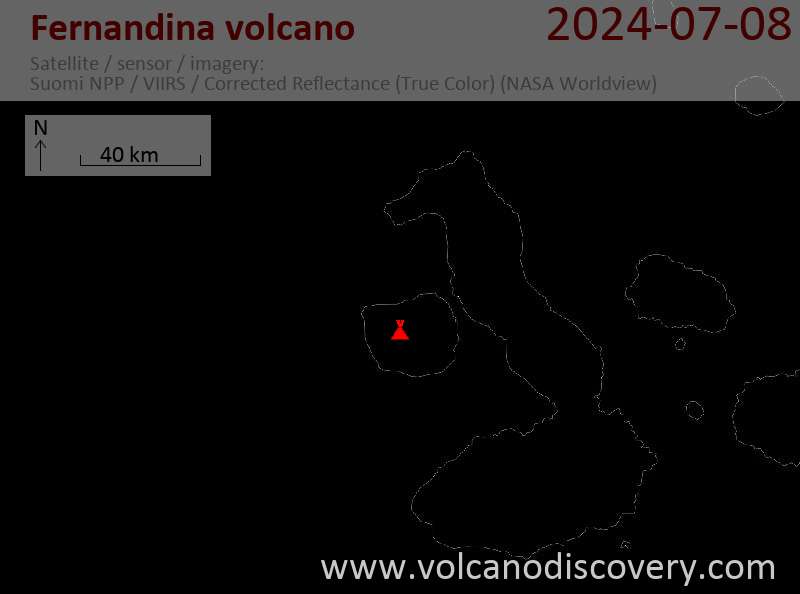
Latest satellite images

Fernandina Volcano Maps
Below is a selection of maps showing the location and surroundings of the volcano at various resolutions based on aerial-imagery / terrain maps. Feel free to use them for non-commercial purposes on your blog or website as long as you credit them with a link back to this page (click to copy it).

Satellite/aerial-type map of Fernandina volcano (world scale)

Terrain-type map of Fernandina volcano (world scale)

Satellite/aerial-type map of Fernandina volcano (region scale large)

Terrain-type map of Fernandina volcano (region scale large)

Satellite/aerial-type map of Fernandina volcano (region scale medium)

Terrain-type map of Fernandina volcano (region scale medium)

Satellite/aerial-type map of Fernandina volcano (region scale small)

Terrain-type map of Fernandina volcano (region scale small)

Satellite/aerial-type map of Fernandina volcano (local scale large)

Terrain-type map of Fernandina volcano (local scale large)

Satellite/aerial-type map of Fernandina volcano (local scale medium)

Terrain-type map of Fernandina volcano (local scale medium)

Satellite/aerial-type map of Fernandina volcano (local scale small)

Terrain-type map of Fernandina volcano (local scale small)

Satellite/aerial-type map of Fernandina volcano (scale of 10s of km)

Terrain-type map of Fernandina volcano (scale of 10s of km)

Satellite/aerial-type map of Fernandina volcano (scale of 20-40 km)

Terrain-type map of Fernandina volcano (scale of 20-40 km)

Satellite/aerial-type map of Fernandina volcano (scale of approx. 10-20 km)

Terrain-type map of Fernandina volcano (scale of approx. 10-20 km)

Satellite/aerial-type map of Fernandina volcano (scale of 5-10 km)

Satellite/aerial-type map of Fernandina volcano (scale of few kilometers)


