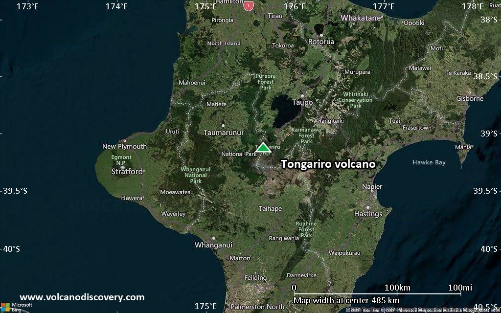
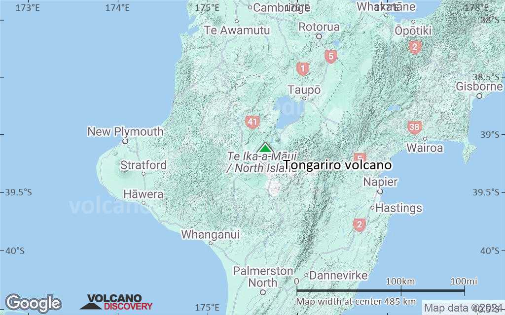
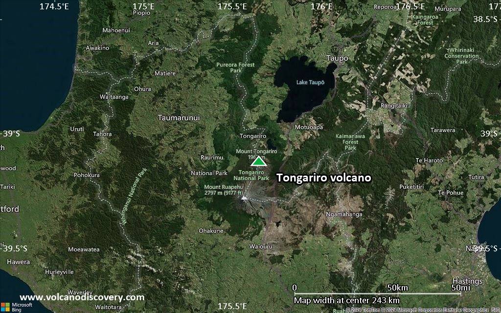
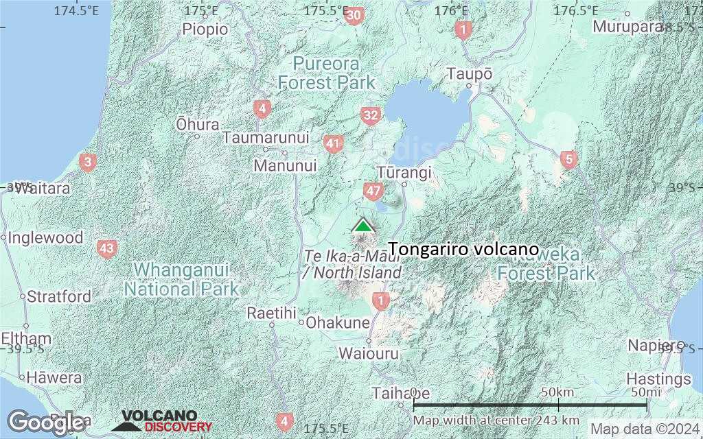
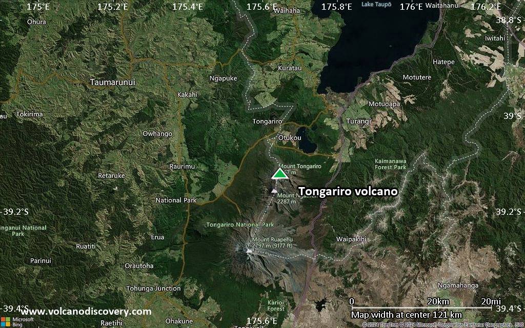
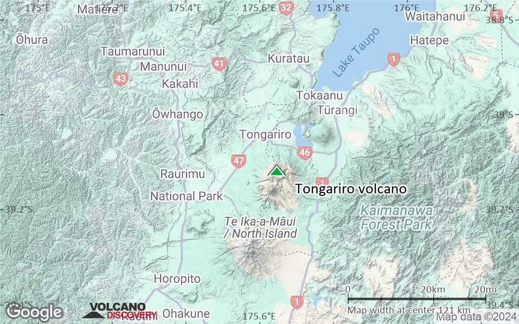
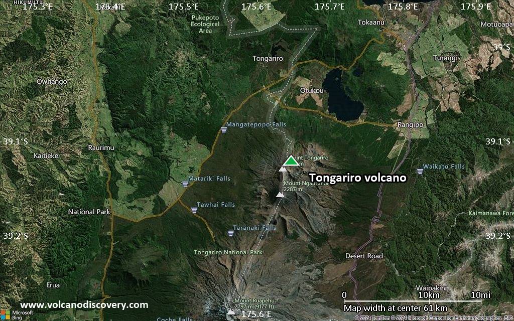
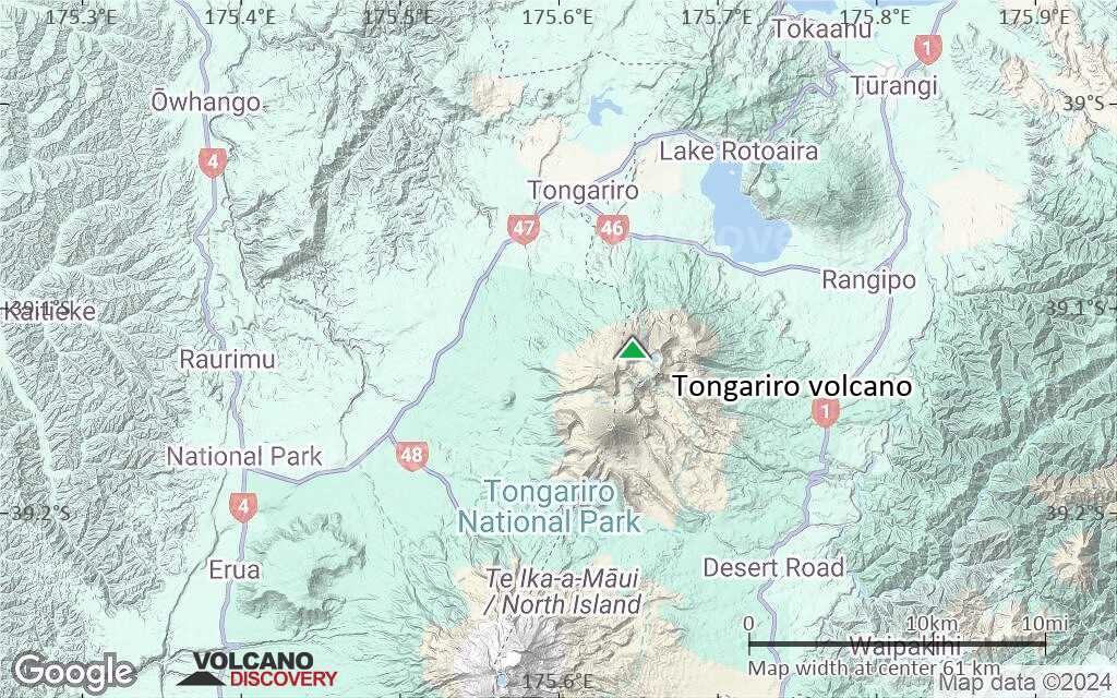
| RSS | EN | DE | EL | ES | FR | IT | RU

Tongariro Volcan

Updated: 6 mai 2025 11:03 GMT -
complex volcano
North Island, New Zealand, -39.12°S / 175.65°E
Summit height: 1978 m / 6,490 ft
Condition actuelle: normal / en sommeil (1 sur 5)
Last update: 10 déc. 2021

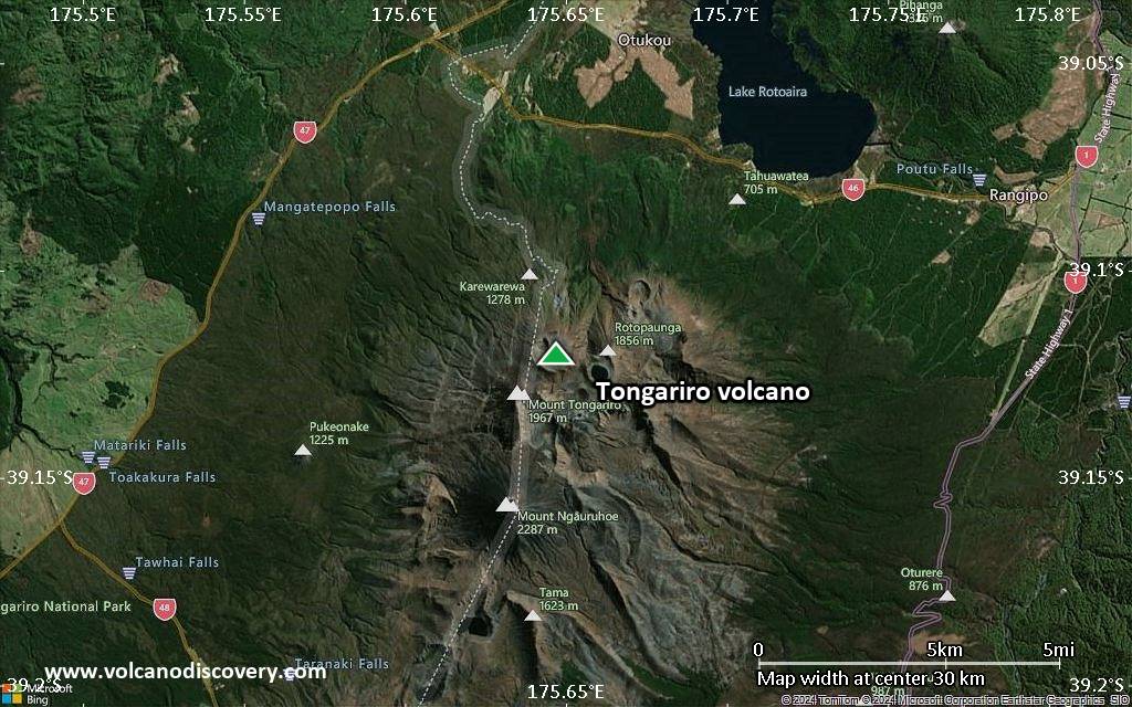
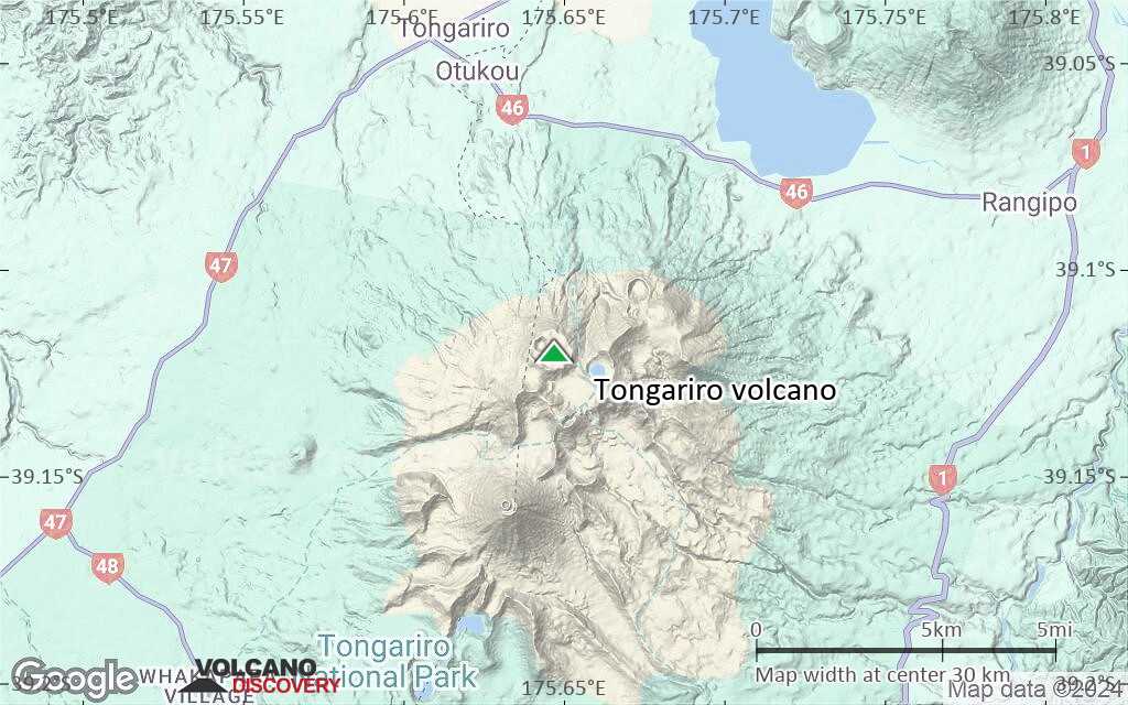
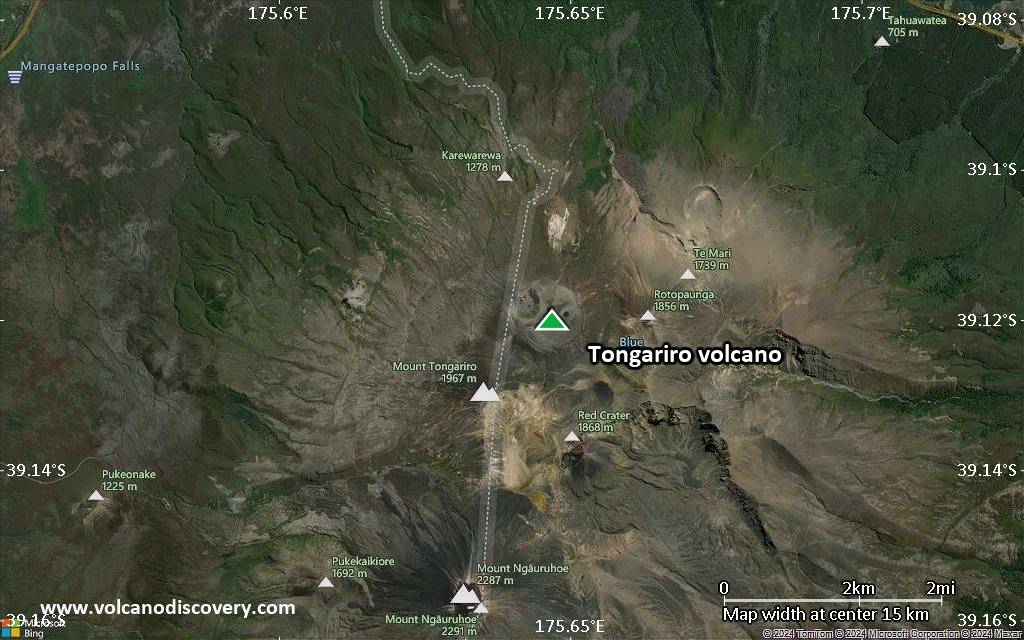
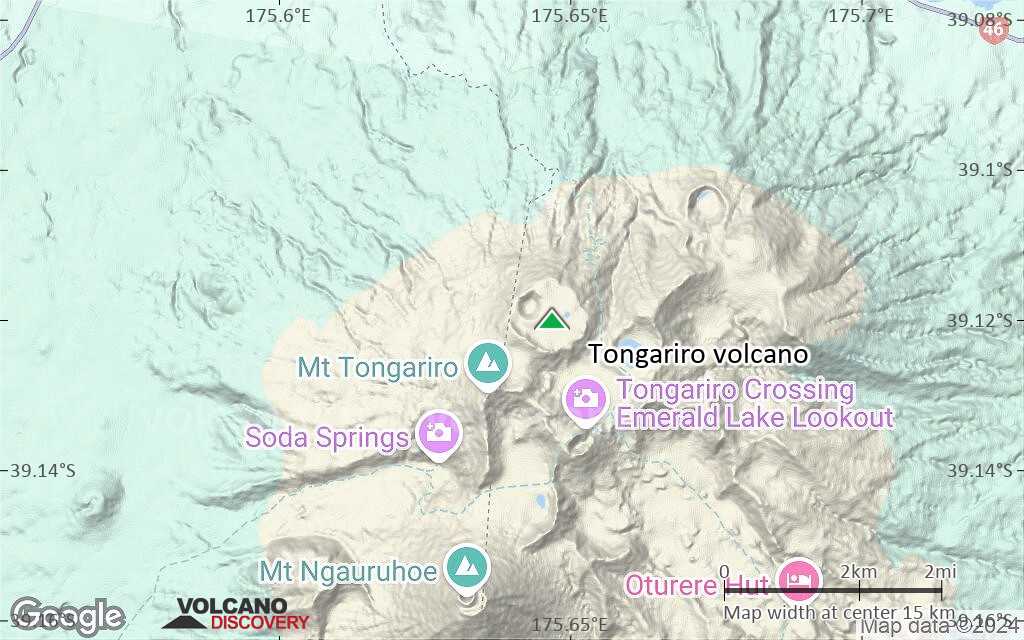
Tongariro volcano is a large complex volcano with about 12 craters and vents, including the steep stratovolcano Ngauruhoe, which is the focus of most activity in recent times.
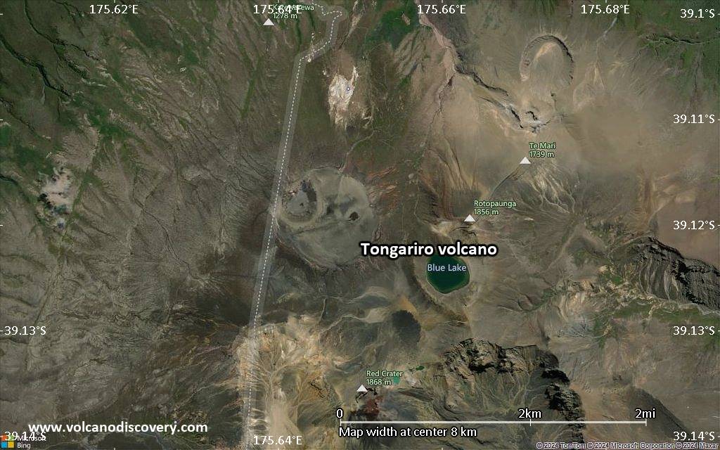
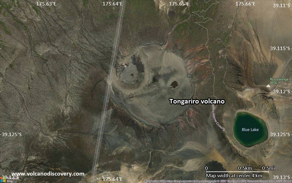
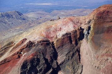
Tongariro with its colorful crater lakes, hot springs, fumaroles, numerous cones and lava deserts is one of the major tourist attractions of the North Island, and the famous "Tongariro crossing" is generally regarded as one of the most scenic hikes in the world.

[smaller] [larger]
Style éruptif tipique: explosive
Eruptions du volcan Tongariro: Eruptions outside Ngauruhoe, mainly on SSE flank (Red Crater): 6 Aug 2012, 1927 (?), 1926, 1896, 1890 (?), 1886, 1885±1, 1869, 1859, 1855, 1500 ± 50, 550 BC ± 200 years, 9350 BC (?), 9450 BC (?), 9650 BC (?), 9850 BC (?)
Eruptions from Ngauruhoe vent: 1975-77, 1972, 1968-69, 1962, 1958-59, 1956, 1948-54, 1939-40, 1937, 1934, 1931, 1924-28, 1917, 1913-14, 1909-10, 1904-07, 1897-98, 1892, 1883, 1881, 1878, 1875, 1869-70, 1862-64, 1857, 1844, 1841, 1839, 550 BC ± 200

Derniers séismes proches

Date et l'heureMag / Prof.Distance / Lieux
6 mai 21:57 (GMT +12)
1.6

10.5 km
29 km au sud-ouest 80 km au nord de Wanganui, Manawatu-Wanganui, Nouvelle-Zélande Info
6 mai 16:56 (GMT +12)
0.4

76 km
14 km au sud-ouest Manawatu-Wanganui, 76 km au sud-ouest de Taupo, Waikato, Nouvelle-Zélande Info
6 mai 14:49 (GMT +12)
0.6

67 km
21 km au sud-ouest 85 km au nord-est de Wanganui, Manawatu-Wanganui, Nouvelle-Zélande Info
lundi, 5 mai 2025 GMT (3 séismes)
6 mai 05:44 (GMT +12)
0.6

3.1 km
19 km au sud-ouest Manawatu-Wanganui, 119 km à l'ouest de Hastings, Hawke's Bay, Nouvelle-Zélande Info
6 mai 03:02 (GMT +12)
2.0

102 km
11 km au nord-ouest Manawatu-Wanganui, 64 km au sud-ouest de Taupo, Waikato, Nouvelle-Zélande Info
5 mai 22:42 (GMT +12)
0.9

11 km
28 km au sud-ouest 83 km au nord de Wanganui, Manawatu-Wanganui, Nouvelle-Zélande Info
dimanche, 4 mai 2025 GMT (2 séismes)
4 mai 20:59 (Temps Universel)
0.3

2 km
2.5 km au nord-est 59 km au sud-ouest de Taupo, Waikato, Nouvelle-Zélande Info
5 mai 04:01 (GMT +12)
1.6

88 km
12 km au sud-est Waikato, 100 km au nord-est de Wanganui, Manawatu-Wanganui, Nouvelle-Zélande Info
dimanche, 27 avril 2025 GMT (1 séisme)
27 avril 15:23 (GMT +12)
1.3

14 km
28 km au sud-ouest 83 km au nord de Wanganui, Manawatu-Wanganui, Nouvelle-Zélande Info

Introduction

Tongariro is a large andesitic volcanic massif, located immediately NE of Ruapehu volcano, that is composed of more than a dozen composite cones constructed over a period of 275,000 years.
Vents along a NE-trending zone extending from Saddle Cone (below Ruapehu volcano) to Te Mari crater (including vents at the present-day location of Ngauruhoe) were active during a several hundred year long period around 10,000 years ago, producing the largest known eruptions at the Tongariro complex during the Holocene. North Crater stratovolcano, one of the largest features of the massif, is truncated by a broad, shallow crater filled by a solidified lava lake that is cut on the NW side by a small explosion crater.
The youngest cone of the complex, Ngauruhoe, has grown to become the highest peak of the massif since its birth about 2500 years ago. The symmetrical, steep-sided Ngauruhoe, along with its neighbor Ruapehu to the south, have been New Zealand's most active volcanoes during historical time.

Tongariro Volcano Photos

Éruptions volcaniques importantes: volcano Tongariro

In the past 10,000 years, Tongariro has had at least 76 confirmed volcanic eruptions, out of which 70 are documented by historical records, while the others can be inferred from geological evidence.
Additionally, there are 3 uncertain or discredited eruptions from Tongariro volcano.
The table below lists all known eruptions (date in bold face) of Tongariro volcano since around 1900. Updates on the most recent volcanic activity of Tongariro can be found on the news page of Tongariro volcano.
DateNoteVEIMortsDommages
2012 Nov 21Upper Te Maari Craters
Obs./docs historiques
2
inconnu
2012 Août 6 - Août 7Upper Te Maari Craters
Obs./docs historiques
2
inconnu
1977 Jul 4Ngauruhoe
Obs./docs historiques
1
inconnu
1976 Août 23 - Août 28Ngauruhoe
Obs./docs historiques
1
inconnu
1975 Fév 12 - Fév 23Ngauruhoe
Obs./docs historiques
3
inconnu
1972 Nov 22 - 1974 Août 19Ngauruhoe
Obs./docs historiques
3
inconnu
1972 Mar 19 - Jun 6Ngauruhoe
Obs./docs historiques
2
inconnu
1969 Jan 21Ngauruhoe
Obs./docs historiques
2
inconnu
1968 Août 18Ngauruhoe
Obs./docs historiques
2
inconnu
1962 Mai 24Ngauruhoe
Obs./docs historiques
2
inconnu
1959 Jun 1Ngauruhoe
Obs./docs historiques
2
inconnu
1958 Nov 5 - Nov 18 ?Ngauruhoe
Obs./docs historiques
2
inconnu
1956 Jan 11 - Fév 11Ngauruhoe (south sub-crater)
Obs./docs historiques
2
inconnu
1954 Mai 13 - 1955 Jun 25Ngauruhoe (south sub-crater)
Obs./docs historiques
3
inconnu
1953 Déc 28 ou avantNgauruhoe (south sub-crater)
Obs./docs historiques
?
inconnu
1952 Nov 29 - 1953 Jul 16 ±15 d.Ngauruhoe (south sub-crater)
Obs./docs historiques
2
inconnu
1951 Mai 16 ±15 d.Ngauruhoe
Obs./docs historiques
2
inconnu
1950 Jun 16Ngauruhoe
Obs./docs historiques
2
inconnu
1949 Fév 9 - Mar 3Ngauruhoe (south sub-crater)
Obs./docs historiques
2
inconnu
1948 SepNgauruhoe
Obs./docs historiques
2
inconnu
1948 Avr 30 - MaiNgauruhoe
Obs./docs historiques
2
inconnu
1940 Sep - OctNgauruhoe
Obs./docs historiques
2
inconnu
1939 AoûtNgauruhoe
Obs./docs historiques
2
inconnu
1937 JanNgauruhoe
Obs./docs historiques
2
inconnu
1934 Déc - 1935 FévNgauruhoe
Obs./docs historiques
2
inconnu
1934 JunNgauruhoe
Obs./docs historiques
2
inconnu
1931 Fév - MaiNgauruhoe
Obs./docs historiques
2
inconnu
1928 JulNgauruhoe
Obs./docs historiques
2
inconnu
1928 Mar 3Ngauruhoe
Obs./docs historiques
2
inconnu
1926 Déc 21 - Déc 30 ?Ngauruhoe
Obs./docs historiques
2
inconnu
?? 1927
Éruption incertaine
1?
inconnu
1926 Avr 16 - JunNgauruhoe and Red Crater
Obs./docs historiques
2
inconnu
1925 Nov - DécNgauruhoe
Obs./docs historiques
2
inconnu
1924 Oct - NovNgauruhoe
Obs./docs historiques
2
inconnu
1924 Mai 22Ngauruhoe
Obs./docs historiques
2
inconnu
1924 Jan 9 - Jan 30Ngauruhoe
Obs./docs historiques
2
inconnu
1917 Oct - NovNgauruhoe
Obs./docs historiques
2
inconnu
1914 Sep - OctNgauruhoe
Obs./docs historiques
2
inconnu
1913 MaiNgauruhoe
Obs./docs historiques
2
inconnu
1913 JanNgauruhoe
Obs./docs historiques
2
inconnu
1910 Oct - 1911 JanNgauruhoe
Obs./docs historiques
2
inconnu
1910 JanNgauruhoe
Obs./docs historiques
2
inconnu
1909 Mar - JulNgauruhoe
Obs./docs historiques
2
inconnu
1907 NovNgauruhoe
Obs./docs historiques
2
inconnu
1907 Fév - MaiNgauruhoe (south sub-crater)
Obs./docs historiques
2
inconnu
1906 MarNgauruhoe
Obs./docs historiques
2
inconnu
1905Ngauruhoe
Obs./docs historiques
2
inconnu
1904 Nov 22Ngauruhoe
Obs./docs historiques
2
inconnu
Remark:
Our list of volcanic eruptions closely follows the database of eruptions of the Smithsonian's Global Volcanism Project (GVP), the internationally most recognized data source for volcanic eruptions, but also includes significant eruptive episodes or related volcano events. "Volcanic eruptions" are usually to be understood as sequences of individual eruptive episodes that can follow each other, or even overlap (if several vents are involved), and can last many years, decades or even longer. For example, the current activity of Stromboli volcano is understood as a single eruption that has been ongoing since 1934.
Sources: NOAA National Centers for Environmental Information (NCEI), Global Significant Volcanic Eruptions Database. doi:10.7289/V5TD9V7K | Global Volcanism Project / Smithsonian Institution

Eruptions du volcan Tongariro


6 August 2012 eruption
A brief but violent phreatic eruption occurred at 23:50 local time on 6 August from new vents near the Te Mari crater of Tongariro.
The explosion followed several weeks of increased earthquakes under the volcano. It produced a 7 km tall ash plume and threw ballistic blocks of up to 1 m diameter to 1.5-2 km distance.

An interesting news article with eyewitness accounts and other information: First Tongariro eruption in over 100 years ...plus d'info

Tongariro Volcano FAQ

+When was the last eruption of Tongariro volcano?

+How often does Tongariro volcano erupt?

+How active is Tongariro volcano at present?

+When was the largest eruption of Tongariro volcano?

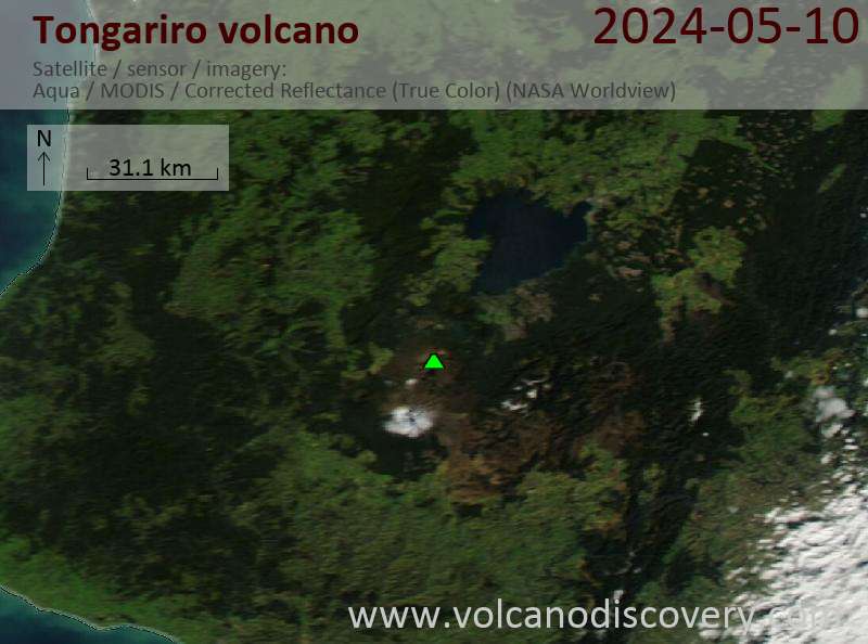
Dernières images satellite

Tongariro image satellite sat1Tongariro image satellite sat2

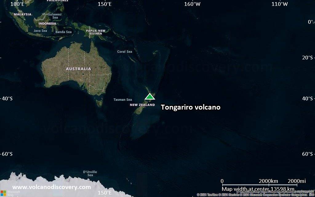
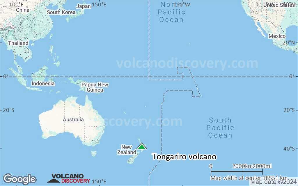
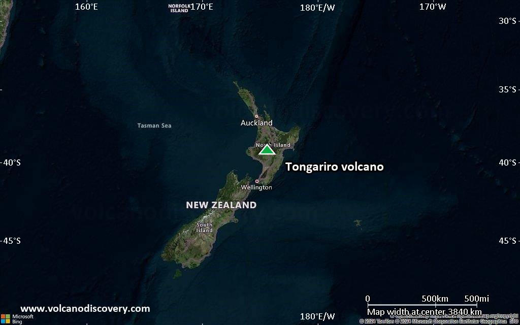
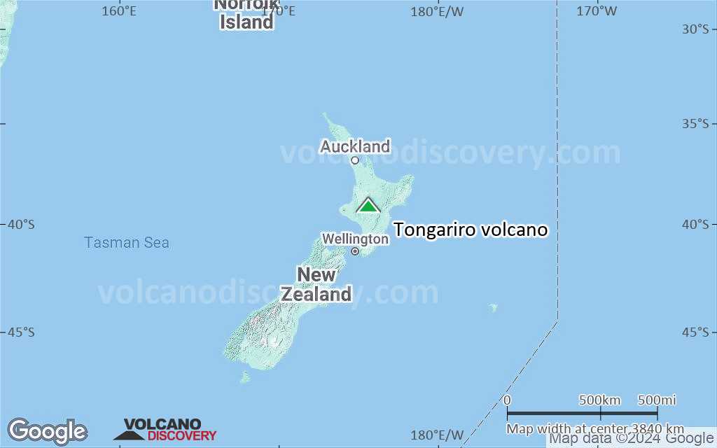
Tongariro Volcan Cartes

Below is a selection of maps showing the location and surroundings of the volcano at various resolutions based on aerial-imagery / terrain maps. Feel free to use them for non-commercial purposes on your blog or website as long as you credit them with a link back to this page (click to copy it).
Satellite/aerial-type map of Tongariro volcano (world scale)
Terrain-type map of Tongariro volcano (world scale)
Satellite/aerial-type map of Tongariro volcano (region scale large)
Terrain-type map of Tongariro volcano (region scale large)
Satellite/aerial-type map of Tongariro volcano (region scale medium)
Terrain-type map of Tongariro volcano (region scale medium)
Satellite/aerial-type map of Tongariro volcano (region scale small)
Terrain-type map of Tongariro volcano (region scale small)
Satellite/aerial-type map of Tongariro volcano (local scale large)
Terrain-type map of Tongariro volcano (local scale large)
Satellite/aerial-type map of Tongariro volcano (local scale medium)
Terrain-type map of Tongariro volcano (local scale medium)
Satellite/aerial-type map of Tongariro volcano (local scale small)
Terrain-type map of Tongariro volcano (local scale small)
Satellite/aerial-type map of Tongariro volcano (scale of 10s of km)
Terrain-type map of Tongariro volcano (scale of 10s of km)
Satellite/aerial-type map of Tongariro volcano (scale of 20-40 km)
Terrain-type map of Tongariro volcano (scale of 20-40 km)
Satellite/aerial-type map of Tongariro volcano (scale of approx. 10-20 km)
Terrain-type map of Tongariro volcano (scale of approx. 10-20 km)
Satellite/aerial-type map of Tongariro volcano (scale of 5-10 km)
Satellite/aerial-type map of Tongariro volcano (scale of few kilometers)
Volcanoes & Earthquakes - new app for Android
Départs garantis:
9-25 juin 2025: Volcans et Épices - Mer des Moluques (Sulawesi, Indonésie)
7-22 juil. 2025: Du Krakatau à Bali - Java (Indonésie)
7-23 juil. 2025: Volcans et Épices - Mer des Moluques (Sulawesi, Indonésie)
1-17 août 2025: Volcans et Épices - Mer des Moluques (Sulawesi, Indonésie)
1-14 oct. 2025: Désert, sels et volcans - Désert de Danakil (Éthiopie)
4-12 oct. 2025: Montagnes de Feu - du Stromboli à l'Etna - Eoliennes + Etna
6-21 oct. 2025: Du Krakatau à Bali - Java (Indonésie)
3-19 nov. 2025: Volcans et Épices - Mer des Moluques (Sulawesi, Indonésie)
= Places libres   = Départ garanti   = Quelques places disponibles   = Groupe fermé
dim., 23 août 2015, 11:05

Tongariro volcano (New Zealand): alert level lowered back to green

On 19 August GeoNet reported that activity at Tongariro's Te Maari Craters had declined significantly since the eruption in 2012, with data suggesting that unrest associated with the eruption was over. Tout lire
mer., 19 août 2015, 06:00

Tongariro volcano (North Island, New Zealand) - Smithsonian / USGS Weekly Volcanic Activity Report for 19 August-25 August 2015 (Continuing Activity)

On 19 August GeoNet reported that activity at Tongariro's Te Maari Craters had declined significantly since the eruption in 2012, with data suggesting that unrest associated with the eruption was over. The Volcanic Alert Level was lowered to 0 (on a scale of 0-5). The Volcanic Alert Level for Ngauruhoe is separate and had been lowered to 0 on 20 April. ... Tout lire

Sur cette page:

Try our free app!
Volcanoes & Earthquakes - new app for Android
Android | iOS version

More on VolcanoDiscovery

Why is there advertising on this site?

Support us - Help us upgrade our services!

We truly love working to bring you the latest volcano and earthquake data from around the world. Maintaining our website and our free apps does require, however, considerable time and resources.
We need financing to increase hard- and software capacity as well as support our editor team. We're aiming to achieve uninterrupted service wherever an earthquake or volcano eruption unfolds, and your donations can make it happen! Every donation will be highly appreciated. If you find the information useful and would like to support our team in integrating further features, write great content, and in upgrading our soft- and hardware, please make a donation (PayPal).

Planned features:Thanks to your past donations, these features have been added recently:
Download and Upgrade the Volcanoes & Earthquakes app to get one of the fastest seismic and volcano alerts online:
Android | IOS
Thank you!
Copyright: VolcanoDiscovery ou autres sources indiquées.
Utilisation des documents: Les textes, les images et les vidéos de ce site internet sont protégées par copyright. Toute reproduction et tout usage sans accord préalable ne sont pas autorisés. Si vous désirez acquérir pour certains documents (photos, vidéos, textes ou autres) le droit de reproduction, d'édition et, plus généralement, de toute utilisation destinée à un usage public, qu'elle soit commerciale ou pas, vous êtes priés de nous contacter.
Volcanoes & Earthquakes
VolcanoDiscovery Home
Volcans | Séismes | Photos | Actualités | | Shop | App
Adventure & Study Travel
Tours to Volcanoes and Volcanic Areas: walking tours, photo tours, study tours
Voyages |
Get our newsletter!
Company info
Contact | Mentions légales | Terms & conditions
Follow us
Follow us on facebook Follow us on Instagram Follow us on Bluesky Follow us on Twitter Visit our Youtube channel
EN | DE | EL | ES | FR | IT | RU
VolcanoDiscovery GmbH, Germany, Reg. nr.: HRB 103744, EU Tax Id: DE 297 465 123 owned and created by
Dr. Tom Pfeiffer, volcanologist, volcano photographer, tour organizer member of
IAVCEI
IAVCEI
Vulkanologische Gesellschaft
Volcanological Society
Ecotourism Greece
Ecotourism Greece
RUV insurance
Insured by R+V
VolcanoDiscovery © 2004- All Rights Reserved | Privacy - Changer Préférences