| RSS | EN | DE | EL | ES | FR | IT | RU

Hakone Volcano

Updated: Sep 6, 2025 09:58 GMT -
complex volcano
Honshu (Japan), 35.23°N / 139.02°E
Summit height: 1438 m / 4,718 ft
Current status: normal or dormant (1 out of 5)
Last update: 12 Dec 2021 (Smithsonian / USGS Weekly Volcanic Activity Report)

Hakone (Hakoneyama) volcano is located 80 km SW of Tokyo. It is a massive stratovolcano truncated by 2 overlapping calderas, the largest being 11 x 10 km wide. It contains several younger vents, mostly lava domes, on a SW-NE trend cutting through the center of the caldera. The Kami-yama stratovolcano, the youngest of these, forms the high point of the volcano.
The calderas are breached to the east by the Haya-kawa canyon. The scenic Lake Ashi (Ashinoko) was created by a phreatic eruption 3000 yeas ago, which followed the collapse of the NW flank of the largest and youngest of the lava domes and dammed the Haya-kawa valley.
The last activity of Hakone volcano was ca. 800 years ago and consisted in phreatic explosions.
Lake Ashi and other major thermal areas in the caldera are a tourist destination SW of Tokyo.

[smaller] [larger]
Typical eruption style: phreatic explosions
Hakone volcano eruptions: 1170 AD ± 100 years (radiocarbon dated), 50 BC (?), 1050 BC (?), 1200 BC (?), 1400 BC ± 100 years, 3700 BC ± 100 years, 6000 BC ± 100 years

Latest nearby earthquakes

Date and TimeMag / DepthDistance / Location
Sep 6, 04:24 pm (GMT +9)
1.0

13 km
22 km (14 mi) to the NE 7.7 km northwest of Hadano, Kanagawa, Japan Info
Friday, September 5, 2025 GMT (2 quakes)
Sep 6, 08:22 am (GMT +9)
0.3

23 km
23 km (14 mi) to the N Japan: Eastern Yamanashi Pref Info
Sep 5, 10:30 pm (GMT +9)
0.3

13 km
24 km (15 mi) to the NE Japan: Kanagawa Pref Info
Thursday, September 4, 2025 GMT (2 quakes)
Sep 5, 02:20 am (GMT +9)
0.9

17 km
18 km (11 mi) to the N Japan: Kanagawa Pref Info
Sep 4, 08:32 pm (GMT +9)
0.4

15 km
24 km (15 mi) to the N Japan: Kanagawa Pref Info
Wednesday, September 3, 2025 GMT (1 quake)
Sep 4, 05:51 am (GMT +9)
0.6

5.2 km
3.2 km (2 mi) to the SW Japan: Hakone Region Info
Tuesday, September 2, 2025 GMT (2 quakes)
Sep 3, 06:16 am (GMT +9)
0.2

3.4 km
0.3 km (0.2 mi) to the SW Japan: Hakone Region Info
Sep 3, 05:49 am (GMT +9)
2.3

4.4 km
0.7 km (0.4 mi) to the SW 13 km west of Odawara, Kanagawa, Japan 1 reportInfo
Thursday, August 28, 2025 GMT (2 quakes)
Aug 29, 03:39 am (GMT +9)
2.6

6.3 km
18 km (11 mi) to the SE Japan: E Off Izu Peninsula 1 reportInfo

Background

The Hakone volcano calderas were formed as a result of 2 major explosive eruptions about 180,000 and 49,000-60,000 years ago.
Dome growth after the caldera formation occurred progressively to the south. Ōwakudani (大涌谷, lit. "Great Boiling Valley") is a valley with intense hydrothermal activity and the location of several phreatic explosions in the past.
The latest magmatic eruption from Hakone was ca. 2900 years ago and produced a pyroclastic flow and a lava dome in the explosion crater. Phreatic eruptions have last occurred in the 12-13th centuries AD. Seismic swarms occurred at Hakone during the 20th century.
(Source: Smithsonian / GVP volcano information)

Significant volcanic eruptions: Hakone volcano

In the past 10,000 years, Hakone has had only one confirmed historic eruption in 2015, but at least 7 eruptions can be inferred from geological evidence.
The table below lists all known eruptions (date in bold face) of Hakone volcano in historic times and during the past 10,000 years. Updates on the most recent volcanic activity of Hakone can be found on the news page of Hakone volcano.
DateNoteVEIDeathsDamage
2015 Jun 29 - Jul 1Owakudani hot springs, 1 km N of Kamiyama dome
Historical obs./docs.
1
1972 Oct 2
(eruptive episode 1972 Oct 2)
02
Info
1953 Jul 26
(eruptive episode 1953 Jul 26)
010
Info
1952 Mar 27
(eruptive episode 1952 Mar 27)
01
Info
1951 Nov 5
(eruptive episode 1951 Nov 5)
02
Info
1933 May 10
(eruptive episode 1933 May 10)
01
Info
1170 ±100 y. ADOwakudani?
50 ? BCNE of Kamiyama?
1050 ? BCNE of Kamiyama?
1200 ? BCNW side of Kami-yama (Kanmuriga-take)2
1400 ±100 y. BCNW side of Kami-yama (Kanmuriga-take)?
3700 ±100 y. BCFutago-yama1
6000 ±100 y. BCKami-yama3
Remark:
Our list of volcanic eruptions closely follows the database of eruptions of the Smithsonian's Global Volcanism Project (GVP), the internationally most recognized data source for volcanic eruptions, but also includes significant eruptive episodes or related volcano events. "Volcanic eruptions" are usually to be understood as sequences of individual eruptive episodes that can follow each other, or even overlap (if several vents are involved), and can last many years, decades or even longer. For example, the current activity of Stromboli volcano is understood as a single eruption that has been ongoing since 1934.
Sources: NOAA National Centers for Environmental Information (NCEI), Global Significant Volcanic Eruptions Database. doi:10.7289/V5TD9V7K | Global Volcanism Project / Smithsonian Institution

Eruptions of Hakone volcano


1991 seismic swarm
On 22 April 1991, 300 earthquakes were recorded 5 km beneath the central part of the caldera, but no eruption has followed.

Hakone Volcano FAQ

+When was the last eruption of Hakone volcano?

+How often does Hakone volcano erupt?

+How active is Hakone volcano at present?

+When was the largest eruption of Hakone volcano?

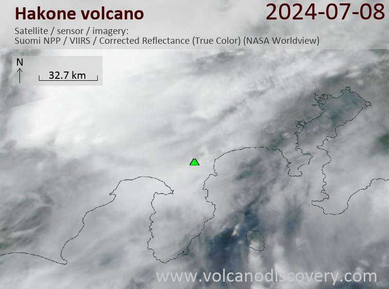
Latest satellite images

Hakone satellite image sat1Hakone satellite image sat2

Hakone Volcano Maps

Below is a selection of maps showing the location and surroundings of the volcano at various resolutions based on aerial-imagery / terrain maps. Feel free to use them for non-commercial purposes on your blog or website as long as you credit them with a link back to this page (click to copy it).
Satellite/aerial-type map of Hakone volcano (world scale)
Terrain-type map of Hakone volcano (world scale)
Satellite/aerial-type map of Hakone volcano (region scale large)
Terrain-type map of Hakone volcano (region scale large)
Satellite/aerial-type map of Hakone volcano (region scale medium)
Terrain-type map of Hakone volcano (region scale medium)
Satellite/aerial-type map of Hakone volcano (region scale small)
Terrain-type map of Hakone volcano (region scale small)
Satellite/aerial-type map of Hakone volcano (local scale large)
Terrain-type map of Hakone volcano (local scale large)
Satellite/aerial-type map of Hakone volcano (local scale medium)
Terrain-type map of Hakone volcano (local scale medium)
Satellite/aerial-type map of Hakone volcano (local scale small)
Terrain-type map of Hakone volcano (local scale small)
Satellite/aerial-type map of Hakone volcano (scale of 10s of km)
Terrain-type map of Hakone volcano (scale of 10s of km)
Satellite/aerial-type map of Hakone volcano (scale of 20-40 km)
Terrain-type map of Hakone volcano (scale of 20-40 km)
Satellite/aerial-type map of Hakone volcano (scale of approx. 10-20 km)
Terrain-type map of Hakone volcano (scale of approx. 10-20 km)
Satellite/aerial-type map of Hakone volcano (scale of 5-10 km)
Satellite/aerial-type map of Hakone volcano (scale of few kilometers)
Volcanoes & Earthquakes - new app for Android
Guaranteed tours
6-21 Oct 2025: From Krakatau to Bali - Java (Indonesia)
3-19 Nov 2025: Volcanoes and Spices - Sulawesi/Halmahera (Indonesia)
9-19 Nov 2025: Guatemala Volcano Special - Guatemala
20 Nov - 3 Dec 2025: Desert, salt and volcanoes - Danakil desert (Ethiopia)
2-10 May 2026: From Stromboli to Etna - Sicily and Eolian Islands (Italy)
= spaces available   = guaranteed   = few spaces left   = booked out
Wed, 2 Oct 2019, 06:00

Hakoneyama volcano (Honshu, Japan) - Smithsonian / USGS Weekly Volcanic Activity Report for 2 October-8 October 2019 (Continuing Activity)

On 7 October JMA lowered the Alert Level for Hakoneyama to 1 (the lowest level on a 5-level scale), noting that the number of volcanic earthquakes had decreased to background levels after a spike in seismicity was recorded in May. Inflation had been detected but had become almost stagnant after late August. Fumaroles in the Owakudani hot springs area continued to be active, with gas-and-steam plumes rising 100-400 m above their vents. ... Read all
Wed, 22 May 2019, 06:00

Hakoneyama volcano (Honshu, Japan) - Smithsonian / USGS Weekly Volcanic Activity Report for 22 May-28 May 2019 (New Activity / Unrest)

JMA reported that the number of earthquakes at Hakoneyama increased on 18 May and remained elevated through 27 May. The epicenters were centered around the W bank of Lake Ashinoko and around Komagatake. Global Navigation Satellite Systems (GNSS) data continued to indicate a trend of inflation. ... Read all

On this page:

Try our free app!
Volcanoes & Earthquakes - new app for Android
Android | iOS version

More on VolcanoDiscovery

Why is there advertising on this site?

Support Us – Help Us Enhance Our Services!

We’re passionate about delivering the latest volcano and earthquake data from around the globe — just for you. However, maintaining our website and free apps requires significant time, effort, and resources.
Your support helps us expand our hardware and software capabilities and empowers our dedicated editorial team. Our mission is to provide uninterrupted, real-time updates whenever an earthquake strikes or a volcano erupts — and your donations make this possible. Every contribution, big or small, is deeply appreciated. If you find our information valuable and want to help us add new features, create compelling content, and improve our technology, please consider making a donation:

Donate with Card or Apple/Google Pay:

Send €5 payment link to support VolcanoDiscovery with 5 EUR
€10 payment link to support VolcanoDiscovery with 10 EUR
€25 payment link to support VolcanoDiscovery with 25 EUR
€50 payment link to support VolcanoDiscovery with 50 EUR
€100 payment link to support VolcanoDiscovery with 100 EUR
€250 payment link to support VolcanoDiscovery with 250 EUR

Donate with PayPal:

Planned Features:

Thanks to your past donations, we have recently added:
Download the Volcanoes & Earthquakes app to stay among the first to receive the fastest seismic and volcano alerts online:
Android | iOS
Thank you for being part of our mission!
Sources: VolcanoDiscovery / VolcanoAdventures and other sources as noted.
Use of material: Most text and images on our websites are owned by us. Re-use is generally not permitted without authorization. Contact us for licensing rights.
Volcanoes & Earthquakes
VolcanoDiscovery Home
Volcanoes | Earthquakes | Photos | Volcano News | | Shop | App
Adventure & Study Travel
Tours to Volcanoes and Volcanic Areas: walking tours, photo tours, study tours
Tours & Dates | FAQ | About us
Get our newsletter!
Company info
Contact | Legal info | Terms & conditions
Follow us
Follow us on facebook Follow us on Instagram Follow us on Bluesky Follow us on Twitter Visit our Youtube channel
EN | DE | EL | ES | FR | IT | RU
VolcanoDiscovery GmbH, Germany, Reg. nr.: HRB 103744, EU Tax Id: DE 297 465 123 owned and created by
Dr. Tom Pfeiffer, volcanologist, volcano photographer, tour organizer member of
IAVCEI
IAVCEI
Vulkanologische Gesellschaft
Volcanological Society
Ecotourism Greece
Ecotourism Greece
RUV insurance
Insured by R+V
VolcanoDiscovery © 2004- All Rights Reserved | Privacy - Cookie Settings