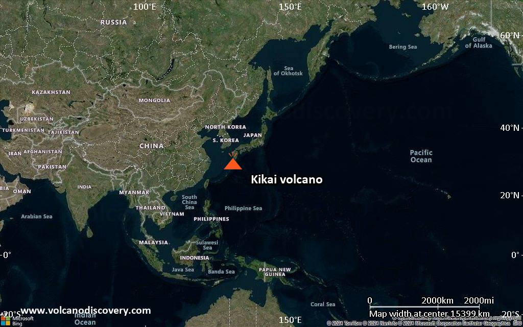
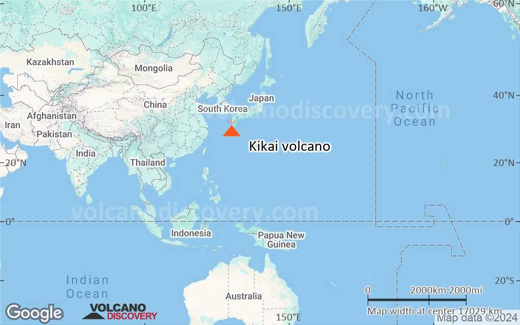
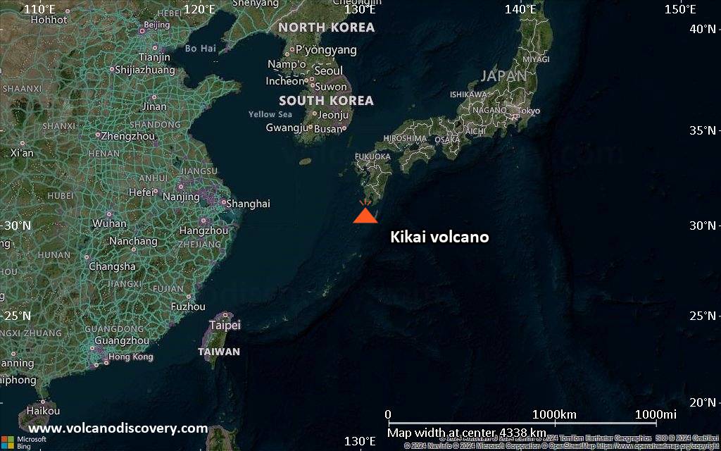
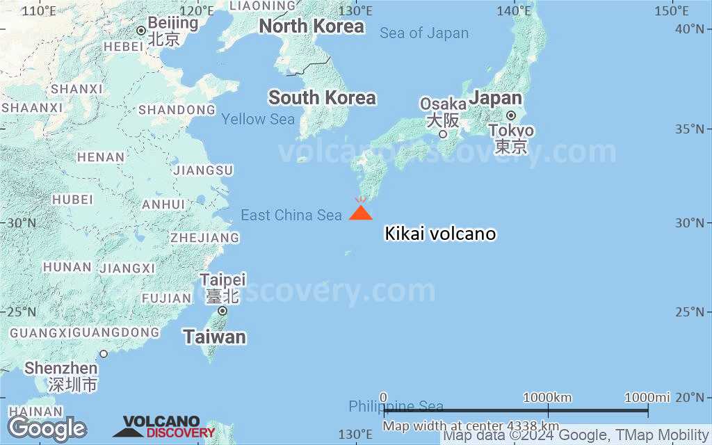
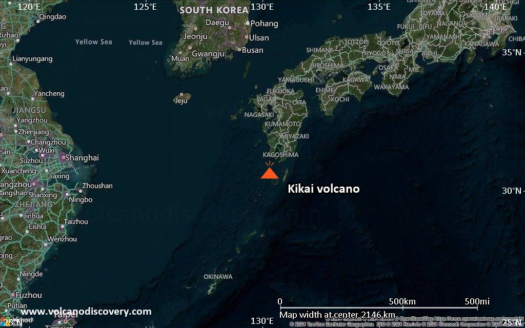
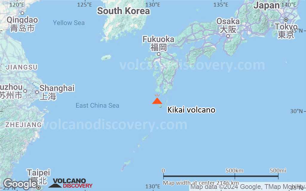
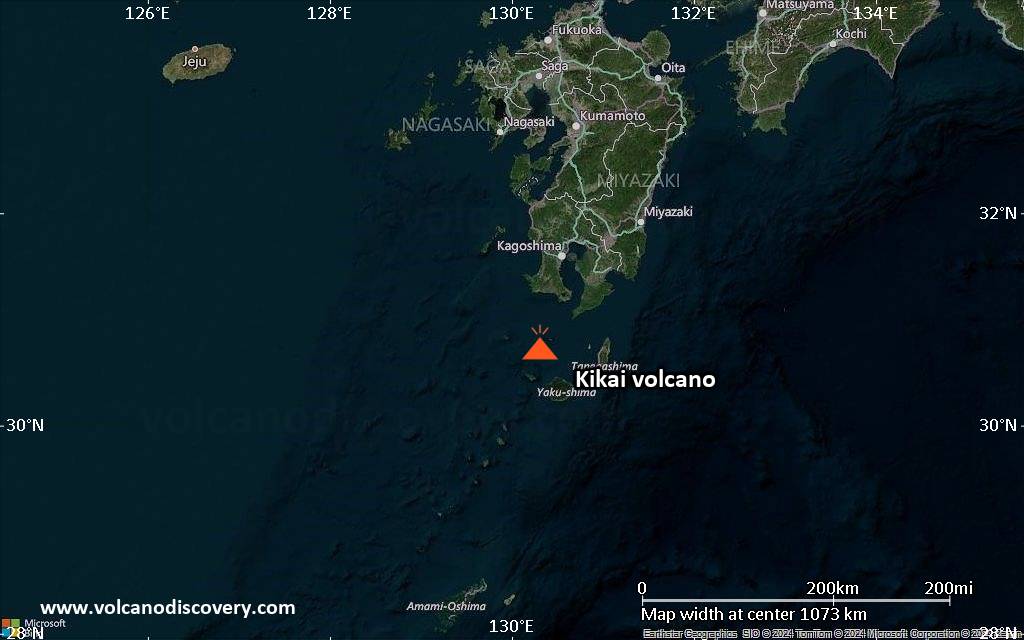
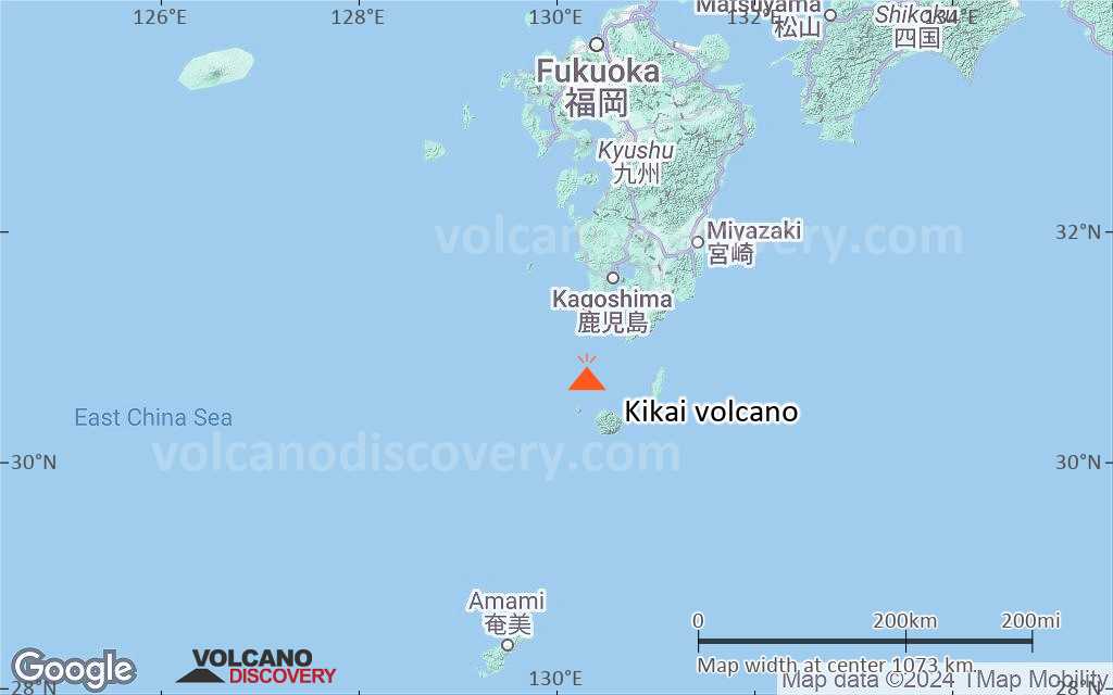
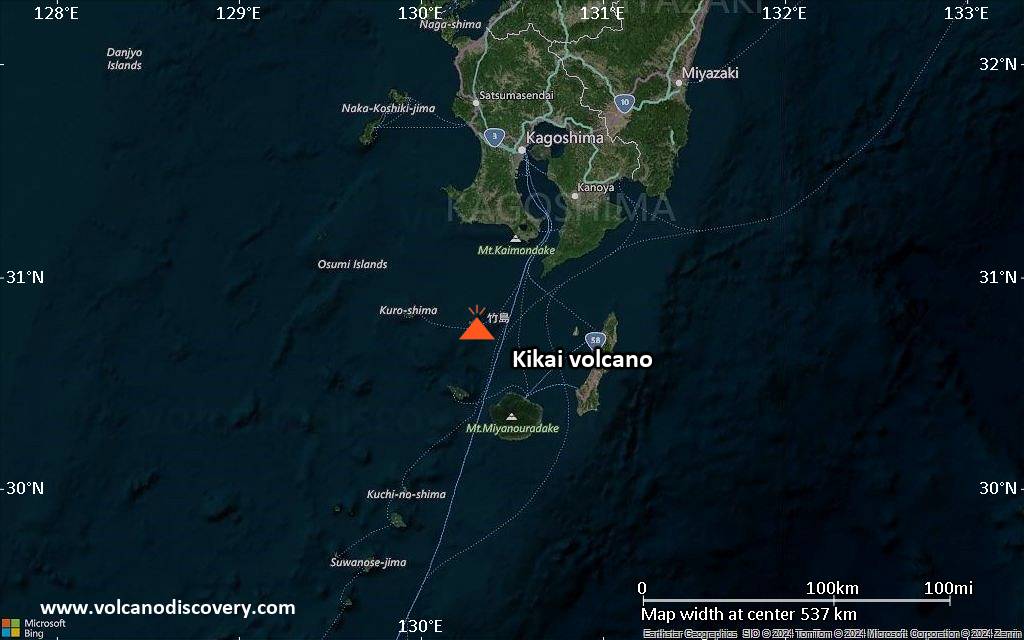
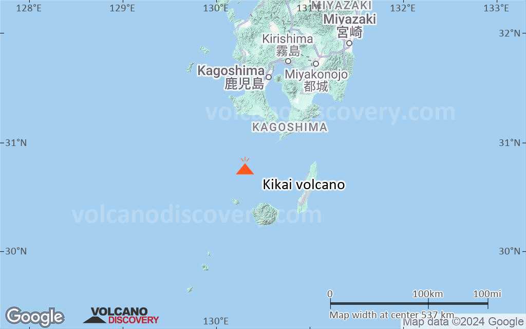
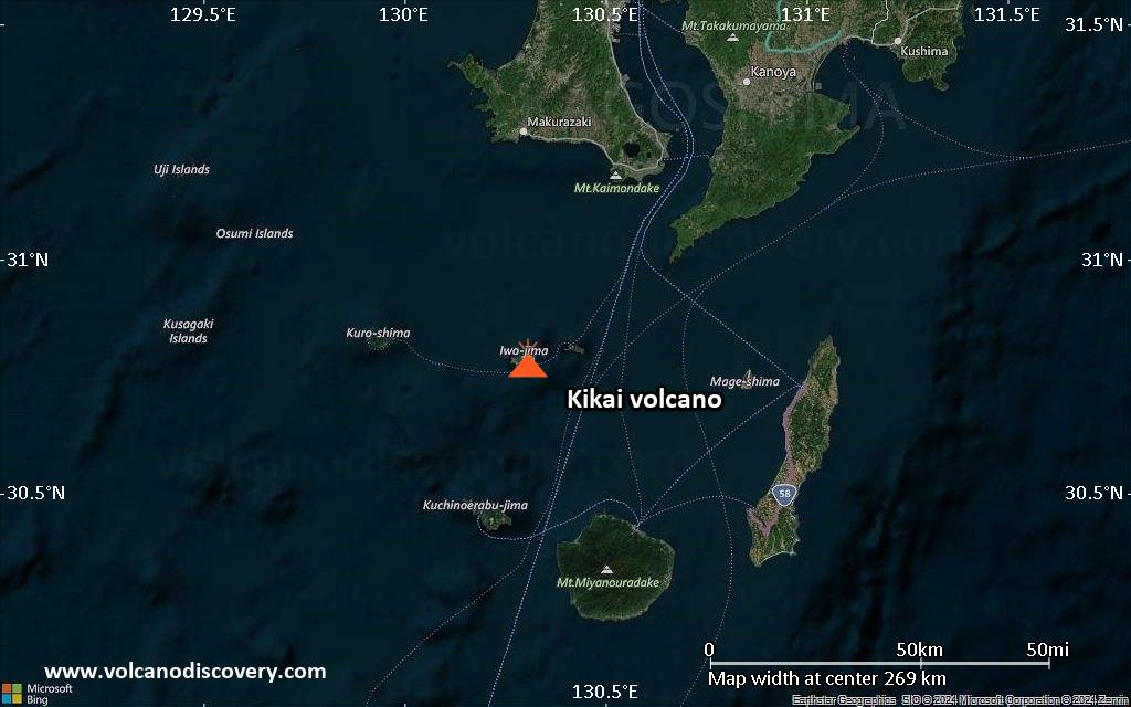
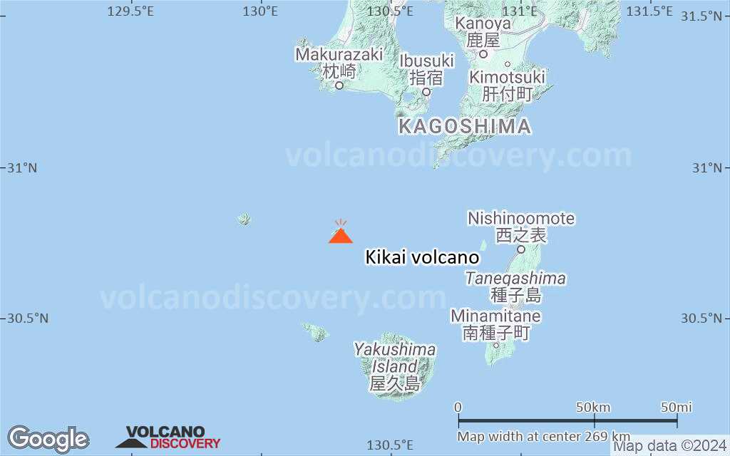
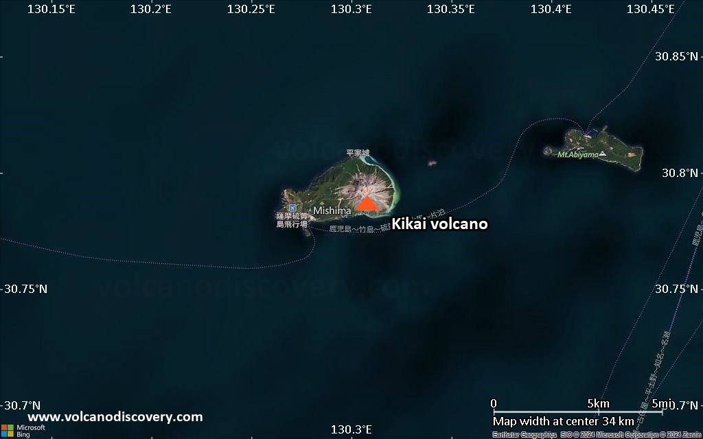
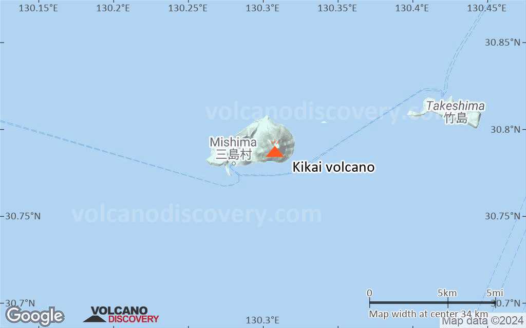
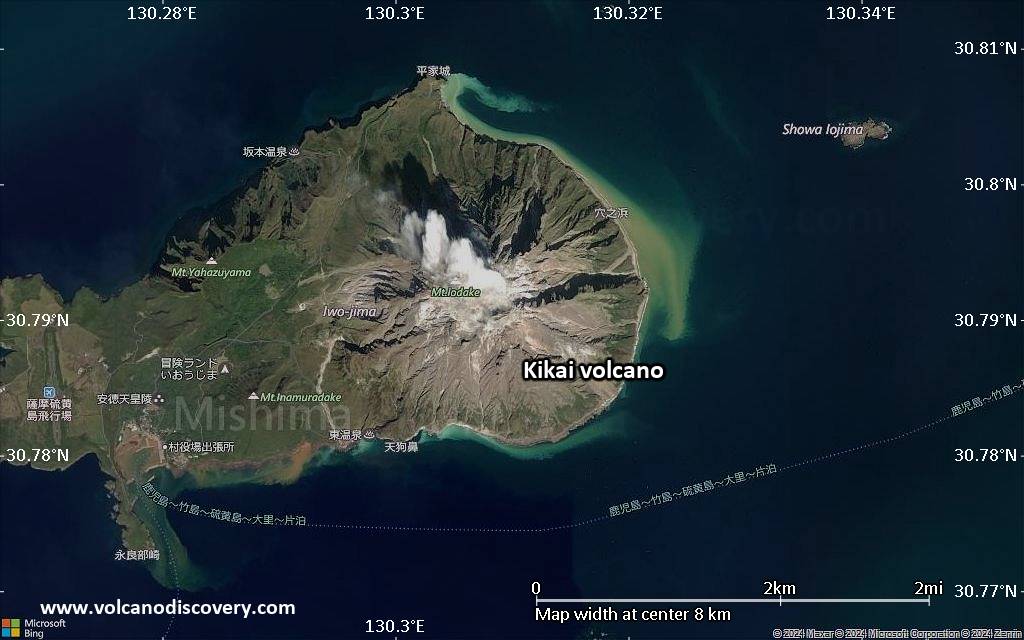
| RSS | EN | DE | EL | ES | FR | IT | RU

Kikai Volcano

Updated: Jul 7, 2025 05:11 GMT -
caldera
Ryukyu Islands (Japan), 30.79°N / 130.31°E
Summit height: 704 m / 2,310 ft
Current status: minor activity or eruption warning (3 out of 5)
Last update: 11 Sep 2024 (Smithsonian / USGS Weekly Volcanic Activity Report)

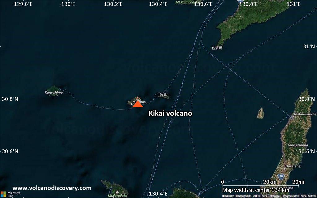
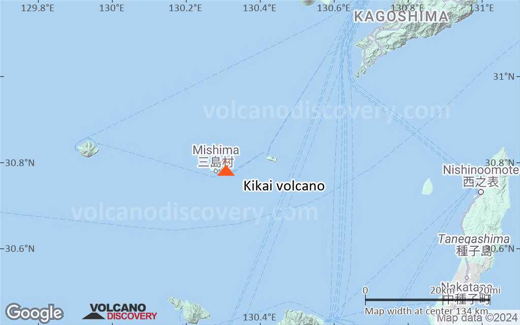
Kikai volcano is a 19 km large, mostly submerged caldera at the northern end of the Ryukyu Islands of Japan, located 45 km south of Kuyshu. It is one of the country's most active and most explosive volcanoes.
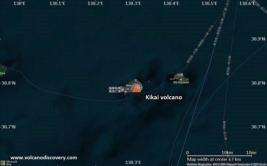
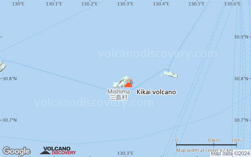
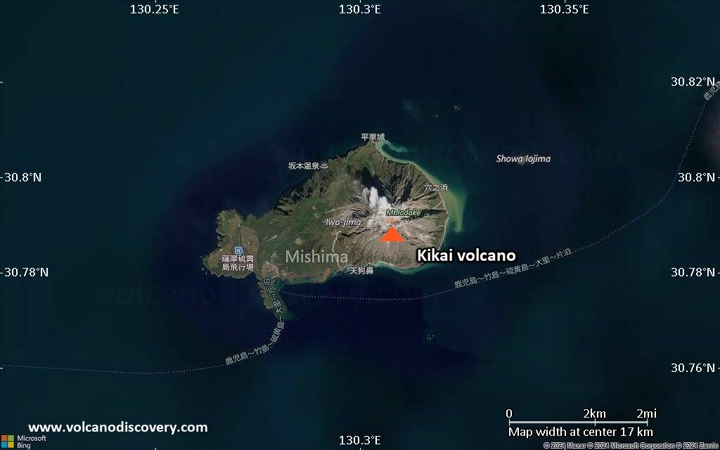
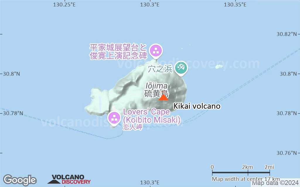
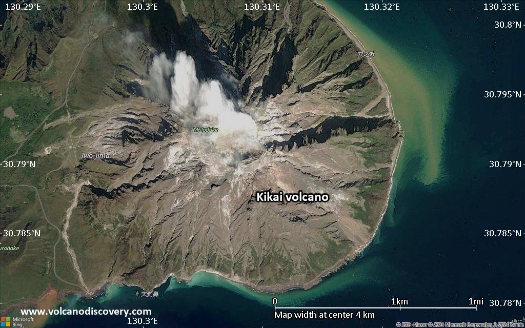
Satsuma-Iojima (or Tokara Iojima), a portion of the mostly submerged NW caldera rim, is a small 6x3 km wide and 681 m high island, which has about 140 inhabitants. Its name meaning "sulphur island", it has been the site of most historic eruptions of the caldera, mostly from the Iwo-dake lava dome.

[smaller] [larger]
Typical eruption style: explosive
Kikai volcano eruptions: 2020, 2019, 2013, 2004, 2003, 2002, 2000-01, 2000, 1998-99, 1997, 1988, 1934-35, 1914 (?)
radiocarbon / tephrochronology dated: 1430 ± 75 years, 1340 ± 30, 1030 ± 40, 1010 ± 40, 750 AD (?), 390 AD ± 100, 280 BC ± 75, 1090 BC ± 100, 1830 BC ± 75, 2450 BC ± 1000, 3250 BC ± 75, 3250 BC ± 75
around 4350 BC: VEI 7 caldera-forming eruption, one of the largest on earth in 10,000 years, producing the Akahoya tephra

Latest nearby earthquakes

Date and TimeMag / DepthDistance / Location
Jul 7, 06:48 am (GMT +9)
0.7

71 km
30 km (18 mi) to the SE Japan: Near Tanegashima Island Info
Wednesday, July 2, 2025 GMT (1 quake)
Jul 2, 04:18 pm (GMT +9)
3.1

11 km
30 km (18 mi) to the NE Japan: Near Tanegashima Island  I FELT IT Info
Monday, June 30, 2025 GMT (1 quake)
Jul 1, 06:50 am (GMT +9)
3.3

11 km
16 km (10.1 mi) to the N Japan: Near Tanegashima Island  I FELT IT Info
Thursday, June 26, 2025 GMT (1 quake)
Jun 27, 08:43 am (GMT +9)
2.6

143 km
12 km (7.6 mi) to the NW Japan: Near Tanegashima Island Info
Tuesday, June 24, 2025 GMT (1 quake)
Jun 25, 01:54 am (GMT +9)
0.5

13 km
31 km (19 mi) to the N Japan: Satsuma Peninsula Region Info

Background

About 6300 years ago, Kikai volcano produced one of the largest known eruptions in the world during the past 10,000 years. The eruption devastated southern and central Kyushu and left the present-day caldera.
Younger cones have grown inside the caldera, including Iwo-dake, a rhyolitic lava dome at the eastern end of Tokara-Iwo-jima. Kikai's frequent historical activity were small to medium explosive eruptions mainly from Iwo-dake.
Showa-Iwo-jima is a lava dome (also known as Iwo-jima-Shinto) that forms a small island 2 km east of Tokara-Iwo-jima. It formed during submarine eruptions in 1934 and 1935.

Significant volcanic eruptions: Kikai volcano

In the past 10,000 years, Kikai has had at least 27 confirmed volcanic eruptions, out of which 14 are documented by historical records, while the others can be inferred from geological evidence.
Additionally, there are 2 uncertain or discredited eruptions from Kikai volcano.
The table below lists all known eruptions (date in bold face) of Kikai volcano in historic times and during the past 10,000 years. Updates on the most recent volcanic activity of Kikai can be found on the news page of Kikai volcano.
DateNoteVEIDeathsDamage
2024 Sep 1 - Oct 17
Historical obs./docs.
?
?? 2023 Mar 27 - Jul 31
Uncertain Eruption
Historical obs./docs.
?
2020 Oct 6
Historical obs./docs.
1
2020 Apr 29
Historical obs./docs.
1
2019 Nov 2
Historical obs./docs.
2
2013 Jun 4Iodake
Historical obs./docs.
1
2004 Mar 5 - Oct 16 ±15 d.Iwo-dake
Historical obs./docs.
2
2003 Feb 16 ±15 d. - Oct 16 ±15 d.Iwo-dake
Historical obs./docs.
2
2002 May 11 - Jul 16 ±15 d.Iwo-dake
Historical obs./docs.
2
2000 Oct 16 ±15 d. - 2001 Dec 16 ±15 d.Iwo-dake
Historical obs./docs.
1
2000 Jan 16 ±15 d. - Mar 16 ±15 d.Iwo-dake
Historical obs./docs.
2?
1998 Apr 25 - 1999 Aug 16 ±15 d.Iwo-dake
Historical obs./docs.
2
1997 Jul 2 ±182 d.Iwo-dake
Historical obs./docs.
1?
1988 Jan 18Iwo-dake
Historical obs./docs.
1
1934 Sep 19 - 1935 Aug2 km east of Tokara-Iwo-Jima
Historical obs./docs.
2
?? 1914 Feb 13
Uncertain Eruption
?
1430 ±75 y. ADIwo-dake?
1340 ±30 y. ADIwo-dake?
1030 ±40 y. ADIwo-dake?
1010 ±40 y. ADIwo-dake?
830 ±40 y. ADIwo-dake?
750 ? ADIwo-dake3
390 ±100 y. ADIwo-dake3
Remark:
Our list of volcanic eruptions closely follows the database of eruptions of the Smithsonian's Global Volcanism Project (GVP), the internationally most recognized data source for volcanic eruptions, but also includes significant eruptive episodes or related volcano events. "Volcanic eruptions" are usually to be understood as sequences of individual eruptive episodes that can follow each other, or even overlap (if several vents are involved), and can last many years, decades or even longer. For example, the current activity of Stromboli volcano is understood as a single eruption that has been ongoing since 1934.
Sources: NOAA National Centers for Environmental Information (NCEI), Global Significant Volcanic Eruptions Database. doi:10.7289/V5TD9V7K | Global Volcanism Project / Smithsonian Institution

Eruptions of Kikai volcano


2004 ash eruptions
Ash clouds with plume heights ranging from 1.2-1.5 km were produced by small explosions from Iwo-dake between March - September 2004.

2000-2003 activity: small ash eruptions
Phases of weak intermittent explosive activity occurred between Oct 2000-Dec 2001, 24 May-5 June 2002, and again 7 June - 22 September 2003.
The height of ash plumes never exceeded 2-3 km and the eruption caused no damage, only minor ash fall in nearby areas.

1998-99 eruptions
Small explosive activity occurred at Iwo-dake some time between late-April and early-May 1998. A 5 cm ash deposit was observed by Japanese geologists at the crater of Iwo-dake lava dome.
Residents of Tokara-Iwo-Jima saw ash eruptions in August and October 1998.

1988 eruptions
Following a quiet of 333 year, the first activity since 1935 occurred on 18 January 1988 and consisted in small phreatic explosions ejecting ash to 400-500 m above the summit crater of Iwo-dake.
Residents did not feel any seismic activity preceding the eruption. A high-temperature fumaraole at the summit was measured 788°C, more or less unchanged since the last survey in 1985.
Source: GVP monthly reports

1934-35 submarine island forming eruption
A submarine eruption occurred 2 km east of Tokara-Iwo-Jima between 17 September 1934 and 20 September 1935.
The eruption started from vents at a water depth of 200-300 m. "Smoke" and floating pumice were seen in September 1934 and detonations could be heard. By November, a new island started to appear, but was destroyed by explosions on 30 December 1934.
A second island formed in January 1935, reaching 300 m length, 150 width and a height of 20 m when measured on 20 January. It had a crater of 50 m diameter and a viscous lava flow was observed on the western side. A 3rd, smaller island was born on 20 February. Its activity was surtseyan, frequent phreatomagmatic eruptions at intervals of less than a few minutes, building up a pyroclastic cone. When observed on 26 March, it was 22-23 m high. The other island had entered a magmatic phase and a lava dome had appeared reaching 50-60 m height.
---
Sources:
- Peter Hedervari (1986) "CATALOG OF SUBMARINE VOLCANOES AND HYDROLOGICAL PHENOMENA ASSOCIATED WITH VOLCANIC EVENTS", World Data Center A for Solid Earth Geophysics, Report SE-42, Georgiana Observatory, Budapest
- Kano, K. (2003) "Subaqueous Pumice Eruptions and Their Products: A Review", in White et al (eds.) "Explosive Subaqueous Volcanism", American Geophysical Union monograph 140, pp 231-244

The Akahoya eruption of Kikai around 4350 BC
This ultra-plinian eruption of Kikai around 4350 BC was one of the largest Holocene eruptions on the planet. It ejected about 150 cubic kilometers of rhyolithic magma, i.e. 3 times more than the largest historic eruption, the 1815 Tambora eruption!
The eruption produced massive rhyolithic pyroclastic flows that traveled across the sea for 100 km and reached southern Kyushu. Ash layers from this eruption are found all over Japan until the northernmost island Hokkaido and form an important geologic marker.
The eruption devastated southern and central Kyushu, which afterwards remained uninhabited for several centuries. The present-day caldera resulted at least partly from collapse after the eruption. ...more info

Kikai Volcano FAQ

+When was the last eruption of Kikai volcano?
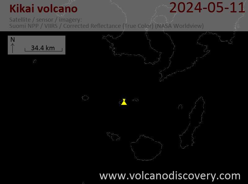
+How often does Kikai volcano erupt?

+How active is Kikai volcano at present?

+When was the largest eruption of Kikai volcano?

Latest satellite images

Kikai satellite image sat1Kikai satellite image sat2

Kikai Volcano Maps

Below is a selection of maps showing the location and surroundings of the volcano at various resolutions based on aerial-imagery / terrain maps. Feel free to use them for non-commercial purposes on your blog or website as long as you credit them with a link back to this page (click to copy it).
Satellite/aerial-type map of Kikai volcano (world scale)
Terrain-type map of Kikai volcano (world scale)
Satellite/aerial-type map of Kikai volcano (region scale large)
Terrain-type map of Kikai volcano (region scale large)
Satellite/aerial-type map of Kikai volcano (region scale medium)
Terrain-type map of Kikai volcano (region scale medium)
Satellite/aerial-type map of Kikai volcano (region scale small)
Terrain-type map of Kikai volcano (region scale small)
Satellite/aerial-type map of Kikai volcano (local scale large)
Terrain-type map of Kikai volcano (local scale large)
Satellite/aerial-type map of Kikai volcano (local scale medium)
Terrain-type map of Kikai volcano (local scale medium)
Satellite/aerial-type map of Kikai volcano (local scale small)
Terrain-type map of Kikai volcano (local scale small)
Satellite/aerial-type map of Kikai volcano (scale of 10s of km)
Terrain-type map of Kikai volcano (scale of 10s of km)
Satellite/aerial-type map of Kikai volcano (scale of 20-40 km)
Terrain-type map of Kikai volcano (scale of 20-40 km)
Satellite/aerial-type map of Kikai volcano (scale of approx. 10-20 km)
Terrain-type map of Kikai volcano (scale of approx. 10-20 km)
Satellite/aerial-type map of Kikai volcano (scale of 5-10 km)
Satellite/aerial-type map of Kikai volcano (scale of few kilometers)
Volcanoes & Earthquakes - new app for Android
Guaranteed tours
1-17 Aug 2025: Volcanoes and Spices - Sulawesi/Halmahera (Indonesia)
1-14 Oct 2025: Desert, salt and volcanoes - Danakil desert (Ethiopia)
4-12 Oct 2025: From Stromboli to Etna - Sicily and Eolian Islands (Italy)
6-21 Oct 2025: From Krakatau to Bali - Java (Indonesia)
3-19 Nov 2025: Volcanoes and Spices - Sulawesi/Halmahera (Indonesia)
= spaces available   = guaranteed   = few spaces left   = booked out
Wed, 11 Sep 2024, 14:00

Kikai (Japan) volcano - Smithsonian / USGS Weekly Volcanic Activity Report for 4 September-10 September 2024 (New Activity / Unrest)

JMA reported that no activity at Iodake Crater located at Satsuma Iwo-jima, a subaerial part of Kikai's NW caldera rim, was detected after the 1 and 3 September eruptive events. Crater incandescence continued to be observed at night. The Alert Level remained at 2 (on a 5-level scale), and residents were warned to stay 500 m away from Iodake Crater. ... Read all
Wed, 4 Sep 2024, 14:00

Kikai (Japan) volcano - Smithsonian / USGS Weekly Volcanic Activity Report for 28 August-3 September 2024 (New Activity / Unrest)

JMA reported that an eruptive event at Iodake Crater located at Satsuma Iwo-jima, a subaerial part of Kikai's NW caldera rim, was recorded at 1128 on 1 September. An ash plume rose 1 km above the crater rim. The report noted that there was no change in the number of earthquakes either before or after the event, and no volcanic tremors were recorded. ... Read all

On this page:

Try our free app!
Volcanoes & Earthquakes - new app for Android
Android | iOS version

More on VolcanoDiscovery

Why is there advertising on this site?

Support us - Help us upgrade our services!

We truly love working to bring you the latest volcano and earthquake data from around the world. Maintaining our website and our free apps does require, however, considerable time and resources.
We need financing to increase hard- and software capacity as well as support our editor team. We're aiming to achieve uninterrupted service wherever an earthquake or volcano eruption unfolds, and your donations can make it happen! Every donation will be highly appreciated. If you find the information useful and would like to support our team in integrating further features, write great content, and in upgrading our soft- and hardware, please make a donation (PayPal).

Planned features:Thanks to your past donations, these features have been added recently:
Download and Upgrade the Volcanoes & Earthquakes app to get one of the fastest seismic and volcano alerts online:
Android | IOS
Thank you!
Sources: VolcanoDiscovery / VolcanoAdventures and other sources as noted.
Use of material: Most text and images on our websites are owned by us. Re-use is generally not permitted without authorization. Contact us for licensing rights.
Volcanoes & Earthquakes
VolcanoDiscovery Home
Volcanoes | Earthquakes | Photos | Volcano News | | Shop | App
Adventure & Study Travel
Tours to Volcanoes and Volcanic Areas: walking tours, photo tours, study tours
Tours & Dates | FAQ | About us
Get our newsletter!
Company info
Contact | Legal info | Terms & conditions
Follow us
Follow us on facebook Follow us on Instagram Follow us on Bluesky Follow us on Twitter Visit our Youtube channel
EN | DE | EL | ES | FR | IT | RU
VolcanoDiscovery GmbH, Germany, Reg. nr.: HRB 103744, EU Tax Id: DE 297 465 123 owned and created by
Dr. Tom Pfeiffer, volcanologist, volcano photographer, tour organizer member of
IAVCEI
IAVCEI
Vulkanologische Gesellschaft
Volcanological Society
Ecotourism Greece
Ecotourism Greece
RUV insurance
Insured by R+V
VolcanoDiscovery © 2004- All Rights Reserved | Privacy - Cookie Settings