Konradi Volcano
Updated: May 13, 2025 22:50 GMT -
Stratovolcano
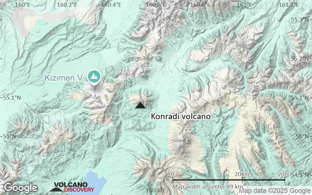
Kamchatka Peninsula, Russia, 55.08°N / 160.53°E 
Summit height: 1912 m / 6273 ft
Current status: (probably) extinct (0 out of 5)
[smaller] [larger]
Konradi volcano eruptions: None during the past 10,000 years
Less than few million years ago (Pleistocene)
Latest nearby earthquakes
| Date and Time | Mag / Depth | Distance / Location | |||
|---|---|---|---|---|---|
| May 12, 10:02 pm (Kamchatka) | 1.1 5.8 km | 24 km (15 mi) to the N | Info | ||
| Sunday, May 11, 2025 GMT (3 quakes) | |||||
| May 12, 06:40 am (Kamchatka) | 0.7 7.2 km | 17 km (10.6 mi) to the N | Info | ||
| May 12, 12:53 am (Kamchatka) | 1.1 6.3 km | 14 km (8.8 mi) to the N | Info | ||
| May 11, 09:16 pm (Kamchatka) | 0.5 8 km | 21 km (13 mi) to the NW | Info | ||
| Saturday, May 10, 2025 GMT (3 quakes) | |||||
| May 11, 06:24 am (Kamchatka) | 0.6 8.5 km | 17 km (10.4 mi) to the N | Info | ||
| May 11, 03:18 am (Kamchatka) | 0.5 2.4 km | 12 km (7.2 mi) to the N | Info | ||
| May 10, 08:58 pm (Kamchatka) | 0.1 1.8 km | 26 km (16 mi) to the NW | Info | ||
| Wednesday, May 7, 2025 GMT (1 quake) | |||||
| May 8, 05:41 am (Kamchatka) | 1.2 4.1 km | 14 km (8.9 mi) to the N | Info | ||
| Friday, May 2, 2025 GMT (2 quakes) | |||||
| May 3, 08:43 am (Kamchatka) | 1.1 14 km | 25 km (16 mi) to the N | Info | ||
Background
Vlasov (1967) notes postglacial activity of Konradi; later work indicates it is of Pleistocene age (Erlich 1985, pers. comm.).---
Source: Smithsonian / GVP volcano information
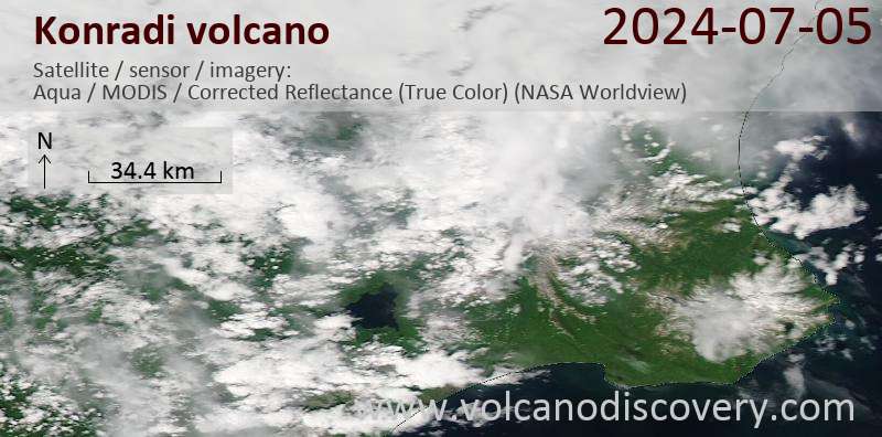
Latest satellite images
Konradi Volcano Maps
Below is a selection of maps showing the location and surroundings of the volcano at various resolutions based on aerial-imagery / terrain maps. Feel free to use them for non-commercial purposes on your blog or website as long as you credit them with a link back to this page (click to copy it).

Satellite/aerial-type map of Konradi volcano (world scale)

Terrain-type map of Konradi volcano (world scale)

Satellite/aerial-type map of Konradi volcano (region scale large)

Terrain-type map of Konradi volcano (region scale large)

Satellite/aerial-type map of Konradi volcano (region scale medium)

Terrain-type map of Konradi volcano (region scale medium)

Satellite/aerial-type map of Konradi volcano (region scale small)

Terrain-type map of Konradi volcano (region scale small)

Satellite/aerial-type map of Konradi volcano (local scale large)

Terrain-type map of Konradi volcano (local scale large)

Satellite/aerial-type map of Konradi volcano (local scale medium)

Terrain-type map of Konradi volcano (local scale medium)

Satellite/aerial-type map of Konradi volcano (local scale small)
Terrain-type map of Konradi volcano (local scale small)

Satellite/aerial-type map of Konradi volcano (scale of 10s of km)

Terrain-type map of Konradi volcano (scale of 10s of km)

Satellite/aerial-type map of Konradi volcano (scale of 20-40 km)

Terrain-type map of Konradi volcano (scale of 20-40 km)

Satellite/aerial-type map of Konradi volcano (scale of approx. 10-20 km)

Terrain-type map of Konradi volcano (scale of approx. 10-20 km)

Satellite/aerial-type map of Konradi volcano (scale of 5-10 km)

Satellite/aerial-type map of Konradi volcano (scale of few kilometers)