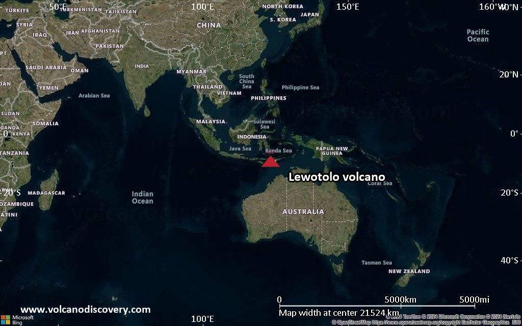
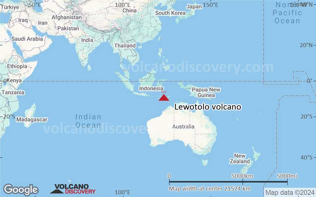
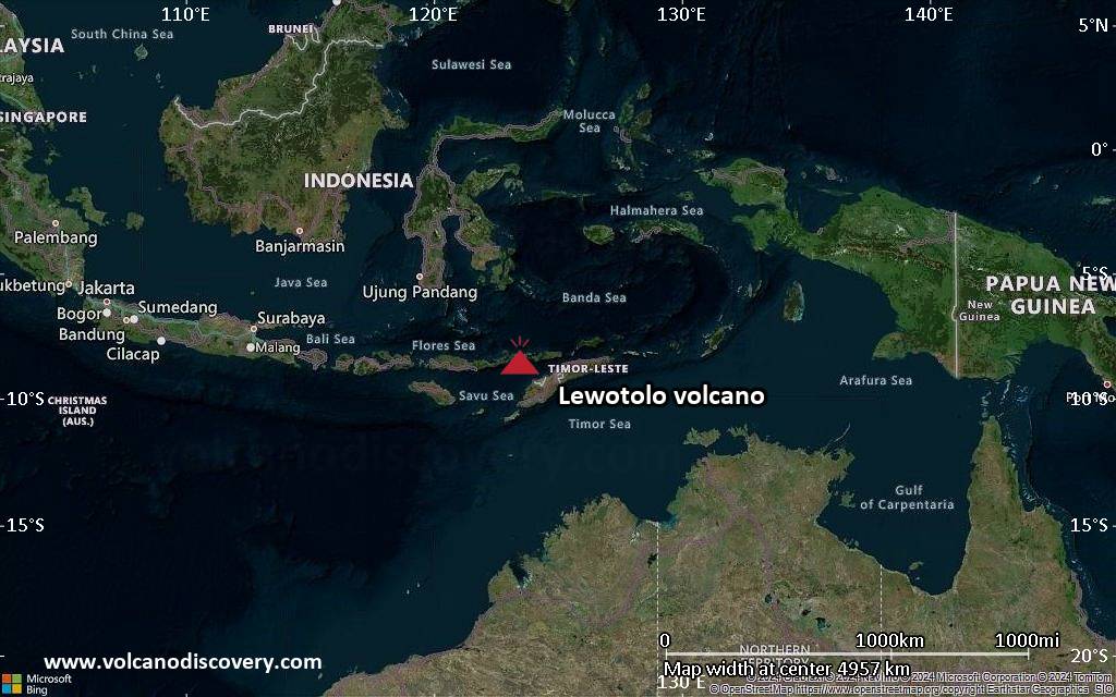
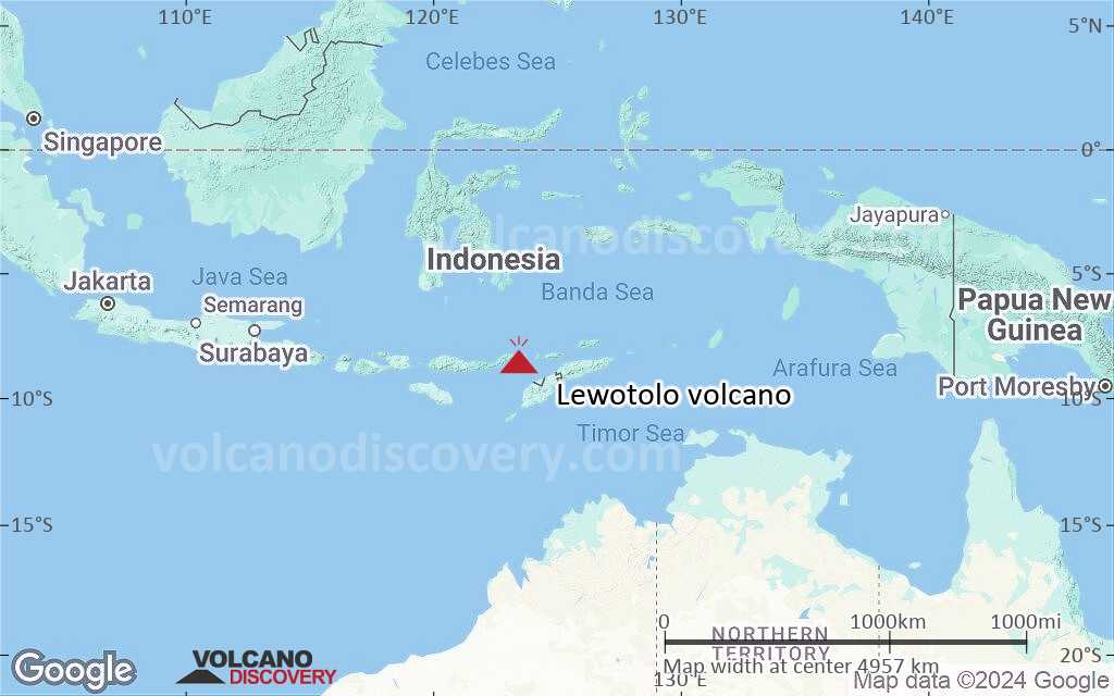
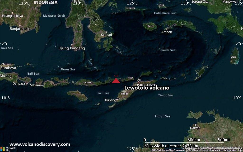
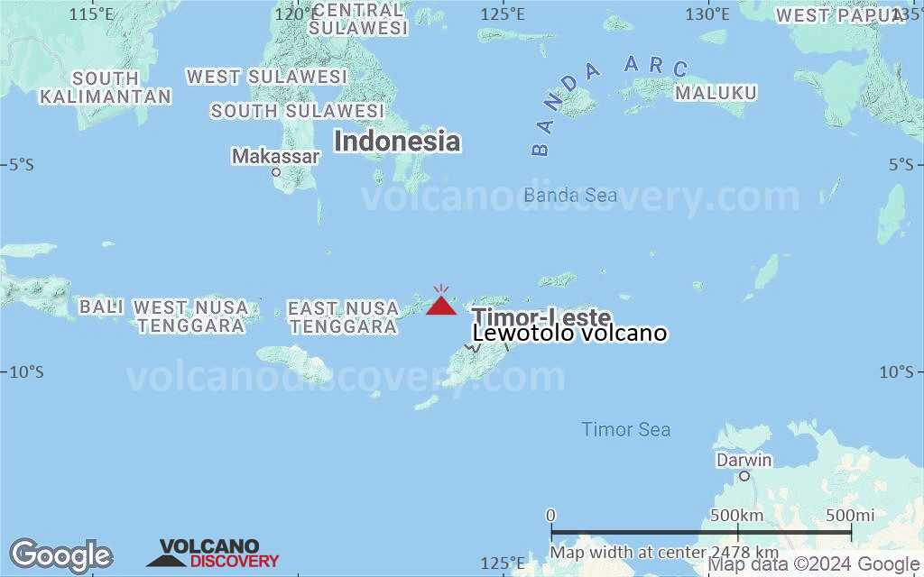
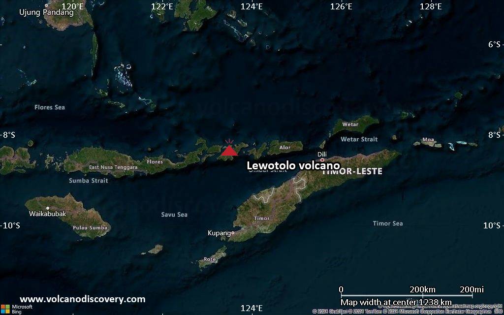
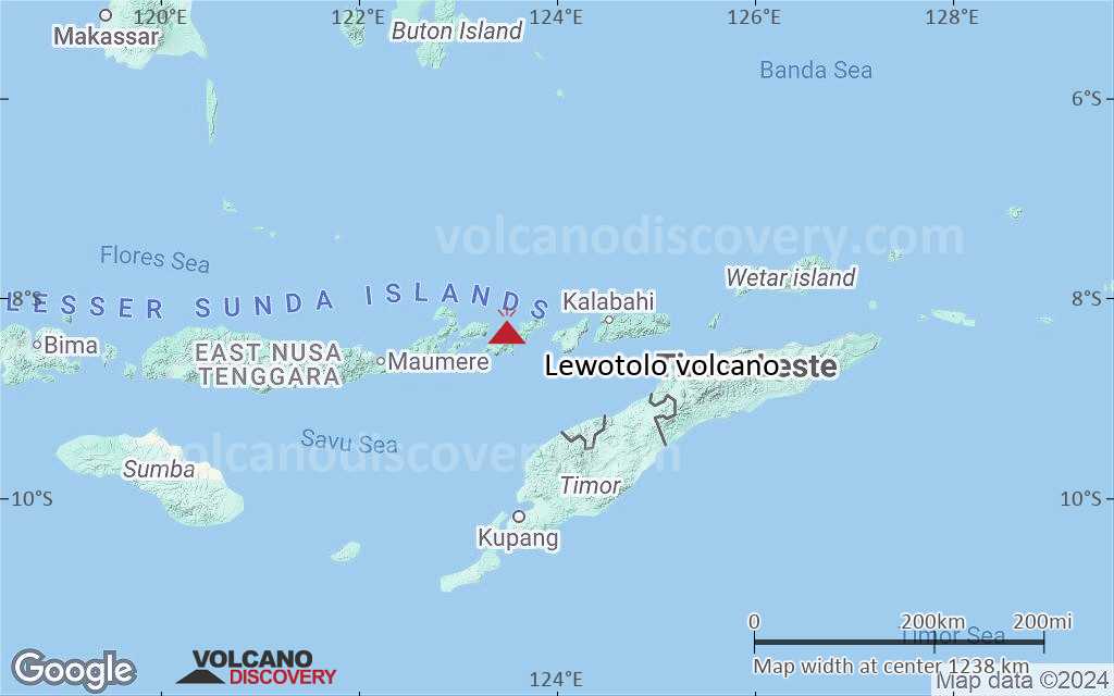
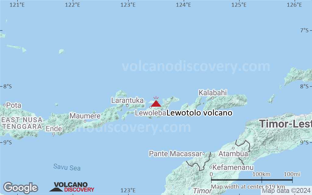
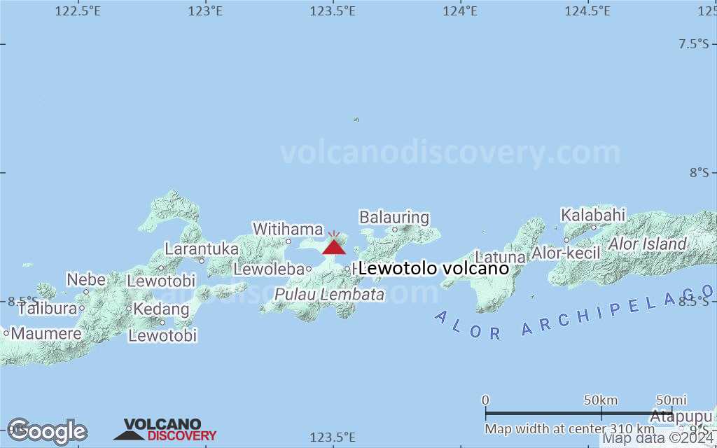
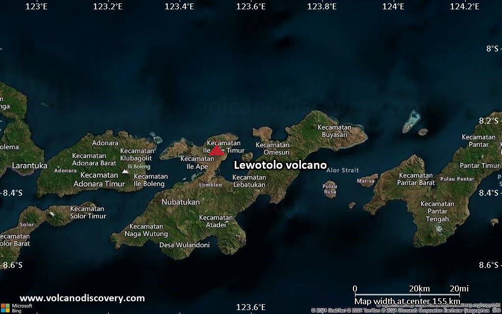
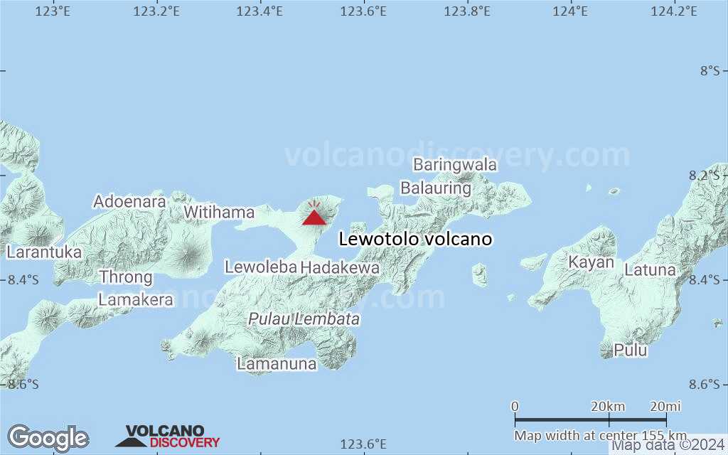
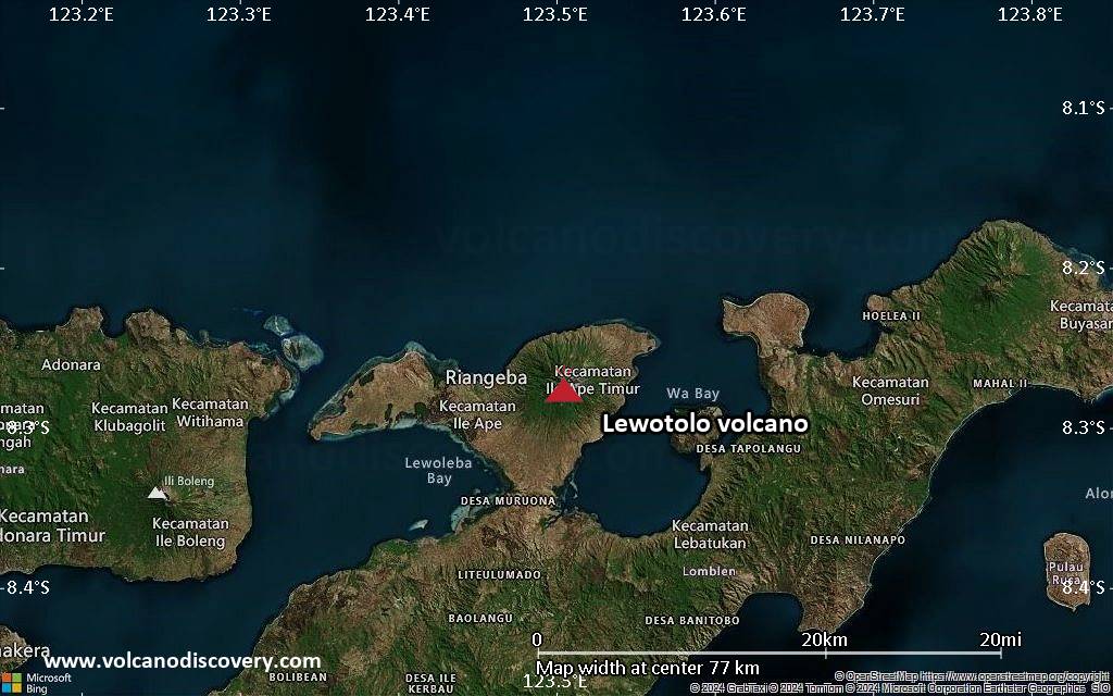
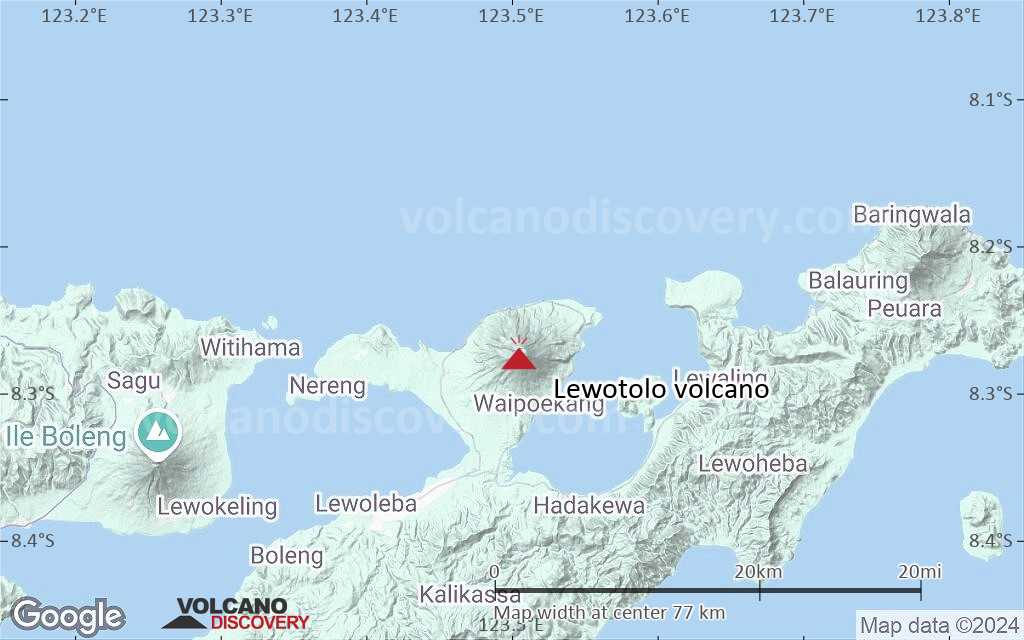
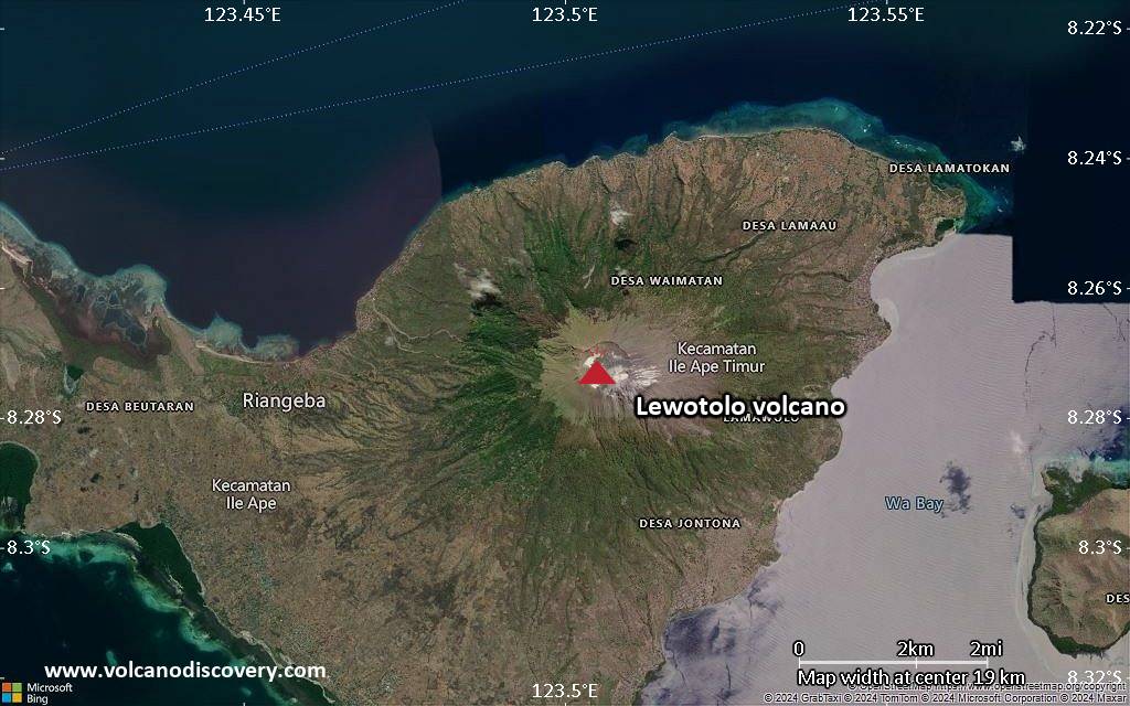
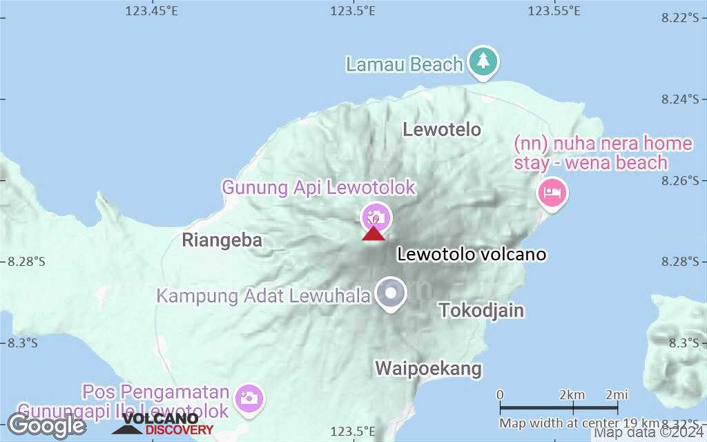
| RSS | EN | DE | EL | ES | FR | IT | RU

Lewotolo Volcano

Updated: Jun 20, 2025 21:31 GMT -
stratovolcano
Lesser Sunda Islands (Indonesia), -8.27°S / 123.51°E
Summit height: 1423 m / 4,669 ft
Current status: erupting (4 out of 5)
Last update: 20 Jun 2025 (Volcanic Ash Advisory)

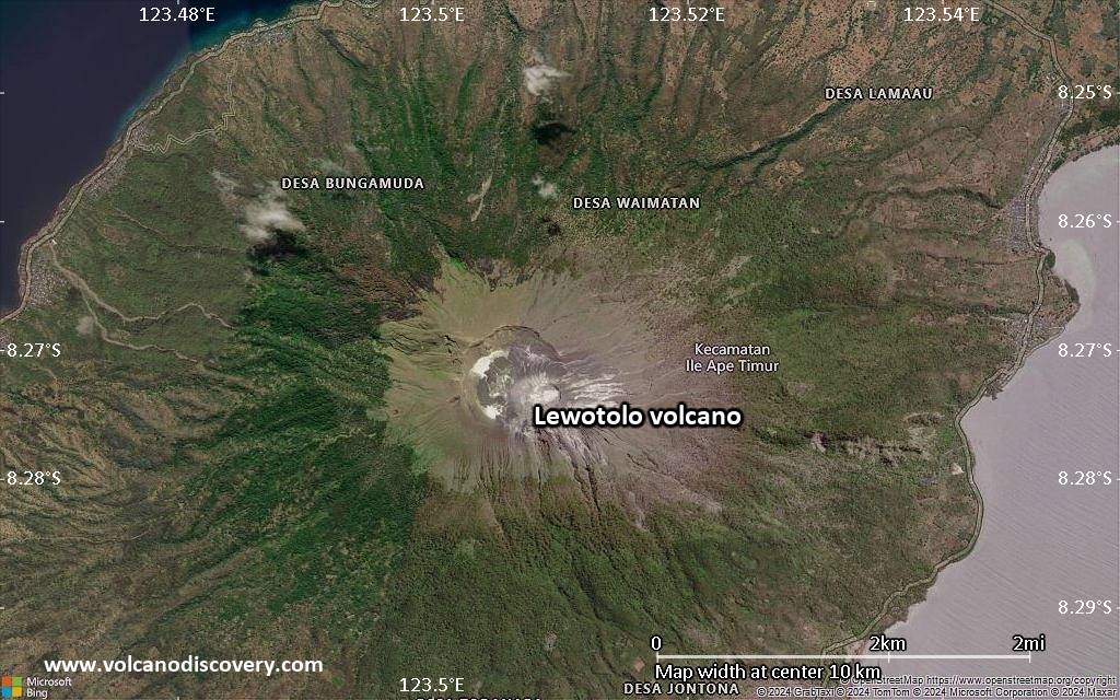
Lewotolo (or Ile Api Lewotolok) volcano on the eastern end of a peninsula of Lembata (formerly Lomblen) Island forms a perfect symmetrical cone. The stratovolcano has 2 craters of 900x800 m and 250x200 m in diameter.
Many lava flows have reached the coastline. Historical eruptions, recorded since 1660, have consisted of explosive activity from the summit crater.

[smaller] [larger]
Typical eruption style: Explosive
Lewotolo volcano eruptions: 2012, 1951, 1920, 1899, 1864, 1852, 1849, 1819, 1660

Latest nearby earthquakes

Date and TimeMag / DepthDistance / Location
Jun 16, 03:25 pm (Universal Time)
2.2

10 km
29 km (18 mi) to the E Savu Sea, 28 km east of Pulau Kawula Island, East Nusa Tenggara, Indonesia Info
Jun 16, 11:08 pm (GMT +8)
2.1

21 km
12 km (7.6 mi) to the SE Kabupaten Lembata, 205 km north of Kupang, Indonesia Info
Jun 16, 11:03 pm (GMT +8)
2.3

10 km
27 km (17 mi) to the E Flores Region, Indonesia Info
Jun 16, 02:54 pm (Universal Time)
2.0

10 km
9.6 km (5.9 mi) to the E Kabupaten Lembata, 209 km north of Kupang, Indonesia Info
Monday, June 9, 2025 GMT (2 quakes)
Jun 9, 05:47 pm (GMT +8)
2.5

10 km
21 km (13 mi) to the S Kabupaten Lembata, 191 km north of Kupang, Indonesia Info
Jun 9, 05:03 pm (GMT +8)
2.4

10 km
22 km (14 mi) to the S Kabupaten Lembata, 189 km north of Kupang, Indonesia Info

Background

Lewotolo's lavas are remarkable because they contain the rare mineral zirconolite (CaZrTi2O7).
Source/literature:
"Volatile-induced transport of HFSE, REE, Th and U in arc magmas: evidence from zirconolite-bearing vesicles in potassic lavas of Lewotolo volcano (Indonesia)" Jan C. M. de Hoog and Manfred J. van Bergen, Contributions to Mineralogy and Petrology, Volume 139, Number 4, 485-502

Lewotolo Volcano Photos

Significant volcanic eruptions: Lewotolo volcano

In the past 10,000 years, Lewotolo has had at least 10 confirmed eruptions, all documented by historical records or observations.
The table below lists all known eruptions (date in bold face) of Lewotolo volcano in historic times and during the past 10,000 years. Updates on the most recent volcanic activity of Lewotolo can be found on the news page of Lewotolo volcano.
DateNoteVEIDeathsDamage
2020 Nov 27 - 2024 Aug 20
Historical obs./docs.
2
2012 Jan 2 - Jan 14Summit crater
Historical obs./docs.
1
1951 Dec 15
Historical obs./docs.
2
1920
Historical obs./docs.
2
1899 Jun 2
Historical obs./docs.
2
1864
Historical obs./docs.
2
1852 Oct 5 - Oct 6K2 crater
Historical obs./docs.
2
1849 Oct 6
Historical obs./docs.
2
1819
Historical obs./docs.
2
1660 AD
Historical obs./docs.
3
Remark:
Our list of volcanic eruptions closely follows the database of eruptions of the Smithsonian's Global Volcanism Project (GVP), the internationally most recognized data source for volcanic eruptions, but also includes significant eruptive episodes or related volcano events. "Volcanic eruptions" are usually to be understood as sequences of individual eruptive episodes that can follow each other, or even overlap (if several vents are involved), and can last many years, decades or even longer. For example, the current activity of Stromboli volcano is understood as a single eruption that has been ongoing since 1934.
Sources: NOAA National Centers for Environmental Information (NCEI), Global Significant Volcanic Eruptions Database. doi:10.7289/V5TD9V7K | Global Volcanism Project / Smithsonian Institution

Lewotolo Volcano FAQ

+When was the last eruption of Lewotolo volcano?

+How often does Lewotolo volcano erupt?

+How active is Lewotolo volcano at present?

+When was the largest eruption of Lewotolo volcano?

Latest satellite images

Lewotolo satellite image sat1Lewotolo satellite image sat2
Lewotolo Volcano Tours
Flores, Indonesia
Indonesia Volcano Special
Volcano expedition to Lewotobi and Ile Lewotolok volcanoes in Feb 2024
7 days (10 days with extension) - Moderate
Price 1750 EUR (7d) / 2480 EUR (10d)
no scheduled dates at present

Lewotolo Volcano Maps

Below is a selection of maps showing the location and surroundings of the volcano at various resolutions based on aerial-imagery / terrain maps. Feel free to use them for non-commercial purposes on your blog or website as long as you credit them with a link back to this page (click to copy it).
Satellite/aerial-type map of Lewotolo volcano (world scale)
Terrain-type map of Lewotolo volcano (world scale)
Satellite/aerial-type map of Lewotolo volcano (region scale large)
Terrain-type map of Lewotolo volcano (region scale large)
Satellite/aerial-type map of Lewotolo volcano (region scale medium)
Terrain-type map of Lewotolo volcano (region scale medium)
Satellite/aerial-type map of Lewotolo volcano (region scale small)
Terrain-type map of Lewotolo volcano (region scale small)
Satellite/aerial-type map of Lewotolo volcano (local scale large)
Terrain-type map of Lewotolo volcano (local scale large)
Satellite/aerial-type map of Lewotolo volcano (local scale medium)
Terrain-type map of Lewotolo volcano (local scale medium)
Satellite/aerial-type map of Lewotolo volcano (local scale small)
Terrain-type map of Lewotolo volcano (local scale small)
Satellite/aerial-type map of Lewotolo volcano (scale of 10s of km)
Terrain-type map of Lewotolo volcano (scale of 10s of km)
Satellite/aerial-type map of Lewotolo volcano (scale of 20-40 km)
Terrain-type map of Lewotolo volcano (scale of 20-40 km)
Satellite/aerial-type map of Lewotolo volcano (scale of approx. 10-20 km)
Terrain-type map of Lewotolo volcano (scale of approx. 10-20 km)
Satellite/aerial-type map of Lewotolo volcano (scale of 5-10 km)
Satellite/aerial-type map of Lewotolo volcano (scale of few kilometers)
Volcanoes & Earthquakes - new app for Android
Guaranteed tours
1-17 Aug 2025: Volcanoes and Spices - Sulawesi/Halmahera (Indonesia)
1-14 Oct 2025: Desert, salt and volcanoes - Danakil desert (Ethiopia)
4-12 Oct 2025: From Stromboli to Etna - Sicily and Eolian Islands (Italy)
6-21 Oct 2025: From Krakatau to Bali - Java (Indonesia)
3-19 Nov 2025: Volcanoes and Spices - Sulawesi/Halmahera (Indonesia)
= spaces available   = guaranteed   = few spaces left   = booked out

On this page:

Try our free app!
Volcanoes & Earthquakes - new app for Android
Android | iOS version

More on VolcanoDiscovery

Why is there advertising on this site?

Support us - Help us upgrade our services!

We truly love working to bring you the latest volcano and earthquake data from around the world. Maintaining our website and our free apps does require, however, considerable time and resources.
We need financing to increase hard- and software capacity as well as support our editor team. We're aiming to achieve uninterrupted service wherever an earthquake or volcano eruption unfolds, and your donations can make it happen! Every donation will be highly appreciated. If you find the information useful and would like to support our team in integrating further features, write great content, and in upgrading our soft- and hardware, please make a donation (PayPal).

Planned features:Thanks to your past donations, these features have been added recently:
Download and Upgrade the Volcanoes & Earthquakes app to get one of the fastest seismic and volcano alerts online:
Android | IOS
Thank you!
Sources: VolcanoDiscovery / VolcanoAdventures and other sources as noted.
Use of material: Most text and images on our websites are owned by us. Re-use is generally not permitted without authorization. Contact us for licensing rights.
Volcanoes & Earthquakes
VolcanoDiscovery Home
Volcanoes | Earthquakes | Photos | Volcano News | | Shop | App
Adventure & Study Travel
Tours to Volcanoes and Volcanic Areas: walking tours, photo tours, study tours
Tours & Dates | FAQ | About us
Get our newsletter!
Company info
Contact | Legal info | Terms & conditions
Follow us
Follow us on facebook Follow us on Instagram Follow us on Bluesky Follow us on Twitter Visit our Youtube channel
EN | DE | EL | ES | FR | IT | RU
VolcanoDiscovery GmbH, Germany, Reg. nr.: HRB 103744, EU Tax Id: DE 297 465 123 owned and created by
Dr. Tom Pfeiffer, volcanologist, volcano photographer, tour organizer member of
IAVCEI
IAVCEI
Vulkanologische Gesellschaft
Volcanological Society
Ecotourism Greece
Ecotourism Greece
RUV insurance
Insured by R+V
VolcanoDiscovery © 2004- All Rights Reserved | Privacy - Cookie Settings