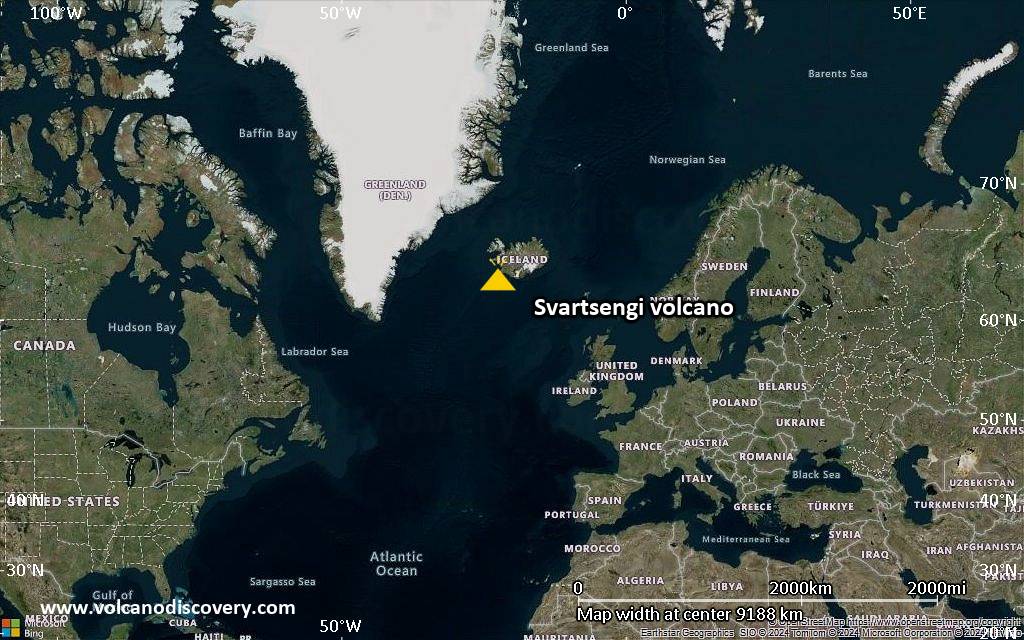
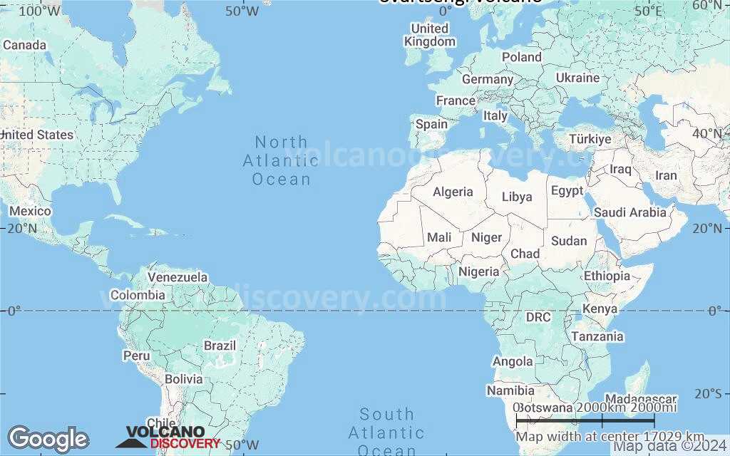
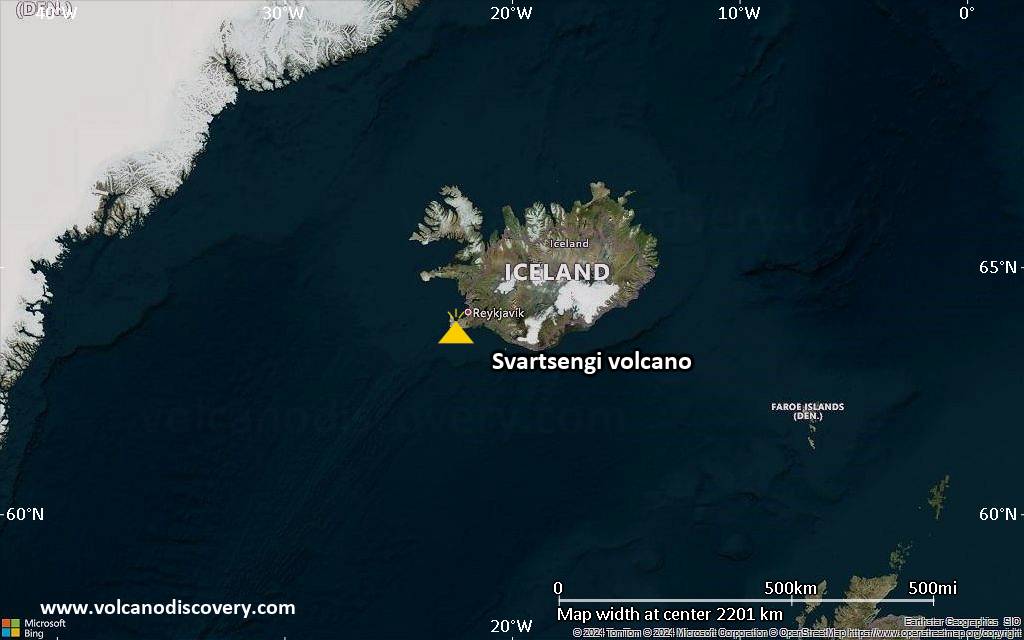
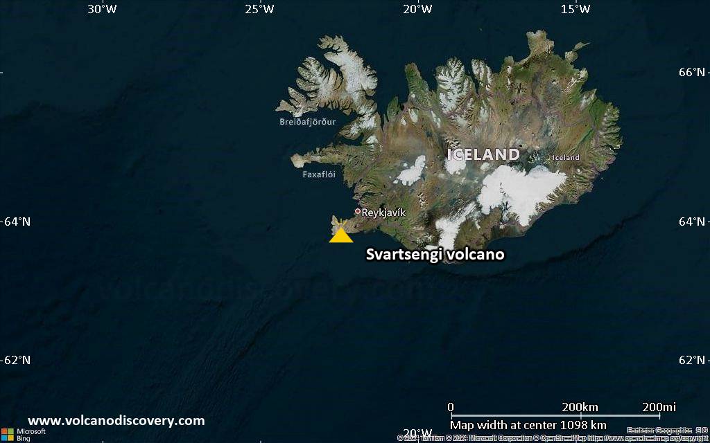
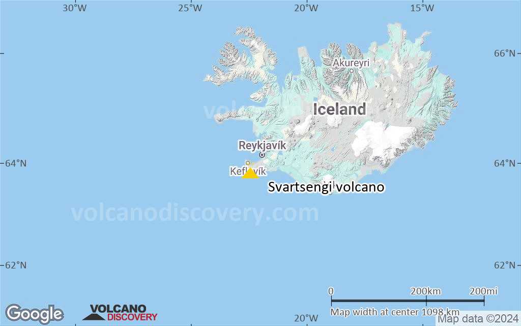
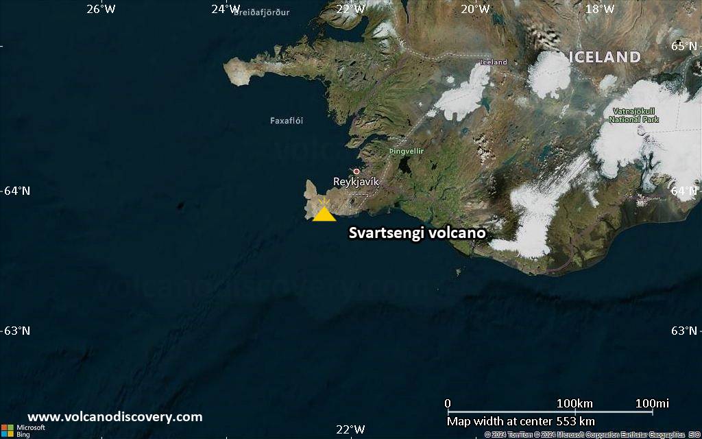
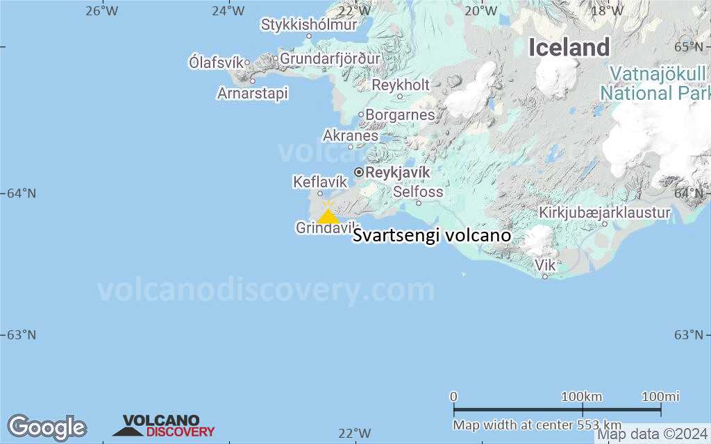
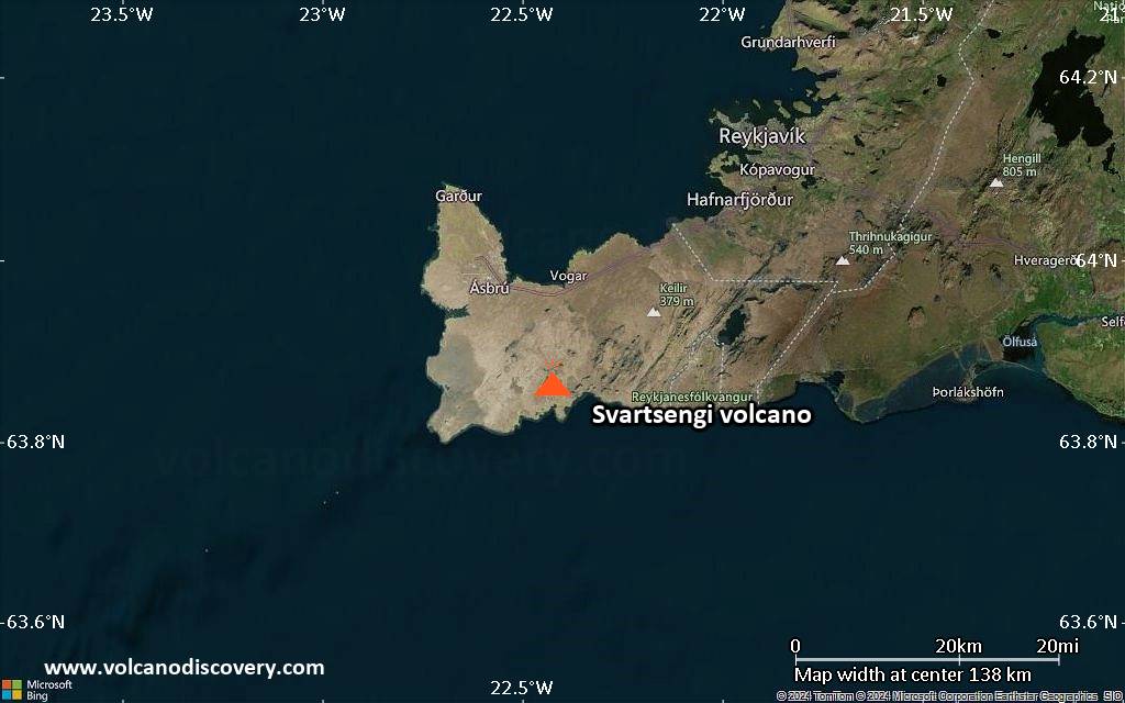
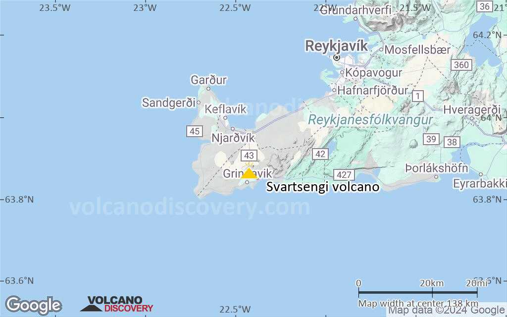
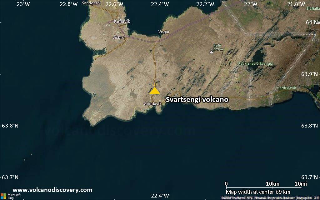
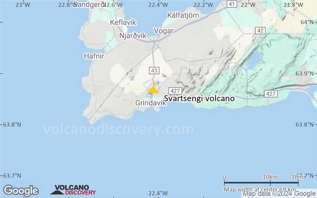
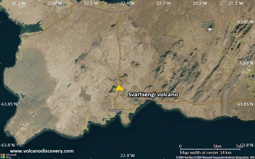
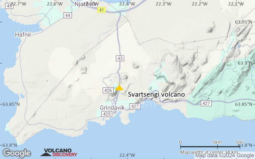
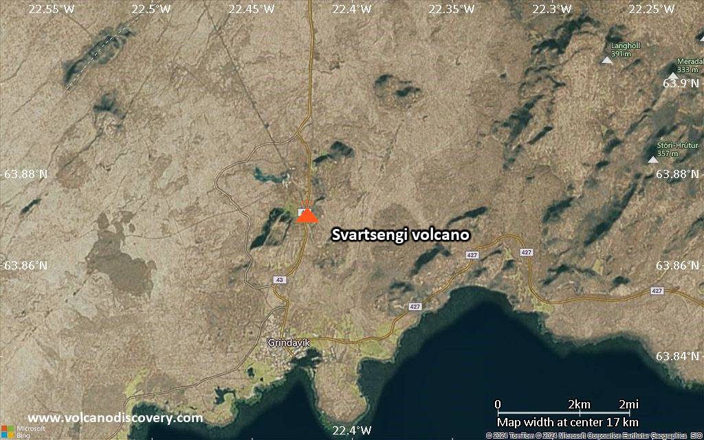
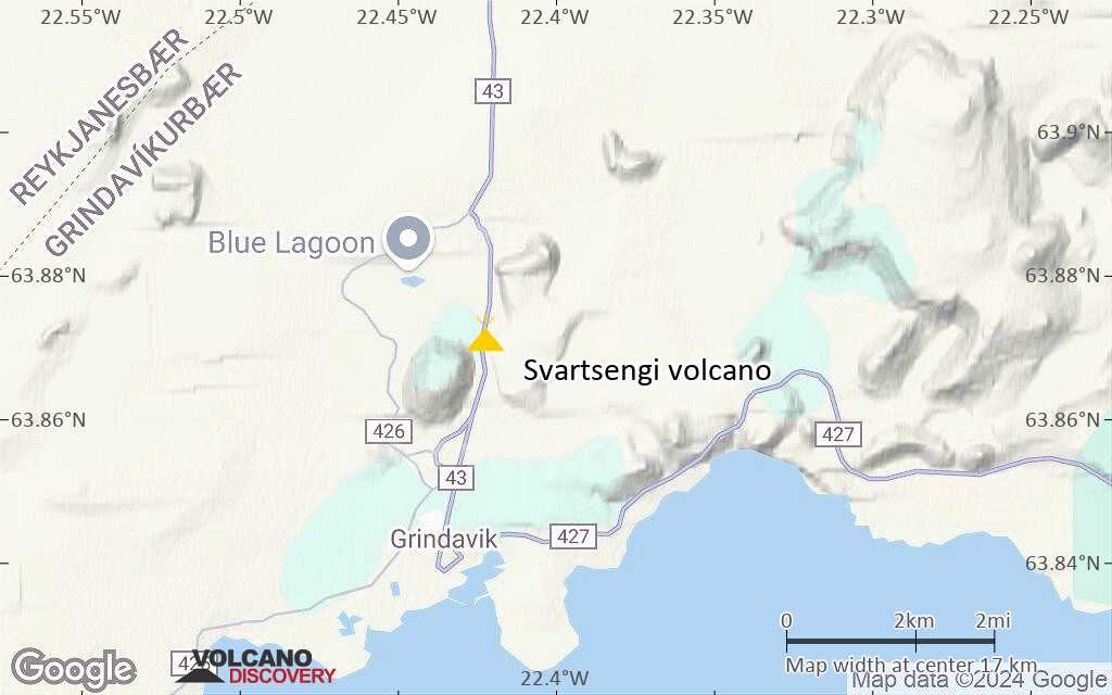
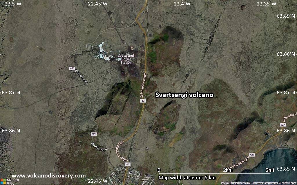
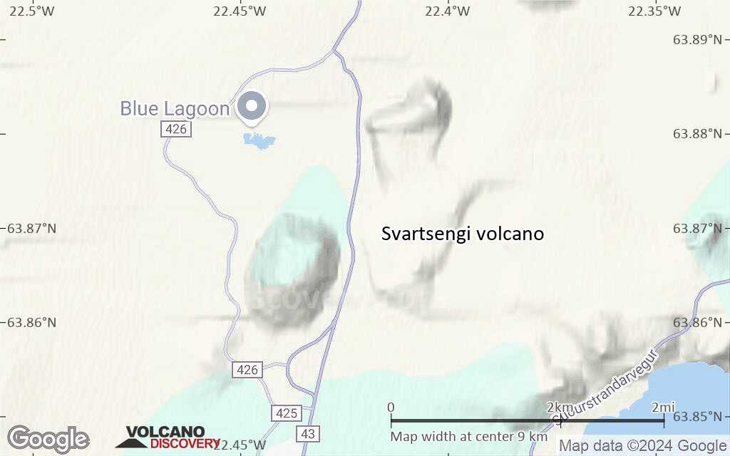
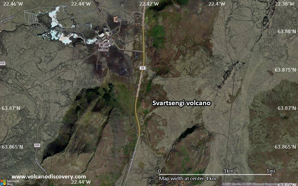
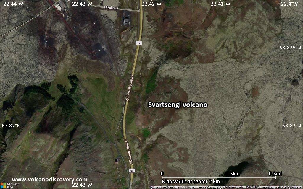
| RSS | EN | DE | EL | ES | FR | IT | RU

Svartsengi Volcano

Updated: May 25, 2025 05:14 GMT -
Crater rows
Reykjanes peninsula, SW Iceland, 63.87°N / -22.42°W
Summit height: 230 m / 755 ft
Current status: restless (2 out of 5)
Last update: 22 May 2025 (uplift continues)

Svartsengi volcano on the Reykjanes peninsula is one of several major volcanic fissure systems that align along the axis of the Reykjanes Peninsula in SW Iceland. They form the southwestern rift zone where the mid-Atlantic Ridge emerges over water. Over the past 4,000 years, volcanic activity in this area appears to have been occurring during periods with intense and frequent eruptions alternating with repose intervals of several centuries.
After about 800 years of repose, a new period of activity on the peninsula started in 2021. 3 eruptions occurred from the neighboring Fagradalsfjall volcano in 2021-2023, followed by a series of so far 7 new fissure eruptions from the Svartsengi volcano since December 2023.

[smaller] [larger]
Typical eruption style: effusive (lava flows)
Svartsengi volcano eruptions: 1211, 1226, 2023 (Dec), 2024 (Jan), 2024 (Feb), 2024 (Mar), 2024 (May-June), 2024 (Aug-Sep), 2024 (Nov-Dec), 2025 (April 1-2)

Latest nearby earthquakes

Date and TimeMag / DepthDistance / Location
May 24, 03:42 pm (Reykjavik)
4.3

10 km
15 km (9.5 mi) to the NW Southern Peninsula, 41 km southwest of Reykjavik, Capital Region, IcelandI FELT IT Info
May 24, 03:36 pm (Reykjavik)
4.4

10 km
19 km (12 mi) to the N Greenland Sea, 32 km west of Reykjavik, Capital Region, IcelandI FELT IT - 3 reportsInfo
May 24, 02:55 pm (Reykjavik)
1.2

13 km
29 km (18 mi) to the W Iceland: 8.4 km NNW of Eldey Info
May 24, 01:18 pm (Reykjavik)
1.5

10.2 km
26 km (16 mi) to the W Iceland: 8.1 km N of Eldey Info
May 24, 12:25 pm (Universal Time)
0.9

9.9 km
28 km (17 mi) to the W 4.9 km N of Eldey Info
May 24, 11:12 am (Reykjavik)
0.1

3.9 km
22 km (13 mi) to the NE Iceland: 6.9 km NNE of Krýsuvík Info
May 24, 08:18 am (Reykjavik)
0.3

3.9 km
18 km (11 mi) to the E Iceland: 2.5 km N of Krýsuvík Info
May 24, 05:40 am (Universal Time)
1.9

7.5 km
22 km (14 mi) to the W 6.9 km W of Reykjanestá Info
Sunday, May 18, 2025 GMT (1 quake)
May 18, 04:33 pm (Universal Time)
1.7

8.1 km
24 km (15 mi) to the W 7.5 km NNE of Eldey Info

Significant volcanic eruptions: Svartsengi volcano

In the past 10,000 years, Svartsengi has had at least 20 confirmed volcanic eruptions, out of which 12 are documented by historical records, while the others can be inferred from geological evidence.
Additionally, there are 3 uncertain or discredited eruptions from Svartsengi volcano.
The table below lists all known eruptions (date in bold face) of Svartsengi volcano since around 1000 AD. Updates on the most recent volcanic activity of Svartsengi can be found on the news page of Svartsengi volcano.
DateNoteVEIDeathsDamage
2023 Dec 18 - ongoingSundhnúkagígar, Svartsengi fissure swarm
Historical obs./docs.
1
Info
2025 Apr 1 - Apr 2
(eruption 2023 Dec 18 - ongoing)
Sundhnúkagígar, Svartsengi fissure swarm1
Info
2024 Nov 20 - Dec 8
(eruption 2023 Dec 18 - ongoing)
Sundhnúkagígar, Svartsengi fissure swarm1
2024 Aug 22 - Sep 6
(eruption 2023 Dec 18 - ongoing)
Sundhnúkagígar, Svartsengi fissure swarm1
2024 May 29 - Jun 20
(eruption 2023 Dec 18 - ongoing)
Sundhnúkagígar, Svartsengi fissure swarm1
2024 Mar 16 - May 8
(eruption 2023 Dec 18 - ongoing)
Sundhnúkagígar, Svartsengi fissure swarm1
2024 Feb 8 - Feb 9
(eruption 2023 Dec 18 - ongoing)
Sundhnúkagígar, Svartsengi fissure swarm1
2024 Jan 14 - Jan 15
(eruption 2023 Dec 18 - ongoing)
Sundhnúkagígar, Svartsengi fissure swarm1
Info
2023 Dec 18 - Dec 21
(eruption 2023 Dec 18 - ongoing)
Sundhnúkagígar, Svartsengi fissure swarm1
Info
2023 Dec 18
(eruption 2023 Dec 18 - ongoing)
Historical obs./docs.
01
moderate
Info
?? 1970 ?
Uncertain Eruption
?
?? 1966 Jul 2 ±182 d.
Uncertain Eruption
?
1830 Mar 13 ? - 1831 MarReykjaneshryggur (Eldeyjarbodi)
Historical obs./docs.
3
1783 May 1 or before - Aug 15 ±60 d.Reykjaneshryggur (Nyey)
Historical obs./docs.
3
1661 AD Dec
Discredited Eruption
1583 AD Jul 15 ±45 d.Reykjaneshryggur (near Eldeyjar Islands)
Historical obs./docs.
2?
1240 ADReykjaneshryggur, Arnarsetur, Illahraun
Historical obs./docs.
1
1238 ADReykjaneshryggur
Historical obs./docs.
?
1231 ADReykjaneshryggur
Historical obs./docs.
3
1226 AD Jul 15 ±45 d. - 1227 ?Reykjaneshryggur
Historical obs./docs.
4
1223 ADReykjaneshryggur
Historical obs./docs.
3
1211 ADStampar, Karlsgigur
Historical obs./docs.
?
1210 ADVatnsfellsgigur
Historical obs./docs.
3?
1179 or before ADReykjaneshryggur
Historical obs./docs.
2
Remark:
Our list of volcanic eruptions closely follows the database of eruptions of the Smithsonian's Global Volcanism Project (GVP), the internationally most recognized data source for volcanic eruptions, but also includes significant eruptive episodes or related volcano events. "Volcanic eruptions" are usually to be understood as sequences of individual eruptive episodes that can follow each other, or even overlap (if several vents are involved), and can last many years, decades or even longer. For example, the current activity of Stromboli volcano is understood as a single eruption that has been ongoing since 1934.
Sources: NOAA National Centers for Environmental Information (NCEI), Global Significant Volcanic Eruptions Database. doi:10.7289/V5TD9V7K | Global Volcanism Project / Smithsonian Institution

Eruptions of Svartsengi volcano


Nov-Dec 2024 eruption
...more info

Aug-Sep 2024 eruption
...more info

May-June 2024 eruption
The fifth eruption of the series began on 29 May 2024 and lasted for 24 days. Its lava flows caused damage to power lines and cut off several road sections

Mar-May 2024 eruption
...more info

Feb 2024 eruption
...more info

Jan 2024 eruption
The second eruption of the 2023-24 series began at approximately 7:57 UTC local time on 14 Jan 2024 morning from a fissure located 400–500 m (1,300–1,600 ft) north of Grindavík. It followed a seismic swarm about 5 hours earlier and produced lava flows that crossed some of the constructed barriers and destroyed three homes.
Fortunately, it only lasted approx. 36 hours and more damage was thus avoided.

Dec 2023 Reykjanes eruption
After the series of the 2021, 2022, and 2023 fissure eruptions at Fagradalsfjall, activity on the by now re-awakened Reykjanes rift zone of SW Iceland moved west to the Eldvörp–Svartsengi volcanic system, north of Gríndavik town and just a few km east of the famous Blue Lagoon area.
A first eruption occurred in Dec 2023, followed by an (ongoing) series of so far 7 eruptions until December 2024 (as of January 2025). ...more info

Svartsengi Volcano FAQ

+When was the last eruption of Svartsengi volcano?

+How often does Svartsengi volcano erupt?

+How active is Svartsengi volcano at present?

+When was the largest eruption of Svartsengi volcano?

Latest satellite images

Svartsengi satellite image sat1Svartsengi satellite image sat2

Svartsengi Volcano Maps

Below is a selection of maps showing the location and surroundings of the volcano at various resolutions based on aerial-imagery / terrain maps. Feel free to use them for non-commercial purposes on your blog or website as long as you credit them with a link back to this page (click to copy it).
Satellite/aerial-type map of Svartsengi volcano (world scale)
Terrain-type map of Svartsengi volcano (world scale)
Satellite/aerial-type map of Svartsengi volcano (region scale large)
Terrain-type map of Svartsengi volcano (region scale large)
Satellite/aerial-type map of Svartsengi volcano (region scale medium)
Terrain-type map of Svartsengi volcano (region scale medium)
Satellite/aerial-type map of Svartsengi volcano (region scale small)
Terrain-type map of Svartsengi volcano (region scale small)
Satellite/aerial-type map of Svartsengi volcano (local scale large)
Terrain-type map of Svartsengi volcano (local scale large)
Satellite/aerial-type map of Svartsengi volcano (local scale medium)
Terrain-type map of Svartsengi volcano (local scale medium)
Satellite/aerial-type map of Svartsengi volcano (local scale small)
Terrain-type map of Svartsengi volcano (local scale small)
Satellite/aerial-type map of Svartsengi volcano (scale of 10s of km)
Terrain-type map of Svartsengi volcano (scale of 10s of km)
Satellite/aerial-type map of Svartsengi volcano (scale of 20-40 km)
Terrain-type map of Svartsengi volcano (scale of 20-40 km)
Satellite/aerial-type map of Svartsengi volcano (scale of approx. 10-20 km)
Terrain-type map of Svartsengi volcano (scale of approx. 10-20 km)
Satellite/aerial-type map of Svartsengi volcano (scale of 5-10 km)
Satellite/aerial-type map of Svartsengi volcano (scale of few kilometers)
Volcanoes & Earthquakes - new app for Android
Guaranteed tours
9-25 Jun 2025: Volcanoes and Spices - Sulawesi/Halmahera (Indonesia)
7-22 Jul 2025: From Krakatau to Bali - Java (Indonesia)
7-23 Jul 2025: Volcanoes and Spices - Sulawesi/Halmahera (Indonesia)
1-17 Aug 2025: Volcanoes and Spices - Sulawesi/Halmahera (Indonesia)
1-14 Oct 2025: Desert, salt and volcanoes - Danakil desert (Ethiopia)
4-12 Oct 2025: From Stromboli to Etna - Sicily and Eolian Islands (Italy)
6-21 Oct 2025: From Krakatau to Bali - Java (Indonesia)
3-19 Nov 2025: Volcanoes and Spices - Sulawesi/Halmahera (Indonesia)
= spaces available   = guaranteed   = few spaces left   = booked out
Thu, 22 May 2025, 04:01

Svartsengi volcano (Reykjanes Peninsula, Iceland): uplift continues

The hazard assessment map remains valid until 3 June (image: Icelandic Met Office)
The area beneath the Svartsengi region continues to swell as magma accumulates within the reservoir. ... Read all
Fri, 9 May 2025, 05:43

Svartsengi volcano update: uplift continues

The new hazard map relating to the current seismic unrest under the area (image: Icelandic Met Office)
Recent GPS deformation data continue to detected the uplift in the Svartsengi area, although the rate of the ground swell has slowed in recent weeks. ... Read all

On this page:

Try our free app!
Volcanoes & Earthquakes - new app for Android
Android | iOS version

More on VolcanoDiscovery

Why is there advertising on this site?

Support us - Help us upgrade our services!

We truly love working to bring you the latest volcano and earthquake data from around the world. Maintaining our website and our free apps does require, however, considerable time and resources.
We need financing to increase hard- and software capacity as well as support our editor team. We're aiming to achieve uninterrupted service wherever an earthquake or volcano eruption unfolds, and your donations can make it happen! Every donation will be highly appreciated. If you find the information useful and would like to support our team in integrating further features, write great content, and in upgrading our soft- and hardware, please make a donation (PayPal).

Planned features:Thanks to your past donations, these features have been added recently:
Download and Upgrade the Volcanoes & Earthquakes app to get one of the fastest seismic and volcano alerts online:
Android | IOS
Thank you!
Sources: VolcanoDiscovery / VolcanoAdventures and other sources as noted.
Use of material: Most text and images on our websites are owned by us. Re-use is generally not permitted without authorization. Contact us for licensing rights.
Volcanoes & Earthquakes
VolcanoDiscovery Home
Volcanoes | Earthquakes | Photos | Volcano News | | Shop | App
Adventure & Study Travel
Tours to Volcanoes and Volcanic Areas: walking tours, photo tours, study tours
Tours & Dates | FAQ | About us
Get our newsletter!
Company info
Contact | Legal info | Terms & conditions
Follow us
Follow us on facebook Follow us on Instagram Follow us on Bluesky Follow us on Twitter Visit our Youtube channel
EN | DE | EL | ES | FR | IT | RU
VolcanoDiscovery GmbH, Germany, Reg. nr.: HRB 103744, EU Tax Id: DE 297 465 123 owned and created by
Dr. Tom Pfeiffer, volcanologist, volcano photographer, tour organizer member of
IAVCEI
IAVCEI
Vulkanologische Gesellschaft
Volcanological Society
Ecotourism Greece
Ecotourism Greece
RUV insurance
Insured by R+V
VolcanoDiscovery © 2004- All Rights Reserved | Privacy - Cookie Settings