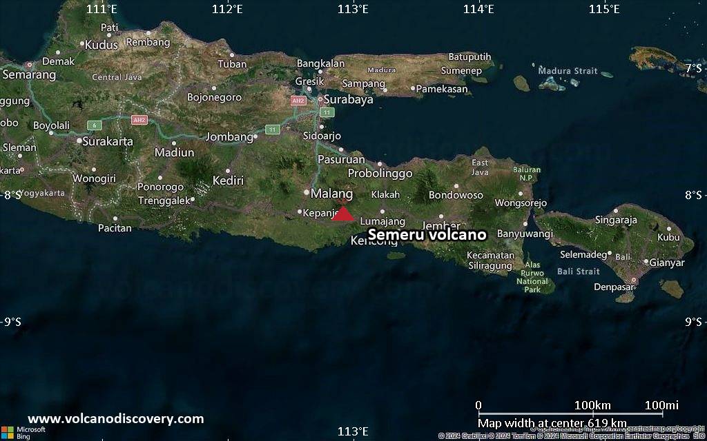
| RSS | EN | DE | EL | ES | FR | IT | RU

Semeru Volcano

Updated: Jul 1, 2025 21:55 GMT -
Stratovolcano
East Java, Indonesia, -8.11°S / 112.92°E
Summit height: 3676 m (12,060 ft)
Current status: erupting (4 out of 5)
Last update: 30 Jun 2025 (Volcanic Ash Advisory)
Night time mild eruptions from Semeru

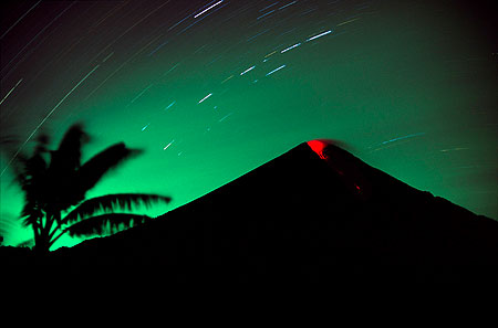
Semeru, the highest volcano on Java, and one of its most active, lies at the southern end of a volcanic massif extending north to the Tengger caldera. Semeru, a favourite mountain trekking destination, has been in almost continuous eruption since 1967. It is known for its regular ash explosions that typically occur at intervals of 10-30 minutes.

[smaller] [larger]
Typical eruption style: Explosive. Near constant strombolian activity, occasionally stronger explosions, lava flows and pyroclastic flows.
Semeru volcano eruptions: 1818, 1829, 1830, 1832, 1836, 1838, 1842, 1844, 1845, 1848, 1849(?), 1851, 1856, 1857, 1865, 1866(?), 1887, 1887, 1888, 1889-91, 1892, 1893, 1893-94, 1895, 1896, 1897, 1899, 1899, 1900, 1901, 1903, 1904, 1905, 1907, 1908, 1909-10, 1910-11, 1911, 1912, 1913, 1941-42, 1945, 1946, 1946-47, 1950-64, 1967-ongoing

Latest nearby earthquakes

Date and TimeMag / DepthDistance / Location

Background

The steep-sided volcano, also referred to as Mahameru (Great Mountain), rises abruptly to 3676 m above coastal plains to the south. Gunung Semeru was constructed south of the overlapping Ajek-ajek and Jambangan calderas. A line of lake-filled maars was constructed along a N-S trend cutting through the summit, and cinder cones and lava domes occupy the eastern and NE flanks. Summit topography is complicated by the shifting of craters from NW to SE. Frequent 19th and 20th century eruptions were dominated by small-to-moderate explosions from the summit crater, with occasional lava flows and larger explosive eruptions accompanied by pyroclastic flows that have reached the lower flanks of the volcano.

Semeru Volcano Photos

Significant volcanic eruptions: Semeru volcano

In the past 10,000 years, Semeru has had at least 63 confirmed eruptions, all documented by historical records or observations. Additionally, there are 3 uncertain or discredited eruptions from Semeru volcano.
The table below lists all known eruptions (date in bold face) of Semeru volcano since around 1900. Updates on the most recent volcanic activity of Semeru can be found on the news page of Semeru volcano.
DateNoteVEIDeathsDamage
2017 Jun 6 - ongoingJonggring Seloko
Historical obs./docs.
4
2022 Dec 4
(eruption 2014 Apr 1 ±15 d. - 2017 Jan 9)
Historical obs./docs.
4
light
Info
2021 Dec 4
(eruption 2014 Apr 1 ±15 d. - 2017 Jan 9)
Historical obs./docs.
445
heavy
Info
2014 Apr 1 ±15 d. - 2017 Jan 9Jonggring Seloko
Historical obs./docs.
4
2013 Oct 18Jonggring Seloko
Historical obs./docs.
1
2011 May 13 or before - 2012 Jul 20 ?Jonggring Seloko
Historical obs./docs.
2
2010 Jan 5 - Nov 29Jonggring Seloko
Historical obs./docs.
2
1967 Aug 31 - 2009 Mar 15Jonggring Seloko
Historical obs./docs.
3
2002
(eruption 1967 Aug 31 - 2009 Mar 15)
Historical obs./docs.
33
Info
2000 Jul 27
(eruption 1967 Aug 31 - 2009 Mar 15)
Historical obs./docs.
32
Info
1997 Sep 2
(eruption 1967 Aug 31 - 2009 Mar 15)
Historical obs./docs.
32
Info
1994 Feb 3
(eruption 1967 Aug 31 - 2009 Mar 15)
Historical obs./docs.
36
Info
1992
(eruption 1967 Aug 31 - 2009 Mar 15)
Historical obs./docs.
33
Info
1988 Jul 30
(eruption 1967 Aug 31 - 2009 Mar 15)
Historical obs./docs.
31
Info
1985 May 10
(eruption 1967 Aug 31 - 2009 Mar 15)
Historical obs./docs.
370
Info
1981 May 14
(eruption 1967 Aug 31 - 2009 Mar 15)
Historical obs./docs.
3372
Info
1981 Mar 29
(eruption 1967 Aug 31 - 2009 Mar 15)
Historical obs./docs.
31
Info
1978 Sep 19
(eruption 1967 Aug 31 - 2009 Mar 15)
Historical obs./docs.
312
Info
1976 Aug 31
(eruption 1967 Aug 31 - 2009 Mar 15)
Historical obs./docs.
2119
Info
1967 Aug 31
(eruption 1967 Aug 31 - 2009 Mar 15)
Historical obs./docs.
33
light
Info
1950 Jul 23 - 1964 Dec 16 ±15 d.Jonggring Seloko
Historical obs./docs.
2
1963 May 5
(eruption 1967 Aug 31 - 2009 Mar 15)
Historical obs./docs.
21
Info
1950 Aug 28
(eruption 1950 Jul 23 - 1964 Dec 16 ±15 d.)
Historical obs./docs.
16
Info
1946 Oct 29 - 1947 JunJonggring Seloko
Historical obs./docs.
2
1946 Oct 29
(eruption 1946 Oct 29 - 1947 Jun)
Historical obs./docs.
2
light
Info
1946 Feb - MayJonggring Seloko
Historical obs./docs.
2
1946 Feb
(eruption 1946 Feb - May)
Historical obs./docs.
26
moderate
Info
1945 Jun 12 - Jun 18Jonggring Seloko
Historical obs./docs.
2
1941 Sep 21 - 1942 FebESE flank (1400-1775 m)
Historical obs./docs.
2
1941 Sep 21
(eruption 1941 Sep 21 - 1942 Feb)
Historical obs./docs.
2
light
Info
1915 ±1 y.
Historical obs./docs.
2?
1913 Jun 23 - Jun 26 ?Jonggring Seloko
Historical obs./docs.
2
1913 Jun 23
(eruption 1913 Jun 23 - Jun 26 ?)
Historical obs./docs.
2
light
Info
1912 Aug 28
Historical obs./docs.
2
1911 Nov 8 - Dec
Historical obs./docs.
3
1911 Nov 8
(eruption 1911 Nov 8 - Dec)
Historical obs./docs.
3
light
Info
1910 Nov 16 - 1911 Feb
Historical obs./docs.
2
1909 Sep - 1910 Mar 22
Historical obs./docs.
2
1909 Sep
(eruption 1909 Sep - 1910 Mar 22)
Historical obs./docs.
2221
light
Info
1908 Jan - Dec
Historical obs./docs.
2
1907 Jul 9 or before
Historical obs./docs.
2
1907 Jan 7 - Jan 10
Historical obs./docs.
2
1905 Aug 4
Historical obs./docs.
2
1904 Jan 2 - Jan 16
Historical obs./docs.
2
1903 Mar 26 - Jun
Historical obs./docs.
2
1901 Jan 29 - Jan 30 or later
Historical obs./docs.
2
1900 Mar 29 - Apr 11 or later
Historical obs./docs.
2
Remark:
Our list of volcanic eruptions closely follows the database of eruptions of the Smithsonian's Global Volcanism Project (GVP), the internationally most recognized data source for volcanic eruptions, but also includes significant eruptive episodes or related volcano events. "Volcanic eruptions" are usually to be understood as sequences of individual eruptive episodes that can follow each other, or even overlap (if several vents are involved), and can last many years, decades or even longer. For example, the current activity of Stromboli volcano is understood as a single eruption that has been ongoing since 1934.
Sources: NOAA National Centers for Environmental Information (NCEI), Global Significant Volcanic Eruptions Database. doi:10.7289/V5TD9V7K | Global Volcanism Project / Smithsonian Institution

Semeru Volcano FAQ

+When was the last eruption of Semeru volcano?

+How often does Semeru volcano erupt?

+How active is Semeru volcano at present?

+When was the largest eruption of Semeru volcano?

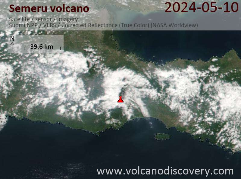
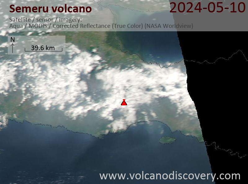
Latest satellite images

Semeru satellite image sat1Semeru satellite image sat2
Semeru Volcano Tours
Java (Indonesia)
From Krakatau to Bali
16-day study and photo tour to Java, Indonesia
16 days / 15 nights - Easy to Moderate
Price 3180 €
Custom and group dates
3-18 Aug 2025
8-23 Sep 2025
6-21 Oct 2025
Java (Indonesia)
Volcanoes of Java
17-day walking and trekking tour on Java
17 days / 16 nights - Moderate to Challenging
Price 3120 €
1-17 Aug 2025
8-24 Sep 2025
6-22 Oct 2025
East Java (Indonesia)
Volcanoes of East Java
5 days walking tour to Bromo, Semeru and Ijen (Incl. Semeru observatory)
5 days - Custom (variable)
Price depending on nr of people and program
Custom tour dates
Flores, Indonesia
Indonesia Volcano Special
Volcano expedition to Lewotobi and Ile Lewotolok volcanoes in Feb 2024
7 days (10 days with extension) - Moderate
Price 1750 EUR (7d) / 2480 EUR (10d)
no scheduled dates at present
East Java (Indonesia)
Bromo, Semeru, Ijen
trekking tour to Semeru, Bromo, Ijen volcanoes (East Java)
7-9 days - Moderate to Challenging
Price depending on nr of persons and itinerary
Custom and group dates

Semeru Volcano Maps

Below is a selection of maps showing the location and surroundings of the volcano at various resolutions based on aerial-imagery / terrain maps. Feel free to use them for non-commercial purposes on your blog or website as long as you credit them with a link back to this page (click to copy it).
Satellite/aerial-type map of Semeru volcano (world scale)
Terrain-type map of Semeru volcano (world scale)
Satellite/aerial-type map of Semeru volcano (region scale large)
Terrain-type map of Semeru volcano (region scale large)
Satellite/aerial-type map of Semeru volcano (region scale medium)
Terrain-type map of Semeru volcano (region scale medium)
Satellite/aerial-type map of Semeru volcano (region scale small)
Terrain-type map of Semeru volcano (region scale small)
Satellite/aerial-type map of Semeru volcano (local scale large)
Terrain-type map of Semeru volcano (local scale large)
Satellite/aerial-type map of Semeru volcano (local scale medium)
Terrain-type map of Semeru volcano (local scale medium)
Satellite/aerial-type map of Semeru volcano (local scale small)
Terrain-type map of Semeru volcano (local scale small)
Satellite/aerial-type map of Semeru volcano (scale of 10s of km)
Terrain-type map of Semeru volcano (scale of 10s of km)
Satellite/aerial-type map of Semeru volcano (scale of 20-40 km)
Terrain-type map of Semeru volcano (scale of 20-40 km)
Satellite/aerial-type map of Semeru volcano (scale of approx. 10-20 km)
Terrain-type map of Semeru volcano (scale of approx. 10-20 km)
Satellite/aerial-type map of Semeru volcano (scale of 5-10 km)
Satellite/aerial-type map of Semeru volcano (scale of few kilometers)
Volcanoes & Earthquakes - new app for Android
Guaranteed tours
1-17 Aug 2025: Volcanoes and Spices - Sulawesi/Halmahera (Indonesia)
1-14 Oct 2025: Desert, salt and volcanoes - Danakil desert (Ethiopia)
4-12 Oct 2025: From Stromboli to Etna - Sicily and Eolian Islands (Italy)
6-21 Oct 2025: From Krakatau to Bali - Java (Indonesia)
3-19 Nov 2025: Volcanoes and Spices - Sulawesi/Halmahera (Indonesia)
= spaces available   = guaranteed   = few spaces left   = booked out
Erupting Semeru volcano seen at sunrise.

On this page:

Try our free app!
Volcanoes & Earthquakes - new app for Android
Android | iOS version

More on VolcanoDiscovery

Why is there advertising on this site?

Support us - Help us upgrade our services!

We truly love working to bring you the latest volcano and earthquake data from around the world. Maintaining our website and our free apps does require, however, considerable time and resources.
We need financing to increase hard- and software capacity as well as support our editor team. We're aiming to achieve uninterrupted service wherever an earthquake or volcano eruption unfolds, and your donations can make it happen! Every donation will be highly appreciated. If you find the information useful and would like to support our team in integrating further features, write great content, and in upgrading our soft- and hardware, please make a donation (PayPal).

Planned features:Thanks to your past donations, these features have been added recently:
Download and Upgrade the Volcanoes & Earthquakes app to get one of the fastest seismic and volcano alerts online:
Android | IOS
Thank you!
Sources: VolcanoDiscovery / VolcanoAdventures and other sources as noted.
Use of material: Most text and images on our websites are owned by us. Re-use is generally not permitted without authorization. Contact us for licensing rights.
Volcanoes & Earthquakes
VolcanoDiscovery Home
Volcanoes | Earthquakes | Photos | Volcano News | | Shop | App
Adventure & Study Travel
Tours to Volcanoes and Volcanic Areas: walking tours, photo tours, study tours
Tours & Dates | FAQ | About us
Get our newsletter!
Company info
Contact | Legal info | Terms & conditions
Follow us
Follow us on facebook Follow us on Instagram Follow us on Bluesky Follow us on Twitter Visit our Youtube channel
EN | DE | EL | ES | FR | IT | RU
VolcanoDiscovery GmbH, Germany, Reg. nr.: HRB 103744, EU Tax Id: DE 297 465 123 owned and created by
Dr. Tom Pfeiffer, volcanologist, volcano photographer, tour organizer member of
IAVCEI
IAVCEI
Vulkanologische Gesellschaft
Volcanological Society
Ecotourism Greece
Ecotourism Greece
RUV insurance
Insured by R+V
VolcanoDiscovery © 2004- All Rights Reserved | Privacy - Cookie Settings