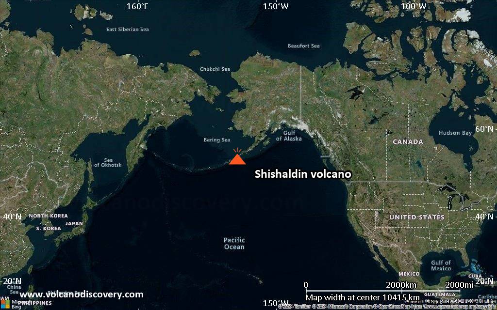
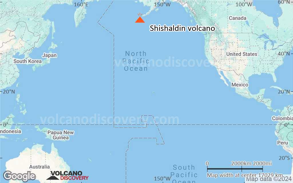
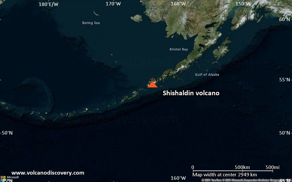
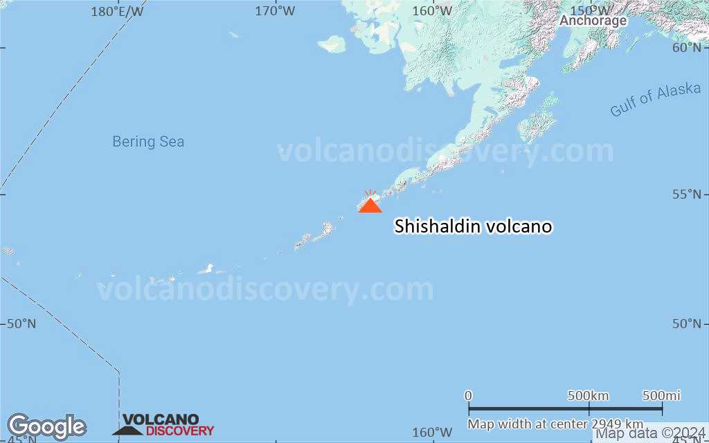
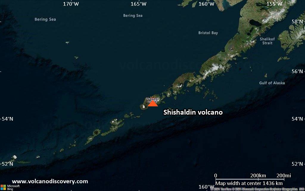
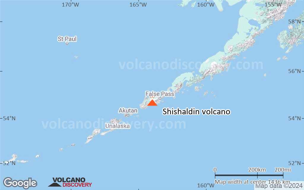
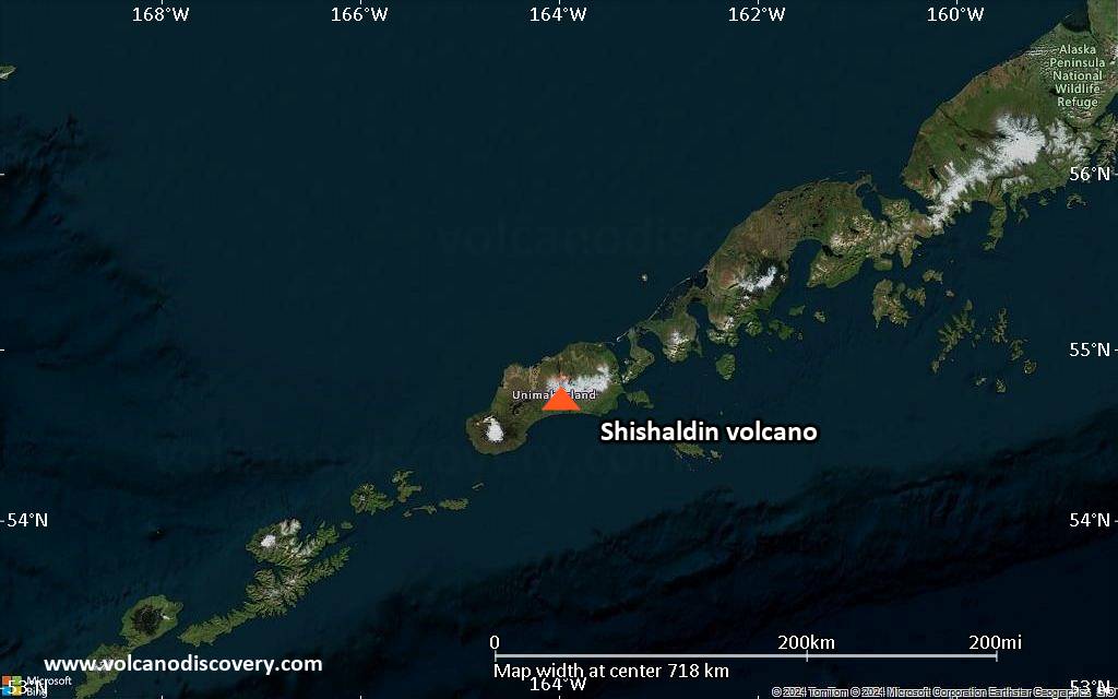
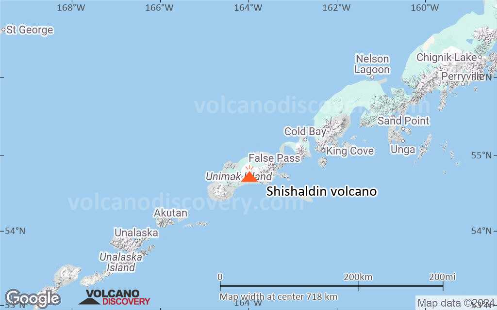
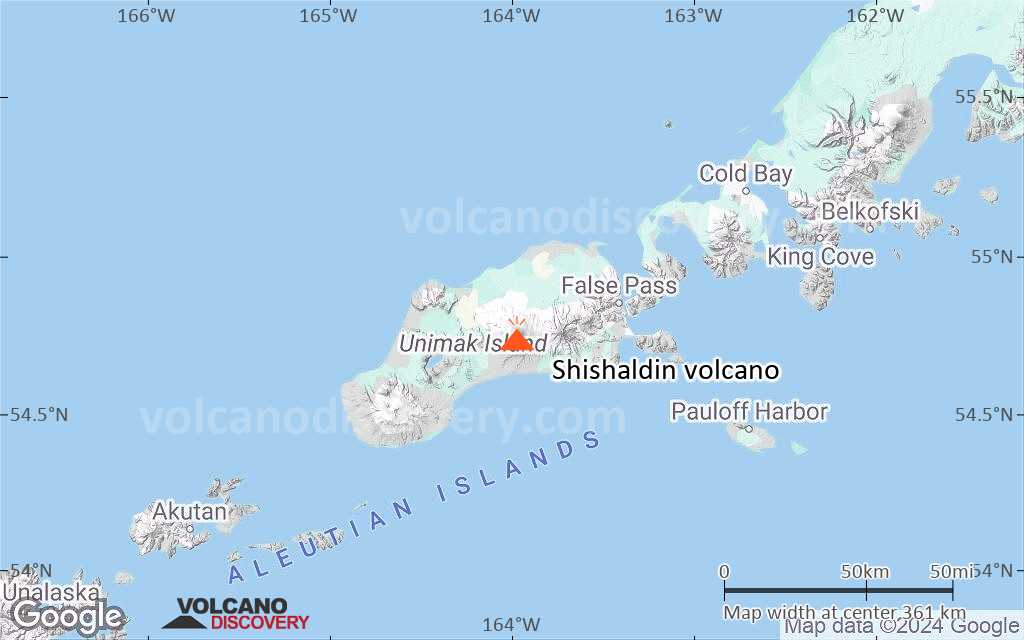
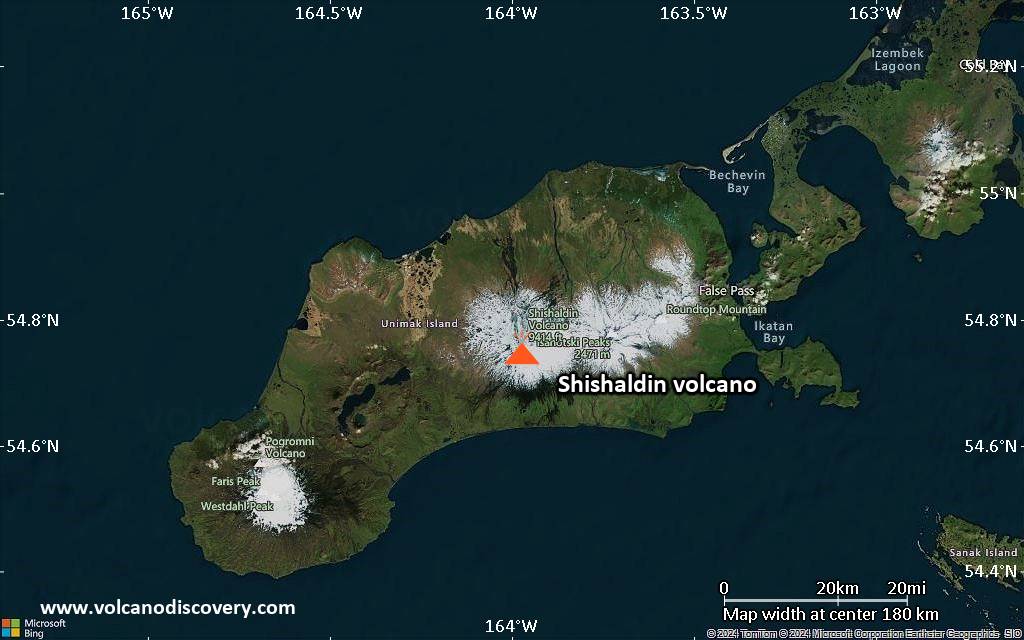
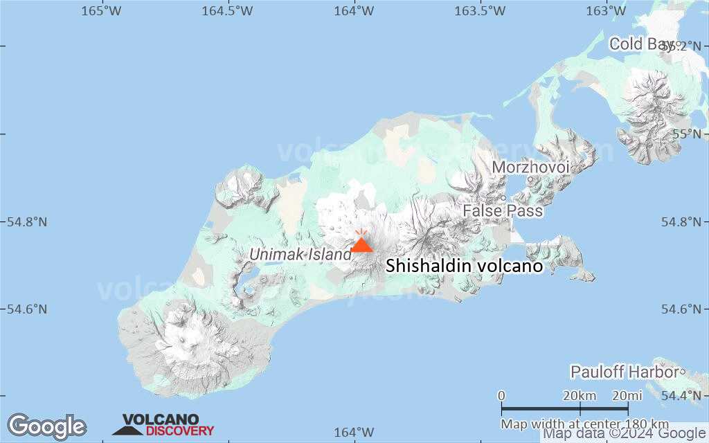
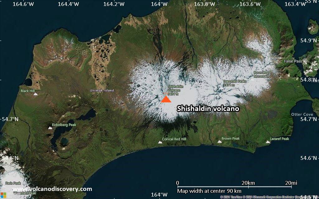
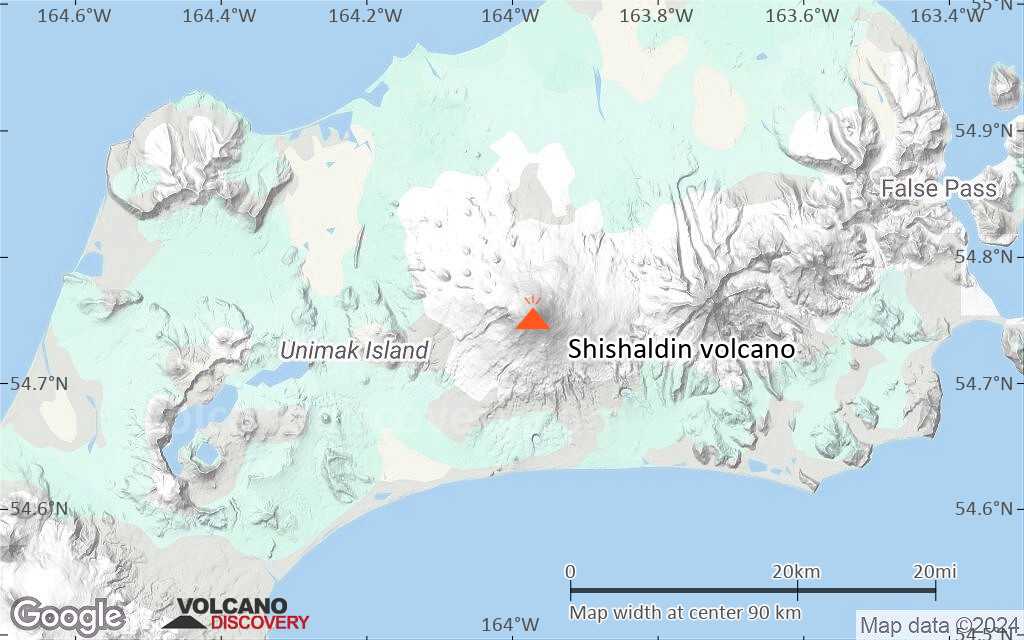
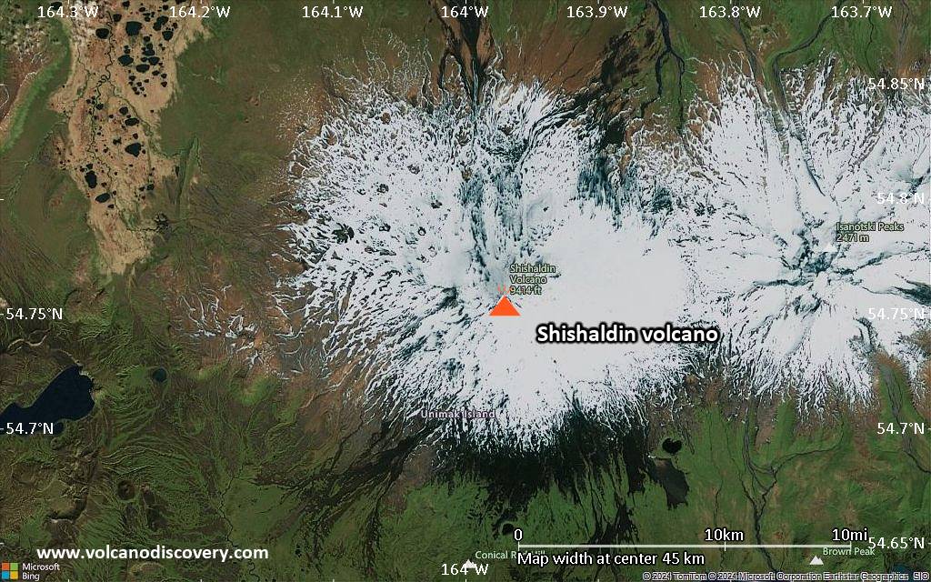
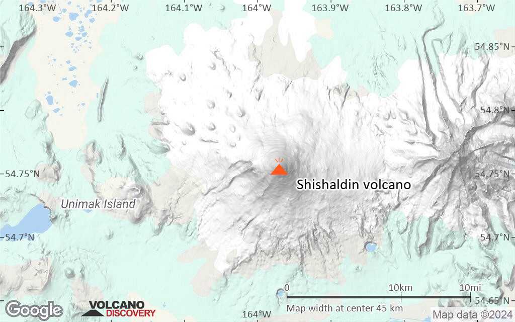
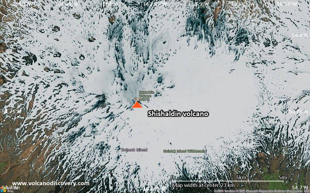
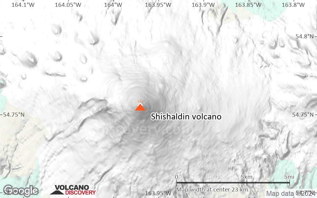
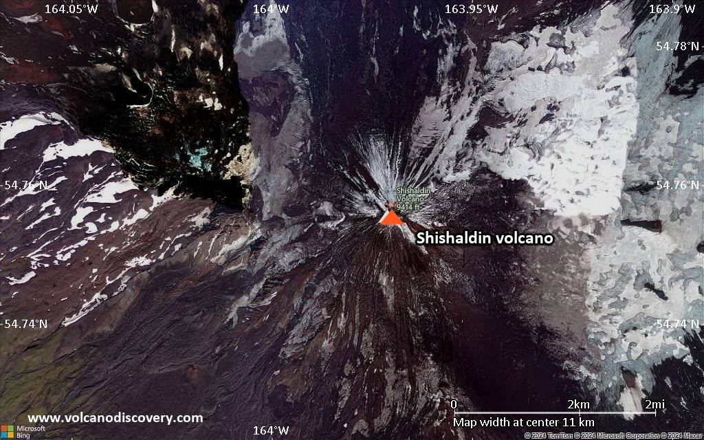
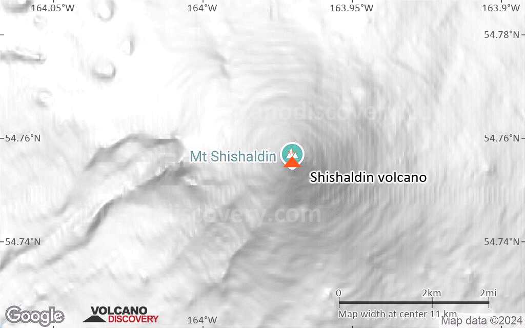
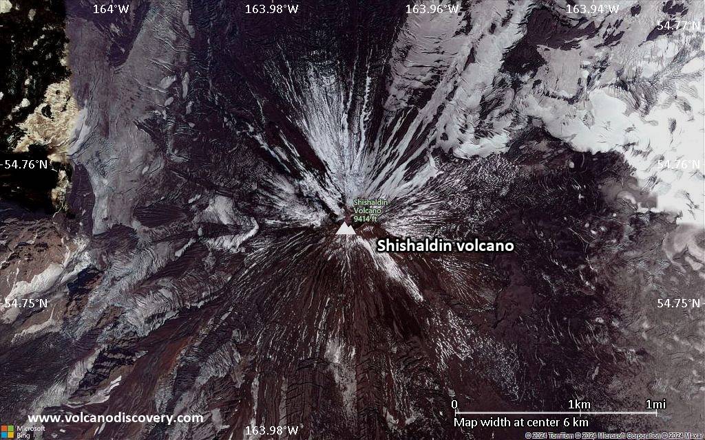
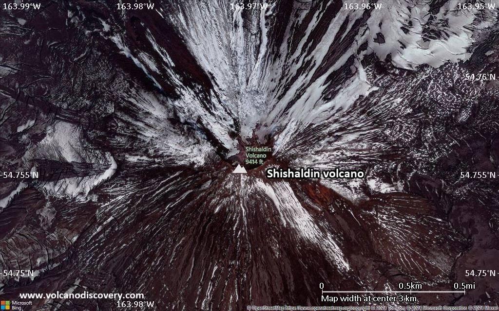
| RSS | EN | DE | EL | ES | FR | IT | RU

Shishaldin Volcano

Updated: Oct 29, 2025 10:48 GMT -
Stratovolcano
Aleutian Islands, Alaska, 54.76°N / -163.97°W
Summit height: 2857 m / 9,373 ft
Current status: minor activity or eruption warning (3 out of 5)
Last update: 12 Oct 2025 (Volcanic Ash Advisory)

[smaller] [larger]
Typical eruption style: explosive
Shishaldin volcano eruptions: 2023 (Jul 12-ongoing), 2019 (Jul 23 - 2020 May 4), 2014-15, 2008 (?), 2004, 2002, 2000, 1999, 1997, 1995, 1993, 1986-87, 1981 (?), 1979, 1978, 1976, 1975, 1967, 1963, 1955, 1953, 1951, 1948, 1946-47, 1932, 1929, 1928, 1927, 1925, 1922, 1912 (?), 1901, 1899 (?), 1898, 1897 (?), 1883, 1880-81, 1865 (?), 1842, 1838, 1830, 1927-29, 1826, 1825, 1824, 1790 (?), 1775-78

Latest nearby earthquakes

Date and TimeMag / DepthDistance / Location
Oct 28, 12:07 pm (Universal Time)
0.9

1.4 km
1 km (0.6 mi) to the S 37 km WSW of False Pass, Alaska Info
Oct 28, 10:27 am (Universal Time)
1.0

4.9 km
1.8 km (1.1 mi) to the S 37 km WSW of False Pass, Alaska Info
Oct 28, 10:05 am (Universal Time)
0.7

9.5 km
3.1 km (1.9 mi) to the W 40 km WSW of False Pass, Alaska Info
Oct 28, 06:23 am (Universal Time)
1.1

5 km
2 km (1.2 mi) to the S 38 km WSW of False Pass, Alaska Info
Oct 28, 04:28 am (Universal Time)
0.6

7.9 km
2.3 km (1.4 mi) to the SW 39 km WSW of False Pass, Alaska Info
Oct 27, 04:25 pm (GMT -8)
1.2

7 km
1 km (0.6 mi) to the W 38 km WSW of False Pass, Alaska Info
Monday, October 27, 2025 GMT (1 quake)
Oct 27, 05:12 pm (Universal Time)
0.3

1.4 km
1.7 km (1.1 mi) to the W 39 km WSW of False Pass, Alaska Info
Sunday, October 26, 2025 GMT (2 quakes)
Oct 26, 11:28 pm (Universal Time)
1.1

10.4 km
2.2 km (1.4 mi) to the NE 35 km WSW of False Pass, Alaska Info
Oct 25, 04:36 pm (GMT -8)
1.0

0.8 km
18 km (10.9 mi) to the S 48 km SW of False Pass, Alaska Info

Background

The beautifully symmetrical volcano of Shishaldin is the highest and one of the most active volcanoes of the Aleutian Islands. The 2857-m-high, glacier-covered volcano is the westernmost of three large stratovolcanoes along an E-W line in the eastern half of Unimak Island. The Aleuts named the volcano Sisquk, meaning "mountain which points the way when I am lost." A steady steam plume rises from its small summit crater. Constructed atop an older glacially dissected volcano, Shishaldin is Holocene in age and largely basaltic in composition. Remnants of an older ancestral volcano are exposed on the west and NE sides at 1500-1800 m elevation. Shishaldin contains over two dozen pyroclastic cones on its NW flank, which is blanketed by massive aa lava flows. Frequent explosive activity, primarily consisting of strombolian ash eruptions from the small summit crater, but sometimes producing lava flows, has been recorded since the 18th century.
---
Smithsonian / GVP volcano information

Shishaldin Volcano Photos

Significant volcanic eruptions: Shishaldin volcano

In the past 10,000 years, Shishaldin has had at least 40 confirmed volcanic eruptions, out of which 37 are documented by historical records, while the others can be inferred from geological evidence.
Additionally, there are 11 uncertain or discredited eruptions from Shishaldin volcano.
The table below lists all known eruptions (date in bold face) of Shishaldin volcano since around 1900. Updates on the most recent volcanic activity of Shishaldin can be found on the news page of Shishaldin volcano.
DateNoteVEIDeathsDamage
2023 Jul 11 ±1 d. -
Historical obs./docs.
3
2019 Jul 23 - 2020 May 4Summit crater
Historical obs./docs.
3
2014 Jan 30 - 2015 Jul 3Summit crater
Historical obs./docs.
1
?? 2008 Feb 12
Uncertain Eruption
1?
2004 Feb 17 - Jul 16 ±15 d.
Historical obs./docs.
2
?? 2000 Aug 11
Uncertain Eruption
1?
?? 1999 Sep 25 ±5 d. - 2000 Feb 4 ?
Uncertain Eruption
1?
1999 Mar 13 - May 27
Historical obs./docs.
3
1998 Nov 4
Historical obs./docs.
1
1997 Jun 2
Historical obs./docs.
1
1995 Dec 23 - 1996 May 16 or before
Historical obs./docs.
3
1993 Sep 4 - Oct 29
Historical obs./docs.
2
1986 Mar 19 - 1987 Feb 15 ?
Historical obs./docs.
2
?? 1981 Sep 25
Uncertain Eruption
?
1979 Feb 16 ±15 d.
Historical obs./docs.
2
1978 Feb 8 - Feb 9 ?
Historical obs./docs.
2
1976 Jan 16 ±15 d. - Sep 28
Historical obs./docs.
2
1975 Sep 13 - Oct 26 ±5 d.
Historical obs./docs.
2
1967 Jan 28
Historical obs./docs.
2
1963 Dec 28
Historical obs./docs.
2
1955 Jul 16 ±15 d.
Historical obs./docs.
2
1953 Oct 4 ±3 d.
Historical obs./docs.
2
1951 Apr 16 ±15 d. - Oct 5 ±4 d.
Historical obs./docs.
2
1948
Historical obs./docs.
2
1946 Aug - 1947 Jan
Historical obs./docs.
2
1932 Feb 1 - May 21
Historical obs./docs.
2
1929 May 28 - Jun 23 or laterSummit and north flank
Historical obs./docs.
2
1928 Aug
Historical obs./docs.
2
1927
Historical obs./docs.
?
1925
Historical obs./docs.
?
1922 Oct 15 ±45 d.
Historical obs./docs.
2
?? 1912
Uncertain Eruption
?
1901
Historical obs./docs.
?
Remark:
Our list of volcanic eruptions closely follows the database of eruptions of the Smithsonian's Global Volcanism Project (GVP), the internationally most recognized data source for volcanic eruptions, but also includes significant eruptive episodes or related volcano events. "Volcanic eruptions" are usually to be understood as sequences of individual eruptive episodes that can follow each other, or even overlap (if several vents are involved), and can last many years, decades or even longer. For example, the current activity of Stromboli volcano is understood as a single eruption that has been ongoing since 1934.
Sources: NOAA National Centers for Environmental Information (NCEI), Global Significant Volcanic Eruptions Database. doi:10.7289/V5TD9V7K | Global Volcanism Project / Smithsonian Institution

Shishaldin Volcano FAQ

+When was the last eruption of Shishaldin volcano?

+How often does Shishaldin volcano erupt?

+How active is Shishaldin volcano at present?

+When was the largest eruption of Shishaldin volcano?

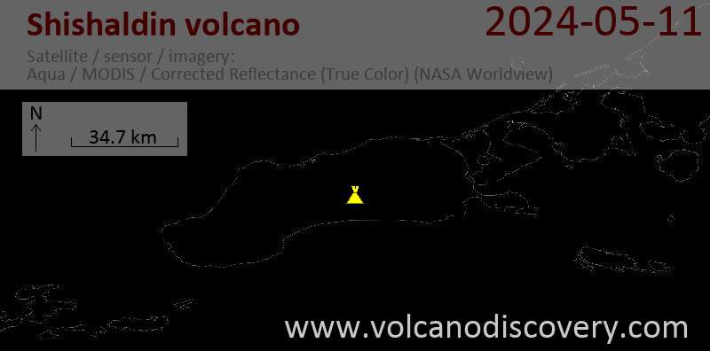
Latest satellite images

shishaldin satellite image sat1shishaldin satellite image sat2

Shishaldin Volcano Maps

Below is a selection of maps showing the location and surroundings of the volcano at various resolutions based on aerial-imagery / terrain maps. Feel free to use them for non-commercial purposes on your blog or website as long as you credit them with a link back to this page (click to copy it).
Satellite/aerial-type map of Shishaldin volcano (world scale)
Terrain-type map of Shishaldin volcano (world scale)
Satellite/aerial-type map of Shishaldin volcano (region scale large)
Terrain-type map of Shishaldin volcano (region scale large)
Satellite/aerial-type map of Shishaldin volcano (region scale medium)
Terrain-type map of Shishaldin volcano (region scale medium)
Satellite/aerial-type map of Shishaldin volcano (region scale small)
Terrain-type map of Shishaldin volcano (region scale small)
Satellite/aerial-type map of Shishaldin volcano (local scale large)
Terrain-type map of Shishaldin volcano (local scale large)
Satellite/aerial-type map of Shishaldin volcano (local scale medium)
Terrain-type map of Shishaldin volcano (local scale medium)
Satellite/aerial-type map of Shishaldin volcano (local scale small)
Terrain-type map of Shishaldin volcano (local scale small)
Satellite/aerial-type map of Shishaldin volcano (scale of 10s of km)
Terrain-type map of Shishaldin volcano (scale of 10s of km)
Satellite/aerial-type map of Shishaldin volcano (scale of 20-40 km)
Terrain-type map of Shishaldin volcano (scale of 20-40 km)
Satellite/aerial-type map of Shishaldin volcano (scale of approx. 10-20 km)
Terrain-type map of Shishaldin volcano (scale of approx. 10-20 km)
Satellite/aerial-type map of Shishaldin volcano (scale of 5-10 km)
Satellite/aerial-type map of Shishaldin volcano (scale of few kilometers)
Volcanoes & Earthquakes - new app for Android
Guaranteed tours
3-19 Nov 2025: Volcanoes and Spices - Sulawesi/Halmahera (Indonesia)
3-19 Nov 2025: From Krakatau to Bali - Java (Indonesia)
20 Nov - 3 Dec 2025: Desert, salt and volcanoes - Danakil desert (Ethiopia)
2-10 May 2026: From Stromboli to Etna - Sicily and Eolian Islands (Italy)
= spaces available   = guaranteed   = few spaces left   = booked out
Wed, 1 Oct 2025, 16:15

Shishaldin Volcano (United States) activity update Sep 30, 2025 - Unrest

The United States Geological Survey - Alaska Volcano Observatory (USGS-AVO) reported that unrest continued at Shishaldin between 29 September 2025 (local) and 30 September 2025 (local). The alert level remained at "Advisory" (level 2 on a 4-level scale). The aviation alert level remained at "Yellow" (level 2 on a 4-level scale). ... Read all

On this page:

Try our free app!
Volcanoes & Earthquakes - new app for Android
Android | iOS version

More on VolcanoDiscovery

Why is there advertising on this site?

Support Us – Help Us Enhance Our Services!

We’re passionate about delivering the latest volcano and earthquake data from around the globe — just for you. However, maintaining our website and free apps requires significant time, effort, and resources.
Your support helps us expand our hardware and software capabilities and empowers our dedicated editorial team. Our mission is to provide uninterrupted, real-time updates whenever an earthquake strikes or a volcano erupts — and your donations make this possible. Every contribution, big or small, is deeply appreciated. If you find our information valuable and want to help us add new features, create compelling content, and improve our technology, please consider making a donation:

Donate with PayPal:

Planned Features:

Thanks to your past donations, we have recently added:
Download the Volcanoes & Earthquakes app to stay among the first to receive the fastest seismic and volcano alerts online:
Android | iOS
Thank you for being part of our mission!
Sources: VolcanoDiscovery / VolcanoAdventures and other sources as noted.
Use of material: Most text and images on our websites are owned by us. Re-use is generally not permitted without authorization. Contact us for licensing rights.
Volcanoes & Earthquakes
VolcanoDiscovery Home
Volcanoes | Earthquakes | Photos | Volcano News | | Shop | App
Adventure & Study Travel
Tours to Volcanoes and Volcanic Areas: walking tours, photo tours, study tours
Tours & Dates | FAQ | About us
Get our newsletter!
Company info
Contact | Legal info | Terms & conditions
Follow us
Follow us on facebook Follow us on Instagram Follow us on Bluesky Follow us on Twitter Visit our Youtube channel
EN | DE | EL | ES | FR | IT | RU
VolcanoDiscovery GmbH, Germany, Reg. nr.: HRB 103744, EU Tax Id: DE 297 465 123 owned and created by
Dr. Tom Pfeiffer, volcanologist, volcano photographer, tour organizer member of
IAVCEI
IAVCEI
Vulkanologische Gesellschaft
Volcanological Society
Ecotourism Greece
Ecotourism Greece
RUV insurance
Insured by R+V
VolcanoDiscovery © 2004- All Rights Reserved | Privacy - Cookie Settings