Volcano W Volcano
Updated: Apr 29, 2024 18:42 GMT -
Submarine volcanoes -900? m / - 2,953 ft
New Zealand, Kermadec Islands, -31.85°S / -179.18°W
Current status: normal or dormant (1 out of 5)
New Zealand, Kermadec Islands, -31.85°S / -179.18°W
Current status: normal or dormant (1 out of 5)
[smaller] [larger]
Volcano W volcano eruptions: unknown, no recent eruptions
Latest nearby earthquakes
| Time | Mag. / Depth | Distance / Location | |||
Background
Twin submarine volcanoes, known informally as Volcano W, were discovered during a New Zealand-American submarine vent mapping expedition to the Kermadec arc in 2004. The two deep-water basaltic volcanoes lie SW of Curtis Island. The summits of both volcanoes are cut by small calderas, and evidence of diffuse hydrothermal venting was observed on the SE volcano in 2005. The SE volcano rises to within about 900 m of the sea surface and contains a cone in its summit caldera. The caldera walls expose pillow lavas, pillow tubes, localized sheet flows, and pillow breccias, with higher proportions of volcaniclastic breccias in the upper portion.---
Smithsonian / GVP volcano information
Volcano W Volcano Photos
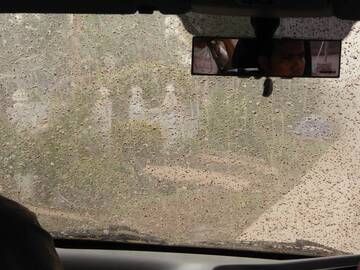
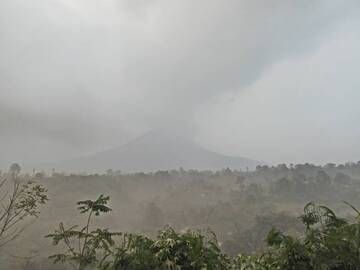
Driving through volcanic ash rain at Sinabung volcano, Sumatra, Indonesia (Oct 2014) (Photo: Walter Reis)
Ashfall at Sinabung volcano, Sumatra, Indonesia (Oct 2014) (Photo: Walter Reis)
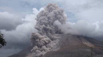
Pyroclastic flow on Sinabung volcano, Sumatra, Indonesia (Oct 2014) (Photo: Walter Reis)
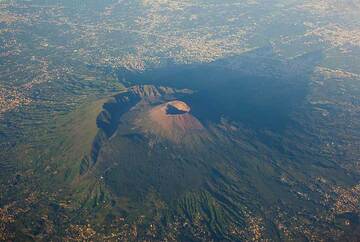
Vesuvius volcano near Naples, Italy, seen from the air. The rim of the remnant of the older Somma volcano which collapsed in the 79 AD Plinian eruption is clearly visible...
Latest satellite images