Grímsvötn Volcano
Updated: May 15, 2024 13:22 GMT -
Caldera 1725 m (5,659 ft)
Iceland, 64.42°N / -17.33°W
Current status: normal or dormant (1 out of 5)
Iceland, 64.42°N / -17.33°W
Current status: normal or dormant (1 out of 5)
Last update: 24 Jan 2024 (Smithsonian / USGS Weekly Volcanic Activity Report)
Grímsvötn is Iceland's most frequently active volcano, probably because it is located on the center of the active NE rift zone of Iceland. Most of the volcano is hidden beneath the giant glacier of Vatnajökull, Europe's largest glacier.
[smaller] [larger]
Produces notorious and frequent floods of melt-water bursts from the glacier (jökulhlaups).
Grímsvötn volcano eruptions: ca. 1310, 1332, 1341, 1354(?), ca. 1370, ca. 1390, ca. 1430, ca. 1450, ca. 1470, ca. 1490, ca. 1510, ca. 1530, 1598, 1603, 1619, 1629, 1638, 1659, 1681, 1684-85, 1706, 1716, 1725, 1753, 1768, 1774, 1783-85 (Laki fissure eruption: the largest historically known effusive eruption), 1794(?), 1796(?), 1816, 1823, 1838, 1854, 1861(?), 1867, 1873, 1883, 1887-89, 1891-92, 1897, 1902-04, 1922, 1933, 1934, 1934, 1938, 1939(?), 1941(?), 1945, 1948(?), 1954, 1972(?), 1983, 1984(?), 1996, 1998, 2004 (Nov.), 2011 (21-26 May)
Latest nearby earthquakes
| Time | Mag. / Depth | Distance / Location | |||
| May 14, 08:47 am (Reykjavik) | 1.2 6.2 km | Info | |||
| Sunday, May 12, 2024 GMT (1 quake) | |||||
| May 12, 06:53 am (Reykjavik) | 1.2 12 km | Info | |||
| Saturday, May 11, 2024 GMT (1 quake) | |||||
| May 11, 11:05 pm (Reykjavik) | 1.5 7 km | 18 km (11 mi) to the W | Info | ||
| Thursday, May 9, 2024 GMT (1 quake) | |||||
| May 9, 05:53 am (Reykjavik) | 1.6 6.7 km | 6.1 km (3.8 mi) to the SW | Info | ||
| Tuesday, May 7, 2024 GMT (2 quakes) | |||||
| May 7, 03:26 pm (Reykjavik) | 1.4 3.1 km | 4 km (2.5 mi) to the S | Info | ||
| May 7, 01:27 am (Reykjavik) | 1.9 0.9 km | 29 km (18 mi) to the N | Info | ||
Background
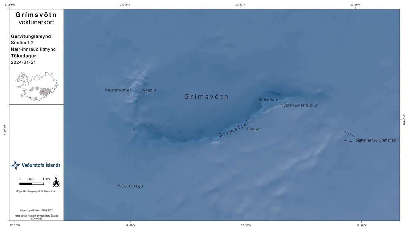
Grímsvötn volcano has a 6x8 km large caldera, whose southern rim is exposed. The caldera contains a lake of liquid water, due to the thermal energy from the volcano. The lake is covered by the ice of the glacier, but during eruptions or times of increased hydrothermal activity from the volcano, the amount of melt water and the pressure of the lake against the ice above becomes strong enough to lift the ice dam and pour out at the South side of the glacier in devastating floods known as jökulhlaups.During eruptions, the overlying part of the glacier is often melted through, creating a giant hole in the ice permitting breathtaking views from above onto the lake, from where ash and steam can escape.
Fissures and the Laki fissure eruption in 1783:
The volcano's structure seems to be dominated by NE-SW trending fissures that correspond to the rift zone. Eruptions from these fissures can occur well beyond the extent of the glacier, such as the huge eruption in 1783, known as the Laki fissure eruption.
It is the largest known effusive eruption that has occurred on earth during the past millennia. About 15 cubic kilometers of basaltic lava flows were erupted from a 27-km long fissure over a period of 7 months. Accompanied by enormous amounts of suphur dioxide and fluoride gas, the eruption caused wide-spread crop damage, killed a large number of lifestock and caused a severe famine on Iceland. As a result, one fifth of Iceland's population was killed. Some consequences of the eruption were even noticed in other parts of the world: Volcanic fog (the gas cloud from the eruption) was drifting over Europe and parts of Asia, altering summer temperatures. This eruption was the first one that brought some scientists to the idea that volcanoes can impact the world's climate.
Background
Grímsnes is a relatively small volcanic system located SE of Thingvallavatn lake east of an en echelon group of volcanic fields extending across the Reykjanes Peninsula.
Grímsnes lava flows cover 54 sq km and were erupted from a group of 11 fissures that produced a series of NE-SW-trending crater rows. The eruptions of the basaltic Grímsnes lavas were restricted to a relatively short interval between about 6500 and 5500 years ago.
---
Source: GVP, Smithsonian Institute
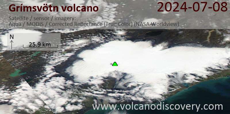
Latest satellite images