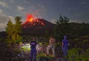
Lavic Lake Volcano
Updated: May 22, 2025 14:53 GMT -
volcanic field
California (Canada and USA (mainland)), 34.75°N / -116.63°W 
Summit height: 1495 m / 4,905 ft
Current status: normal or dormant (1 out of 5)
Lavic Lake, a dry lakebed in the Mojave desert, California, is a volcanic field of 4 cinder cones, 3 of which are in the Lavic Lake area and a fourth in the Rodman Maountains 20 km to the west.
Pisgah crater is the main feature, a prominent 100 m high cinder cone north of Lavic Lake surrounded by an 80 km2 basalt lava flow field.
[smaller] [larger]
Lavic Lake volcano eruptions:
Latest nearby earthquakes
| Date and Time | Mag / Depth | Distance / Location | |||
|---|---|---|---|---|---|
| May 22, 08:07 am (Universal Time) | 1.2 5.6 km | 15 km (9.2 mi) to the S | Info | ||
Background
Vents near Pisgah crater were the source of mostly pahoehoe lava flows that traveled 8 km SE to Lavic Lake, and in a narrow lobe as far as 18 km west of the vent. Paleomagnetic, argon-argon, and cosmogenic helium dated locate it at about 25,000 years before present. Another very youthful looking, but undated cinder cone and lava field of the Lavic Lake volcanic field is located in the Sunshine Peak area of the Lava Beds Mountains, south of the better known Pisgah Crater.---
Source: GVP Lavic Lake information
Latest satellite images

Lavic Lake Volcano Maps
Below is a selection of maps showing the location and surroundings of the volcano at various resolutions based on aerial-imagery / terrain maps. Feel free to use them for non-commercial purposes on your blog or website as long as you credit them with a link back to this page (click to copy it).

Satellite/aerial-type map of Lavic Lake volcano (world scale)

Terrain-type map of Lavic Lake volcano (world scale)

Satellite/aerial-type map of Lavic Lake volcano (region scale large)

Terrain-type map of Lavic Lake volcano (region scale large)

Satellite/aerial-type map of Lavic Lake volcano (region scale medium)

Terrain-type map of Lavic Lake volcano (region scale medium)

Satellite/aerial-type map of Lavic Lake volcano (region scale small)

Terrain-type map of Lavic Lake volcano (region scale small)

Satellite/aerial-type map of Lavic Lake volcano (local scale large)

Terrain-type map of Lavic Lake volcano (local scale large)

Satellite/aerial-type map of Lavic Lake volcano (local scale medium)

Terrain-type map of Lavic Lake volcano (local scale medium)

Satellite/aerial-type map of Lavic Lake volcano (local scale small)

Terrain-type map of Lavic Lake volcano (local scale small)

Satellite/aerial-type map of Lavic Lake volcano (scale of 10s of km)

Terrain-type map of Lavic Lake volcano (scale of 10s of km)

Satellite/aerial-type map of Lavic Lake volcano (scale of 20-40 km)

Terrain-type map of Lavic Lake volcano (scale of 20-40 km)

Satellite/aerial-type map of Lavic Lake volcano (scale of approx. 10-20 km)

Terrain-type map of Lavic Lake volcano (scale of approx. 10-20 km)

Satellite/aerial-type map of Lavic Lake volcano (scale of 5-10 km)

Satellite/aerial-type map of Lavic Lake volcano (scale of few kilometers)