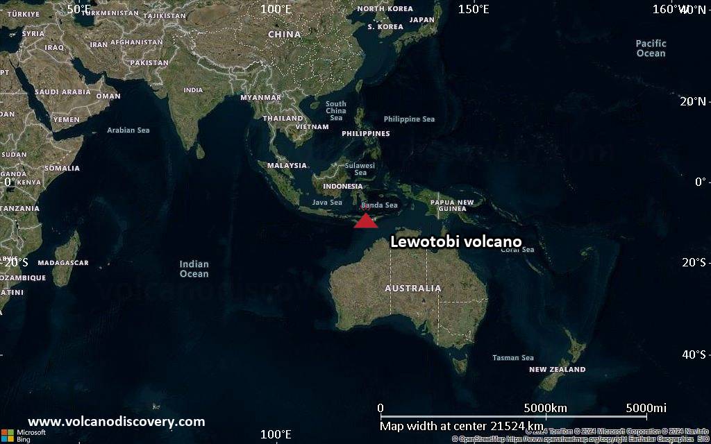
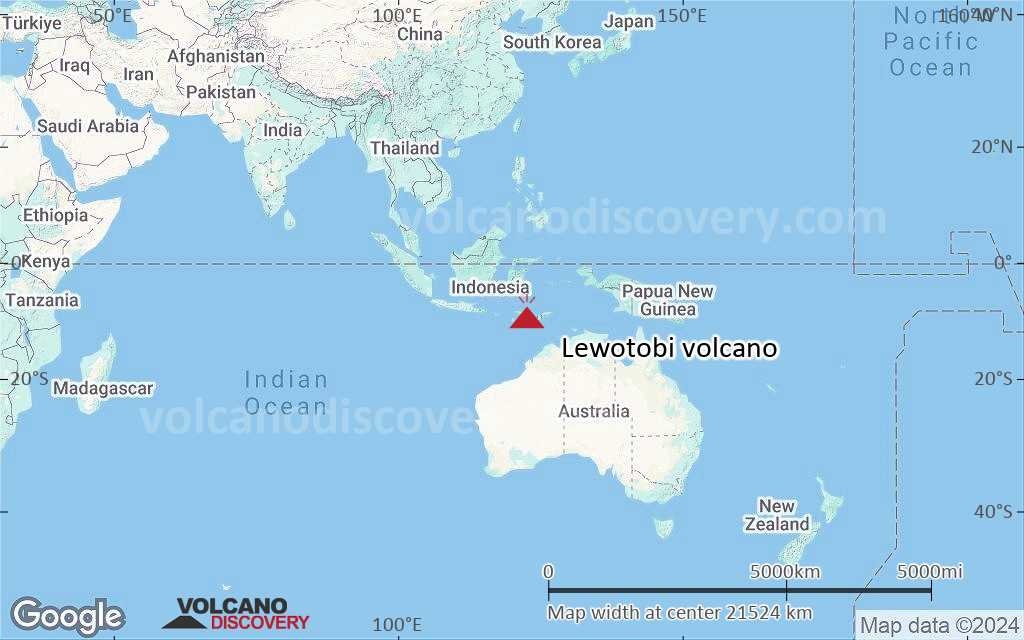
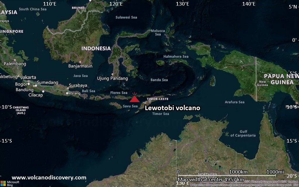
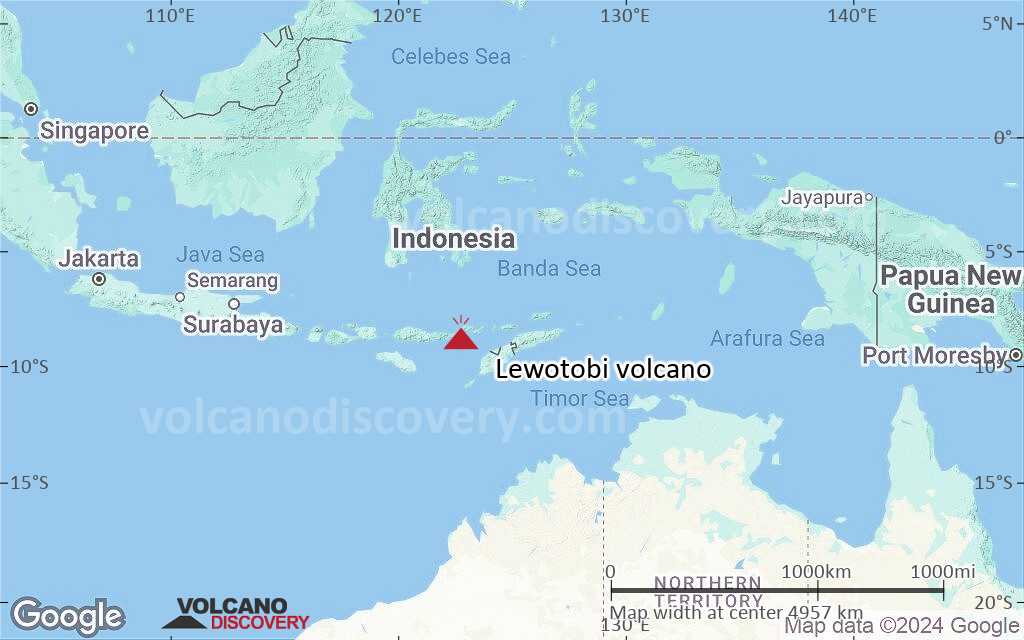
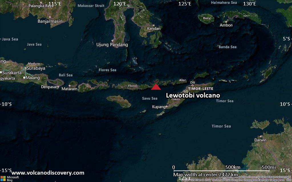
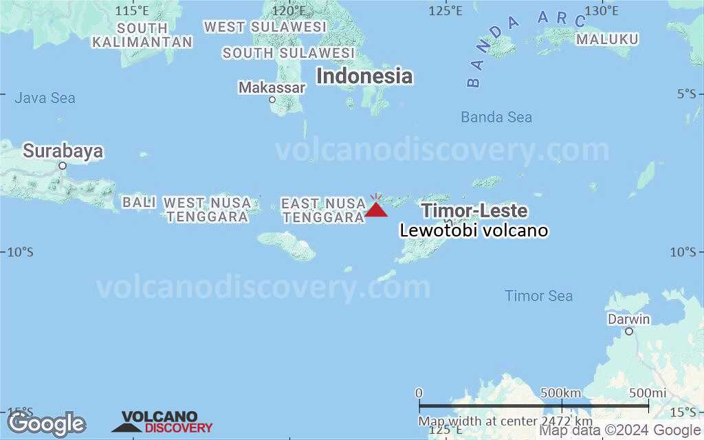
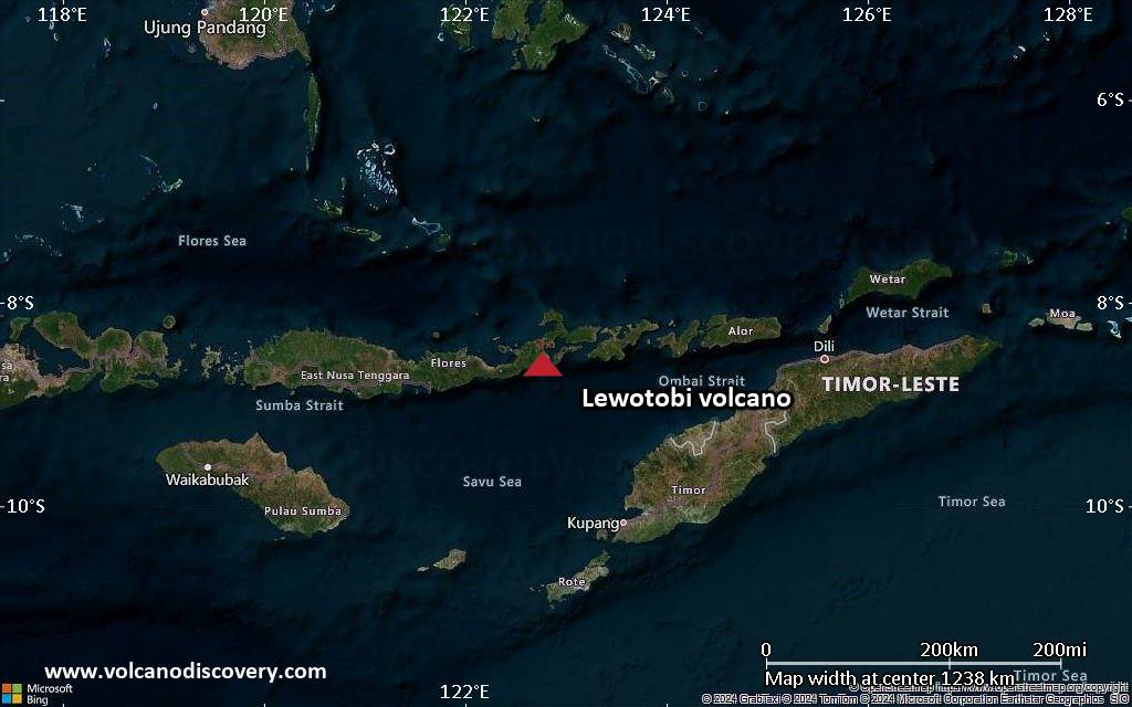
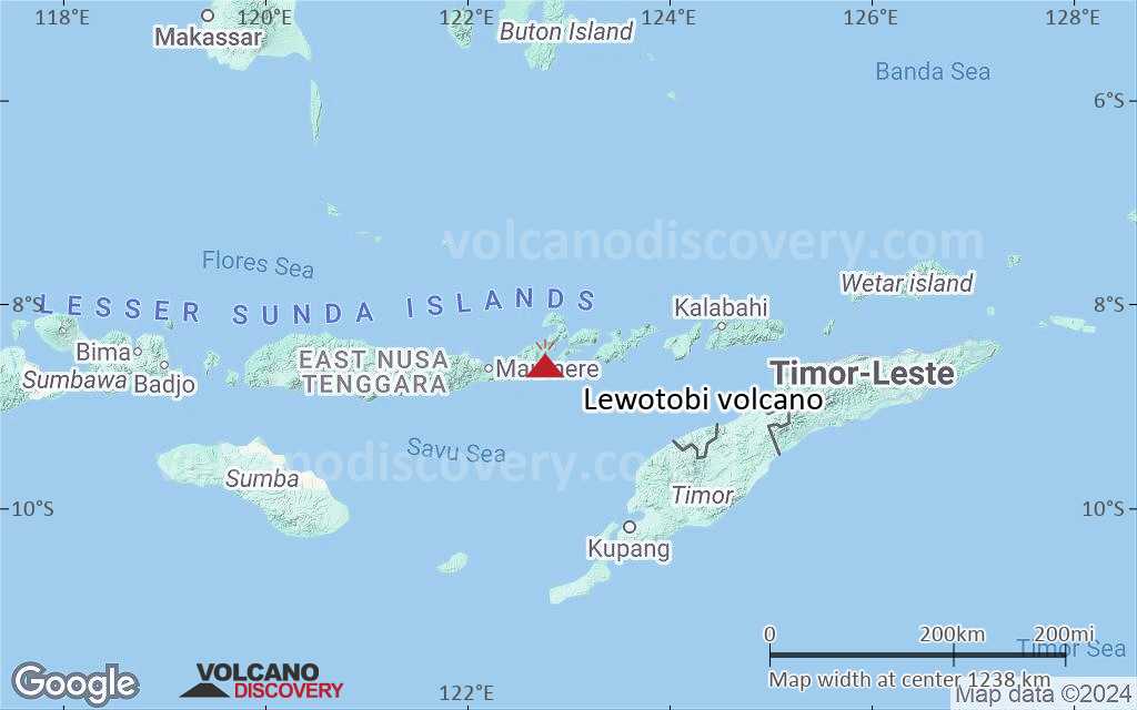
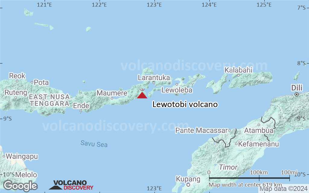
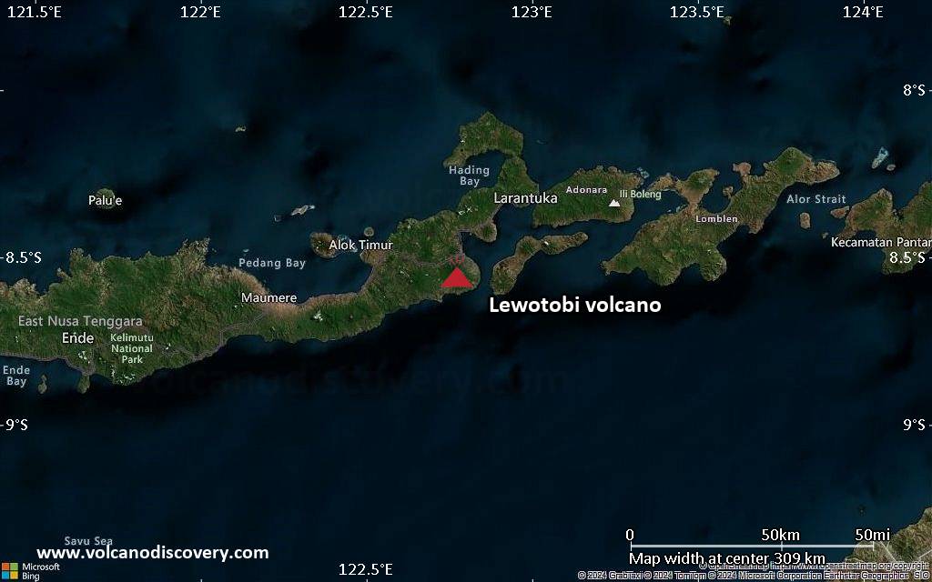
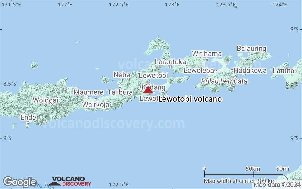
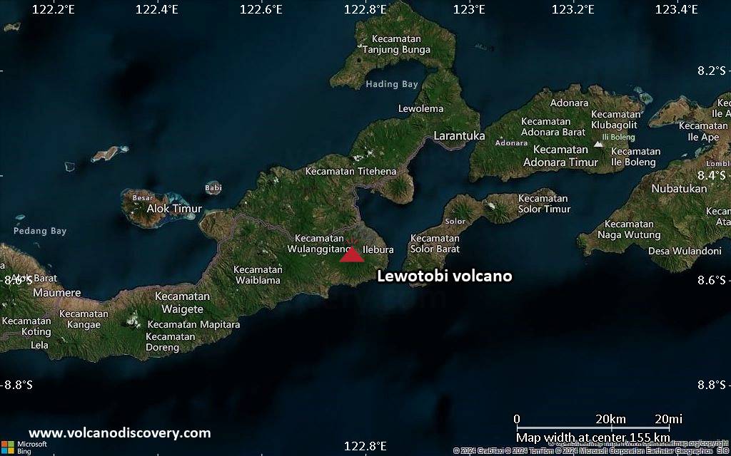
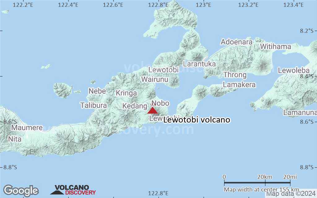
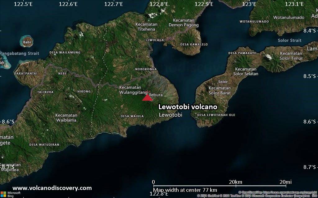
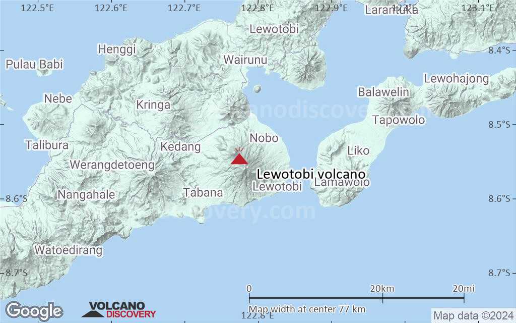
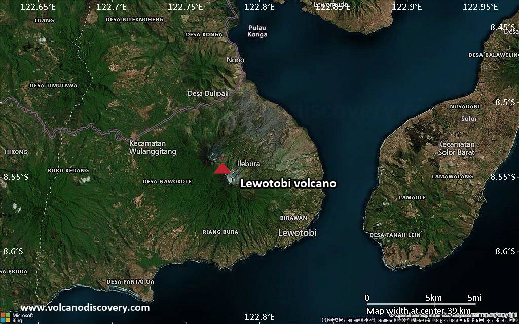
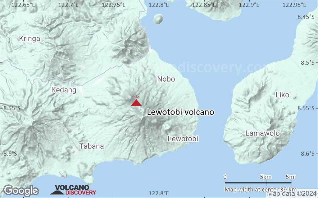
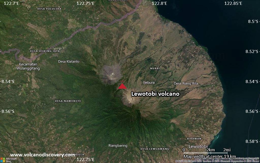
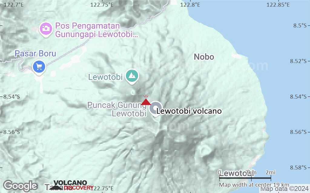
| RSS | EN | DE | EL | ES | FR | IT | RU

Lewotobi Volcano

Updated: May 21, 2025 12:22 GMT -
stratovolcano
Flores (Indonesia), -8.54°S / 122.78°E
Summit height: 1703 m / 5,587 ft
Current status: erupting (4 out of 5)
Last update: 21 May 2025 (Volcanic Ash Advisory)
Lewotobi Lakilaki and Lewotobi Perempuan twin volcano

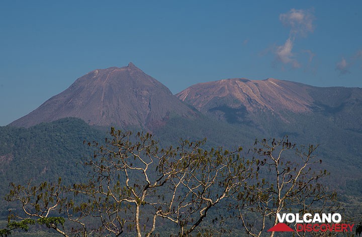
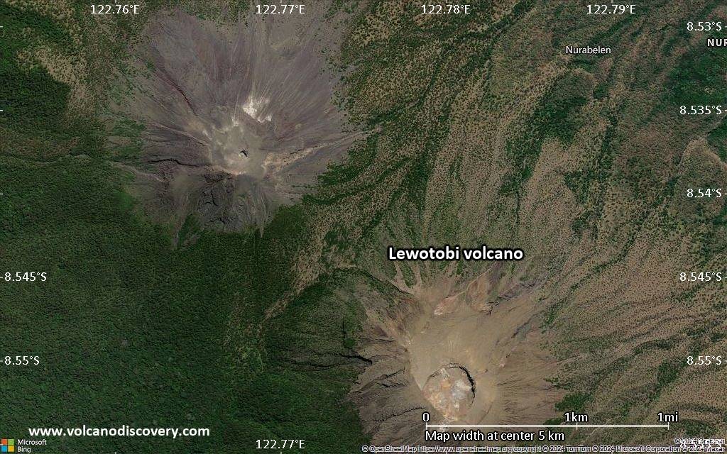
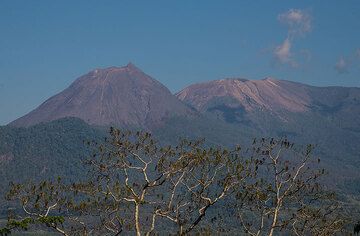
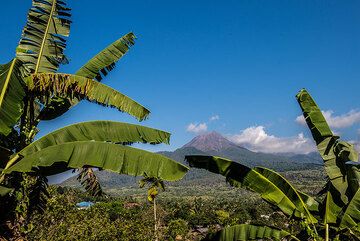
Lewotobi volcano at the eastern end of Flores Island is one of the most frequently active volcanoes in the region. It has two peaks arranged on a NW-SE line separated by 2 km and a 1232 m high saddle. This gave the twin volcano its name Lewotobi "husband and wife" (also spelled Lewetobi).
The two peaks correspond to the Lewotobi Lakilaki and Lewotobi Perempuan stratovolcanoes. Lewotobi Lakilaki (1584 m) has a summit crater of 400 m diameter open to the north. Lewotobi Perampuan (1703 m)'s crater is 700 m wide.

[smaller] [larger]
Typical eruption style: Explosive
Lewotobi volcano eruptions: 2023-ongoing, 2014?, 2003, 2002, 1999, 1991, 1990, 1971, 1970, 1968-69, 1939-40, 1935, 1932-33, 1921, 1914, 1909-10, 1907, 1889, 1869, 1868, 1865, 1861, 1859(?), 1675

Latest nearby earthquakes

Date and TimeMag / DepthDistance / Location

Background

Lewotobi Lakilaki has been frequently active during the 19th and 20th centuries, while the taller and broader Lewotobi Perempuan has erupted only twice in historical time. Small lava domes have grown during the 20th century in the summit craters of both volcanoes. A prominent flank cone, Iliwokar, occurs on the east flank of Lewotobi Perampuan.

Lewotobi Volcano Photos

Significant volcanic eruptions: Lewotobi volcano

In the past 10,000 years, Lewotobi has had at least 23 confirmed eruptions, all documented by historical records or observations. Additionally, there are 2 uncertain or discredited eruptions from Lewotobi volcano.
The table below lists all known eruptions (date in bold face) of Lewotobi volcano since around 1800. Updates on the most recent volcanic activity of Lewotobi can be found on the news page of Lewotobi volcano.
DateNoteVEIDeathsDamage
2023 Dec 23 - ongoing
Historical obs./docs.
2
2024 Nov 3
(eruptive episode 2024 Nov 3)
Historical obs./docs.
09
heavy
Info
?? 2014 Oct 6
Uncertain Eruption
Historical obs./docs.
2
2003 May 30 - Sep 1 or laterLewotobi Lakilaki
Historical obs./docs.
2
2002 Oct 12Lewotobi Lakilaki
Historical obs./docs.
1
1999 Mar 31 - Jul 1 ?Lewotobi Lakilaki
Historical obs./docs.
2
1991 May 11 - 1992 Dec 31 or laterLewotobi Lakilaki
Historical obs./docs.
1
1990 Jan 28 - Jun 16 ±15 d.Lewotabi Lakilaki
Historical obs./docs.
1
1971 Jan 16 ±15 d.Lewotobi Lakilaki
Historical obs./docs.
2
1970 Jul 2 ±182 d.Lewotobi Lakilaki
Historical obs./docs.
2
1968 Nov 28 - 1969 Feb 2Lewotobi Lakilaki
Historical obs./docs.
2
1939 Dec 17 - 1940 Apr 21Lewotobi Lakilaki
Historical obs./docs.
2
1935 Dec - Dec 25 or laterLewetobi Perempuan
Historical obs./docs.
2
1932 May 23 - 1933 Dec 26 ±5 d.Lewotobi Lakilaki
Historical obs./docs.
3
1921 Jan 1 - Dec 20Lewotobi Perempuan
Historical obs./docs.
2
1914 Jun 29Lewotobi Lakilaki
Historical obs./docs.
2
1909 Jan 8 - 1910 May 26Lewotobi Lakilaki
Historical obs./docs.
2
1907 Sep 28 - Oct 30Lewotobi Lakilaki
Historical obs./docs.
3
1907 Sep 28
(eruption 1907 Sep 28 - Oct 30)
Historical obs./docs.
21
Info
1889Lewotobi Lakilaki
Historical obs./docs.
2
1869 Jul 7 - Jul 27Lewotobi Lakilaki
Historical obs./docs.
2
1869 Jul 7
(eruption 1869 Jul 7 - Jul 27)
Historical obs./docs.
22
Info
1868 Dec 15Lewotobi Lakilaki
Historical obs./docs.
2
1868 Jul 13 or beforeLewotobi Lakilaki
Historical obs./docs.
2
1865 May 4Lewotobi Lakilaki
Historical obs./docs.
2
1861 May 4 - May 18Lewotobi Lakilaki
Historical obs./docs.
2
?? 1859 Jul
Uncertain Eruption
?
Remark:
Our list of volcanic eruptions closely follows the database of eruptions of the Smithsonian's Global Volcanism Project (GVP), the internationally most recognized data source for volcanic eruptions, but also includes significant eruptive episodes or related volcano events. "Volcanic eruptions" are usually to be understood as sequences of individual eruptive episodes that can follow each other, or even overlap (if several vents are involved), and can last many years, decades or even longer. For example, the current activity of Stromboli volcano is understood as a single eruption that has been ongoing since 1934.
Sources: NOAA National Centers for Environmental Information (NCEI), Global Significant Volcanic Eruptions Database. doi:10.7289/V5TD9V7K | Global Volcanism Project / Smithsonian Institution

Eruptions of Lewotobi volcano


2003 eruption
Lewotobi volcano erupted on 30 May 2003. Ash plumes were seen 200 m above the summit and light ash fall occurred at the observatory 5 km from the crater. Small eruptions continued in June and July, producing ashfall in the villages of Bawalatang, Duang, and Boru.
On 31 August, a more powerful explosion produced an ash plume to a height of ~2.5 km above the summit that drifted W, incandescent lava bombs ignited forest fires up to 1 km radius from the crater. Ash fall damaged crops on nearby farmland. Following that 2003 eruption, according to the daily Jakarta Post, at least 565 villagers living on the slopes of Lewotobi were affected by sulfur and ash emissions. The residents experienced respiratory problems and skin afflictions.
The eruption ended sometime in October.
---
Source: GVP monthly activity reports

2002 eruption
An moderate explosion occurred at the volcano on 12 October 2002, the first activity since 1999. ...more info

1999 eruption
Small ash explosions began at Lewotobi volcano on 21 March 1999.
The activity consisted typically of weak steam and ash emissions reaching a few 100 m above the summit, sometimes interrupted by more powerful explosions. In April and May, mild strombolian activity with visibly incandescent lava was observed, ejecting bombs to 50-75 m above the crater. A stronger explosion, accompanied by a blast, occurred on 1 July 1999. The explosion threw glowing bombs to more than 500 m distance from the crater, igniting forest fires that burnt vegetation up to 2.5 km north of the volcano. Minor ash fell occurred in an 8 km radius, including the villages of Boru, Bawalatang, and Watukubu.
No reports of further activity after July are available, when the eruption probably started to die out.

1991 eruption
Mild eruptive activity resumed at the summit crater in the first half and until around July/August of 1991. Mild ash emission and strombolian activity was observed between March-July. The highest reported ash plumes reached about 800 m and incandescent material reached 100 m height above the crater. It was reported that hot ash fall (smelling of sulfur) onto nearby areas caused residents to flee during eruptions in July.

1939 eruption
Lewotobi volcano erupted on 17 December 1939, exactly 6 years after the start of the previous eruption. It is reported that the eruption caused lapilli fall "like hen eggs" at the Hokeng mission post for 10 minutes.

1933 eruption
A powerful ash eruption occurred at Lewotobi volcano on 17 December 1933. Incandescent bombs were visible from Doeang and Nobo.

Lewotobi Volcano FAQ

+When was the last eruption of Lewotobi volcano?

+How often does Lewotobi volcano erupt?

+How active is Lewotobi volcano at present?

+When was the largest eruption of Lewotobi volcano?

Latest satellite images

Lewotobi satellite image sat1Lewotobi satellite image sat2

Lewotobi Volcano Maps

Below is a selection of maps showing the location and surroundings of the volcano at various resolutions based on aerial-imagery / terrain maps. Feel free to use them for non-commercial purposes on your blog or website as long as you credit them with a link back to this page (click to copy it).
Satellite/aerial-type map of Lewotobi volcano (world scale)
Terrain-type map of Lewotobi volcano (world scale)
Satellite/aerial-type map of Lewotobi volcano (region scale large)
Terrain-type map of Lewotobi volcano (region scale large)
Satellite/aerial-type map of Lewotobi volcano (region scale medium)
Terrain-type map of Lewotobi volcano (region scale medium)
Satellite/aerial-type map of Lewotobi volcano (region scale small)
Terrain-type map of Lewotobi volcano (region scale small)
Satellite/aerial-type map of Lewotobi volcano (local scale large)
Terrain-type map of Lewotobi volcano (local scale large)
Satellite/aerial-type map of Lewotobi volcano (local scale medium)
Terrain-type map of Lewotobi volcano (local scale medium)
Satellite/aerial-type map of Lewotobi volcano (local scale small)
Terrain-type map of Lewotobi volcano (local scale small)
Satellite/aerial-type map of Lewotobi volcano (scale of 10s of km)
Terrain-type map of Lewotobi volcano (scale of 10s of km)
Satellite/aerial-type map of Lewotobi volcano (scale of 20-40 km)
Terrain-type map of Lewotobi volcano (scale of 20-40 km)
Satellite/aerial-type map of Lewotobi volcano (scale of approx. 10-20 km)
Terrain-type map of Lewotobi volcano (scale of approx. 10-20 km)
Satellite/aerial-type map of Lewotobi volcano (scale of 5-10 km)
Satellite/aerial-type map of Lewotobi volcano (scale of few kilometers)
Volcanoes & Earthquakes - new app for Android
Guaranteed tours
9-25 Jun 2025: Volcanoes and Spices - Sulawesi/Halmahera (Indonesia)
7-22 Jul 2025: From Krakatau to Bali - Java (Indonesia)
7-23 Jul 2025: Volcanoes and Spices - Sulawesi/Halmahera (Indonesia)
1-17 Aug 2025: Volcanoes and Spices - Sulawesi/Halmahera (Indonesia)
1-14 Oct 2025: Desert, salt and volcanoes - Danakil desert (Ethiopia)
4-12 Oct 2025: From Stromboli to Etna - Sicily and Eolian Islands (Italy)
6-21 Oct 2025: From Krakatau to Bali - Java (Indonesia)
3-19 Nov 2025: Volcanoes and Spices - Sulawesi/Halmahera (Indonesia)
= spaces available   = guaranteed   = few spaces left   = booked out

On this page:

Try our free app!
Volcanoes & Earthquakes - new app for Android
Android | iOS version

More on VolcanoDiscovery

Why is there advertising on this site?

Support us - Help us upgrade our services!

We truly love working to bring you the latest volcano and earthquake data from around the world. Maintaining our website and our free apps does require, however, considerable time and resources.
We need financing to increase hard- and software capacity as well as support our editor team. We're aiming to achieve uninterrupted service wherever an earthquake or volcano eruption unfolds, and your donations can make it happen! Every donation will be highly appreciated. If you find the information useful and would like to support our team in integrating further features, write great content, and in upgrading our soft- and hardware, please make a donation (PayPal).

Planned features:Thanks to your past donations, these features have been added recently:
Download and Upgrade the Volcanoes & Earthquakes app to get one of the fastest seismic and volcano alerts online:
Android | IOS
Thank you!
Sources: VolcanoDiscovery / VolcanoAdventures and other sources as noted.
Use of material: Most text and images on our websites are owned by us. Re-use is generally not permitted without authorization. Contact us for licensing rights.
Volcanoes & Earthquakes
VolcanoDiscovery Home
Volcanoes | Earthquakes | Photos | Volcano News | | Shop | App
Adventure & Study Travel
Tours to Volcanoes and Volcanic Areas: walking tours, photo tours, study tours
Tours & Dates | FAQ | About us
Get our newsletter!
Company info
Contact | Legal info | Terms & conditions
Follow us
Follow us on facebook Follow us on Instagram Follow us on Bluesky Follow us on Twitter Visit our Youtube channel
EN | DE | EL | ES | FR | IT | RU
VolcanoDiscovery GmbH, Germany, Reg. nr.: HRB 103744, EU Tax Id: DE 297 465 123 owned and created by
Dr. Tom Pfeiffer, volcanologist, volcano photographer, tour organizer member of
IAVCEI
IAVCEI
Vulkanologische Gesellschaft
Volcanological Society
Ecotourism Greece
Ecotourism Greece
RUV insurance
Insured by R+V
VolcanoDiscovery © 2004- All Rights Reserved | Privacy - Cookie Settings