Moti Volcano
Updated: May 21, 2025 13:39 GMT -
stratovolcano
Halmahera (Indonesia), 0.45°N / 127.4°E 
Summit height: 950 m / 3,117 ft
Current status: normal or dormant (1 out of 5)
Moti (also spelled Motir) volcano forms a 5 km wide island surrounded by coral reefs north of Makian volcano. It is part of the N-S aligned chain of volcanoes off the W coast of Halmahera Island, Indonesia.
[smaller] [larger]
Moti volcano eruptions: none in historic times
Latest nearby earthquakes
| Date and Time | Mag / Depth | Distance / Location | |||
|---|---|---|---|---|---|
Background
Moti has a truncated conical shape with a crater on the SSW side, and a lava flow is visible on the NW base. The volcano has no confirmed historic activity, although there are reports about a possible small eruption in 1774 or shortly before, although it is likely that this came from its more active neighbor Gamalana.Moti Volcano Photos
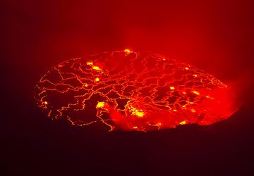
View of the lava lake at night, partly obscured by fumes. It's impossible to photograph the real sight - raising emotions, pictures and dreams of the birth of earth. (Ph...
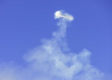
The "successful plume" has the right motion and geometry to produce a vortex that detaches and keeps stable, despite the strong wind that disperses the other steam plumes...
Another experiment with a neutral density filter to blur the wave motion in daylight... (Photo: Tom Pfeiffer)
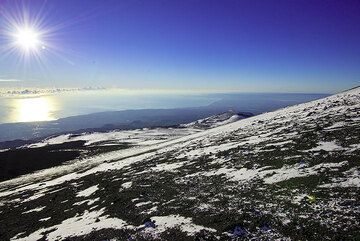
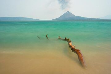
The peaceful atmosphere of a glorious sunny morning ends a night filled with incredible emotions given by some of earth's most powerful displays. (Photo: Tom Pfeiffer)
Significant volcanic eruptions: Moti volcano
In the past 10,000 years, Moti has had only one confirmed historic eruption ###WHEN1###|only one confirmed historic eruption ###WHEN1### and one ###WHEN2### inferred from geological evidence|only one confirmed historic eruption ###WHEN1###, but at least ###NUM_INFERRED### eruptions can be inferred from geological evidence|at least ###NUM_CONFIRMED### confirmed eruptions, all documented by historical records or observations|at least ###NUM_CONFIRMED### confirmed volcanic eruptions, out of which ###NUM_HISTORIC### are documented by historical records, while the others can be inferred from geological evidence.
No historic eruptions are known from Moti volcano, but at least one eruption ###WHEN2### can be inferred from geological evidence|evidence from at least ###NUM_CONFIRMED### eruptions during the past 10,000 years can be found in the geological record.
There is one uncertain or discredited eruption in 1774 from Moti volcano.
The table below lists all known eruptions (date in bold face) of Moti volcano in historic times and during the past 10,000 years. Updates on the most recent volcanic activity of Moti can be found on the news page of Moti volcano.
| Date | Note | VEI | Deaths | Damage | ||
|---|---|---|---|---|---|---|
Discredited Eruption | ||||||
Remark:
Our list of volcanic eruptions closely follows the database of eruptions of the Smithsonian's Global Volcanism Project (GVP), the internationally most recognized data source for volcanic eruptions, but also includes significant eruptive episodes or related volcano events. "Volcanic eruptions" are usually to be understood as sequences of individual eruptive episodes that can follow each other, or even overlap (if several vents are involved), and can last many years, decades or even longer. For example, the current activity of Stromboli volcano is understood as a single eruption that has been ongoing since 1934.
Sources: NOAA National Centers for Environmental Information (NCEI), Global Significant Volcanic Eruptions Database. doi:10.7289/V5TD9V7K | Global Volcanism Project / Smithsonian Institution
Latest satellite images
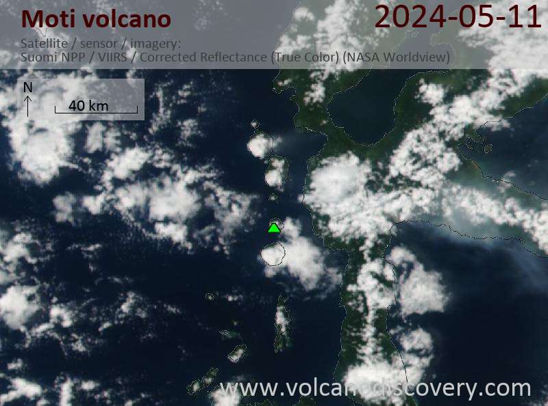
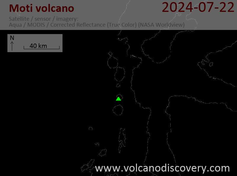
Moti Volcano Maps
Below is a selection of maps showing the location and surroundings of the volcano at various resolutions based on aerial-imagery / terrain maps. Feel free to use them for non-commercial purposes on your blog or website as long as you credit them with a link back to this page (click to copy it).
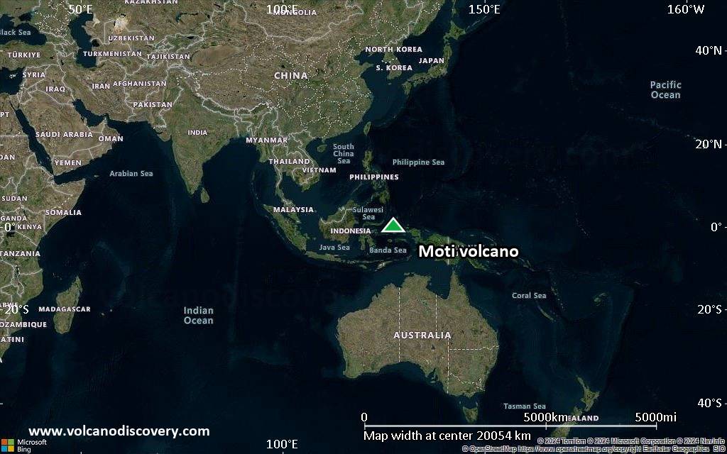
Satellite/aerial-type map of Moti volcano (world scale)

Terrain-type map of Moti volcano (world scale)

Satellite/aerial-type map of Moti volcano (region scale large)

Terrain-type map of Moti volcano (region scale large)

Satellite/aerial-type map of Moti volcano (region scale medium)

Terrain-type map of Moti volcano (region scale medium)

Satellite/aerial-type map of Moti volcano (region scale small)

Terrain-type map of Moti volcano (region scale small)

Satellite/aerial-type map of Moti volcano (local scale large)

Terrain-type map of Moti volcano (local scale large)

Satellite/aerial-type map of Moti volcano (local scale medium)

Terrain-type map of Moti volcano (local scale medium)

Satellite/aerial-type map of Moti volcano (local scale small)

Terrain-type map of Moti volcano (local scale small)

Satellite/aerial-type map of Moti volcano (scale of 10s of km)

Terrain-type map of Moti volcano (scale of 10s of km)

Satellite/aerial-type map of Moti volcano (scale of 20-40 km)

Terrain-type map of Moti volcano (scale of 20-40 km)

Satellite/aerial-type map of Moti volcano (scale of approx. 10-20 km)

Terrain-type map of Moti volcano (scale of approx. 10-20 km)

Satellite/aerial-type map of Moti volcano (scale of 5-10 km)

Satellite/aerial-type map of Moti volcano (scale of few kilometers)