| RSS | EN | DE | EL | ES | FR | IT | RU

San Cristobal Volcano

Updated: May 24, 2025 08:04 GMT -
stratovolcano
Nicaragua, 12.7°N / -87°W
Summit height: 1745 m / 5,725 ft
Current status: minor activity or eruption warning (3 out of 5)
Last update: 12 Jun 2024 (Smithsonian / USGS Weekly Volcanic Activity Report)

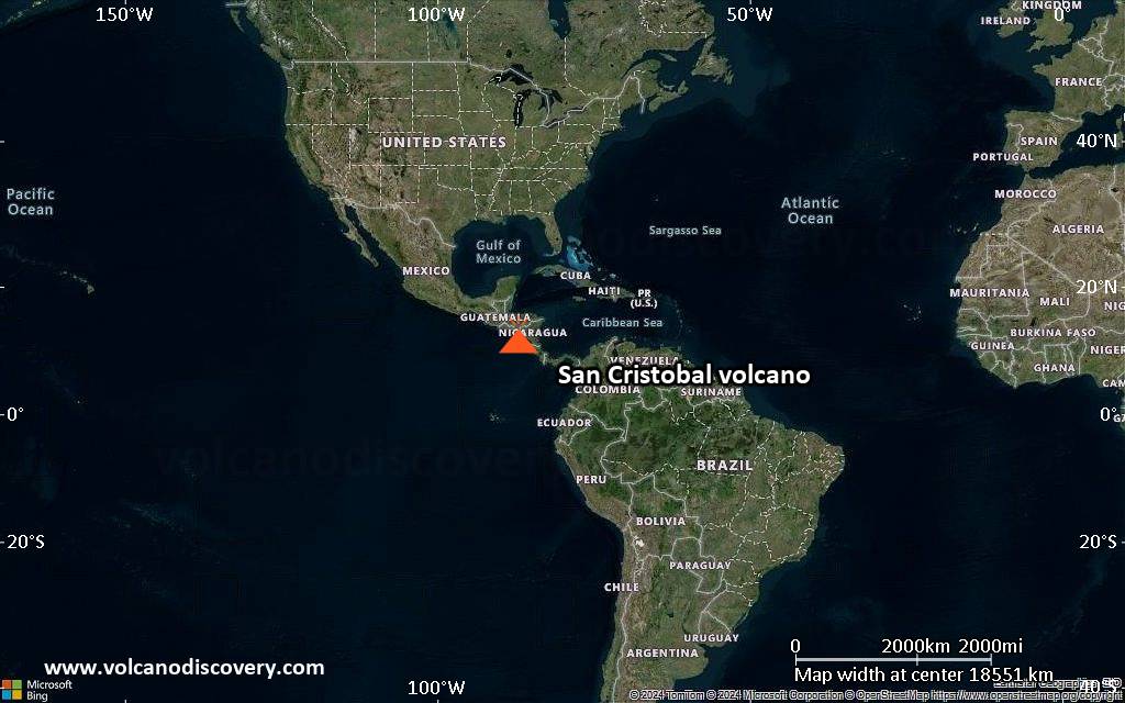
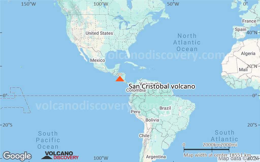
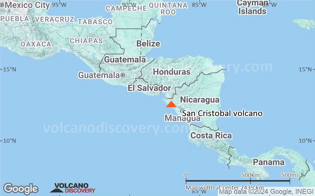
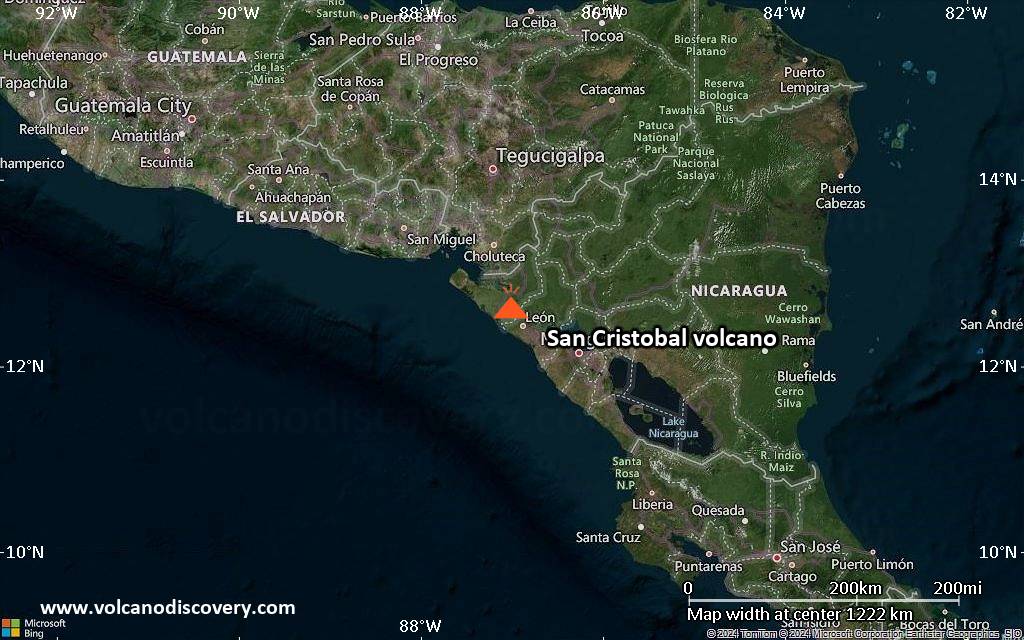
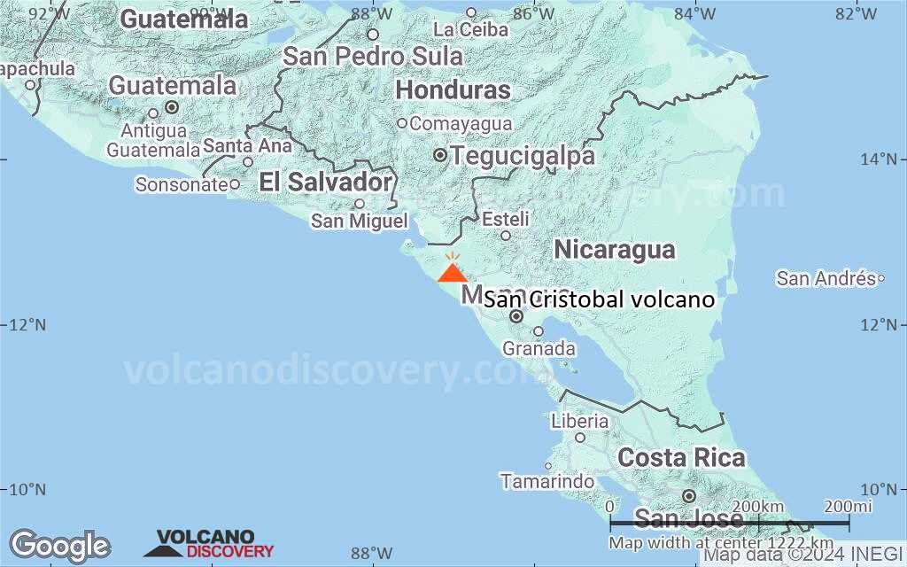
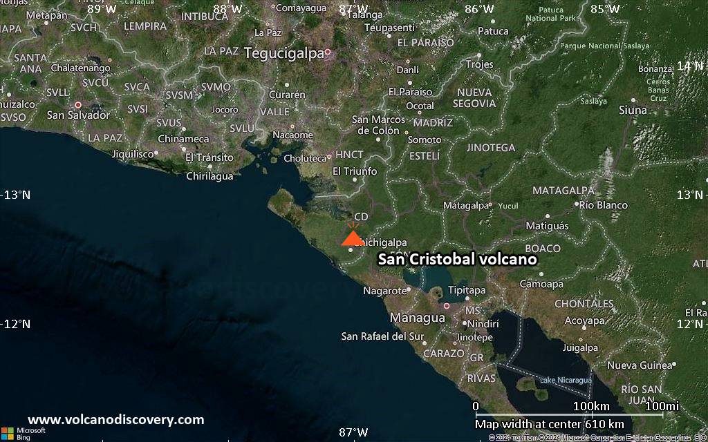
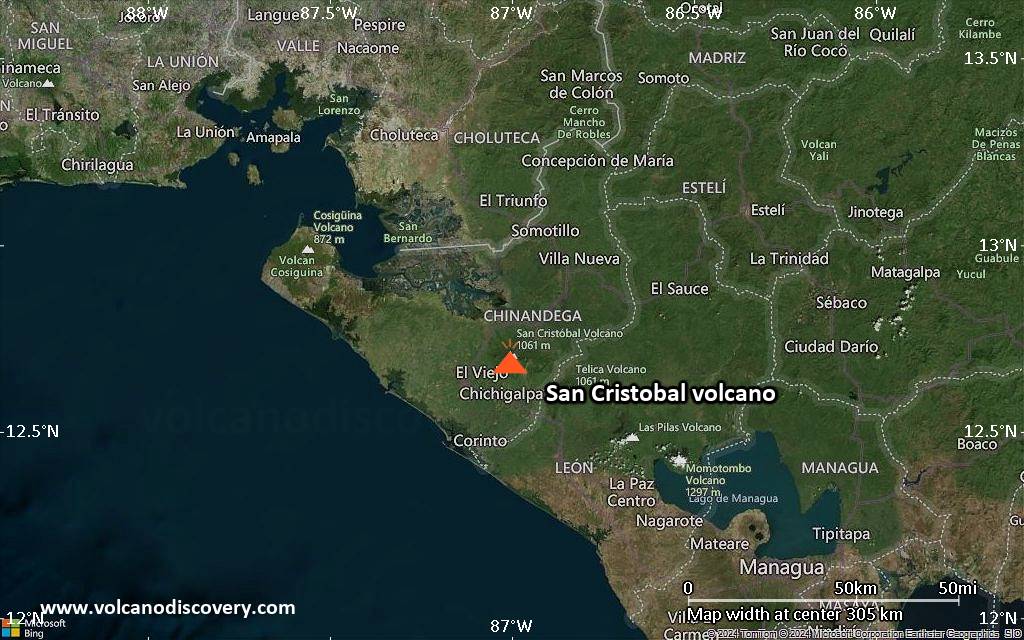
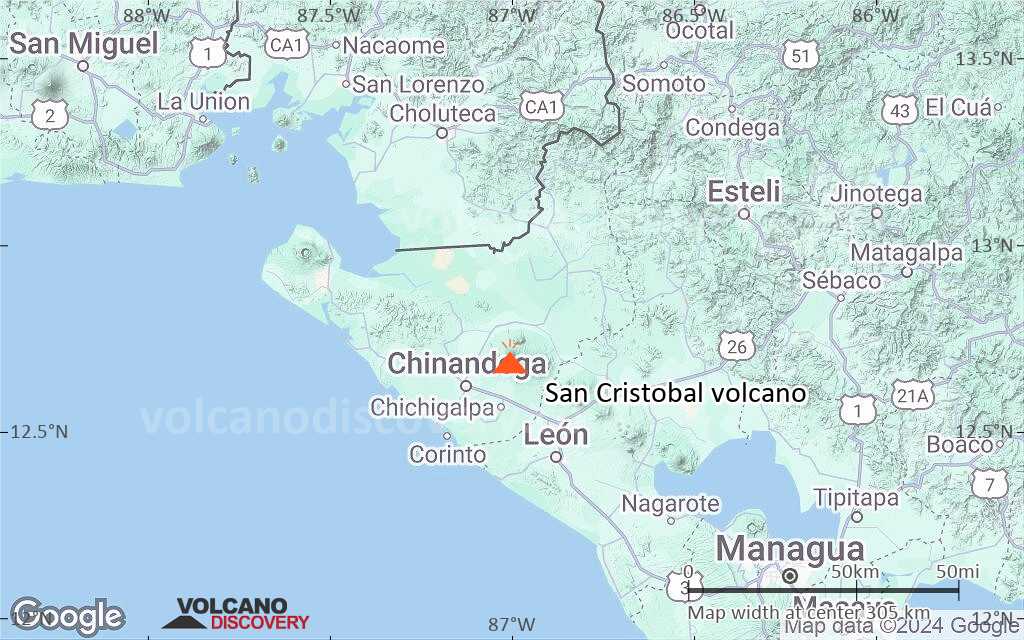
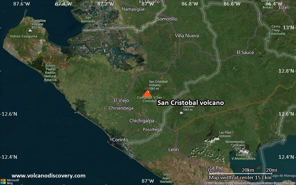
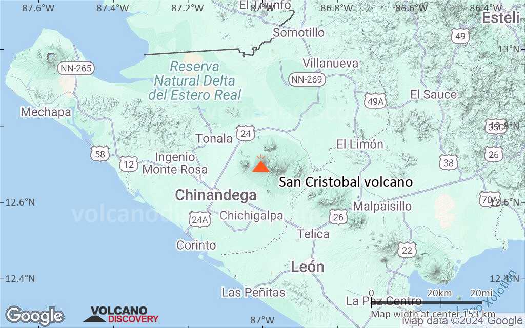
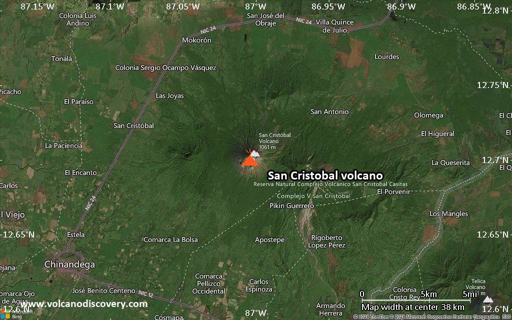
San Cristobal volcano, also known as El Viejo, is the highest and one of the most active volcanoes in Nicaragua. It is located near the northwest corner of the country near the city of Chinandega, 110 km WSW of the capital Managua.
San Cristobal has had frequent small to medium-sized ash eruptions reported since the 16th century. When first observed by the Spanish in 1528, the volcano was in strong eruption and was described as sending "smoke" during the day and "flames" at night.

[smaller] [larger]
Typical eruption style: explosive
San Cristobal volcano eruptions: 2016, 2015, 2012, 2010-11, 2010, 2009, 2008 (Nov), 2008 (Aug), 2007, 2005-06, 2003-04, 2002, 2001, 2000, 1999-2000, 1997,1987 (?), 1985 (?), 1977, 1976 (Aug), 1976 (Mar), 1971, 1685, 1684, 1680, 1613 (?), 1528 ± 1 year

Latest nearby earthquakes

Date and TimeMag / DepthDistance / Location
May 23, 07:37 pm (GMT -6)
2.4

8 km
5.3 km (3.3 mi) to the SE 18 km east of Chinandega, Departamento de Chinandega, Nicaragua Info
Friday, May 23, 2025 GMT (2 quakes)
May 23, 12:45 pm (GMT -6)
1.4

7 km
30 km (19 mi) to the E 46 km east of Chinandega, Departamento de Chinandega, Nicaragua Info
May 23, 12:45 pm (GMT -6)
1.5

34 km
21 km (13 mi) to the E 29 km north of Leon, Departamento de Leon, Nicaragua Info
Sunday, May 18, 2025 GMT (1 quake)
May 18, 04:19 am (Universal Time)
1.0

8 km
26 km (16 mi) to the E 26 km northeast of Leon, Departamento de Leon, Nicaragua Info
Saturday, May 17, 2025 GMT (1 quake)
May 17, 07:56 pm (Universal Time)
1.0

3 km
25 km (16 mi) to the SE 21 km northeast of Leon, Departamento de Leon, Nicaragua Info
Monday, May 12, 2025 GMT (1 quake)
May 12, 09:30 pm (Universal Time)
1.3

11 km
30 km (19 mi) to the E 38 km northeast of Leon, Departamento de Leon, Nicaragua Info

Background

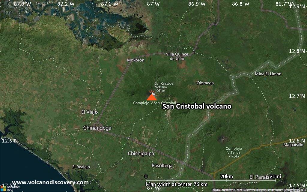
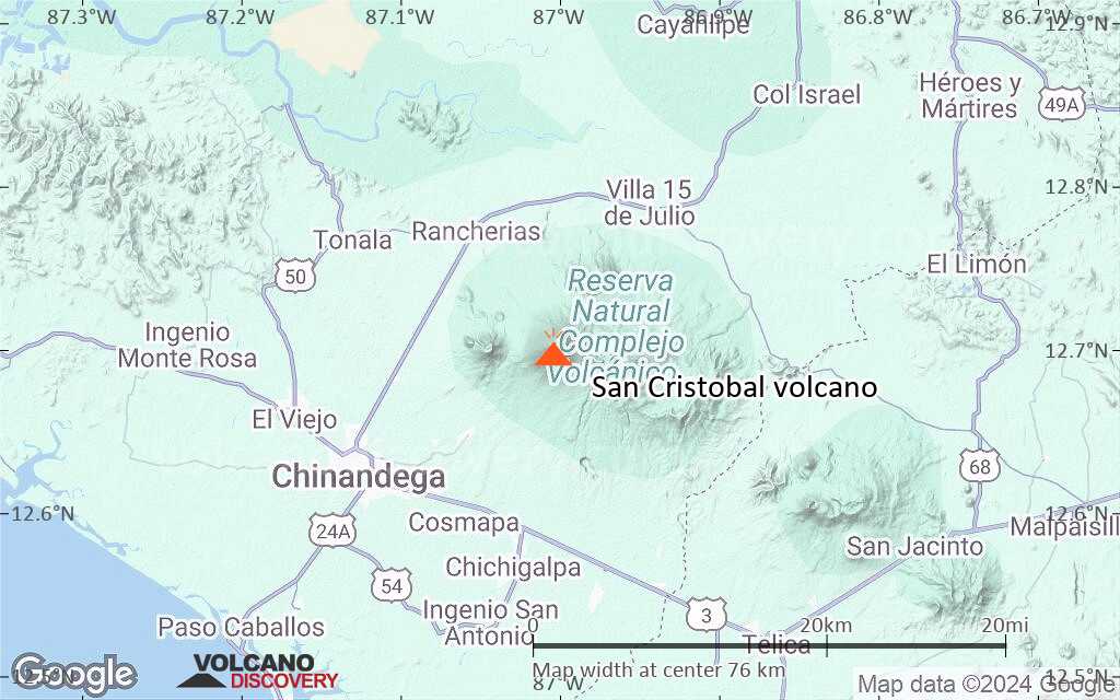
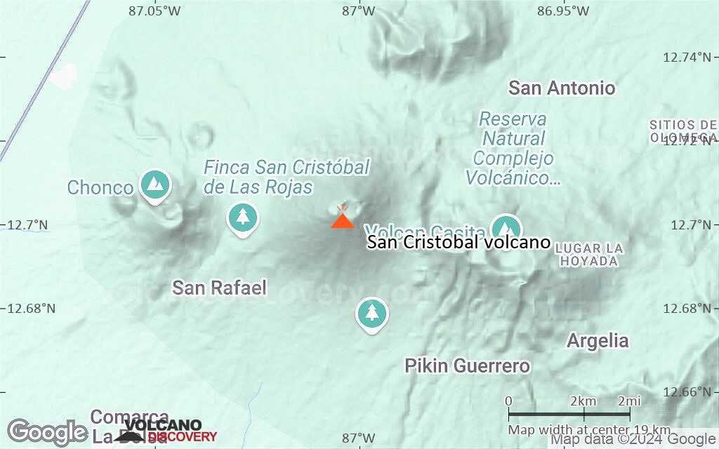
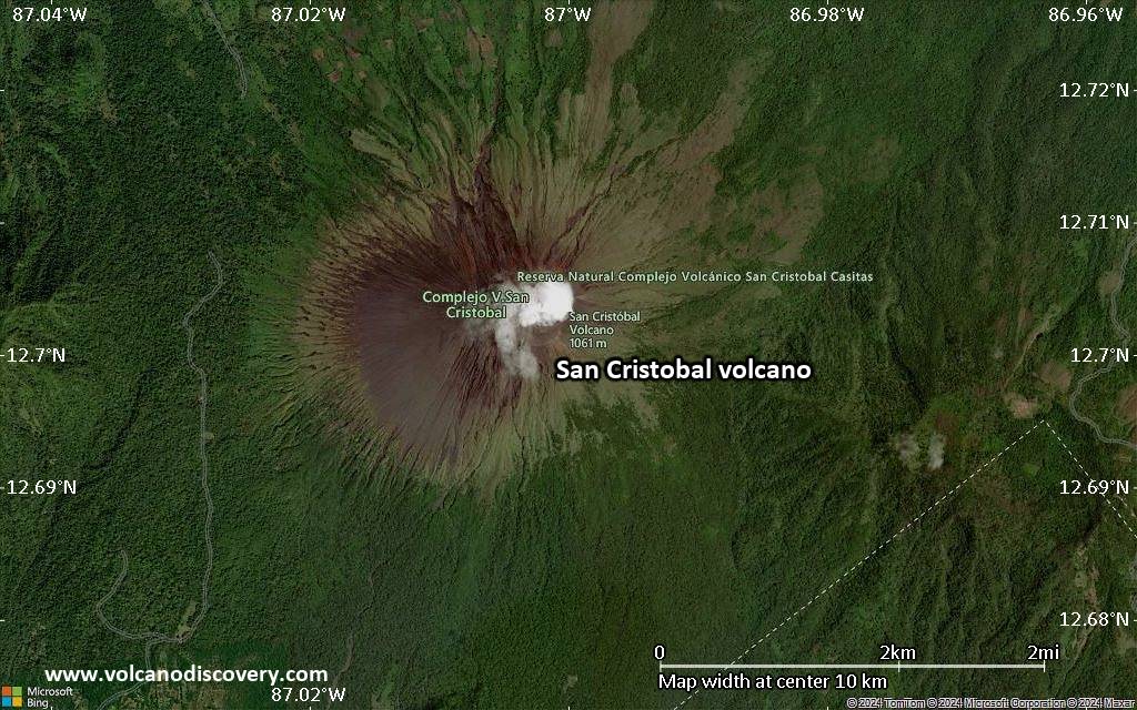
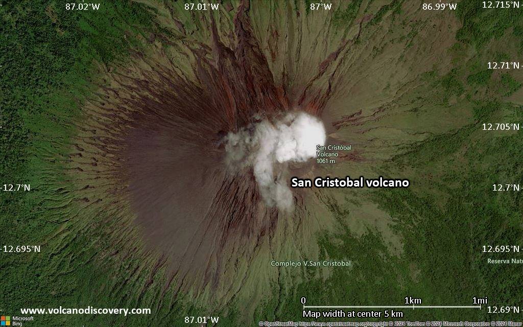
The San Cristóbal volcanic complex at the NW end of the Marrabios Range consists of 5 main volcanic edifices: 1 the main cone of San Cristóbal, which contains a 500 x 600 m wide crater, 2 El Chonco, with several flank lava domes, located 4 km to the west of San Cristóbal, 3 the eroded Moyotepe volcano 4 km to the NE of San Cristóbal, 3 Volcán Casita with an elongated summit crater immediately east of San Cristóbal, and 5 La Pelona, an older caldera is located at the eastern end of the San Cristóbal complex.
Volcán Casita volcano was probably active in the 16th century and has several active fumarole fields. It was the site of a catastrophic landslide and lahar in 1998, triggered by torrential rains from Hurricane Mitch, and killing 1560 people.

The climb to San Cristóbal with its very steep slopes is one of the most difficult climbs in Nicaragua. The climb takes about 1 day normally and guides can be found in León or Chinandega.

San Cristobal Volcano Photos

Significant volcanic eruptions: San Cristobal volcano

In the past 10,000 years, San Cristobal has had at least 35 confirmed eruptions, all documented by historical records or observations.
Additionally, there are 3 uncertain or discredited eruptions from San Cristobal volcano.
The table below lists all known eruptions (date in bold face) of San Cristobal volcano since around 2000. Updates on the most recent volcanic activity of San Cristobal can be found on the news page of San Cristobal volcano.
DateNoteVEIDeathsDamage
2024 Jul 5 - Jul 7
Historical obs./docs.
?
2023 Jul 5
Historical obs./docs.
1
2020 Dec 27 ? - 2022 Jun 26
Historical obs./docs.
2
2019 Mar 4
Historical obs./docs.
1
2018 Apr 22
Historical obs./docs.
1
2017 Aug 18 - Nov 11Summit crater
Historical obs./docs.
3
2017 Feb 18 - Apr 19Summit crater
Historical obs./docs.
1
2016 Apr 22Summit crater
Historical obs./docs.
2
2015 Mar 5 - Jun 12Summit crater
Historical obs./docs.
2
2014 Jul 20 - Oct 1Summit crater
Historical obs./docs.
1
2014 Feb 4 - Apr 12Summit crater
Historical obs./docs.
1
2013 Jun 7Summit crater
Historical obs./docs.
1
2012 Dec 26 - Dec 28Summit crater
Historical obs./docs.
2
2012 Sep 8 - Sep 15Summit crater
Historical obs./docs.
2
2011 Aug 21 ? - Oct 23Summit crater
Historical obs./docs.
1
2010 Jun 9 - 2011 Jan 13Summit crater
Historical obs./docs.
2
2009 Sep 6 - Dec 26 ?
Historical obs./docs.
2?
2008 Nov 21
Historical obs./docs.
1
2008 Jun 22 - Aug 5 ±4 d.
Historical obs./docs.
1
2007 Nov 8 or before
Historical obs./docs.
1?
2005 Nov 13 - 2006 May 27
Historical obs./docs.
2
2004 Dec 3 - Dec 7
Historical obs./docs.
1
2003 Jun 17 - 2004 Jun 13
Historical obs./docs.
1?
2002 May 29 - Dec 16 ?
Historical obs./docs.
1
2001 May 11 ? - Dec 9 ?
Historical obs./docs.
1
1999 May 1 ±180 d. - 2000 Jun 16 ±15 d.
Historical obs./docs.
2
Remark:
Our list of volcanic eruptions closely follows the database of eruptions of the Smithsonian's Global Volcanism Project (GVP), the internationally most recognized data source for volcanic eruptions, but also includes significant eruptive episodes or related volcano events. "Volcanic eruptions" are usually to be understood as sequences of individual eruptive episodes that can follow each other, or even overlap (if several vents are involved), and can last many years, decades or even longer. For example, the current activity of Stromboli volcano is understood as a single eruption that has been ongoing since 1934.
Sources: NOAA National Centers for Environmental Information (NCEI), Global Significant Volcanic Eruptions Database. doi:10.7289/V5TD9V7K | Global Volcanism Project / Smithsonian Institution

Eruptions of San Cristobal volcano


2004-2010 eruptions
Frequent small ash and gas explosions took place during 2006-2010.
More intense periods of activity were recorded in Dec 2004, Nov 2005 - February 2006. Small phreatic explosions causing minor ash fall were noted on 6 March and 23 April 2006.
Another episode of phreatic explosions began on 18 May and continued until 27 May 2006.
Climbers at the summit on 10 November 2006. aw fresh ejecta from explosions during the previous days.
On 22 June 2008, a moderate explosion generated a gas-and-ash plume causing minor ash fall in 16 km distance SW. A series of explosions occurred on 11 July, and again on 22 November 2008.
An explosion on 6 September 2009 generated a small 200 m high ash plume, and one on 14 Sep reached 350 m.
On 9 June 2010, the Washington VAAC reported a well-defined ash plume drifting about 115 km WNW and originating most likely from San Cristobal.

1997 eruption
An eruption began at San Cristóbal volcano during the night of 19-20 May 1997. The eruption had been preceded by 2 weeks of intense seismic activity and elevated SO2 emission. A series of ash explosions occurred, producing plumes rising up to 800 m. On 20 May explosions were sometimes nearly continuous for few minutes, and then stopped for minutes or even hours.
One explosion on 22 May could be heard in 3 km distance.
Field work on 23 May revealed that the inner pit crater of the inner crater cone had grown considerably and a new a new 4 m wide vent was observed at the SW end of its floor, at a location where there had been high-temperature fumaroles (600 deg C) previously.
The activity produced a layer of light gray ash on the W flank of the mountain. Activity calmed down towards the end of May, but isolated eruptions occurred throughout June and July.
Source: Smithsonian / GVP monthly reports

San Cristobal Volcano FAQ

+When was the last eruption of San Cristobal volcano?

+How often does San Cristobal volcano erupt?

+How active is San Cristobal volcano at present?

+When was the largest eruption of San Cristobal volcano?

Latest satellite images

SanCristobal satellite image sat1SanCristobal satellite image sat2

San Cristobal Volcano Maps

Below is a selection of maps showing the location and surroundings of the volcano at various resolutions based on aerial-imagery / terrain maps. Feel free to use them for non-commercial purposes on your blog or website as long as you credit them with a link back to this page (click to copy it).
Satellite/aerial-type map of San Cristobal volcano (world scale)
Terrain-type map of San Cristobal volcano (world scale)
Satellite/aerial-type map of San Cristobal volcano (region scale large)
Terrain-type map of San Cristobal volcano (region scale large)
Satellite/aerial-type map of San Cristobal volcano (region scale medium)
Terrain-type map of San Cristobal volcano (region scale medium)
Satellite/aerial-type map of San Cristobal volcano (region scale small)
Terrain-type map of San Cristobal volcano (region scale small)
Satellite/aerial-type map of San Cristobal volcano (local scale large)
Terrain-type map of San Cristobal volcano (local scale large)
Satellite/aerial-type map of San Cristobal volcano (local scale medium)
Terrain-type map of San Cristobal volcano (local scale medium)
Satellite/aerial-type map of San Cristobal volcano (local scale small)
Terrain-type map of San Cristobal volcano (local scale small)
Satellite/aerial-type map of San Cristobal volcano (scale of 10s of km)
Terrain-type map of San Cristobal volcano (scale of 10s of km)
Satellite/aerial-type map of San Cristobal volcano (scale of 20-40 km)
Terrain-type map of San Cristobal volcano (scale of 20-40 km)
Satellite/aerial-type map of San Cristobal volcano (scale of approx. 10-20 km)
Terrain-type map of San Cristobal volcano (scale of approx. 10-20 km)
Satellite/aerial-type map of San Cristobal volcano (scale of 5-10 km)
Satellite/aerial-type map of San Cristobal volcano (scale of few kilometers)
Volcanoes & Earthquakes - new app for Android
Guaranteed tours
9-25 Jun 2025: Volcanoes and Spices - Sulawesi/Halmahera (Indonesia)
7-22 Jul 2025: From Krakatau to Bali - Java (Indonesia)
7-23 Jul 2025: Volcanoes and Spices - Sulawesi/Halmahera (Indonesia)
1-17 Aug 2025: Volcanoes and Spices - Sulawesi/Halmahera (Indonesia)
1-14 Oct 2025: Desert, salt and volcanoes - Danakil desert (Ethiopia)
4-12 Oct 2025: From Stromboli to Etna - Sicily and Eolian Islands (Italy)
6-21 Oct 2025: From Krakatau to Bali - Java (Indonesia)
3-19 Nov 2025: Volcanoes and Spices - Sulawesi/Halmahera (Indonesia)
= spaces available   = guaranteed   = few spaces left   = booked out
Wed, 12 Jun 2024, 14:00

San Cristobal volcano - Smithsonian / USGS Weekly Volcanic Activity Report for 5 June-11 June 2024 (New Activity / Unrest)

The Washington VAAC reported that ash plumes from San Cristóbal were visible in webcam images at around 1500 and 1700 on 7 June rising above the summit and drifting N. The plumes were not identified in satellite images due to weather conditions. According to a news report the ash plume rose 1 km above the summit. ... Read all
Sun, 9 Jun 2024, 07:21

San Cristobal volcano (Nicaragua): new eruption

The Geografía de Nicaragua reported that the volcano erupted at 03:15 PM local time on 7 June. Read all

On this page:

Try our free app!
Volcanoes & Earthquakes - new app for Android
Android | iOS version

More on VolcanoDiscovery

Why is there advertising on this site?

Support us - Help us upgrade our services!

We truly love working to bring you the latest volcano and earthquake data from around the world. Maintaining our website and our free apps does require, however, considerable time and resources.
We need financing to increase hard- and software capacity as well as support our editor team. We're aiming to achieve uninterrupted service wherever an earthquake or volcano eruption unfolds, and your donations can make it happen! Every donation will be highly appreciated. If you find the information useful and would like to support our team in integrating further features, write great content, and in upgrading our soft- and hardware, please make a donation (PayPal).

Planned features:Thanks to your past donations, these features have been added recently:
Download and Upgrade the Volcanoes & Earthquakes app to get one of the fastest seismic and volcano alerts online:
Android | IOS
Thank you!
Sources: VolcanoDiscovery / VolcanoAdventures and other sources as noted.
Use of material: Most text and images on our websites are owned by us. Re-use is generally not permitted without authorization. Contact us for licensing rights.
Volcanoes & Earthquakes
VolcanoDiscovery Home
Volcanoes | Earthquakes | Photos | Volcano News | | Shop | App
Adventure & Study Travel
Tours to Volcanoes and Volcanic Areas: walking tours, photo tours, study tours
Tours & Dates | FAQ | About us
Get our newsletter!
Company info
Contact | Legal info | Terms & conditions
Follow us
Follow us on facebook Follow us on Instagram Follow us on Bluesky Follow us on Twitter Visit our Youtube channel
EN | DE | EL | ES | FR | IT | RU
VolcanoDiscovery GmbH, Germany, Reg. nr.: HRB 103744, EU Tax Id: DE 297 465 123 owned and created by
Dr. Tom Pfeiffer, volcanologist, volcano photographer, tour organizer member of
IAVCEI
IAVCEI
Vulkanologische Gesellschaft
Volcanological Society
Ecotourism Greece
Ecotourism Greece
RUV insurance
Insured by R+V
VolcanoDiscovery © 2004- All Rights Reserved | Privacy - Cookie Settings